Scale Bars, Inset Maps and Ratio Text in Cartography
There are several ways to help readers understand the distance and map scale.
Maps are generally never on the same scale as the real world. This is why cartographers use scale bars that compare a map distance to an actual distance.
Not only do scale bars, ratio scales, and stated scales also show size and distance in a way that people understand, but inset maps help understand map scale.
Similar to other cartographic elements used in maps, here are all the ways cartographers represent map scale in their work.
Representative Text / Ratio Scale
Ratio scales are one of the most common ways to depict scale on maps. It tells the map reader that one unit on the map is equal to a certain number of units in the real world.
Example: 1:2500
For example, 1:2500 means that 1 cm = 2500 cm. Because 2,500 cm is difficult to interpret, we can convert it into an understandable unit.
In this case, there are 100 centimeters in a meter. When we convert centimeters to meters, 1 cm on the map is equal to 25 meters in real life. When you change scales, it makes more sense to understand distance.

Stated Scale
Stated scales tie in well with ratio scales. But the key difference is how you start with a ratio and convert the units to a more understandable format for the map reader.
Example: 1 cm = 25 m
Instead of 1:2500, you would give the desirable stated scale format. In this case, 1 cm = 25 m, meaning 1 centimeter on the map is 25 meters in real life.
Stated scales are a textual way to show how much distance of represented for a unit. Its main advantage is that you can bring out a ruler and find distances with ease.
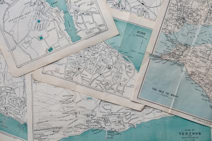
Inset Maps / Locator Maps
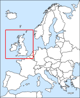
Finally, inset maps are a completely visual way to show map scale by including surroundings. For those who know the area, this is extremely handy to get your bearings immediately.
Locator maps are often smaller-scale maps with an extent rectangle. The main focus of the map is a zoomed-in, larger-scale map of that extent rectangle.
For example, a locator map of the globe is very small-scale at 1:360,000,000,000. If there is an extent rectangle of Vatican City, this larger scale gives more detail and is the main map’s focus.
Scale Bar / Linear Scale
Scale bars come in different sizes, shapes, and forms. They always have a unit of distance, such as feet, meters, or miles that is proportional to the map.

The distance that’s in the scale bar represents a relationship between distance on a map and in the real world. It’s arbitrary for the cartographer to select that specific linear distance in a scale bar.
For example, this scale bars units are in kilometers. Each tick graphically shows a kilometer that you can put your fingers to find its rough distance.
Types of Map Scale in Geography
There are several ways to depict scale and represent distances on maps.
While ratio scales (separated by a colon) have the same units, stated scales (separated by an equal sign) do the conversion previously so it’s easily understandable.
A scale bar graphically represents the relationship between the map and the real world.
Finally, inset maps are extent maps that tie the map’s focus with a smaller scale one.
25 Map Types for Building Unbeatable Maps
Epic Web Maps – The Maps Hall of Fame
50 Map Projections Types: A Visual Guide
How Map Projections Work
Esri JavaScript API Examples: 15 High-Tech Webmaps and Webscenes
Ocean Currents Map: Visualize Our Oceans Movement
3 Wildfire Maps for Tracking Real-Time Forest Fires
10 Topographic Maps From Around the World