Index of /wp-content/uploads/2022/04
Name
Last modified
Size
Description
Parent Directory
-
Ventusky-1000x479.png
2024-03-17 09:10
934K
ArcGIS-Drone2Map-100..>
2024-03-17 21:20
904K
Esri-Business-Analys..>
2022-04-24 12:39
870K
ISS-Satellite-Feed.png
2022-08-20 15:19
868K
High-Resolution-Worl..>
2024-03-17 07:16
827K
ArcGIS-Experience-Bu..>
2022-04-24 13:17
798K
Esri-Business-Analys..>
2022-04-24 12:40
797K
ArcGIS-API-for-Pytho..>
2022-04-24 13:10
754K
Drive-Time-Map-Isoch..>
2022-04-24 13:30
744K
ArcGIS-Experience-Bu..>
2022-04-24 13:18
743K
Black-Marble-NASA-Wo..>
2022-08-20 15:35
710K
Dot-Density-Map.jpg
2022-04-24 11:01
699K
ArcGIS-Experience-Bu..>
2022-04-24 13:16
677K
USGS-EarthNow-1000x4..>
2024-03-17 14:51
670K
Esri-Business-Analys..>
2022-04-24 12:39
668K
Real-Time-Satellite-..>
2024-03-17 14:56
668K
Drive-Time-Map-Isoch..>
2022-04-24 13:28
651K
Territory-Design-155..>
2022-04-24 12:44
635K
Boston-as-the-Eagle-..>
2022-04-24 13:39
633K
Popup-Charts-Arcade-..>
2022-04-24 13:33
632K
Black-Marble-NASA-Wo..>
2022-08-20 15:34
619K
Esri-Business-Analys..>
2022-04-24 12:40
617K
Drive-Time-Map-Isoch..>
2022-04-24 13:30
584K
Esri-Business-Analys..>
2022-04-24 12:38
579K
Basemap-Feature-1550..>
2022-04-24 13:13
576K
Black-Marble-NASA-12..>
2022-08-20 15:37
576K
Landsat-9-Satellite.png
2022-04-24 10:55
575K
ArcGIS-Arcade-1265x6..>
2022-04-24 13:34
570K
ArcGIS-Experience-Bu..>
2022-04-24 13:19
565K
Mobile-Webmap-App-GP..>
2022-04-24 13:07
565K
Blue-Marble-2012.png
2022-08-20 15:32
563K
Black-Marble-NASA-Wo..>
2022-08-20 15:35
562K
Ventusky-768x368.png
2024-03-17 09:10
560K
Basemap-Feature-1265..>
2022-04-24 13:14
543K
ArcGIS-Drone2Map-768..>
2024-03-17 21:20
537K
Drive-Time-Map-Isoch..>
2022-04-24 13:28
533K
Aerial-Image-Helicop..>
2022-04-24 13:38
507K
Territory-Design-153..>
2022-04-24 12:44
506K
Territory-Design-126..>
2022-04-24 12:45
502K
Customer-Profiling-2..>
2022-04-19 10:23
496K
GISP-Certification-S..>
2022-04-24 15:48
489K
Black-Marble-NASA-Wo..>
2022-08-20 15:34
488K
Black-Marble-NASA.png
2022-08-20 15:36
480K
GISP-Certification-S..>
2022-04-24 15:49
464K
ArcGIS-Solutions-Tem..>
2022-04-24 12:36
454K
ArcGIS-Drone2Map.png
2024-03-17 21:20
450K
Boston-as-the-Eagle-..>
2022-04-24 13:39
449K
Basemap-Feature-1536..>
2022-04-24 13:13
447K
Ventusky-678x325.png
2024-03-17 09:10
438K
Thematic-Map-United-..>
2022-04-24 12:48
437K
Popup-Charts-Arcade-..>
2022-04-24 13:33
433K
ISS-Satellite-Feed-7..>
2022-08-20 15:20
425K
ArcGIS-Drone2Map-678..>
2024-03-17 21:20
420K
Popup-Charts-Arcade-..>
2022-04-24 13:33
419K
Real-Time-Satellite-..>
2024-03-17 14:56
419K
Landsat-9-Feature-12..>
2022-04-24 10:56
416K
Esri-Business-Analys..>
2022-04-19 10:17
412K
Real-Time-Satellite-..>
2024-03-17 14:56
412K
AutoCAD-Course.png
2022-08-20 15:11
408K
USGS-EarthNow-768x32..>
2024-03-17 14:51
407K
ISS-Satellite-Feed-9..>
2022-08-20 15:20
407K
Blue-Marble-2002.png
2022-08-20 15:31
405K
Esri-Business-Analys..>
2022-04-19 10:17
404K
ArcGIS-Server-2048x1..>
2022-04-24 12:34
402K
Blue-Marble-2015.png
2022-08-20 15:33
401K
Thematic-Map-United-..>
2022-04-24 12:48
395K
ArcGIS-Velocity.png
2022-04-24 13:09
384K
Blue-Marble-2012-550..>
2022-08-20 15:32
381K
Landsat-9-Satellite-..>
2022-04-24 10:55
380K
GISP-Certification-S..>
2022-04-24 15:49
378K
Blue-Marble-2012-550..>
2022-08-20 15:32
374K
ArcGIS-Velocity-Step..>
2022-04-24 13:05
369K
ArcGIS-Pro-Associate..>
2022-08-20 15:39
362K
Aerial-Image-Helicop..>
2022-04-24 13:38
361K
Thematic-Map-United-..>
2022-04-24 12:48
361K
Aerial-Image-Drone.jpg
2022-04-24 13:36
360K
Aerial-Image-Helicop..>
2022-04-24 13:38
354K
GISP-Certification-S..>
2022-04-24 15:56
344K
ISS-Satellite-Feed-6..>
2022-08-20 15:20
343K
Real-Time-Satellite-..>
2024-03-17 14:56
335K
Esri-Business-Analys..>
2022-04-24 12:37
332K
Ventusky.png
2024-03-17 09:10
330K
ArcGIS-API-for-Pytho..>
2022-04-24 13:11
326K
Boston-as-the-Eagle-..>
2022-04-24 13:39
326K
Mobile-Webmap-App-GP..>
2022-04-24 13:08
320K
USGS-EarthNow-678x28..>
2024-03-17 14:51
318K
High-Resolution-Worl..>
2024-03-17 07:16
317K
ArcGIS-API-for-Pytho..>
2022-04-24 13:11
316K
Blue-Marble-2012-425..>
2022-08-20 15:32
316K
Blue-Marble-2012-550..>
2022-08-20 15:32
314K
Customer-Profiling-1..>
2022-04-19 10:23
308K
Boston-as-the-Eagle-..>
2022-04-24 13:39
306K
Drive-Time-Map-Isoch..>
2022-04-24 13:30
306K
Esri-Certification-T..>
2022-08-20 15:40
299K
Customer-Profiling-1..>
2022-04-19 10:23
299K
Esri-Business-Analys..>
2022-04-19 10:17
296K
Blue-Marble-2015-500..>
2022-08-20 15:33
294K
HERE-WeGo-Maps-Conce..>
2022-08-20 15:29
294K
ArcGIS-Solutions-Tem..>
2022-04-24 12:36
293K
ArcGIS-Velocity-768x..>
2022-04-16 15:30
292K
Ventusky-550x264.png
2024-03-17 09:10
292K
Esri-Certification-T..>
2022-08-20 15:40
290K
Blue-Marble-2015-500..>
2022-08-20 15:33
290K
ArcGIS-Pro-Associate..>
2022-08-20 15:39
289K
ArcGIS-Solutions-Tem..>
2022-04-24 12:36
288K
GISP-Certification-S..>
2022-04-24 15:49
286K
ArcGIS-Drone2Map-550..>
2024-03-17 21:20
285K
Drive-Time-Analysis-..>
2022-04-24 12:41
280K
ArcGIS-Velocity-900x..>
2022-04-16 15:30
275K
Blue-Marble-2015-425..>
2022-08-20 15:33
272K
PowerBI-Dashboard.jpg
2022-04-24 11:02
272K
Mobile-Webmap-App-GP..>
2022-04-24 13:08
272K
Drive-Time-Map-Isoch..>
2022-04-24 13:29
271K
Blue-Marble-2002-900..>
2022-08-20 15:31
268K
Drive-Time-Analysis-..>
2022-04-24 12:41
266K
GISP-Certification-S..>
2022-04-24 15:49
263K
ISS-Satellite-Feed-5..>
2022-08-20 15:20
263K
Geospatial-vs-GIS-Ge..>
2022-04-24 13:04
263K
Landsat-9-Satellite-..>
2022-04-24 10:55
263K
Thematic-Map-United-..>
2022-04-24 12:51
262K
Aerial-Image-Helicop..>
2022-04-24 13:38
260K
ArcGIS-Velocity-Step..>
2022-04-24 13:06
259K
Esri-Business-Analys..>
2022-04-24 12:38
257K
Esri-Business-Analys..>
2022-04-24 12:40
257K
Drive-Time-Map-Isoch..>
2022-04-24 13:28
257K
GISP-Certification-S..>
2022-04-24 15:49
256K
Drive-Time-Map-Isoch..>
2022-04-24 13:30
256K
Landsat-9-Feature.png
2022-04-24 10:56
255K
ArcGIS-API-for-Pytho..>
2022-04-24 13:11
251K
Landsat-9-Satellite-..>
2022-04-24 10:55
249K
Drive-Time-Map-Isoch..>
2022-04-24 13:31
249K
ArcGIS-Experience-Bu..>
2022-04-24 13:19
249K
ArcGIS-Arcade.png
2022-04-24 13:34
248K
Blue-Marble-2015-500..>
2022-08-20 15:32
246K
Blue-Marble-2002-678..>
2022-08-20 15:31
246K
ArcGIS-Solutions-Tem..>
2022-04-24 12:36
245K
ISS-Satellite-Feed-6..>
2022-08-20 15:20
243K
ArcGIS-Velocity-678x..>
2022-04-16 15:30
241K
Esri-Business-Analys..>
2022-04-24 12:38
241K
ISS-Satellite-Feed-5..>
2022-08-20 15:20
239K
Aerial-Image-Drone-1..>
2022-04-24 13:36
238K
ArcGIS-Arcade-900x32..>
2022-04-24 13:34
238K
ArcGIS-Server-1550x7..>
2022-04-24 12:34
238K
HERE-WeGo-Maps-Featu..>
2022-08-20 15:30
236K
Dot-Density-Map-1550..>
2022-04-24 11:01
236K
Aerial-Image-Drone-1..>
2022-04-24 13:36
235K
Dot-Density-Map-1536..>
2022-04-24 11:01
234K
Business-Model-1550x..>
2022-04-24 12:42
234K
Blue-Marble-2012-360..>
2022-08-20 15:32
234K
Blue-Marble-2002-768..>
2022-08-20 15:31
232K
Black-Marble-NASA-76..>
2022-08-20 15:37
230K
Landsat-9-Satellite-..>
2022-04-24 10:55
229K
Real-Time-Satellite-..>
2024-03-17 14:56
228K
ArcGIS-Experience-Bu..>
2022-04-24 13:19
227K
Free-GIS-Training-1.jpg
2023-11-18 19:48
226K
ArcGIS-Server-1536x7..>
2022-04-24 12:35
226K
High-Resolution-Worl..>
2024-03-17 07:16
225K
ArcGIS-API-for-Pytho..>
2022-04-24 13:11
225K
Black-Marble-NASA-90..>
2022-08-20 15:37
225K
Drive-Time-Map-Isoch..>
2022-04-24 13:29
224K
ArcGIS-Velocity-Step..>
2022-04-24 13:06
224K
AutoCAD-Logo-2048x69..>
2022-08-20 15:17
223K
CubeSat-Feature-768x..>
2022-04-24 10:58
222K
ArcGIS-Pro-Associate..>
2022-08-20 15:39
221K
GISP-Certification-7..>
2022-04-24 15:57
218K
Mobile-Webmap-App-GP..>
2022-04-24 13:08
218K
ArcGIS-Velocity-580x..>
2022-04-16 15:30
218K
Black-Marble-NASA-Wo..>
2022-08-20 15:36
217K
CubeSat-Feature-900x..>
2022-04-24 10:58
217K
ArcGIS-Solutions-Tem..>
2022-04-24 12:36
215K
ArcGIS-Arcade-768x37..>
2022-04-24 13:35
214K
USGS-EarthNow.png
2024-03-17 14:51
214K
Satellite-Image-of-E..>
2022-08-20 15:33
211K
CubeSat-Feature.png
2022-04-24 10:58
210K
Geoenrich-2048x1170.png
2022-04-24 12:46
210K
USGS-EarthNow-550x23..>
2024-03-17 14:51
210K
Black-Marble-NASA-Wo..>
2022-08-20 15:36
210K
AutoCAD-Course-768x3..>
2022-08-20 15:11
208K
Blue-Marble-2002-580..>
2022-08-20 15:31
207K
AutoCAD-Course-900x3..>
2022-08-20 15:11
205K
Business-Model-1536x..>
2022-04-24 12:43
204K
Basemap-Feature.png
2022-04-24 13:12
203K
Blue-Marble-2015-360..>
2022-08-20 15:33
203K
Street-View-Demograp..>
2022-04-24 13:00
202K
Drive-Time-Analysis-..>
2022-04-24 12:42
202K
CubeSat-Size.png
2022-04-24 10:57
201K
Esri-Business-Analys..>
2022-04-24 12:40
200K
Basemap-Feature-900x..>
2022-04-24 13:15
199K
Esri-Business-Analys..>
2022-04-24 12:40
198K
Maya-Logo-1550x534.png
2022-08-20 15:14
197K
Esri-Business-Analys..>
2022-04-24 12:38
197K
HERE-WeGo-Maps-Conce..>
2022-08-20 15:29
197K
Landsat-9-Satellite-..>
2022-04-24 10:55
196K
Satellite-Image-of-E..>
2022-08-20 15:33
196K
3ds-Max-Logo-1536x48..>
2022-08-20 15:13
196K
Esri-Certification-T..>
2022-08-20 15:40
195K
3ds-Max-Logo-1550x48..>
2022-08-20 15:13
195K
ArcGIS-API-for-Pytho..>
2022-04-24 13:11
195K
Esri-Certification-T..>
2022-08-20 15:40
195K
HERE-WeGo-Developer.jpg
2022-08-20 15:28
194K
HERE-WeGo-Maps-Conce..>
2022-08-20 15:29
194K
Pigeon-Photographers..>
2022-04-24 13:38
193K
PowerBI-Dashboard-Ma..>
2022-04-24 12:30
192K
ArcGIS-Solutions-Tem..>
2022-04-24 12:36
192K
Maya-Logo-1536x529.png
2022-08-20 15:14
192K
Popup-Charts-Arcade-..>
2022-04-24 13:32
191K
Black-Marble-NASA-67..>
2022-08-20 15:37
191K
ArcGIS-Experience-Bu..>
2022-04-24 13:19
190K
Geoenrich-1536x878.png
2022-04-24 12:46
189K
Drive-Time-Map-Isoch..>
2022-04-24 13:29
189K
ArcGIS-Arcade-678x32..>
2022-04-24 13:35
188K
Customer-Profiling-1..>
2022-04-19 10:23
187K
ArcGIS-Velocity-620x..>
2022-04-16 15:30
187K
Esri-Certification-7..>
2022-08-20 15:41
186K
Esri-Certification-T..>
2022-08-20 15:40
185K
CubeSat-Size-900x320..>
2022-04-24 10:57
185K
Black-Marble-NASA-Wo..>
2022-08-20 15:36
185K
Drive-Time-Map-Isoch..>
2022-04-24 13:31
184K
Business-Model-1265x..>
2022-04-24 12:43
183K
Landsat-9-Feature-90..>
2022-04-24 10:57
183K
Revit-Logo-1536x588.png
2022-08-20 15:16
182K
Territory-Design-678..>
2022-04-24 12:45
181K
ArcGIS-Velocity-Step..>
2022-04-24 13:06
181K
AutoCAD-Course-678x3..>
2022-08-20 15:11
180K
CubeSat-Feature-678x..>
2022-04-24 10:59
179K
Revit-Logo-1550x593.png
2022-08-20 15:16
178K
Ventusky-425x204.png
2024-03-17 09:10
177K
GISP-Certification-6..>
2022-04-24 15:58
176K
Mobile-Webmap-App-GP..>
2022-04-24 13:08
176K
ArcGIS-Drone2Map-425..>
2024-03-17 21:20
174K
Drive-Time-Map-Isoch..>
2022-04-24 13:31
174K
Esri-Business-Analys..>
2022-04-24 12:38
173K
Mobile-Webmap-App-GP..>
2022-04-24 13:08
173K
Google-Street-View.jpg
2022-04-24 13:03
173K
ArcGIS-Solutions-Fea..>
2022-04-24 12:35
172K
ArcGIS-Solutions-Tem..>
2022-04-24 12:36
171K
Blue-Marble-2002-620..>
2022-08-20 15:31
170K
ArcGIS-API-for-Pytho..>
2022-04-24 13:12
169K
GISP-Certification-S..>
2022-04-24 15:49
168K
ArcGIS-Arcade-580x32..>
2022-04-24 13:35
168K
Blue-Marble-2012-300..>
2022-08-20 15:32
167K
ArcGIS-Experience-Bu..>
2022-04-24 13:17
167K
Satellite-Imagery-US..>
2025-04-10 19:40
166K
Satellite-Imagery-US..>
2025-04-10 19:40
165K
Mapillary-Feature.jpg
2022-04-24 12:59
164K
ArcGIS-Server-1265x6..>
2022-04-24 12:35
164K
Drive-Time-Map-Isoch..>
2022-04-24 13:29
164K
Dot-Density-Map-1265..>
2022-04-24 11:01
164K
Drive-Time-Map-Isoch..>
2022-04-24 13:31
163K
Blue-Marble-2002-550..>
2022-08-20 15:31
163K
ArcGIS-Velocity-550x..>
2022-04-16 15:30
163K
Aerial-Image-Drone-1..>
2022-04-24 13:36
163K
Esri-Certification-T..>
2022-08-20 15:40
162K
Territory-Design-768..>
2022-04-24 12:45
161K
Black-Marble-NASA-58..>
2022-08-20 15:38
161K
ArcGIS-Pro-Associate..>
2022-08-20 15:39
160K
Esri-Certification-6..>
2022-08-20 15:41
159K
AutoCAD-Course-580x3..>
2022-08-20 15:12
157K
Landsat-9-Feature-76..>
2022-04-24 10:57
157K
Cubesat-Dimensions-1..>
2022-04-24 10:59
155K
CubeSat-Feature-580x..>
2022-04-24 10:59
155K
Esri-Business-Analys..>
2022-04-24 12:38
155K
Autodesk-Review.png
2022-08-20 15:18
155K
Black-Marble-NASA-Wo..>
2022-08-20 15:36
152K
Basemap-Feature-678x..>
2022-04-24 13:15
152K
ISS-Satellite-Feed-4..>
2022-08-20 15:20
152K
Esri-Business-Analys..>
2022-04-24 12:41
151K
Mobile-Webmap-App-GP..>
2022-04-24 13:08
150K
GISP-Certification-9..>
2022-04-24 15:57
149K
Esri-Business-Analys..>
2022-04-24 12:41
149K
Pigeon-Photographers..>
2022-04-24 13:39
148K
ArcGIS-Experience-Bu..>
2022-04-24 13:17
147K
Geoenrich-1265x723.png
2022-04-24 12:46
147K
Blue-Marble-2015-300..>
2022-08-20 15:33
147K
Esri-Certification-9..>
2022-08-20 15:41
146K
Basemap-Feature-768x..>
2022-04-24 13:15
146K
3ds-Max-Logo-1265x39..>
2022-08-20 15:13
145K
CubeSat-Size-768x328..>
2022-04-24 10:57
143K
High-Resolution-Worl..>
2024-03-17 07:16
142K
Real-Time-Satellite-..>
2024-03-17 14:56
141K
Thematic-Map-United-..>
2022-04-24 12:48
141K
Popup-Charts-Arcade-..>
2022-04-24 13:34
140K
Historical-Imagery-S..>
2022-04-24 13:02
139K
Drive-Time-Map-Isoch..>
2022-04-24 13:29
139K
Esri-Certification.png
2022-08-20 15:41
139K
AutoCAD-Logo-1550x52..>
2022-08-20 15:17
139K
Antarctica-Google-St..>
2022-04-24 13:01
138K
ArcGIS-Pro-Associate..>
2022-08-20 15:39
137K
AutoCAD-Course-620x2..>
2022-08-20 15:12
137K
Esri-Business-Analys..>
2022-04-24 12:38
136K
Popup-Charts-Arcade-..>
2022-04-24 13:33
135K
Black-Marble-NASA-62..>
2022-08-20 15:38
135K
HERE-WeGo-Maps-Conce..>
2022-08-20 15:29
135K
Maya-Logo-1265x436.png
2022-08-20 15:14
133K
ArcGIS-Arcade-550x26..>
2022-04-24 13:35
133K
ArcGIS-Pro-Associate..>
2022-08-20 15:39
132K
Landsat-9-Satellite-..>
2022-04-24 10:55
132K
Basemap-Feature-620x..>
2022-04-24 13:15
132K
ArcGIS-Pro-Associate..>
2022-08-20 15:39
131K
Esri-Business-Analys..>
2022-04-19 10:17
131K
Pigeon-Photographers..>
2022-04-24 13:38
130K
GISP-Certification-5..>
2022-04-24 15:58
129K
Revit-Logo-1265x484.png
2022-08-20 15:16
129K
Ventusky-360x173.png
2024-03-17 09:10
129K
Black-Marble-NASA-55..>
2022-08-20 15:38
128K
Esri-Business-Analys..>
2022-04-24 12:41
128K
Autodesk-Review-768x..>
2022-08-20 15:18
128K
ArcGIS-Drone2Map-360..>
2024-03-17 21:20
128K
ArcGIS-Experience-Bu..>
2022-04-24 13:16
128K
Drive-Time-Analysis-..>
2022-04-24 12:42
127K
Esri-Business-Analys..>
2022-04-19 10:17
127K
CubeSat-Size-580x326..>
2022-04-24 10:58
127K
USGS-EarthNow-425x17..>
2024-03-17 14:51
127K
Landsat-9-Feature-67..>
2022-04-24 10:57
127K
Esri-360-Videos.jpg
2022-08-20 15:27
127K
Boston-as-the-Eagle-..>
2022-04-24 13:40
126K
Geoenrich.png
2022-04-24 12:46
125K
Black-Marble-NASA-Wo..>
2022-08-20 15:36
125K
Esri-Free-Books.jpg
2022-08-20 15:28
125K
AutoCAD-Course-550x2..>
2022-08-20 15:12
125K
GISP-Certification-S..>
2022-04-24 15:49
125K
Esri-MOOC.jpg
2022-08-20 15:27
125K
AutoCAD-Logo-1536x51..>
2022-08-20 15:17
124K
Popup-Charts-Arcade-..>
2022-04-24 13:33
123K
Cubesat-Dimensions-1..>
2022-04-24 10:59
123K
Black-Marble-NASA-Wo..>
2022-08-20 15:36
123K
ArcGIS-Experience-Bu..>
2022-04-24 13:25
121K
Pigeon-Photographers..>
2022-04-24 13:39
121K
PowerBI-Dashboard-15..>
2022-04-24 11:02
120K
Basemap-Feature-580x..>
2022-04-24 13:15
119K
CubeSat-Feature-620x..>
2022-04-24 10:59
119K
Popup-Charts-Arcade-..>
2022-04-24 13:34
118K
Basemap-Feature-550x..>
2022-04-24 13:15
118K
PowerBI-Dashboard-15..>
2022-04-24 11:02
117K
Blue-Marble-2005-360..>
2022-08-20 15:32
115K
CubeSat-Size-678x289..>
2022-04-24 10:58
115K
Satellite-Image-of-E..>
2022-08-20 15:33
114K
Landsat-9-Feature-58..>
2022-04-24 10:57
114K
GISP-Certification-6..>
2022-04-24 15:58
114K
ISS-Satellite-Feed-3..>
2022-08-20 15:20
113K
Esri-Certification-T..>
2022-08-20 15:40
113K
Autodesk-Review-678x..>
2022-08-20 15:18
113K
Territory-Design-550..>
2022-04-24 12:45
112K
AutoCAD-Logo.png
2022-08-20 15:17
111K
Thematic-Map-United-..>
2022-04-24 12:51
111K
Landsat-9-Feature-62..>
2022-04-24 10:57
111K
Aerial-Image-Helicop..>
2022-04-24 13:38
109K
Thematic-Map-United-..>
2022-04-24 12:51
109K
Esri-Certification-5..>
2022-08-20 15:41
109K
ArcGIS-Solutions-Tem..>
2022-04-24 12:36
108K
ArcGIS-Arcade-620x26..>
2022-04-24 13:35
108K
HERE-WeGo-Maps-Featu..>
2022-08-20 15:30
107K
CubeSat-Feature-550x..>
2022-04-24 10:59
107K
Network-Analysis-768..>
2022-04-24 12:47
106K
Territory-Design.png
2022-04-24 12:43
106K
Free-GIS-Training-1-..>
2023-11-18 19:48
105K
Aerial-Photography-v..>
2025-04-10 19:42
105K
Drive-Time-Map-Isoch..>
2022-04-24 13:31
105K
Real-Time-Satellite-..>
2024-03-17 14:56
104K
Esri-Certification-6..>
2022-08-20 15:41
104K
Esri-Business-Analys..>
2022-04-19 10:17
104K
Blue-Marble-2002-425..>
2022-08-20 15:31
103K
ArcGIS-Velocity-425x..>
2022-04-16 15:30
103K
ArcGIS-Velocity-Step..>
2022-04-24 13:07
103K
ArcGIS-API-for-Pytho..>
2022-04-24 13:12
103K
Dot-Maps-Feature-678..>
2022-04-24 11:00
102K
Boston-as-the-Eagle-..>
2022-04-24 13:40
102K
Street-View-App-Coll..>
2022-04-24 13:02
100K
Popup-Charts-Arcade-..>
2022-04-24 13:34
100K
GISP-Certification.png
2022-04-24 15:57
100K
Geospatial-Google-Tr..>
2022-04-24 13:04
98K
Dot-Maps-Feature-580..>
2022-04-24 11:01
97K
Territory-Design-900..>
2022-04-24 12:45
97K
Blue-Marble-2005.png
2022-08-20 15:32
97K
Popup-Charts-Arcade-..>
2022-04-24 13:34
97K
ArcGIS-Arcade-Playgr..>
2022-04-24 13:32
97K
ArcGIS-Solutions-Fea..>
2022-04-24 12:35
97K
CubeSat-Size-620x264..>
2022-04-24 10:58
96K
Autodesk-Review-900x..>
2022-08-20 15:18
96K
AutoCAD-Logo-1265x42..>
2022-08-20 15:17
95K
Drive-Time-Map-Isoch..>
2022-04-24 13:29
95K
Mobile-Webmap-App-GP..>
2022-04-24 13:09
95K
Customer-Profiling-9..>
2022-04-19 10:23
95K
Esri-Business-Analys..>
2022-04-24 12:39
95K
ArcGIS-Pro-Associate..>
2022-08-20 15:40
95K
Thematic-Map-United-..>
2022-04-24 12:51
94K
Pigeon-Photographers..>
2022-04-24 13:39
94K
3ds-Max-Logo-900x320..>
2022-08-20 15:13
94K
ArcGIS-Server.png
2022-04-24 12:34
93K
Blue-Marble-2005-375..>
2022-08-20 15:31
93K
Landsat-9-Feature-55..>
2022-04-24 10:57
93K
Mapillary-Street-Vie..>
2022-04-24 12:58
92K
USGS-EarthNow-360x15..>
2024-03-17 14:51
92K
Network-Analysis-678..>
2022-04-24 12:47
91K
Blue-Marble-2005-375..>
2022-08-20 15:31
91K
ArcGIS-Drone2Map-300..>
2024-03-17 21:20
91K
Ventusky-300x144.png
2024-03-17 09:10
91K
Territory-Design-580..>
2022-04-24 12:45
91K
Aerial-Photography-v..>
2025-04-10 19:42
90K
GISP-Certification-S..>
2022-04-24 15:48
90K
HERE-WeGo-Maps-768x7..>
2025-04-10 19:54
89K
Free-GIS-Training.jpg
2022-08-20 15:26
89K
PowerBI-Dashboard-12..>
2022-04-24 11:02
89K
PowerBI-Dashboard-Ma..>
2022-04-24 12:30
89K
Aerial-Image-Helicop..>
2022-04-24 13:38
88K
PowerBI-Dashboard-Ma..>
2022-04-24 12:30
88K
Customer-Profiling-7..>
2022-04-19 10:23
88K
Satellite-Image-of-E..>
2022-08-20 15:33
87K
Esri-Business-Analys..>
2022-04-24 12:38
86K
ArcGIS-Experience-Bu..>
2022-04-24 13:25
86K
Free-GIS-Training-1-..>
2023-11-18 19:48
86K
HERE-WeGo-Developer-..>
2022-08-20 15:28
85K
Pigeon-Photographers..>
2022-04-24 13:39
85K
Mapillary-Feature-12..>
2022-04-24 12:59
85K
Geoenrich-1550x886.png
2022-04-24 12:46
85K
Portal-For-ArcGIS-Ic..>
2022-08-20 15:25
85K
HERE-WeGo-Developer-..>
2022-08-20 15:28
84K
ArcGIS-Enterprise-Ar..>
2022-08-20 15:26
84K
ArcGIS-Arcade-425x20..>
2022-04-24 13:35
84K
Autodesk-Review-580x..>
2022-08-20 15:19
84K
Mapillary-App.jpg
2022-04-18 11:39
83K
ArcGIS-Velocity-Step..>
2022-04-24 13:05
83K
Pigeon-Photographers..>
2022-04-24 13:39
83K
GIS-Layers-678x985.jpg
2025-04-04 18:25
82K
ISS-Satellite-Feed-3..>
2022-08-20 15:20
82K
AutoCAD-Course-425x2..>
2022-08-20 15:12
81K
Landsat-9-Satellite-..>
2022-04-24 10:56
81K
ArcGIS-Velocity-Step..>
2022-04-24 13:06
80K
Revit-Logo.png
2022-08-20 15:16
80K
ArcGIS-Solutions-Tem..>
2022-04-24 12:36
80K
CubeSat-Size-550x235..>
2022-04-24 10:58
80K
ArcGIS-Velocity-Step..>
2022-04-24 13:07
79K
Drive-Time-Analysis-..>
2022-04-24 12:41
79K
ArcGIS-Experience-Bu..>
2022-04-24 13:19
79K
Blue-Marble-2012-200..>
2022-08-20 15:32
79K
Black-Marble-NASA-42..>
2022-08-20 15:38
79K
Blue-Marble-2005-375..>
2022-08-20 15:31
79K
Territory-Design-620..>
2022-04-24 12:45
78K
Drive-Time-Map-Isoch..>
2022-04-24 13:30
78K
Maya-Logo-900x320.png
2022-08-20 15:14
77K
Esri-Business-Analys..>
2022-04-19 10:17
77K
Esri-Business-Analys..>
2022-04-24 12:55
77K
Territory-Design-425..>
2022-04-24 12:43
77K
Autodesk-Review-550x..>
2022-08-20 15:19
76K
Black-Marble-NASA-Wo..>
2022-08-20 15:34
76K
ArcGIS-API-for-Pytho..>
2022-04-24 13:11
75K
Esri-Business-Analys..>
2022-04-19 10:17
75K
Real-Time-Satellite-..>
2024-03-17 14:56
75K
Basemap-Feature-425x..>
2022-04-24 13:12
74K
ArcGIS-Velocity-360x..>
2022-04-16 15:30
74K
Esri-Business-Analys..>
2022-04-19 10:17
74K
HERE-WeGo-Maps-678x6..>
2025-04-10 19:54
74K
Esri-Certification-T..>
2022-08-20 15:40
74K
Autodesk-Review-620x..>
2022-08-20 15:18
74K
Aerial-Photography-v..>
2025-04-10 19:42
74K
Cubesat-Dimensions-9..>
2022-04-24 10:59
73K
ArcGIS-Server-Icon-4..>
2022-08-20 15:25
73K
Dot-Density-Map-900x..>
2022-04-24 11:01
73K
HERE-WeGo-Maps.jpg
2025-04-10 19:54
72K
Customer-Profiling-6..>
2022-04-19 10:23
72K
ArcGIS-Server-900x32..>
2022-04-24 12:35
72K
Aerial-Image-Helicop..>
2022-04-24 13:38
72K
Blue-Marble-2002-360..>
2022-08-20 15:31
72K
Mobile-Webmap-App-GP..>
2022-04-24 13:07
72K
Blue-Marble-2005-300..>
2022-08-20 15:32
71K
Blue-Marble-2015-200..>
2022-08-20 15:32
71K
Geospatial-vs-GIS-Ge..>
2022-04-24 13:04
71K
High-Resolution-Worl..>
2024-03-17 07:16
71K
Drive-Time-Map-Isoch..>
2022-04-24 13:28
71K
Satellite-Image-of-E..>
2022-08-20 15:33
70K
ArcGIS-Experience-Bu..>
2022-04-24 13:25
70K
Revit-Logo-900x320.png
2022-08-20 15:16
70K
Esri-Business-Analys..>
2022-04-24 12:39
70K
Geospatial-vs-GIS-Ge..>
2022-04-24 13:04
69K
ArcGIS-Experience-Bu..>
2022-04-24 13:25
69K
Thematic-Map-United-..>
2022-04-24 12:52
69K
Autodesk-Civil-3D.png
2022-08-20 15:18
69K
Drive-Time-Analysis-..>
2022-04-24 12:42
68K
PowerBI-Dashboard-Ma..>
2022-04-24 12:30
68K
Thematic-Map-United-..>
2022-04-24 12:51
68K
Customer-Profiling-5..>
2022-04-19 10:23
65K
GIS-Layers.jpg
2025-04-04 18:25
65K
ArcGIS-Server-768x38..>
2022-04-24 12:35
65K
USGS-EarthNow-300x12..>
2024-03-17 14:51
65K
Fulcrum-App-Free.jpg
2022-04-24 12:56
65K
Portal-For-ArcGIS-Ic..>
2022-08-20 15:25
64K
Dot-Density-Map-768x..>
2022-04-24 11:01
64K
Esri-Business-Analys..>
2022-04-24 12:37
64K
GISP-Certification-5..>
2022-04-24 15:58
64K
Business-Model-768x5..>
2022-04-24 12:43
64K
ArcGIS-Velocity-Step..>
2022-04-24 13:07
63K
Esri-360-Videos-1265..>
2022-08-20 15:27
63K
HERE-WeGo-Developer-..>
2022-08-20 15:28
63K
ArcGIS-Arcade-360x17..>
2022-04-24 13:34
63K
Cubesat-Dimensions.png
2022-04-24 10:59
62K
Satellite-Image-of-E..>
2022-08-20 15:33
62K
Mapillary-Street-Vie..>
2022-04-24 12:57
62K
Thematic-Map-United-..>
2022-04-24 12:48
62K
3ds-Max-Logo-768x241..>
2022-08-20 15:13
62K
Business-Model-678x4..>
2022-04-24 12:43
62K
ArcGIS-Pro-Associate..>
2022-08-20 15:40
62K
Aerial-Image-Drone-7..>
2022-04-24 13:36
62K
Mapillary-App-539x10..>
2022-04-18 11:39
61K
Network-Analysis-534..>
2022-04-24 12:47
61K
Aerial-Image-Helicop..>
2022-04-24 13:38
61K
Satellite-Image-of-E..>
2022-08-20 15:33
61K
Street-View-Demograp..>
2022-04-24 13:00
60K
Esri-Certification-5..>
2022-08-20 15:43
60K
Boston-as-the-Eagle-..>
2022-04-24 13:39
60K
Popup-Charts-Arcade-..>
2022-04-24 13:32
59K
Network-Analysis.png
2022-04-24 12:47
58K
Customer-Profiling-6..>
2022-04-19 10:23
58K
Free-GIS-Training-1-..>
2023-11-18 19:48
58K
Landsat-9-Satellite-..>
2022-04-24 10:55
58K
Autodesk-Inventor-Lo..>
2022-08-20 15:14
58K
ArcGIS-Experience-Bu..>
2022-04-24 13:16
58K
AutoCAD-Logo-900x320..>
2022-08-20 15:17
57K
Geospatial-vs-GIS-Ge..>
2022-04-24 13:04
57K
Maya-Logo-768x265.png
2022-08-20 15:14
57K
Black-Marble-NASA-36..>
2022-08-20 15:36
57K
Mapillary-Street-Vie..>
2022-04-24 12:58
57K
ArcGIS-Server-Icon-3..>
2022-08-20 15:25
57K
AutoCAD-Course-360x1..>
2022-08-20 15:11
57K
ArcGIS-For-AutoCAD.jpg
2022-04-24 12:36
56K
Travel-Time-App.jpg
2025-04-10 19:56
56K
Dot-Maps-Feature-900..>
2022-04-24 11:00
56K
Drive-Time-Map-Isoch..>
2022-04-24 13:30
56K
ArcGIS-Solutions-Tem..>
2022-04-24 12:36
56K
Landsat-9-Feature-42..>
2022-04-24 10:57
56K
Street-View-Demograp..>
2022-04-24 13:00
56K
Drive-Time-Analysis-..>
2022-04-24 12:42
56K
Drive-Time-Analysis-..>
2022-04-24 12:42
56K
Esri-Certification-T..>
2022-08-20 15:40
55K
CubeSat-Feature-425x..>
2022-04-24 10:59
55K
Pigeon-Photographers..>
2022-04-24 13:39
55K
Geoenrichment.jpg
2023-08-12 15:56
54K
Boston-as-the-Eagle-..>
2022-04-24 13:40
54K
Geoenrich-678x387.png
2022-04-24 12:47
54K
HERE-WeGo-Maps-Conce..>
2022-08-20 15:29
54K
Revit-Logo-768x294.png
2022-08-20 15:16
54K
ArcGIS-Experience-Bu..>
2022-04-24 13:25
54K
Dot-Maps-Feature-620..>
2022-04-24 11:00
54K
ArcGIS-Server-678x33..>
2022-04-24 12:35
54K
ArcGIS-Experience-Bu..>
2025-04-10 19:51
54K
ArcGIS-API-for-Pytho..>
2022-04-24 13:11
54K
Customer-Profiling.png
2022-04-24 12:54
54K
ArcGIS-Velocity-Step..>
2022-04-24 13:07
53K
Black-Marble-NASA-Wo..>
2022-08-20 15:34
53K
Aerial-Image-Drone-9..>
2022-04-24 13:36
53K
ArcGIS-Experience-Bu..>
2025-04-10 19:51
53K
Blue-Marble-2002-300..>
2022-08-20 15:31
52K
ArcGIS-Arcade-Playgr..>
2022-04-24 13:32
52K
Landsat-Banner.jpg
2025-04-10 19:48
52K
Mobile-Webmap-App-GP..>
2022-04-24 13:07
52K
3ds-Max-Logo-678x213..>
2022-08-20 15:13
52K
Aerial-Image-Helicop..>
2022-04-24 13:38
52K
Esri-Business-Analys..>
2022-04-24 12:39
51K
Drive-Time-Map-Isoch..>
2022-04-24 13:28
51K
Travel-Time-App-768x..>
2025-04-10 19:56
51K
Dot-Density-Map-678x..>
2022-04-24 11:01
51K
Google-Street-View-9..>
2022-04-24 13:03
51K
CubeSat-Size-425x181..>
2022-04-24 10:58
51K
OLI-2-TIRS-2-Wavelen..>
2022-04-24 10:56
50K
3ds-Max-Logo-620x264..>
2022-08-20 15:13
50K
ArcGIS-Velocity-300x..>
2022-04-16 15:30
50K
Satellite-Image-of-E..>
2022-08-20 15:33
49K
Aerial-Image-Drone-6..>
2022-04-24 13:36
49K
Geospatial-Google-Tr..>
2022-04-24 13:04
49K
GISP-Certification-3..>
2022-04-24 15:57
48K
ArcGIS-Drone2Map-150..>
2024-03-17 21:20
48K
ArcGIS-Arcade-Playgr..>
2022-04-24 13:32
48K
Cubesat-Dimensions-7..>
2022-04-24 11:00
48K
HERE-WeGo-Maps-Featu..>
2022-08-20 15:30
48K
Antarctica-Google-St..>
2022-04-24 13:01
48K
Geoenrich-768x439.png
2022-04-24 12:47
48K
Basemap-Feature-360x..>
2022-04-24 13:12
48K
ArcGIS-Arcade-Playgr..>
2022-04-24 13:32
48K
Geospatial-vs-GIS-Ge..>
2022-04-24 13:05
48K
SRTM-DEM.jpg
2025-03-29 21:36
47K
Autodesk-Review-425x..>
2022-08-20 15:19
47K
ArcGIS-Enterprise-Ar..>
2022-08-20 15:26
47K
ArcGIS-Pro-Associate..>
2022-08-20 15:39
47K
CubeSat-Feature-360x..>
2022-04-24 10:58
47K
HERE-WeGo-Maps-Conce..>
2022-08-20 15:29
47K
Google-Street-View-7..>
2022-04-24 13:03
47K
Mapillary-Street-Vie..>
2022-04-24 12:59
47K
Dot-Maps-Feature-768..>
2022-04-24 11:00
47K
Esri-Business-Analys..>
2022-04-19 10:17
46K
Esri-Business-Analys..>
2022-04-24 12:37
46K
Maya-Logo-678x234.png
2022-08-20 15:14
46K
GISP-Certification-4..>
2022-04-24 15:58
46K
Esri-Free-Books-768x..>
2022-08-20 15:28
46K
Blue-Marble-2012-150..>
2022-08-20 15:32
46K
Mapillary-Street-Vie..>
2022-04-18 11:35
46K
ArcGIS-Solutions-Fea..>
2022-04-24 12:35
46K
Customer-Profiling-5..>
2022-04-19 10:23
46K
Portal-For-ArcGIS-Ic..>
2022-08-20 15:25
45K
Historical-Imagery-S..>
2022-04-24 13:02
45K
Esri-Free-Books-900x..>
2022-08-20 15:28
45K
Street-View-Demograp..>
2022-04-24 13:00
45K
Aerial-Image-Helicop..>
2022-04-24 13:38
45K
Ventusky-150x150.png
2024-03-17 09:10
45K
ArcGIS-Arcade-300x14..>
2022-04-24 13:34
45K
Dot-Density-Map-580x..>
2022-04-24 11:01
45K
Historical-Imagery-S..>
2022-04-24 13:02
45K
Boston-as-the-Eagle-..>
2022-04-24 13:40
45K
High-Resolution-Worl..>
2024-03-17 07:16
45K
Cubesat-Dimensions-5..>
2022-04-24 11:00
45K
ArcGIS-Solutions-Fea..>
2022-04-24 12:35
45K
Cubesat-Dimensions-6..>
2022-04-24 11:00
44K
ArcGIS-Experience-Bu..>
2022-04-24 13:25
44K
Kubernetes-Logo-425x..>
2022-08-20 15:23
44K
HERE-WeGo-Maps-Conce..>
2022-08-20 15:29
44K
ArcGIS-Experience-Bu..>
2025-04-10 19:51
44K
AutoCAD-Course-300x1..>
2022-08-20 15:11
43K
Business-Model.png
2022-04-24 12:42
43K
Maya-Logo-580x326.png
2022-08-20 15:14
43K
ArcGIS-Drone2Map-200..>
2024-03-17 21:20
43K
HERE-WeGo-Maps-Featu..>
2022-08-20 15:30
43K
Revit-Logo-580x326.png
2022-08-20 15:16
43K
ArcGIS-Arcade-Playgr..>
2022-04-24 13:32
43K
SRTM-DEM-768x413.jpg
2025-03-29 21:36
43K
Esri-Certification-3..>
2022-08-20 15:41
43K
Maya-Logo-620x264.png
2022-08-20 15:14
43K
USGS-Earth-Explorer-..>
2025-04-10 19:47
43K
Antarctica-Google-St..>
2022-04-24 13:01
42K
Esri-Certification-4..>
2022-08-20 15:43
42K
Revit-Logo-678x260.png
2022-08-20 15:16
42K
GISP-Certification-S..>
2022-04-24 15:49
42K
Territory-Design-360..>
2022-04-24 12:43
42K
Blue-Marble-2015-150..>
2022-08-20 15:32
42K
ArcGIS-Server-620x26..>
2022-04-24 12:35
42K
Travel-Time-App-678x..>
2025-04-10 19:56
42K
ArcGIS-Experience-Bu..>
2022-04-24 13:19
42K
Drive-Time-Analysis-..>
2022-04-24 12:41
42K
Dot-Maps-Feature-550..>
2022-04-24 11:01
42K
Autodesk-Constructio..>
2022-08-20 15:12
42K
Real-Time-Satellite-..>
2024-03-17 14:56
42K
ArcGIS-Experience-Bu..>
2022-04-24 13:25
42K
Geospatial-vs-GIS-Ge..>
2022-04-24 13:05
42K
Cubesat-Dimensions-6..>
2022-04-24 11:00
41K
Landsat-9-Feature-36..>
2022-04-24 10:56
41K
Thematic-Map-United-..>
2022-04-24 12:48
41K
Ventusky-200x96.png
2024-03-17 09:10
41K
PowerBI-Dashboard-90..>
2022-04-24 11:02
41K
Black-Marble-NASA-Wo..>
2022-08-20 15:34
41K
Pigeon-Photographers..>
2022-04-24 13:38
41K
3ds-Max-Logo.png
2022-08-20 15:13
41K
PowerBI-Dashboard-76..>
2022-04-24 11:02
41K
ArcGIS-Server-580x32..>
2022-04-24 12:35
41K
Esri-360-Videos-900x..>
2022-08-20 15:27
41K
Black-Marble-NASA-30..>
2022-08-20 15:36
41K
Mapillary-Street-Vie..>
2022-04-18 11:35
41K
Drive-Time-Analysis-..>
2022-04-24 12:42
41K
Mapillary-Street-Vie..>
2022-04-18 11:35
41K
3ds-Max-Logo-580x326..>
2022-08-20 15:13
41K
Esri-Certification-T..>
2022-08-20 15:40
40K
Landsat-9-Satellite-..>
2022-04-24 10:55
40K
Street-View-Demograp..>
2022-04-24 13:01
40K
Autodesk-Inventor-Lo..>
2022-08-20 15:15
40K
Mapillary-Feature-90..>
2022-04-24 12:59
40K
Business-Model-580x3..>
2022-04-24 12:43
40K
Network-Analysis-413..>
2022-04-24 12:47
40K
GISP-Certification-S..>
2022-04-24 15:49
40K
Network-Analysis-900..>
2022-04-24 12:47
40K
ISS-Satellite-Feed-2..>
2022-08-20 15:20
40K
HERE-WeGo-Maps-Featu..>
2022-08-20 15:30
40K
Esri-Free-Books-678x..>
2022-08-20 15:28
40K
Business-Model-550x3..>
2022-04-24 12:43
39K
Popup-Charts-Arcade-..>
2022-04-24 13:32
39K
Dot-Density-Map-620x..>
2022-04-24 11:01
39K
ISS-Satellite-Feed-1..>
2022-08-20 15:20
39K
AutoCAD-Logo-768x259..>
2022-08-20 15:17
39K
Revit-Logo-620x264.png
2022-08-20 15:16
39K
Geospatial-vs-GIS-Ge..>
2022-04-24 13:05
39K
CubeSat-Size-360x154..>
2022-04-24 10:57
38K
ArcGIS-Server-Icon-3..>
2022-08-20 15:26
38K
3ds-Max-Logo-550x173..>
2022-08-20 15:13
38K
Boston-as-the-Eagle-..>
2022-04-24 13:40
38K
Aerial-Image-Helicop..>
2022-04-24 13:38
38K
ArcGIS-Solutions-Fea..>
2022-04-24 12:35
38K
Street-View-Demograp..>
2022-04-24 13:01
38K
USGS-EarthNow-150x15..>
2024-03-17 14:51
37K
Blue-Marble-2005-200..>
2022-08-20 15:31
37K
Google-Street-View-6..>
2022-04-24 13:03
37K
PowerBI-Dashboard-58..>
2022-04-21 06:58
37K
ArcGIS-Server-550x27..>
2022-04-24 12:34
37K
CubeSat-Feature-300x..>
2022-04-24 10:58
37K
Mapillary-Feature-76..>
2022-04-24 12:59
37K
Network-Analysis-580..>
2022-04-24 12:47
37K
Satellite-Imagery-US..>
2025-04-10 19:40
37K
Business-Model-900x3..>
2022-04-24 12:43
37K
Aerial-Image-Drone-5..>
2022-04-24 13:37
37K
Esri-Business-Analys..>
2022-04-19 10:17
37K
Historical-Imagery-S..>
2022-04-24 13:02
37K
ArcGIS-Velocity-Step..>
2022-04-24 13:05
37K
USGS-Earth-Explorer-..>
2025-04-10 19:47
36K
Autodesk-Civil-3D-42..>
2022-08-20 15:18
36K
Free-GIS-Training-1-..>
2023-11-18 19:48
36K
SRTM-DEM-678x364.jpg
2025-03-29 21:36
36K
Geoenrichment-1000x4..>
2023-08-12 15:56
36K
High-Resolution-Worl..>
2024-03-17 07:16
36K
Street-View-App-Coll..>
2022-04-24 13:02
36K
Drive-Time-Analysis-..>
2022-04-24 12:42
36K
Real-Time-Satellite-..>
2024-03-17 14:56
36K
Business-Model-620x2..>
2022-04-24 12:43
36K
Esri-MOOC-900x320.jpg
2022-08-20 15:27
35K
Autodesk-Constructio..>
2022-08-20 15:12
35K
ArcGIS-Pro-Associate..>
2022-08-20 15:39
35K
Basemap-Feature-300x..>
2022-04-24 13:12
35K
Mapillary-App-360x68..>
2022-04-18 11:39
35K
Landsat-9-Satellite-..>
2022-04-24 10:55
35K
Boston-as-the-Eagle-..>
2022-04-24 13:39
35K
Boston-as-the-Eagle-..>
2022-04-24 13:39
35K
Antarctica-Google-St..>
2022-04-24 13:01
35K
ArcGIS-Experience-Bu..>
2022-04-24 13:25
34K
Dot-Density-Map-550x..>
2022-04-24 11:01
34K
AutoCAD-Logo-678x229..>
2022-08-20 15:17
34K
Dot-Maps-Feature.png
2022-04-24 11:00
34K
HERE-WeGo-Developer-..>
2022-08-20 15:28
34K
ArcGIS-Velocity-150x..>
2022-04-16 15:30
34K
PowerBI-Dashboard-67..>
2022-04-24 11:02
34K
Google-Street-View-5..>
2022-04-24 13:03
34K
Esri-Free-Books-580x..>
2022-08-20 15:28
33K
Aerial-Image-Drone-5..>
2022-04-24 13:37
33K
Street-View-App-Coll..>
2022-04-24 13:02
33K
HERE-WeGo-Maps-Conce..>
2022-08-20 15:29
33K
PowerBI-Dashboard-62..>
2022-04-21 06:58
33K
Mobile-Webmap-App-GP..>
2022-04-24 13:07
33K
PowerBI-Dashboard-Ma..>
2022-04-24 12:30
32K
ArcGIS-API-for-Pytho..>
2022-04-24 13:10
32K
HERE-WeGo-Maps-Featu..>
2022-08-20 15:30
32K
Maya-Logo-550x189.png
2022-08-20 15:14
32K
Esri-MOOC-768x311.jpg
2022-08-20 15:28
32K
Blue-Marble-2012-150..>
2022-08-20 15:32
32K
Historical-Imagery-S..>
2022-04-24 13:03
32K
Esri-Certification-T..>
2022-08-20 15:40
32K
Thematic-Map-United-..>
2022-04-24 12:48
32K
Satellite-Image-of-E..>
2022-08-20 15:34
32K
Free-GIS-Training-90..>
2022-08-20 15:26
32K
Street-View-Demograp..>
2022-04-24 13:01
32K
Antarctica-Google-St..>
2022-04-24 13:01
32K
Orthoimagery-Orthogr..>
2022-04-24 13:36
32K
Popup-Charts-Arcade-..>
2022-04-24 13:32
32K
Territory-Design-300..>
2022-04-24 12:43
31K
Landsat-9-Feature-30..>
2022-04-24 10:56
31K
ArcGIS-Solutions-Fea..>
2022-04-24 12:35
31K
Aerial-Image-Drone-6..>
2022-04-24 13:36
31K
Fulcrum-App-Free-900..>
2022-04-19 07:41
31K
Customer-Profiling-4..>
2022-04-19 10:23
31K
Revit-Logo-550x211.png
2022-08-20 15:16
31K
Dot-Maps-Feature-425..>
2022-04-24 11:01
31K
USGS-EarthNow-200x84..>
2024-03-17 14:51
31K
ArcGIS-Drone2Map-150..>
2024-03-17 21:20
31K
Blue-Marble-2015-150..>
2022-08-20 15:32
31K
Ventusky-150x100.png
2024-03-17 09:10
31K
Google-Street-View-6..>
2022-04-24 13:03
30K
HERE-WeGo-Maps-Conce..>
2022-08-20 15:29
30K
Historical-Imagery-S..>
2022-04-24 13:02
30K
Cubesat-Dimensions-5..>
2022-04-24 11:00
30K
Landsat-Banner-768x4..>
2025-04-10 19:48
30K
PowerBI-Dashboard-Ma..>
2022-04-24 12:30
30K
PowerBI-Dashboard-55..>
2022-04-21 06:58
30K
Esri-Free-Books-620x..>
2022-08-20 15:28
30K
Mapillary-Feature-67..>
2022-04-24 13:00
30K
USGS-Earth-Explorer-..>
2025-04-10 19:47
30K
HERE-WeGo-Developer-..>
2022-08-20 15:28
30K
ArcGIS-Solutions-Fea..>
2022-04-24 12:35
30K
Drive-Time-Map-Isoch..>
2022-04-24 13:30
30K
Pigeon-Photographers..>
2022-04-24 13:38
30K
Blue-Marble-2002-150..>
2022-08-20 15:31
30K
Drive-Time-Map-Isoch..>
2022-04-24 13:28
30K
Maya-Logo.png
2022-08-20 15:13
30K
ArcGIS-Solutions-Tem..>
2022-04-24 12:36
29K
HERE-WeGo-Maps-Conce..>
2022-08-20 15:29
29K
Network-Analysis-360..>
2022-04-24 12:47
29K
Antarctica-Google-St..>
2022-04-24 13:01
29K
Esri-Business-Analys..>
2022-04-24 12:37
29K
Fusion-360-768x234.png
2022-08-20 15:17
29K
GISP-Certification-S..>
2022-04-24 15:49
29K
AutoCAD-Logo-620x264..>
2022-08-20 15:18
29K
ArcGIS-Solutions-Tem..>
2022-04-24 12:36
29K
Geoenrich-900x320.png
2022-04-24 12:46
29K
ArcGIS-Data-Store-Ic..>
2022-08-20 15:24
29K
ArcGIS-Arcade-Playgr..>
2022-04-24 13:32
28K
Esri-360-Videos-768x..>
2022-08-20 15:27
28K
Autodesk-Civil-3D-36..>
2022-08-20 15:18
28K
HERE-WeGo-Maps-Featu..>
2022-08-20 15:30
28K
HERE-WeGo-Maps-Featu..>
2022-08-20 15:30
28K
Blue-Marble-2012-115..>
2022-08-20 15:32
28K
Aerial-Image-Helicop..>
2022-04-24 13:38
28K
Drive-Time-Map-Isoch..>
2022-04-24 13:30
28K
USGS-EarthNow-150x10..>
2024-03-17 14:51
28K
CubeSat-Size-300x128..>
2022-04-24 10:57
28K
Autodesk-Inventor-Lo..>
2022-08-20 15:15
28K
PowerBI-Dashboard-Ma..>
2022-04-24 12:30
28K
Business-Model-425x2..>
2022-04-24 12:42
28K
Autodesk-Constructio..>
2022-08-20 15:12
28K
Street-View-App-Coll..>
2022-04-24 13:02
28K
Esri-Free-Books-550x..>
2022-08-20 15:28
28K
Free-GIS-Training-76..>
2022-08-20 15:26
28K
ISS-Satellite-Feed-1..>
2022-08-20 15:20
28K
Real-Time-Satellite-..>
2024-03-17 14:56
28K
Geoenrich-580x326.png
2022-04-24 12:47
27K
Fulcrum-App-Free-768..>
2022-04-19 07:41
27K
Mapillary-App-592x32..>
2022-04-18 11:39
27K
ArcGIS-Arcade-150x15..>
2022-04-24 13:34
27K
Mapillary-Street-Vie..>
2022-04-18 11:35
27K
ArcGIS-Experience-Bu..>
2022-04-24 13:19
27K
Geoenrich-550x314.png
2022-04-24 12:46
27K
Esri-360-Videos-580x..>
2022-08-20 15:27
27K
ArcGIS-Solutions-Fea..>
2022-04-24 12:35
27K
ArcGIS-Enterprise-Ar..>
2022-08-20 15:26
27K
Street-View-App-Coll..>
2022-04-24 13:02
27K
Esri-Business-Analys..>
2022-04-19 10:17
27K
ArcGIS-Data-Store-Ic..>
2022-08-20 15:24
27K
Blue-Marble-2015-115..>
2022-08-20 15:32
27K
Landsat-Banner-678x3..>
2025-04-10 19:48
27K
Free-GIS-Training-1-..>
2023-11-18 19:48
26K
Mapillary-Feature-58..>
2022-04-24 13:00
26K
Historical-Imagery-S..>
2022-04-24 13:03
26K
OLI-2-TIRS-2-Wavelen..>
2022-04-24 10:56
26K
Esri-MOOC-678x274.jpg
2022-08-20 15:28
26K
Mapillary-App-580x32..>
2022-04-18 11:39
26K
ArcGIS-API-for-Pytho..>
2022-04-24 13:11
26K
Google-Street-View-5..>
2022-04-24 13:03
26K
Esri-Business-Analys..>
2022-04-24 12:39
26K
Mobile-Webmap-App-GP..>
2022-04-24 13:07
26K
High-Resolution-Worl..>
2024-03-17 07:16
26K
Autodesk-Constructio..>
2022-08-20 15:12
26K
Mapillary-Feature-62..>
2022-04-24 13:00
26K
ArcGIS-Velocity-200x..>
2022-04-16 15:30
26K
3ds-Max-Logo-425x133..>
2022-08-20 15:13
25K
Drive-Time-Map-Isoch..>
2022-04-24 13:28
25K
Mapillary-App-290x55..>
2022-04-18 11:39
25K
AutoCAD-Logo-550x186..>
2022-08-20 15:17
25K
Geoenrichment-768x34..>
2023-08-12 15:56
25K
HERE-WeGo-Developer-..>
2022-08-20 15:28
25K
Geospatial-Google-Tr..>
2022-04-24 13:04
24K
Antarctica-Google-St..>
2022-04-24 13:01
24K
Web-Adaptor-Icon-360..>
2022-08-20 15:24
24K
Blue-Marble-2002-200..>
2022-08-20 15:31
24K
Fusion-360-678x207.png
2022-08-20 15:17
24K
GISP-Certification-3..>
2022-04-24 15:57
24K
Customer-Profiling-3..>
2022-04-19 10:23
24K
Satellite-Image-of-E..>
2022-08-20 15:33
24K
OLI-2-TIRS-2-Wavelen..>
2022-04-24 10:56
24K
Esri-360-Videos-620x..>
2022-08-20 15:27
24K
Esri-MOOC-580x326.jpg
2022-08-20 15:28
24K
Esri-MOOC-620x264.jpg
2022-08-20 15:28
24K
ArcGIS-Enterprise-Ar..>
2022-08-20 15:26
24K
AutoCAD-Course-150x1..>
2022-08-20 15:11
24K
ArcGIS-Server-425x21..>
2022-04-24 12:34
24K
Blue-Marble-2012-135..>
2022-08-20 15:32
24K
Geospatial-vs-GIS-Ge..>
2022-04-24 13:05
24K
Fulcrum-App-Free-580..>
2022-04-19 07:41
24K
Street-View-App-Coll..>
2022-04-24 13:02
24K
Thematic-Map-United-..>
2022-04-24 12:48
24K
Esri-Business-Analys..>
2022-04-24 12:37
23K
Blue-Marble-2005-150..>
2022-08-20 15:31
23K
Fulcrum-App-Free-678..>
2022-04-19 07:41
23K
Esri-Certification-T..>
2022-08-20 15:40
23K
Autodesk-Review-360x..>
2022-08-20 15:18
23K
Free-GIS-Training-67..>
2022-08-20 15:26
23K
ArcGIS-Velocity-Step..>
2022-04-24 13:05
23K
Geospatial-Google-Tr..>
2022-04-24 13:04
23K
Network-Analysis-291..>
2022-04-24 12:47
23K
Web-Adaptor-Icon-425..>
2022-08-20 15:24
23K
ArcGIS-Arcade-200x97..>
2022-04-24 13:34
23K
Kubernetes-Logo-360x..>
2022-08-20 15:23
23K
Portal-For-ArcGIS-Ic..>
2022-08-20 15:24
22K
Esri-Certification-3..>
2022-08-20 15:41
22K
PowerBI-Dashboard-Ma..>
2022-04-24 12:30
22K
Esri-360-Videos-678x..>
2022-08-20 15:27
22K
ArcGIS-Pro-Associate..>
2022-08-20 15:39
22K
AutoCAD-Course-200x9..>
2022-08-20 15:11
22K
Esri-Business-Analys..>
2022-04-24 12:39
22K
ArcGIS-Velocity-150x..>
2022-04-16 15:30
22K
Blue-Marble-2015-135..>
2022-08-20 15:32
22K
ArcGIS-Solutions-Tem..>
2022-04-24 12:36
22K
ArcGIS-API-for-Pytho..>
2022-04-24 13:10
22K
HERE-WeGo-Developer-..>
2022-08-20 15:28
22K
Landsat-9-Satellite-..>
2022-04-24 10:55
22K
Drive-Time-Analysis-..>
2022-04-24 12:41
22K
Fulcrum-App-Free-620..>
2022-04-19 07:41
22K
Geoenrichment-678x30..>
2023-08-12 15:56
21K
HERE-WeGo-Developer-..>
2022-08-20 15:29
21K
Mapillary-App-592x26..>
2022-04-24 12:57
21K
Autodesk-Design-Revi..>
2022-08-20 15:15
21K
Drive-Time-Map-Isoch..>
2022-04-24 13:28
21K
ArcGIS-For-AutoCAD-7..>
2022-04-24 12:37
21K
Mapillary-Feature-55..>
2022-04-24 13:00
21K
ArcGIS-Experience-Bu..>
2022-04-24 13:19
21K
Kubernetes-Logo-300x..>
2022-08-20 15:23
21K
ArcGIS-Data-Store-Ic..>
2022-08-20 15:24
21K
Dot-Density-Map-425x..>
2022-04-24 11:01
21K
ArcGIS-Enterprise-Ar..>
2022-08-20 15:26
21K
Autodesk-Civil-3D-30..>
2022-08-20 15:18
21K
CubeSat-Feature-150x..>
2022-04-24 10:58
21K
Free-GIS-Training-58..>
2022-08-20 15:26
21K
Maya-Logo-425x146.png
2022-08-20 15:14
21K
Fusion-360.png
2022-08-20 15:16
21K
Aerial-Image-Drone-4..>
2022-04-24 13:36
21K
Orthoimagery-Orthogr..>
2022-04-24 13:36
21K
Mapillary-Street-Vie..>
2022-04-24 12:57
20K
Street-View-App-Coll..>
2022-04-24 13:02
20K
PowerBI-Dashboard-Ma..>
2022-04-24 12:30
20K
Mobile-Webmap-App-GP..>
2022-04-24 13:07
20K
PowerBI-Dashboard-Ma..>
2022-04-24 12:30
20K
Street-View-Demograp..>
2022-04-24 13:01
20K
Aerial-Image-Helicop..>
2022-04-24 13:38
20K
Black-Marble-NASA-Wo..>
2022-08-20 15:34
20K
Ventusky-135x70.png
2024-03-17 09:10
20K
Black-Marble-NASA-Wo..>
2022-08-20 15:34
20K
Revit-Logo-425x163.png
2022-08-20 15:16
20K
Free-GIS-Training-62..>
2022-08-20 15:26
20K
Geoenrich-425x243.png
2022-04-24 12:46
20K
HERE-WeGo-Maps-300x2..>
2025-04-10 19:54
20K
Blue-Marble-2002-150..>
2022-08-20 15:31
20K
ArcGIS-Arcade-Playgr..>
2022-04-24 13:31
20K
Drive-Time-Map-Isoch..>
2022-04-24 13:30
20K
ArcGIS-Drone2Map-135..>
2024-03-17 21:20
20K
3ds-Max-Logo-360x113..>
2022-08-20 15:13
20K
Black-Marble-NASA-15..>
2022-08-20 15:36
20K
Esri-Business-Analys..>
2022-04-24 12:37
20K
OLI-2-TIRS-2-Wavelen..>
2022-04-24 10:56
20K
Geospatial-Google-Tr..>
2022-04-24 13:04
20K
Cubesat-Dimensions-4..>
2022-04-24 11:00
20K
HERE-WeGo-Maps-Conce..>
2022-08-20 15:29
20K
Esri-Certification-T..>
2022-08-20 15:40
20K
ArcGIS-Server-360x17..>
2022-04-24 12:34
19K
Boston-as-the-Eagle-..>
2022-04-24 13:39
19K
Black-Marble-NASA-20..>
2022-08-20 15:36
19K
Territory-Design-200..>
2022-04-24 12:43
19K
GISP-Certification-S..>
2022-04-24 15:49
19K
ArcGIS-Server-Icon-2..>
2022-08-20 15:25
19K
ArcGIS-Experience-Bu..>
2022-04-24 13:25
19K
HERE-WeGo-Maps-Featu..>
2022-08-20 15:30
19K
ArcGIS-Arcade-150x10..>
2022-04-24 13:34
19K
Esri-MOOC-550x223.jpg
2022-08-20 15:28
19K
Free-GIS-Training-1-..>
2023-11-18 19:48
19K
USGS-EarthNow-135x70..>
2024-03-17 14:51
19K
Basemap-Feature-200x..>
2022-04-24 13:12
18K
Fusion-360-550x168.png
2022-08-20 15:17
18K
Real-Time-Satellite-..>
2024-03-17 14:56
18K
ISS-Satellite-Feed-1..>
2022-08-20 15:20
18K
Web-Adaptor-Icon-300..>
2022-08-20 15:24
18K
Aerial-Photography-v..>
2025-04-10 19:42
18K
Autodesk-Constructio..>
2022-08-20 15:12
18K
Autodesk-Inventor-Lo..>
2022-08-20 15:15
18K
Basemap-Feature-150x..>
2022-04-24 13:12
18K
Satellite-Image-of-E..>
2022-08-20 15:33
18K
Fusion-360-900x288.png
2022-08-20 15:17
18K
ArcGIS-Enterprise-Ar..>
2022-08-20 15:26
18K
Customer-Profiling-3..>
2022-04-19 10:23
18K
Dot-Maps-Feature-360..>
2022-04-24 11:00
18K
ArcGIS-Solutions-Fea..>
2022-04-24 12:35
18K
Orthoimagery-Orthogr..>
2022-04-24 13:36
18K
Fusion-360-620x264.png
2022-08-20 15:17
18K
CubeSat-Feature-200x..>
2022-04-24 10:58
18K
ArcGIS-Pro-Associate..>
2022-08-20 15:39
18K
HERE-WeGo-Developer-..>
2022-08-20 15:29
18K
AutoCAD-Course-150x1..>
2022-08-20 15:11
18K
Geoenrichment-550x24..>
2023-08-12 15:56
17K
Geospatial-Google-Tr..>
2022-04-24 13:04
17K
Popup-Charts-Arcade-..>
2022-04-24 13:32
17K
Esri-Free-Books-425x..>
2022-08-20 15:28
17K
Esri-Business-Analys..>
2022-04-24 12:39
17K
Geospatial-vs-GIS-Ge..>
2022-04-24 13:04
17K
Autodesk-Constructio..>
2022-08-20 15:12
17K
ArcGIS-Experience-Bu..>
2022-04-24 13:16
17K
Free-GIS-Training-55..>
2022-08-20 15:26
17K
OLI-2-TIRS-2-Wavelen..>
2022-04-24 10:56
17K
Historical-Imagery-S..>
2022-04-24 13:03
17K
AutoCAD-Logo-580x326..>
2022-08-20 15:18
17K
Mapillary-App-224x42..>
2022-04-18 11:39
17K
ArcGIS-Enterprise-Ar..>
2022-08-20 15:26
17K
OLI-2-TIRS-2-Wavelen..>
2022-04-24 10:56
17K
AutoCAD-Logo-425x143..>
2022-08-20 15:17
17K
ArcGIS-Velocity-Step..>
2022-04-24 13:05
17K
Landsat-9-Feature-15..>
2022-04-24 10:56
17K
Blue-Marble-2005-150..>
2022-08-20 15:31
17K
ArcGIS-For-AutoCAD-6..>
2022-04-24 12:37
17K
Landsat-9-Satellite-..>
2022-04-24 10:55
17K
ArcGIS-Pro-Associate..>
2022-08-20 15:39
17K
Fulcrum-App-Free-550..>
2022-04-19 07:41
17K
Popup-Charts-Arcade-..>
2022-04-24 13:32
17K
Geospatial-Google-Tr..>
2022-04-24 13:04
17K
High-Resolution-Worl..>
2024-03-17 07:16
17K
Esri-Certification-T..>
2022-08-20 15:40
16K
Google-Street-View-4..>
2022-04-24 13:03
16K
Esri-360-Videos-550x..>
2022-08-20 15:27
16K
Blue-Marble-2005-115..>
2022-08-20 15:31
16K
Antarctica-Google-St..>
2022-04-24 13:01
16K
Landsat-9-Feature-20..>
2022-04-24 10:56
16K
Maya-Logo-360x124.png
2022-08-20 15:13
16K
3ds-Max-Logo-300x94.png
2022-08-20 15:13
16K
ArcGIS-Drone2Map-115..>
2024-03-17 21:20
15K
Aerial-Image-Drone-3..>
2022-04-24 13:36
15K
GISP-Certification-S..>
2022-04-24 15:49
15K
Autodesk-Inventor-Lo..>
2022-08-20 15:14
15K
Dot-Density-Map-360x..>
2022-04-24 11:01
15K
ArcGIS-Solutions-Tem..>
2022-04-24 12:36
15K
Mapillary-Street-Vie..>
2022-04-24 12:57
15K
Revit-Logo-360x138.png
2022-08-20 15:16
15K
PowerBI-Dashboard-42..>
2022-04-24 11:02
15K
Street-View-Demograp..>
2022-04-24 13:00
15K
Black-Marble-NASA-15..>
2022-08-20 15:36
15K
CubeSat-Feature-150x..>
2022-04-24 10:58
15K
ArcGIS-Enterprise-Ar..>
2022-08-20 15:26
15K
ArcGIS-Data-Store-Ic..>
2022-08-20 15:23
15K
HERE-WeGo-Maps-Conce..>
2022-08-20 15:29
15K
Autodesk-Constructio..>
2022-08-20 15:12
15K
Dot-Maps-Feature-150..>
2022-04-24 11:00
15K
OLI-2-TIRS-2-Wavelen..>
2022-04-24 10:56
15K
ISS-Satellite-Feed-1..>
2022-08-20 15:20
15K
ArcGIS-API-for-Pytho..>
2022-04-24 13:10
14K
Geospatial-Google-Tr..>
2022-04-24 13:04
14K
Esri-Business-Analys..>
2022-04-19 10:17
14K
Esri-Business-Analys..>
2022-04-19 10:17
14K
Cubesat-Dimensions-3..>
2022-04-24 10:59
14K
Pigeon-Photographers..>
2022-04-24 13:38
14K
ArcGIS-Velocity-135x..>
2022-04-16 15:30
14K
Black-Marble-NASA-Wo..>
2022-08-20 15:34
14K
HERE-WeGo-Maps-Featu..>
2022-08-20 15:30
14K
Basemap-Feature-150x..>
2022-04-24 13:12
14K
Ventusky-115x55.png
2024-03-17 09:10
14K
CubeSat-Size-200x85.png
2022-04-24 10:57
14K
Web-Adaptor-Icon-200..>
2022-08-20 15:24
14K
ArcGIS-Server-300x14..>
2022-04-24 12:34
14K
Autodesk-Constructio..>
2022-08-20 15:12
14K
ArcGIS-Experience-Bu..>
2022-04-24 13:25
14K
Esri-Certification-1..>
2022-08-20 15:41
14K
Drive-Time-Map-Isoch..>
2022-04-24 13:28
14K
Drive-Time-Analysis-..>
2022-04-24 12:41
14K
Street-View-App-Coll..>
2022-04-24 13:02
14K
ArcGIS-Arcade-Playgr..>
2022-04-24 13:31
14K
Drive-Time-Map-Isoch..>
2022-04-24 13:30
14K
Autodesk-Review-300x..>
2022-08-20 15:18
14K
Autodesk-Design-Revi..>
2022-08-20 15:15
13K
Kubernetes-Logo-200x..>
2022-08-20 15:23
13K
ArcGIS-Solutions-Fea..>
2022-04-24 12:35
13K
Mapillary-Feature-42..>
2022-04-24 13:00
13K
Business-Model-360x2..>
2022-04-24 12:42
13K
AutoCAD-Logo-360x122..>
2022-08-20 15:17
13K
Portal-For-ArcGIS-Ic..>
2022-08-20 15:24
13K
ArcGIS-Velocity-Step..>
2022-04-24 13:05
13K
Fusion-360-425x130.png
2022-08-20 15:17
13K
ArcGIS-For-AutoCAD-5..>
2022-04-24 12:37
13K
Pigeon-Photographers..>
2022-04-24 13:38
13K
PowerBI-Dashboard-Ma..>
2022-04-24 12:30
13K
Real-Time-Satellite-..>
2024-03-17 14:56
13K
Mobile-Webmap-App-GP..>
2022-04-24 13:07
13K
Network-Analysis-194..>
2022-04-24 12:47
13K
Esri-Free-Books-360x..>
2022-08-20 15:28
13K
Landsat-9-Satellite-..>
2022-04-24 10:55
13K
Orthoimagery-Orthogr..>
2022-04-24 13:36
13K
Business-Model-300x2..>
2022-04-24 12:42
13K
Esri-Business-Analys..>
2022-04-24 12:37
13K
CubeSat-Size-150x150..>
2022-04-24 10:57
13K
GIS-Layers-206x300.jpg
2025-04-04 18:25
13K
High-Resolution-Worl..>
2024-03-17 07:16
13K
Blue-Marble-2002-135..>
2022-08-20 15:31
13K
Thematic-Map-United-..>
2022-04-24 12:48
13K
Historical-Imagery-S..>
2022-04-24 13:02
13K
ArcGIS-Arcade-Playgr..>
2022-04-24 13:31
13K
Free-GIS-Training-42..>
2022-08-20 15:26
13K
Landsat-9-Feature-15..>
2022-04-24 10:56
13K
CubeSat-Size-150x100..>
2022-04-24 10:57
13K
ArcGIS-Arcade-135x70..>
2022-04-24 13:34
12K
Blue-Marble-2005-135..>
2022-08-20 15:31
12K
AutoCAD-Course-135x7..>
2022-08-20 15:11
12K
Popup-Charts-Arcade-..>
2022-04-24 13:32
12K
Autodesk-Design-Revi..>
2022-08-20 15:15
12K
Fulcrum-App-Free-425..>
2022-04-19 07:41
12K
Geospatial-vs-GIS-Ge..>
2022-04-24 13:04
12K
ArcGIS-Velocity-Step..>
2022-04-24 13:05
12K
Drive-Time-Analysis-..>
2022-04-24 12:41
12K
ArcGIS-For-AutoCAD-5..>
2022-04-24 12:37
12K
Esri-MOOC-425x172.jpg
2022-08-20 15:28
12K
Maya-Logo-300x103.png
2022-08-20 15:13
12K
Territory-Design-150..>
2022-04-24 12:43
12K
ArcGIS-Pro-Associate..>
2022-08-20 15:39
12K
ArcGIS-Experience-Bu..>
2025-04-10 19:51
12K
PowerBI-Dashboard-36..>
2022-04-24 11:02
12K
Google-Street-View-3..>
2022-04-24 13:03
12K
GISP-Certification-1..>
2022-04-24 15:57
12K
Antarctica-Google-St..>
2022-04-24 13:01
12K
Network-Analysis-620..>
2022-04-24 12:47
12K
Autodesk-Design-Revi..>
2022-08-20 15:15
12K
GISP-Certification-2..>
2022-04-24 15:57
12K
Esri-Business-Analys..>
2022-04-24 12:39
11K
Revit-Logo-300x115.png
2022-08-20 15:16
11K
Drive-Time-Map-Isoch..>
2022-04-24 13:30
11K
HERE-WeGo-Developer-..>
2022-08-20 15:28
11K
SRTM-DEM-300x161.jpg
2025-03-29 21:36
11K
ArcGIS-Experience-Bu..>
2022-04-24 13:16
11K
Travel-Time-App-300x..>
2025-04-10 19:56
11K
ArcGIS-For-AutoCAD-9..>
2022-04-24 12:36
11K
Street-View-Demograp..>
2022-04-24 13:00
11K
Geoenrichment-425x18..>
2023-08-12 15:56
11K
USGS-EarthNow-115x48..>
2024-03-17 14:51
11K
Cubesat-Dimensions-3..>
2022-04-24 10:59
11K
Dot-Density-Map-300x..>
2022-04-24 11:01
11K
HERE-WeGo-Maps-Conce..>
2022-08-20 15:29
11K
Aerial-Image-Drone-3..>
2022-04-24 13:36
11K
Autodesk-Civil-3D-20..>
2022-08-20 15:18
11K
ArcGIS-Server-Icon-1..>
2022-08-20 15:25
11K
Thematic-Map-United-..>
2022-04-24 12:48
11K
Mapillary-App-158x30..>
2022-04-18 11:39
11K
Fusion-360-360x110.png
2022-08-20 15:17
11K
Esri-Certification-2..>
2022-08-20 15:41
11K
Autodesk-Constructio..>
2022-08-20 15:12
11K
Street-View-App-Coll..>
2022-04-24 13:02
11K
HERE-WeGo-Maps-Featu..>
2022-08-20 15:30
10K
ArcGIS-Solutions-Tem..>
2022-04-24 12:36
10K
Black-Marble-NASA-Wo..>
2022-08-20 15:34
10K
Drive-Time-Map-Isoch..>
2022-04-24 13:28
10K
Dot-Maps-Feature-300..>
2022-04-24 11:00
10K
AutoCad-Mechanical-3..>
2022-08-20 15:12
10K
Esri-Business-Analys..>
2022-04-24 12:39
10K
Mapillary-Feature-36..>
2022-04-24 12:59
10K
OLI-2-TIRS-2-Wavelen..>
2022-04-24 10:56
10K
ArcGIS-Enterprise-Ar..>
2022-08-20 15:26
10K
ArcGIS-Velocity-115x..>
2022-04-16 15:30
10K
AutoCad-Mechanical.png
2022-08-20 15:12
10K
AutoCAD-Logo-300x101..>
2022-08-20 15:17
10K
Esri-360-Videos-425x..>
2022-08-20 15:27
10K
Mobile-Webmap-App-GP..>
2022-04-24 13:07
10K
ArcGIS-API-for-Pytho..>
2022-04-24 13:10
10K
PowerBI-Dashboard-Ma..>
2022-04-24 12:30
10K
Basemap-Feature-135x..>
2022-04-24 13:12
9.9K
ArcGIS-Solutions-Fea..>
2022-04-24 12:35
9.9K
Aerial-Photography-v..>
2025-04-10 19:42
9.9K
CubeSat-Feature-135x..>
2022-04-24 10:58
9.9K
Autodesk-Review-150x..>
2022-08-20 15:18
9.9K
Geoenrich-360x206.png
2022-04-24 12:46
9.9K
Geospatial-Google-Tr..>
2022-04-24 13:04
9.9K
Autodesk-Design-Revi..>
2022-08-20 15:15
9.8K
Fulcrum-App-Free-360..>
2022-04-19 07:41
9.8K
Pigeon-Photographers..>
2022-04-24 13:38
9.8K
Free-GIS-Training-1-..>
2023-11-18 19:48
9.7K
Esri-Free-Books-300x..>
2022-08-20 15:28
9.6K
Customer-Profiling-2..>
2022-04-19 10:23
9.6K
Esri-MOOC-360x146.jpg
2022-08-20 15:27
9.6K
Dot-Maps-Feature-150..>
2022-04-24 11:00
9.6K
Free-GIS-Training-36..>
2022-08-20 15:26
9.6K
Historical-Imagery-S..>
2022-04-24 13:02
9.5K
Satellite-Imagery-US..>
2025-04-10 19:40
9.5K
Boston-as-the-Eagle-..>
2022-04-24 13:39
9.5K
CubeSat-Size-135x70.png
2022-04-24 10:57
9.5K
Aerial-Image-Helicop..>
2022-04-24 13:38
9.4K
High-Resolution-Worl..>
2024-03-17 07:16
9.4K
Black-Marble-NASA-13..>
2022-08-20 15:36
9.4K
Esri-Business-Analys..>
2022-04-19 10:17
9.3K
Autodesk-Review-200x..>
2022-08-20 15:18
9.3K
Satellite-Image-of-E..>
2022-08-20 15:33
9.3K
Blue-Marble-2002-115..>
2022-08-20 15:31
9.3K
GISP-Certification-1..>
2022-04-24 15:57
9.3K
ArcGIS-Velocity-Step..>
2022-04-24 13:05
9.2K
Popup-Charts-Arcade-..>
2022-04-24 13:32
9.2K
Portal-For-ArcGIS-Ic..>
2022-08-20 15:24
9.2K
Network-Analysis-150..>
2022-04-24 12:47
9.2K
Territory-Design-115..>
2022-04-24 12:43
9.2K
Kubernetes-Logo-150x..>
2022-08-20 15:23
9.1K
Esri-Certification-1..>
2022-08-20 15:41
9.1K
Esri-Business-Analys..>
2022-04-24 12:37
9.1K
AutoCAD-Course-115x5..>
2022-08-20 15:11
9.0K
ArcGIS-Arcade-115x56..>
2022-04-24 13:34
9.0K
3ds-Max-Logo-200x63.png
2022-08-20 15:13
9.0K
ArcGIS-Arcade-Playgr..>
2022-04-24 13:31
9.0K
Geoenrichment-360x16..>
2023-08-12 15:56
9.0K
Free-GIS-Training-1-..>
2023-11-18 19:48
8.9K
PowerBI-Dashboard-30..>
2022-04-24 11:02
8.9K
Landsat-9-Feature-13..>
2022-04-24 10:56
8.9K
Antarctica-Google-St..>
2022-04-24 13:01
8.9K
Thematic-Map-United-..>
2022-04-24 12:48
8.8K
HERE-WeGo-Developer-..>
2022-08-20 15:28
8.8K
Orthoimagery-Orthogr..>
2022-04-24 13:36
8.8K
Autodesk-Inventor-Lo..>
2022-08-20 15:14
8.7K
Google-Street-View-3..>
2022-04-24 13:03
8.7K
Orthoimagery-Orthogr..>
2022-04-24 13:36
8.7K
GISP-Certification-1..>
2022-04-24 15:57
8.7K
ArcGIS-Experience-Bu..>
2022-04-24 13:25
8.7K
Satellite-Image-of-E..>
2022-08-20 15:33
8.6K
Autodesk-Inventor-Lo..>
2022-08-20 15:14
8.6K
Customer-Profiling-1..>
2022-04-19 10:23
8.6K
Landsat-Banner-300x1..>
2025-04-10 19:48
8.6K
Fusion-360-300x92.png
2022-08-20 15:17
8.4K
Geoenrich-620x264.png
2022-04-24 12:47
8.4K
ArcGIS-Experience-Bu..>
2022-04-24 13:25
8.4K
AutoCAD-Map-3D-300x1..>
2022-08-20 15:15
8.4K
Street-View-App-Coll..>
2022-04-24 13:02
8.3K
Geoenrich-300x171.png
2022-04-24 12:46
8.3K
Territory-Design-150..>
2022-04-24 12:43
8.3K
ArcGIS-Experience-Bu..>
2022-04-24 13:16
8.2K
Autodesk-Design-Revi..>
2022-08-20 15:15
8.1K
Esri-Certification-1..>
2022-08-20 15:41
8.1K
ArcGIS-Server-200x99..>
2022-04-24 12:34
8.1K
SRTM-DEM-150x150.jpg
2025-03-29 21:36
8.0K
Orthoimagery-Orthogr..>
2022-04-24 13:36
8.0K
OLI-2-TIRS-2-Wavelen..>
2022-04-24 10:56
8.0K
AutoCad-Mechanical-3..>
2022-08-20 15:13
7.9K
Satellite-Image-of-E..>
2022-08-20 15:33
7.9K
ArcGIS-Enterprise-Ar..>
2022-08-20 15:26
7.8K
Esri-360-Videos-360x..>
2022-08-20 15:27
7.8K
Business-Model-200x1..>
2022-04-24 12:42
7.8K
Fulcrum-App-Free-300..>
2022-04-19 07:41
7.8K
PowerBI-Dashboard-Ma..>
2022-04-24 12:30
7.8K
AutoCAD-Map-3D.png
2022-08-20 15:15
7.7K
Black-Marble-NASA-Wo..>
2022-08-20 15:34
7.7K
Basemap-Feature-115x..>
2022-04-24 13:12
7.7K
CubeSat-Feature-115x..>
2022-04-24 10:58
7.6K
Autodesk-Review-150x..>
2022-08-20 15:18
7.6K
Autodesk-Civil-3D-15..>
2022-08-20 15:18
7.6K
Geospatial-Google-Tr..>
2022-04-24 13:04
7.6K
Mapillary-Feature-30..>
2022-04-24 12:59
7.6K
Territory-Design-135..>
2022-04-24 12:43
7.6K
USGS-Earth-Explorer-..>
2025-04-10 19:47
7.5K
Mapillary-Street-Vie..>
2022-04-24 12:57
7.5K
Portal-For-ArcGIS-Ic..>
2022-08-20 15:24
7.5K
Business-Model-150x1..>
2022-04-24 12:42
7.5K
3ds-Max-Logo-150x100..>
2022-08-20 15:13
7.4K
3ds-Max-Logo-150x150..>
2022-08-20 15:13
7.4K
ArcGIS-For-AutoCAD-6..>
2022-04-24 12:37
7.4K
Esri-Business-Analys..>
2022-04-19 10:17
7.4K
Free-GIS-Training-30..>
2022-08-20 15:26
7.3K
HERE-WeGo-Maps-150x1..>
2025-04-10 19:54
7.3K
Aerial-Image-Helicop..>
2022-04-24 13:38
7.3K
Esri-Certification-T..>
2022-08-20 15:40
7.3K
Customer-Profiling-1..>
2022-04-19 10:23
7.2K
Travel-Time-App-150x..>
2025-04-10 19:56
7.2K
ArcGIS-For-AutoCAD-4..>
2022-04-24 12:37
7.1K
Orthoimagery-Orthogr..>
2022-04-24 13:36
7.1K
Free-GIS-Training-1-..>
2023-11-18 19:48
7.1K
Boston-as-the-Eagle-..>
2022-04-24 13:39
7.1K
Autodesk-Civil-3D-13..>
2022-08-20 15:18
7.1K
Black-Marble-NASA-11..>
2022-08-20 15:36
7.0K
Popup-Charts-Arcade-..>
2022-04-24 13:32
7.0K
Kubernetes-Logo-150x..>
2022-08-20 15:23
6.9K
Geoenrichment-300x13..>
2023-08-12 15:56
6.9K
Mapillary-Street-Vie..>
2022-04-24 12:57
6.9K
Drive-Time-Analysis-..>
2022-04-24 12:41
6.9K
Autodesk-Inventor-Lo..>
2022-08-20 15:14
6.8K
Esri-MOOC-300x121.jpg
2022-08-20 15:27
6.8K
ArcGIS-Velocity-Step..>
2022-04-24 13:05
6.8K
Dot-Density-Map-150x..>
2022-04-24 11:01
6.8K
ArcGIS-Data-Store-Ic..>
2022-08-20 15:23
6.8K
Mapillary-App-115x21..>
2022-04-18 11:39
6.7K
GIS-Layers-150x150.jpg
2025-04-04 18:25
6.7K
ArcGIS-Pro-Associate..>
2022-08-20 15:39
6.7K
Thematic-Map-United-..>
2022-04-24 12:48
6.7K
Dot-Maps-Feature-200..>
2022-04-24 11:00
6.7K
Landsat-9-Feature-11..>
2022-04-24 10:56
6.6K
ArcGIS-Experience-Bu..>
2022-04-24 13:25
6.6K
Network-Analysis-115..>
2022-04-24 12:47
6.6K
HERE-WeGo-Developer-..>
2022-08-20 15:28
6.5K
Pigeon-Photographers..>
2022-04-24 13:38
6.5K
Maya-Logo-200x69.png
2022-08-20 15:13
6.4K
Autodesk-Civil-3D-15..>
2022-08-20 15:18
6.4K
ArcGIS-Arcade-Playgr..>
2022-04-24 13:31
6.4K
ArcGIS-Experience-Bu..>
2022-04-24 13:25
6.4K
Fulcrum-App-Free-150..>
2022-04-19 07:41
6.4K
Orthoimagery-Orthogr..>
2022-04-24 13:36
6.4K
Landsat-9-Satellite-..>
2022-04-24 10:55
6.4K
Cubesat-Dimensions-2..>
2022-04-24 10:59
6.3K
Network-Analysis-150..>
2022-04-24 12:47
6.3K
Esri-Business-Analys..>
2022-04-19 10:17
6.3K
Mapillary-App-150x15..>
2022-04-18 11:39
6.3K
ArcGIS-Velocity-Step..>
2022-04-24 13:05
6.3K
Mapillary-App-105x20..>
2022-04-18 11:39
6.3K
Revit-Logo-200x77.png
2022-08-20 15:16
6.3K
Geospatial-vs-GIS-Ge..>
2022-04-24 13:04
6.2K
GISP-Certification-1..>
2022-04-24 15:57
6.2K
Kubernetes-Logo-115x..>
2022-08-20 15:23
6.1K
OLI-2-TIRS-2-Wavelen..>
2022-04-24 10:56
6.1K
Autodesk-Constructio..>
2022-08-20 15:12
6.1K
Esri-Certification-1..>
2022-08-20 15:41
6.1K
Blue-Marble-2012-50x..>
2022-08-20 15:32
6.1K
ArcGIS-Server-150x15..>
2022-04-24 12:34
6.1K
ArcGIS-Server-Icon-1..>
2022-08-20 15:25
6.1K
Dot-Maps-Feature-135..>
2022-04-24 11:00
6.1K
ArcGIS-Enterprise-Ar..>
2022-08-20 15:26
6.0K
Blue-Marble-2015-50x..>
2022-08-20 15:32
6.0K
HERE-WeGo-Maps-Featu..>
2022-08-20 15:30
6.0K
Street-View-Demograp..>
2022-04-24 13:00
6.0K
ArcGIS-Experience-Bu..>
2022-04-24 13:25
6.0K
AutoCAD-Logo-200x68.png
2022-08-20 15:17
6.0K
High-Resolution-Worl..>
2024-03-17 07:16
5.9K
Autodesk-Inventor-Lo..>
2022-08-20 15:14
5.9K
Customer-Profiling-1..>
2022-04-19 10:23
5.9K
ArcGIS-For-AutoCAD-3..>
2022-04-24 12:36
5.8K
Web-Adaptor-Icon-115..>
2022-08-20 15:24
5.8K
CubeSat-Size-115x49.png
2022-04-24 10:57
5.8K
Thematic-Map-United-..>
2022-04-24 12:48
5.8K
HERE-WeGo-Maps-Conce..>
2022-08-20 15:29
5.8K
Esri-360-Videos-300x..>
2022-08-20 15:27
5.7K
Geospatial-Google-Tr..>
2022-04-24 13:04
5.7K
Autodesk-Review-135x..>
2022-08-20 15:18
5.7K
PowerBI-Dashboard-15..>
2022-04-24 11:02
5.7K
HERE-WeGo-Maps-Featu..>
2022-08-20 15:30
5.6K
ArcGIS-Experience-Bu..>
2025-04-10 19:51
5.6K
Aerial-Image-Drone-1..>
2022-04-24 13:36
5.6K
Landsat-Banner-150x1..>
2025-04-10 19:48
5.5K
Street-View-Demograp..>
2022-04-24 13:00
5.5K
ArcGIS-Server-Icon-1..>
2022-08-20 15:25
5.5K
Mapillary-Street-Vie..>
2022-04-24 12:57
5.5K
3ds-Max-Logo-135x70.png
2022-08-20 15:13
5.5K
Geospatial-vs-GIS-Ge..>
2022-04-24 13:04
5.5K
Street-View-App-Coll..>
2022-04-24 13:02
5.4K
Aerial-Image-Drone-2..>
2022-04-24 13:36
5.4K
Dot-Density-Map-200x..>
2022-04-24 11:01
5.3K
ArcGIS-Solutions-Fea..>
2022-04-24 12:36
5.3K
Boston-as-the-Eagle-..>
2022-04-24 13:39
5.3K
Kubernetes-Logo-135x..>
2022-08-20 15:23
5.3K
Aerial-Image-Helicop..>
2022-04-24 13:38
5.2K
HERE-WeGo-Maps-Conce..>
2022-08-20 15:29
5.2K
Satellite-Image-of-E..>
2022-08-20 15:33
5.2K
Cubesat-Dimensions-1..>
2022-04-24 10:59
5.2K
Pigeon-Photographers..>
2022-04-24 13:38
5.1K
Portal-For-ArcGIS-Ic..>
2022-08-20 15:24
5.1K
Antarctica-Google-St..>
2022-04-24 13:01
5.1K
Orthoimagery-Orthogr..>
2022-04-24 13:36
5.1K
Maya-Logo-150x100.png
2022-08-20 15:13
5.1K
High-Resolution-Worl..>
2024-03-17 07:16
5.1K
Historical-Imagery-S..>
2022-04-24 13:02
5.1K
Autodesk-Inventor-Lo..>
2022-08-20 15:14
5.0K
Fusion-360-200x61.png
2022-08-20 15:17
5.0K
Cubesat-Dimensions-1..>
2022-04-24 10:59
5.0K
ArcGIS-Solutions-Fea..>
2022-04-24 12:35
5.0K
Esri-Free-Books-150x..>
2022-08-20 15:28
4.9K
Dot-Maps-Feature-115..>
2022-04-24 11:00
4.9K
ArcGIS-Arcade-Playgr..>
2022-04-24 13:31
4.9K
Autodesk-Inventor-Lo..>
2022-08-20 15:15
4.9K
USGS-Earth-Explorer-..>
2025-04-10 19:47
4.9K
Boston-as-the-Eagle-..>
2022-04-24 13:39
4.9K
Geoenrich-150x150.png
2022-04-24 12:46
4.8K
ArcGIS-Server-135x70..>
2022-04-24 12:34
4.8K
Fulcrum-App-Free-200..>
2022-04-19 07:41
4.8K
AutoCAD-Map-3D-200x7..>
2022-08-20 15:15
4.7K
Historical-Imagery-S..>
2022-04-24 13:02
4.7K
Autodesk-Inventor-Lo..>
2022-08-20 15:14
4.7K
PowerBI-Dashboard-20..>
2022-04-24 11:02
4.7K
Drive-Time-Analysis-..>
2022-04-24 12:41
4.7K
Autodesk-Civil-3D-11..>
2022-08-20 15:18
4.7K
Street-View-Demograp..>
2022-04-24 13:00
4.7K
Kubernetes-Logo.png
2022-08-20 15:23
4.6K
Network-Analysis-135..>
2022-04-24 12:47
4.6K
Business-Model-150x1..>
2022-04-24 12:42
4.6K
Revit-Logo-135x70.png
2022-08-20 15:16
4.6K
Google-Street-View-1..>
2022-04-24 13:03
4.6K
Antarctica-Google-St..>
2022-04-24 13:01
4.6K
Autodesk-Review-115x..>
2022-08-20 15:18
4.5K
ArcGIS-Arcade-Playgr..>
2022-04-24 13:31
4.5K
Free-GIS-Training-1-..>
2023-11-18 19:48
4.5K
Street-View-App-Coll..>
2022-04-24 13:02
4.5K
3ds-Max-Logo-115x36.png
2022-08-20 15:13
4.5K
Dot-Density-Map-150x..>
2022-04-24 11:01
4.5K
Esri-Free-Books-200x..>
2022-08-20 15:28
4.4K
Mapillary-Feature-15..>
2022-04-24 12:59
4.4K
Geoenrichment-150x15..>
2023-08-12 15:56
4.4K
ArcGIS-For-AutoCAD-3..>
2022-04-24 12:36
4.4K
PowerBI-Dashboard-Ma..>
2022-04-24 12:30
4.4K
AutoCad-Mechanical-2..>
2022-08-20 15:13
4.4K
Esri-360-Videos-150x..>
2022-08-20 15:27
4.4K
HERE-WeGo-Maps-Featu..>
2022-08-20 15:30
4.3K
High-Resolution-Worl..>
2024-03-17 07:16
4.3K
Esri-MOOC-150x150.jpg
2022-08-20 15:27
4.3K
Google-Street-View-2..>
2022-04-24 13:03
4.3K
AutoCAD-Map-3D-150x1..>
2022-08-20 15:15
4.3K
Maya-Logo-150x150.png
2022-08-20 15:13
4.3K
ArcGIS-Data-Store-Ic..>
2022-08-20 15:23
4.3K
Fulcrum-App-Free-150..>
2022-04-19 07:41
4.2K
Customer-Profiling-1..>
2022-04-19 10:23
4.2K
Portal-For-ArcGIS-Ic..>
2022-08-20 15:24
4.2K
Free-GIS-Training-20..>
2022-08-20 15:26
4.2K
PowerBI-Dashboard-Ma..>
2022-04-24 12:30
4.2K
Geospatial-vs-GIS-Ge..>
2022-04-24 13:04
4.2K
HERE-WeGo-Maps-Conce..>
2022-08-20 15:29
4.1K
PowerBI-Dashboard-15..>
2022-04-24 11:02
4.1K
Blue-Marble-2005-50x..>
2022-08-20 15:31
4.0K
Geoenrichment-200x89..>
2023-08-12 15:56
4.0K
Street-View-App-Coll..>
2022-04-24 13:02
4.0K
Maya-Logo-135x70.png
2022-08-20 15:13
4.0K
ArcGIS-Data-Store-Ic..>
2022-08-20 15:23
4.0K
ArcGIS-Server-150x10..>
2022-04-24 12:34
4.0K
Satellite-Image-of-E..>
2022-08-20 15:33
4.0K
Kubernetes-Logo-468x..>
2022-08-20 15:23
4.0K
Autodesk-Design-Revi..>
2022-08-20 15:15
4.0K
Aerial-Image-Drone-1..>
2022-04-24 13:36
4.0K
Mapillary-Street-Vie..>
2022-04-24 12:57
3.9K
Cubesat-Dimensions-1..>
2022-04-24 10:59
3.9K
Free-GIS-Training-15..>
2022-08-20 15:26
3.9K
Kubernetes-Logo-468x..>
2022-08-20 15:23
3.9K
Mapillary-Feature-20..>
2022-04-24 12:59
3.9K
Antarctica-Google-St..>
2022-04-24 13:01
3.8K
Historical-Imagery-S..>
2022-04-24 13:02
3.8K
Geoenrich-200x114.png
2022-04-24 12:46
3.8K
Geoenrichment-150x10..>
2023-08-12 15:56
3.8K
Mapillary-App-150x10..>
2022-04-18 11:39
3.8K
AutoCAD-Map-3D-135x7..>
2022-08-20 15:15
3.8K
Esri-MOOC-200x81.jpg
2022-08-20 15:27
3.8K
Esri-Free-Books-150x..>
2022-08-20 15:28
3.7K
ArcGIS-Server-115x57..>
2022-04-24 12:34
3.7K
Fusion-360-580x288.png
2022-08-20 15:17
3.7K
Revit-Logo-150x100.png
2022-08-20 15:16
3.7K
Business-Model-115x8..>
2022-04-24 12:42
3.7K
Autodesk-Constructio..>
2022-08-20 15:12
3.7K
ArcGIS-Solutions-Fea..>
2022-04-24 12:35
3.7K
Autodesk-Inventor-Lo..>
2022-08-20 15:14
3.6K
Google-Street-View-1..>
2022-04-24 13:03
3.6K
ArcGIS-Data-Store-Ic..>
2022-08-20 15:23
3.5K
Orthoimagery-Orthogr..>
2022-04-24 13:36
3.5K
ArcGIS-Data-Store-Ic..>
2022-08-20 15:23
3.5K
ArcGIS-Arcade-Playgr..>
2022-04-24 13:31
3.5K
Aerial-Image-Helicop..>
2022-04-24 13:38
3.5K
Aerial-Image-Helicop..>
2022-04-24 13:38
3.5K
Autodesk-Constructio..>
2022-08-20 15:12
3.5K
Free-GIS-Training-1-..>
2023-11-18 19:48
3.5K
Boston-as-the-Eagle-..>
2022-04-24 13:39
3.5K
Free-GIS-Training-15..>
2022-08-20 15:26
3.5K
Drive-Time-Analysis-..>
2022-04-24 12:41
3.5K
Web-Adaptor-Icon-150..>
2022-08-20 15:24
3.4K
ArcGIS-Enterprise-Ar..>
2022-08-20 15:26
3.4K
GISP-Certification-S..>
2022-04-24 15:49
3.4K
ArcGIS-Enterprise-Ar..>
2022-08-20 15:26
3.4K
HERE-WeGo-Developer-..>
2022-08-20 15:28
3.4K
Kubernetes-Logo-468x..>
2022-08-20 15:23
3.4K
Mapillary-App-135x70..>
2022-04-18 11:39
3.3K
Business-Model-135x7..>
2022-04-24 12:42
3.3K
AutoCad-Mechanical-1..>
2022-08-20 15:13
3.3K
Geoenrich-150x100.png
2022-04-24 12:46
3.3K
ISS-Satellite-Feed-5..>
2022-08-20 15:20
3.3K
Maya-Logo-115x40.png
2022-08-20 15:13
3.2K
Fulcrum-App-Free-135..>
2022-04-19 07:41
3.2K
Street-View-Demograp..>
2022-04-24 13:00
3.2K
OLI-2-TIRS-2-Wavelen..>
2022-04-24 10:56
3.2K
Drive-Time-Analysis-..>
2022-04-24 12:41
3.2K
PowerBI-Dashboard-Ma..>
2022-04-24 12:30
3.2K
Geospatial-Google-Tr..>
2022-04-24 13:04
3.2K
Mapillary-Feature-15..>
2022-04-24 12:59
3.2K
Esri-MOOC-150x100.jpg
2022-08-20 15:27
3.2K
Geospatial-Google-Tr..>
2022-04-24 13:04
3.1K
Mapillary-Street-Vie..>
2022-04-24 12:57
3.1K
Autodesk-Constructio..>
2022-08-20 15:12
3.1K
OLI-2-TIRS-2-Wavelen..>
2022-04-24 10:56
3.1K
HERE-WeGo-Developer-..>
2022-08-20 15:28
3.1K
ArcGIS-Velocity-Step..>
2022-04-24 13:05
3.1K
Revit-Logo-115x44.png
2022-08-20 15:16
3.0K
High-Resolution-Worl..>
2024-03-17 07:16
3.0K
Web-Adaptor-Icon.png
2022-08-20 15:24
3.0K
Drive-Time-Map-Isoch..>
2022-04-24 13:30
3.0K
Esri-360-Videos-150x..>
2022-08-20 15:27
3.0K
AutoCAD-Logo-135x70.png
2022-08-20 15:17
3.0K
Territory-Design-50x..>
2022-04-24 12:43
3.0K
Esri-360-Videos-200x..>
2022-08-20 15:27
3.0K
HERE-WeGo-Maps-Featu..>
2022-08-20 15:30
3.0K
Dot-Density-Map-135x..>
2022-04-24 11:01
3.0K
Cubesat-Dimensions-1..>
2022-04-24 10:59
2.9K
Street-View-App-Coll..>
2022-04-24 13:02
2.9K
HERE-WeGo-Maps-Conce..>
2022-08-20 15:29
2.9K
Web-Adaptor-Icon-150..>
2022-08-20 15:24
2.9K
Geoenrichment-135x70..>
2023-08-12 15:56
2.9K
Orthoimagery-Orthogr..>
2022-04-24 13:36
2.9K
Autodesk-Constructio..>
2022-08-20 15:12
2.8K
AutoCAD-Logo-115x39.png
2022-08-20 15:17
2.8K
Web-Adaptor-Icon-135..>
2022-08-20 15:24
2.8K
Antarctica-Google-St..>
2022-04-24 13:01
2.8K
ArcGIS-Server-Icon-1..>
2022-08-20 15:25
2.8K
Fusion-360-150x150.png
2022-08-20 15:17
2.8K
Historical-Imagery-S..>
2022-04-24 13:02
2.8K
Drive-Time-Map-Isoch..>
2022-04-24 13:28
2.7K
Aerial-Image-Drone-1..>
2022-04-24 13:36
2.7K
HERE-WeGo-Developer-..>
2022-08-20 15:28
2.7K
ArcGIS-Enterprise-Ar..>
2022-08-20 15:26
2.7K
Geospatial-vs-GIS-Ge..>
2022-04-24 13:04
2.6K
ArcGIS-Solutions-Fea..>
2022-04-24 12:35
2.6K
PowerBI-Dashboard-13..>
2022-04-24 11:02
2.6K
Esri-Business-Analys..>
2022-04-24 12:39
2.6K
AutoCAD-Logo-150x150..>
2022-08-20 15:17
2.6K
ArcGIS-Server-Icon.png
2022-08-20 15:25
2.6K
Geospatial-Google-Tr..>
2022-04-24 13:04
2.6K
Portal-For-ArcGIS-Ic..>
2022-08-20 15:24
2.6K
Portal-For-ArcGIS-Ic..>
2022-08-20 15:24
2.6K
ArcGIS-Data-Store-Ic..>
2022-08-20 15:23
2.5K
OLI-2-TIRS-2-Wavelen..>
2022-04-24 10:56
2.5K
ArcGIS-Data-Store-Ic..>
2022-08-20 15:23
2.5K
Google-Street-View-1..>
2022-04-24 13:03
2.5K
Fusion-360-150x100.png
2022-08-20 15:16
2.5K
Drive-Time-Analysis-..>
2022-04-24 12:41
2.5K
ArcGIS-Solutions-Tem..>
2022-04-24 12:36
2.5K
Esri-Free-Books-135x..>
2022-08-20 15:28
2.5K
Portal-For-ArcGIS-Ic..>
2022-08-20 15:24
2.5K
AutoCad-Mechanical-1..>
2022-08-20 15:12
2.5K
Mobile-Webmap-App-GP..>
2022-04-24 13:07
2.5K
ArcGIS-Data-Store-Ic..>
2022-08-20 15:23
2.5K
HERE-WeGo-Maps-Featu..>
2022-08-20 15:30
2.5K
ArcGIS-Velocity-50x2..>
2022-04-16 15:30
2.5K
Fusion-360-115x35.png
2022-08-20 15:16
2.4K
Geoenrich-135x70.png
2022-04-24 12:46
2.4K
Fulcrum-App-Free-115..>
2022-04-19 07:41
2.4K
HERE-WeGo-Maps-Conce..>
2022-08-20 15:29
2.4K
ArcGIS-API-for-Pytho..>
2022-04-24 13:10
2.4K
Free-GIS-Training-13..>
2022-08-20 15:26
2.4K
High-Resolution-Worl..>
2024-03-17 07:16
2.4K
Aerial-Image-Drone-1..>
2022-04-24 13:36
2.4K
Network-Analysis-50x..>
2022-04-24 12:47
2.4K
PowerBI-Dashboard-Ma..>
2022-04-24 12:30
2.4K
Autodesk-Design-Revi..>
2022-08-20 15:15
2.4K
Autodesk-Design-Revi..>
2022-08-20 15:15
2.4K
ArcGIS-For-AutoCAD-2..>
2022-04-24 12:36
2.3K
ArcGIS-Arcade-50x24.png
2022-04-24 13:34
2.3K
Street-View-Demograp..>
2022-04-24 13:00
2.3K
Mapillary-Feature-13..>
2022-04-24 12:59
2.3K
AutoCAD-Logo-150x100..>
2022-08-20 15:17
2.3K
Esri-360-Videos-135x..>
2022-08-20 15:27
2.3K
Blue-Marble-2002-50x..>
2022-08-20 15:31
2.3K
Fusion-360-135x70.png
2022-08-20 15:16
2.3K
AutoCAD-Course-50x24..>
2022-08-20 15:11
2.3K
Esri-MOOC-135x70.jpg
2022-08-20 15:27
2.2K
AutoCAD-Map-3D-115x4..>
2022-08-20 15:15
2.2K
ArcGIS-For-AutoCAD-1..>
2022-04-24 12:36
2.2K
Dot-Density-Map-115x..>
2022-04-24 11:01
2.1K
HERE-WeGo-Developer-..>
2022-08-20 15:28
2.1K
Kubernetes-Logo-50x4..>
2022-08-20 15:23
2.1K
Esri-Business-Analys..>
2022-04-24 12:37
2.1K
Autodesk-Design-Revi..>
2022-08-20 15:15
2.1K
Geoenrich-115x66.png
2022-04-24 12:46
2.1K
AutoCad-Mechanical-1..>
2022-08-20 15:12
2.1K
Geoenrichment-115x51..>
2023-08-12 15:56
2.1K
ArcGIS-Experience-Bu..>
2022-04-24 13:16
2.1K
Street-View-App-Coll..>
2022-04-24 13:02
2.1K
Popup-Charts-Arcade-..>
2022-04-24 13:32
2.1K
OLI-2-TIRS-2-Wavelen..>
2022-04-24 10:56
2.0K
Historical-Imagery-S..>
2022-04-24 13:02
2.0K
Antarctica-Google-St..>
2022-04-24 13:01
2.0K
ArcGIS-Enterprise-Ar..>
2022-08-20 15:26
2.0K
Geospatial-vs-GIS-Ge..>
2022-04-24 13:04
2.0K
Free-GIS-Training-11..>
2022-08-20 15:26
2.0K
Esri-Business-Analys..>
2022-04-19 10:17
2.0K
PowerBI-Dashboard-11..>
2022-04-24 11:02
2.0K
Black-Marble-NASA-Wo..>
2022-08-20 15:34
2.0K
Thematic-Map-United-..>
2022-04-24 12:48
1.9K
ArcGIS-Solutions-Fea..>
2022-04-24 12:35
1.9K
Basemap-Feature-50x2..>
2022-04-24 13:12
1.9K
Landsat-9-Feature-50..>
2022-04-24 10:56
1.9K
Orthoimagery-Orthogr..>
2022-04-24 13:36
1.9K
Google-Street-View-1..>
2022-04-24 13:03
1.9K
Portal-For-ArcGIS-Ic..>
2022-08-20 15:24
1.9K
Esri-Free-Books-115x..>
2022-08-20 15:28
1.8K
Autodesk-Design-Revi..>
2022-08-20 15:15
1.8K
PowerBI-Dashboard-Ma..>
2022-04-24 12:30
1.8K
Mapillary-Feature-11..>
2022-04-24 12:59
1.8K
Geospatial-Google-Tr..>
2022-04-24 13:04
1.8K
ArcGIS-For-AutoCAD-1..>
2022-04-24 12:36
1.8K
CubeSat-Feature-50x2..>
2022-04-24 10:58
1.8K
Black-Marble-NASA-50..>
2022-08-20 15:36
1.8K
CubeSat-Size-50x21.png
2022-04-24 10:57
1.7K
ArcGIS-Pro-Associate..>
2022-08-20 15:39
1.6K
Esri-Certification-T..>
2022-08-20 15:40
1.6K
OLI-2-TIRS-2-Wavelen..>
2022-04-24 10:56
1.6K
ArcGIS-Enterprise-Ar..>
2022-08-20 15:26
1.6K
Landsat-9-Satellite-..>
2022-04-24 10:55
1.6K
ArcGIS-Data-Store-Ic..>
2022-08-20 15:23
1.6K
AutoCad-Mechanical-1..>
2022-08-20 15:12
1.6K
GISP-Certification-5..>
2022-04-24 15:57
1.6K
Revit-Logo-150x150.png
2022-08-20 15:16
1.6K
Esri-MOOC-115x47.jpg
2022-08-20 15:27
1.5K
HERE-WeGo-Developer-..>
2022-08-20 15:28
1.5K
ArcGIS-Server-Icon-5..>
2022-08-20 15:25
1.5K
Orthoimagery-Orthogr..>
2022-04-24 13:36
1.5K
3ds-Max-Logo-50x16.png
2022-08-20 15:13
1.5K
Esri-360-Videos-115x..>
2022-08-20 15:27
1.5K
Esri-Certification-5..>
2022-08-20 15:41
1.5K
AutoCAD-Map-3D-150x1..>
2022-08-20 15:15
1.4K
Autodesk-Civil-3D-50..>
2022-08-20 15:18
1.4K
ArcGIS-Experience-Bu..>
2022-04-24 13:25
1.4K
ArcGIS-Server-50x25.png
2022-04-24 12:34
1.4K
Autodesk-Inventor-Lo..>
2022-08-20 15:14
1.4K
Customer-Profiling-5..>
2022-04-19 10:23
1.4K
ArcGIS-Arcade-Playgr..>
2022-04-24 13:31
1.4K
Web-Adaptor-Icon-510..>
2022-08-20 15:24
1.4K
Web-Adaptor-Icon-510..>
2022-08-20 15:24
1.4K
Orthoimagery-Orthogr..>
2022-04-24 13:36
1.3K
Geospatial-Google-Tr..>
2022-04-24 13:04
1.3K
Web-Adaptor-Icon-510..>
2022-08-20 15:24
1.3K
Autodesk-Review-50x2..>
2022-08-20 15:18
1.3K
Web-Adaptor-Icon-50x..>
2022-08-20 15:24
1.3K
Mapillary-App-26x50.jpg
2022-04-18 11:39
1.3K
Dot-Maps-Feature-50x..>
2022-04-24 11:00
1.3K
Drive-Time-Analysis-..>
2022-04-24 12:41
1.2K
Business-Model-50x35..>
2022-04-24 12:42
1.2K
Fulcrum-App-Free-50x..>
2022-04-19 07:41
1.2K
ArcGIS-Server-Icon-5..>
2022-08-20 15:25
1.2K
ArcGIS-For-AutoCAD-1..>
2022-04-24 12:36
1.2K
Cubesat-Dimensions-5..>
2022-04-24 10:59
1.2K
ArcGIS-Server-Icon-5..>
2022-08-20 15:25
1.2K
Pigeon-Photographers..>
2022-04-24 13:38
1.2K
ArcGIS-Velocity-Step..>
2022-04-24 13:05
1.2K
Maya-Logo-50x17.png
2022-08-20 15:13
1.2K
ArcGIS-Server-Icon-5..>
2022-08-20 15:25
1.2K
Satellite-Image-of-E..>
2022-08-20 15:33
1.2K
ArcGIS-For-AutoCAD-1..>
2022-04-24 12:36
1.1K
Revit-Logo-50x19.png
2022-08-20 15:16
1.1K
Boston-as-the-Eagle-..>
2022-04-24 13:39
1.0K
AutoCAD-Logo-50x17.png
2022-08-20 15:17
1.0K
Autodesk-Constructio..>
2022-08-20 15:12
1.0K
Aerial-Image-Helicop..>
2022-04-24 13:38
1.0K
Mapillary-Street-Vie..>
2022-04-24 12:57
1.0K
Orthoimagery-Orthogr..>
2022-04-24 13:36
967
Fusion-360-50x15.png
2022-08-20 15:16
939
HERE-WeGo-Maps-Featu..>
2022-08-20 15:30
880
Geoenrich-50x29.png
2022-04-24 12:46
844
AutoCAD-Map-3D-50x20..>
2022-08-20 15:15
839
Aerial-Image-Drone-5..>
2022-04-24 13:36
822
HERE-WeGo-Maps-Conce..>
2022-08-20 15:29
816
Street-View-Demograp..>
2022-04-24 13:00
795
Free-GIS-Training-50..>
2022-08-20 15:26
794
AutoCad-Mechanical-5..>
2022-08-20 15:12
782
Street-View-App-Coll..>
2022-04-24 13:02
754
Antarctica-Google-St..>
2022-04-24 13:01
753
Dot-Density-Map-50x2..>
2022-04-24 11:01
715
Autodesk-Design-Revi..>
2022-08-20 15:15
708
PowerBI-Dashboard-50..>
2022-04-24 11:02
702
Historical-Imagery-S..>
2022-04-24 13:02
701
Mapillary-Feature-50..>
2022-04-24 12:59
696
PowerBI-Dashboard-Ma..>
2022-04-24 12:30
691
Geospatial-vs-GIS-Ge..>
2022-04-24 13:04
690
Google-Street-View-5..>
2022-04-24 13:03
689
Esri-Free-Books-50x2..>
2022-08-20 15:28
656
ArcGIS-Solutions-Fea..>
2022-04-24 12:35
652
Esri-MOOC-50x20.jpg
2022-08-20 15:27
644
HERE-WeGo-Developer-..>
2022-08-20 15:28
635
Esri-360-Videos-50x1..>
2022-08-20 15:27
610
ArcGIS-Enterprise-Ar..>
2022-08-20 15:26
609
OLI-2-TIRS-2-Wavelen..>
2022-04-24 10:56
599
ArcGIS-For-AutoCAD-5..>
2022-04-24 12:36
527
Geospatial-Google-Tr..>
2022-04-24 13:04
515
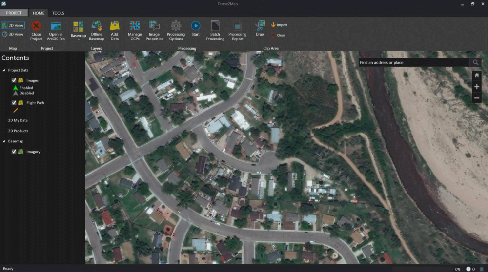
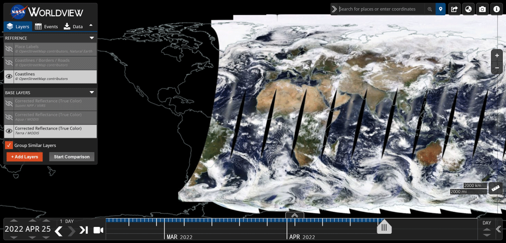
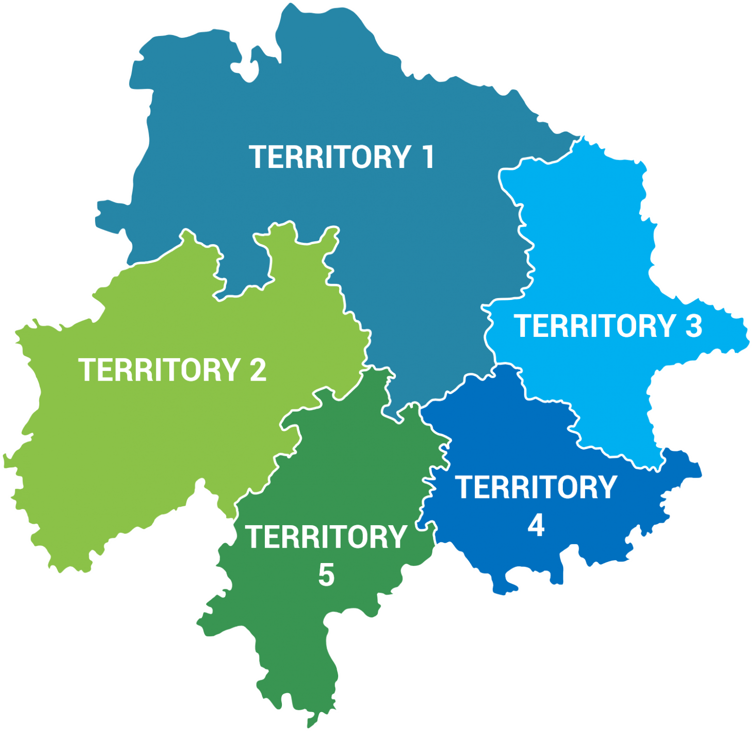
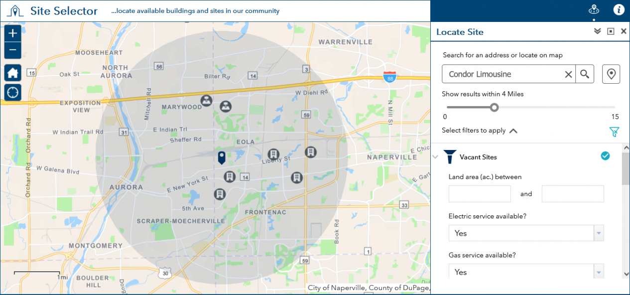
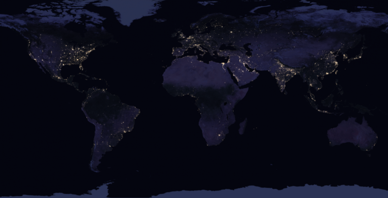
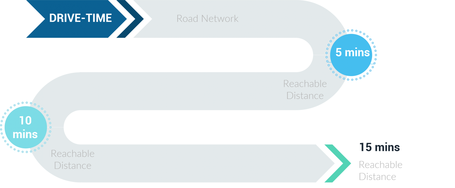
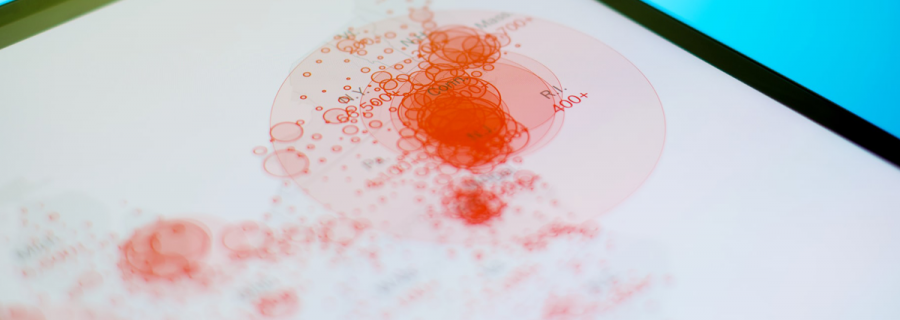
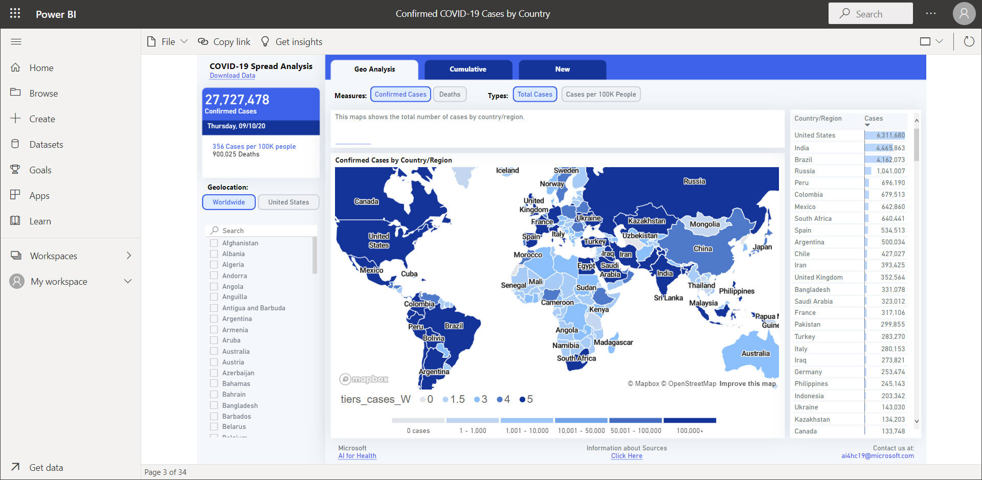
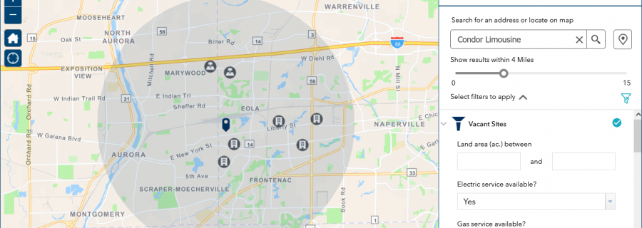
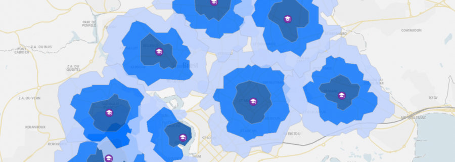
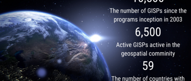
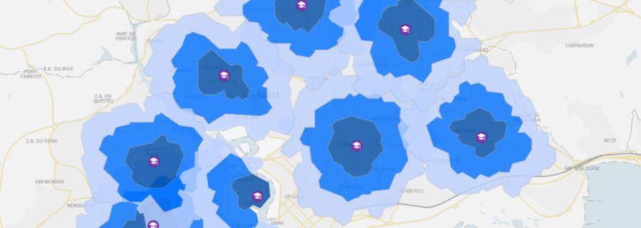
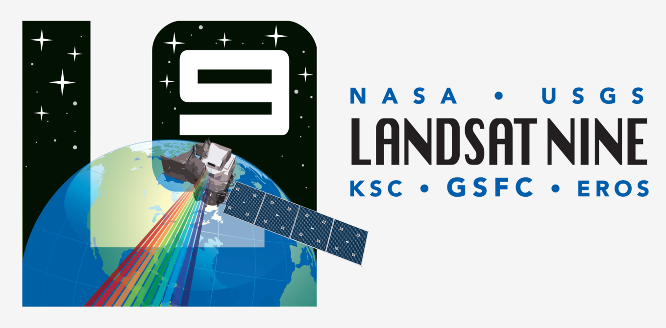
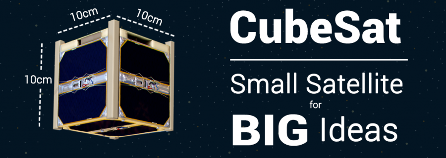
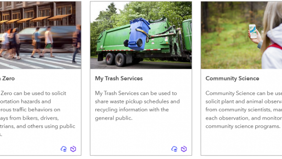
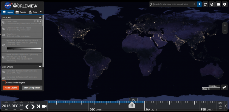
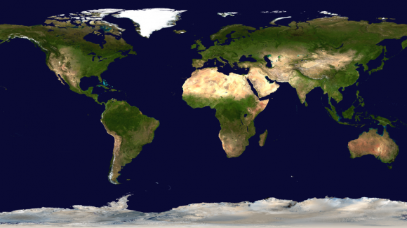
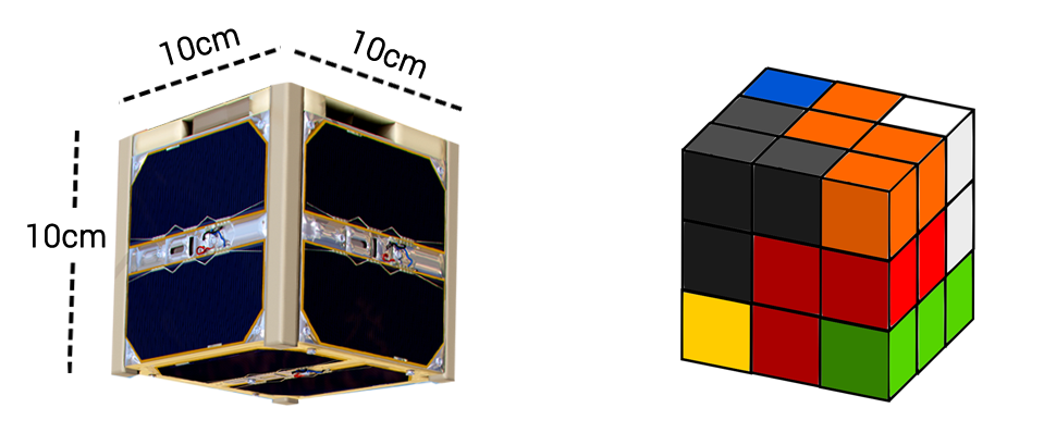
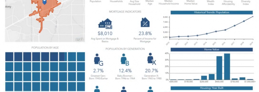
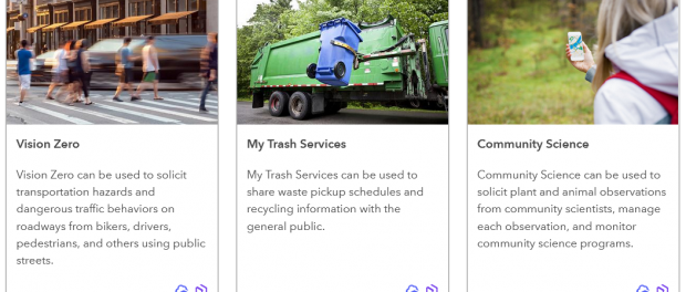
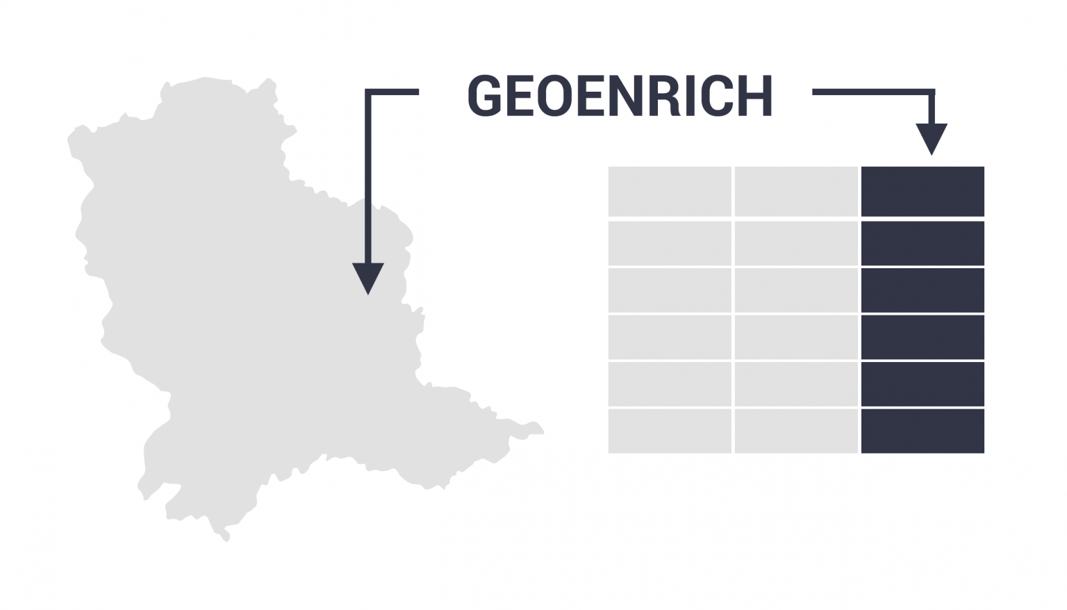
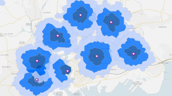
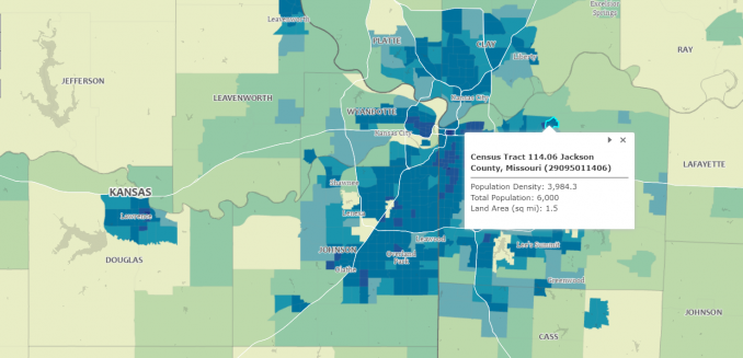
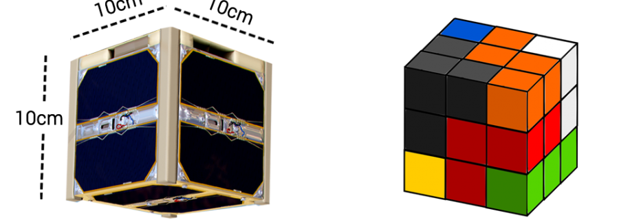
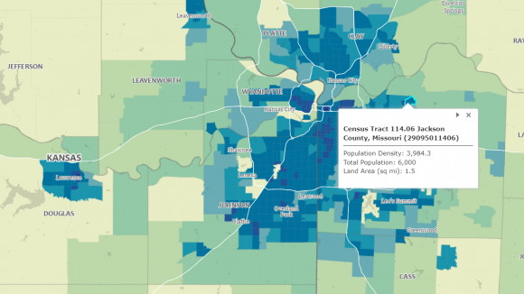
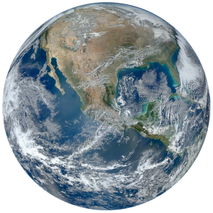
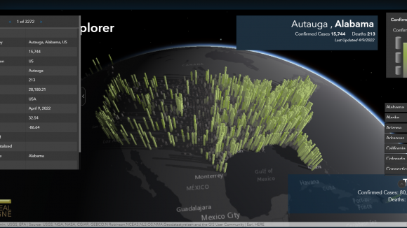
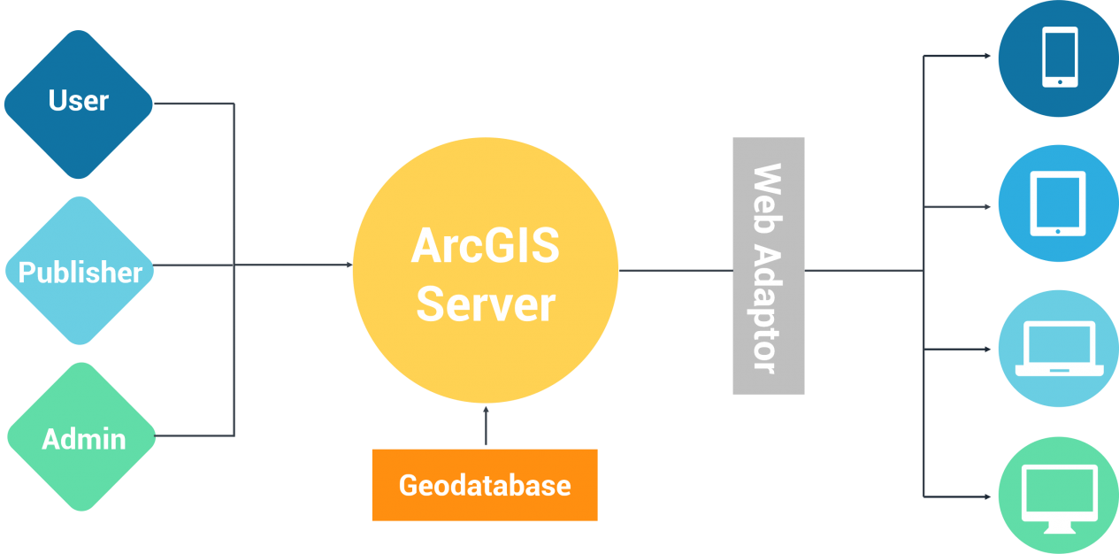
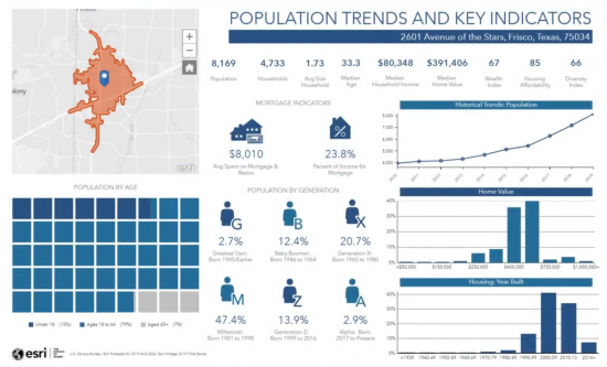
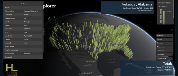
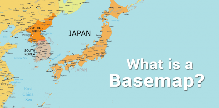
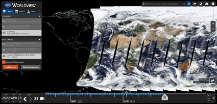
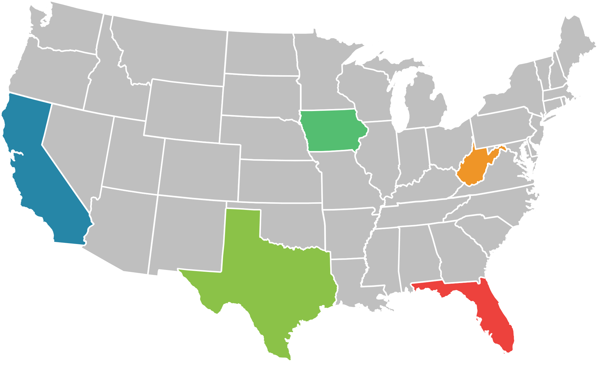
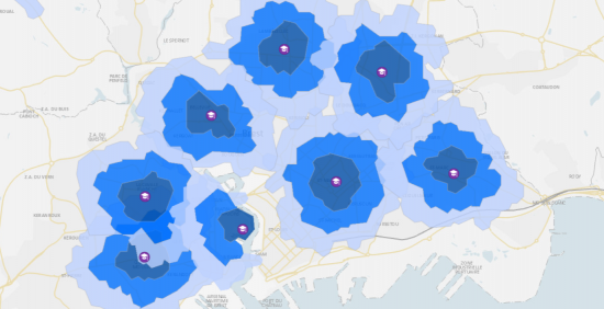
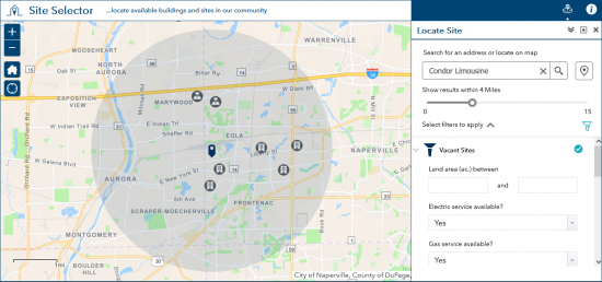
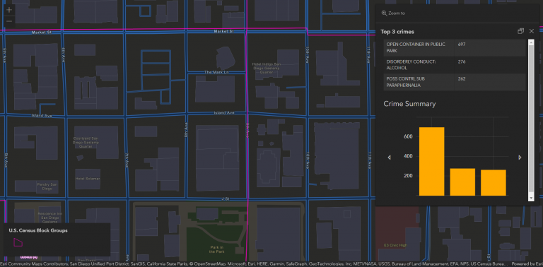
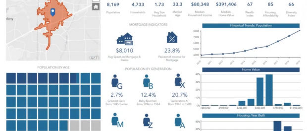
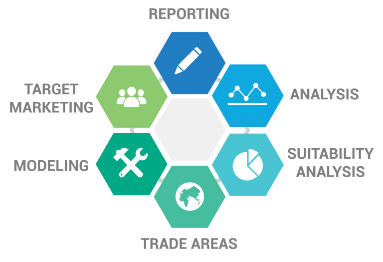
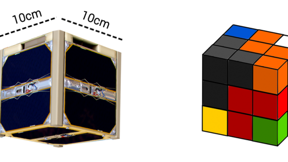
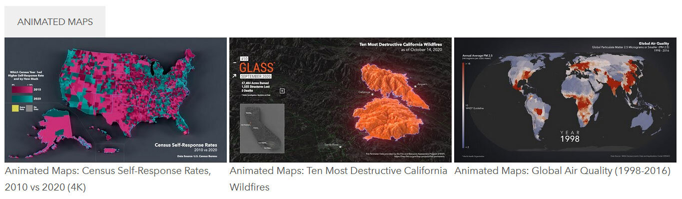
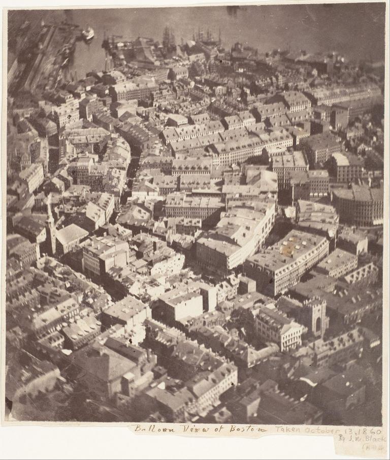
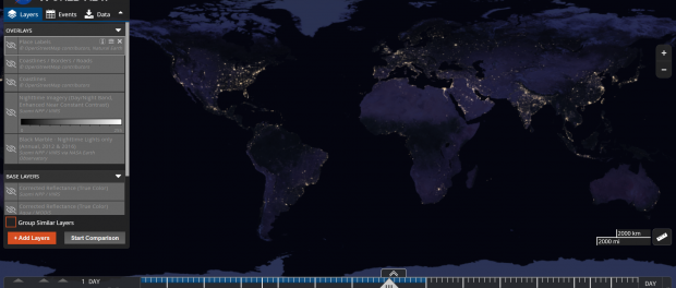
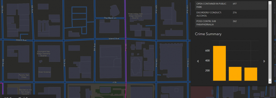
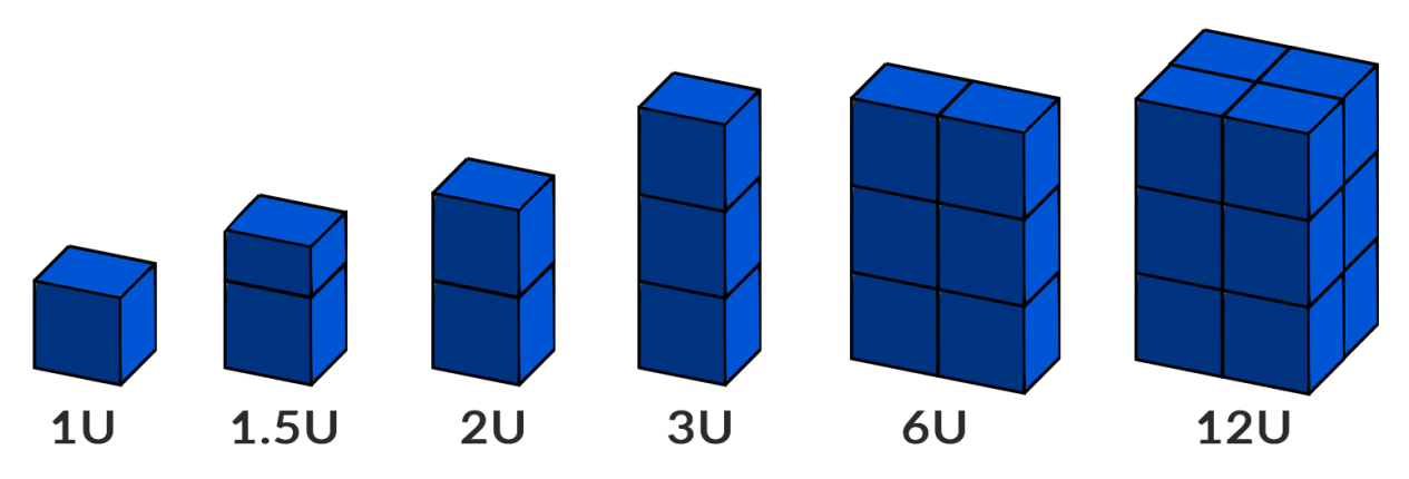
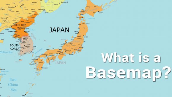
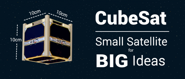
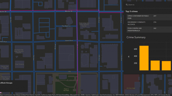
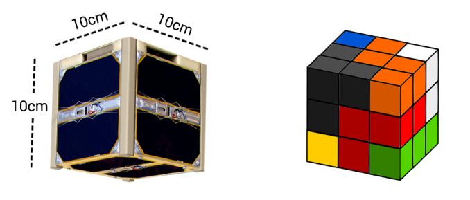
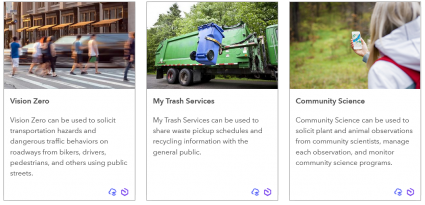
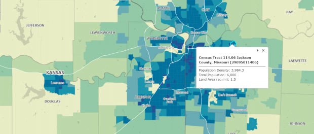
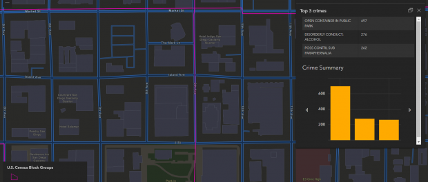
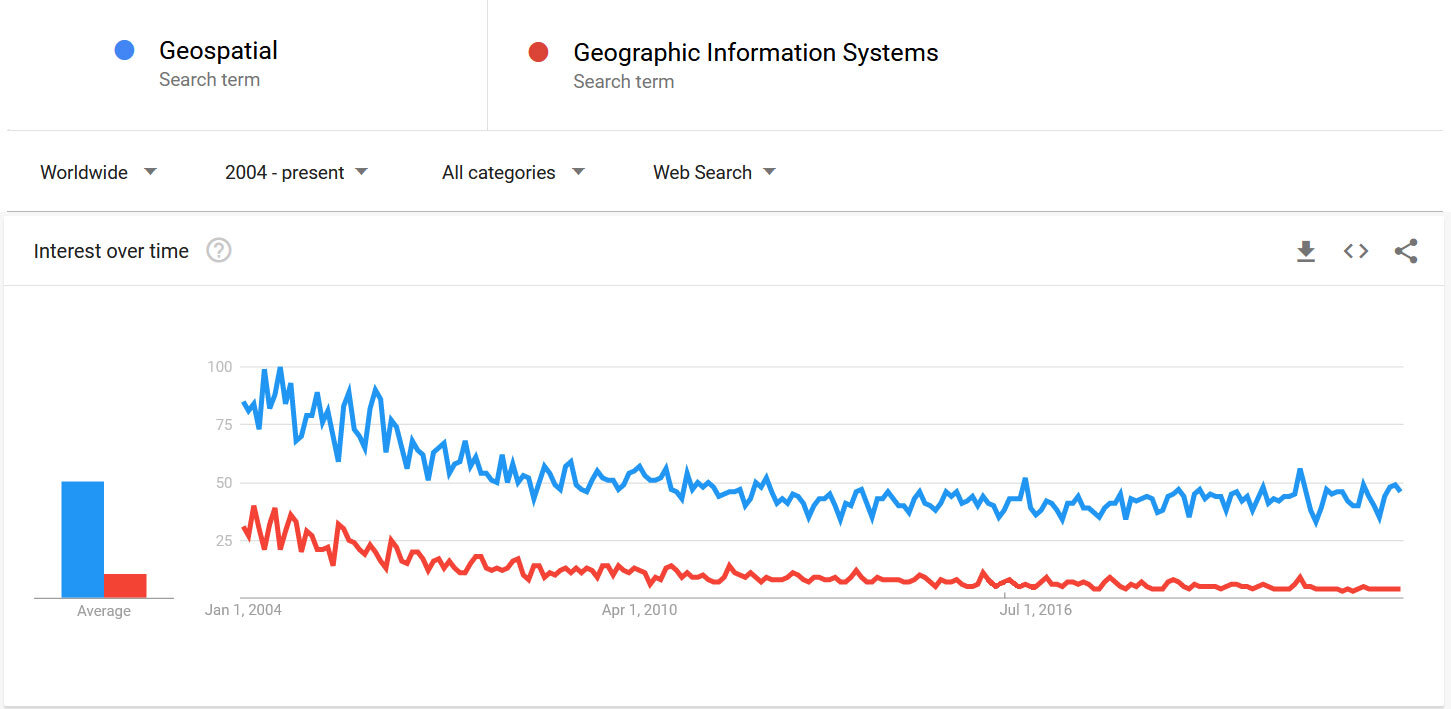
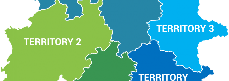
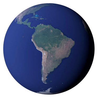
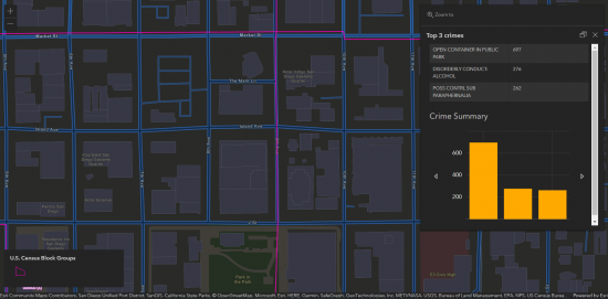
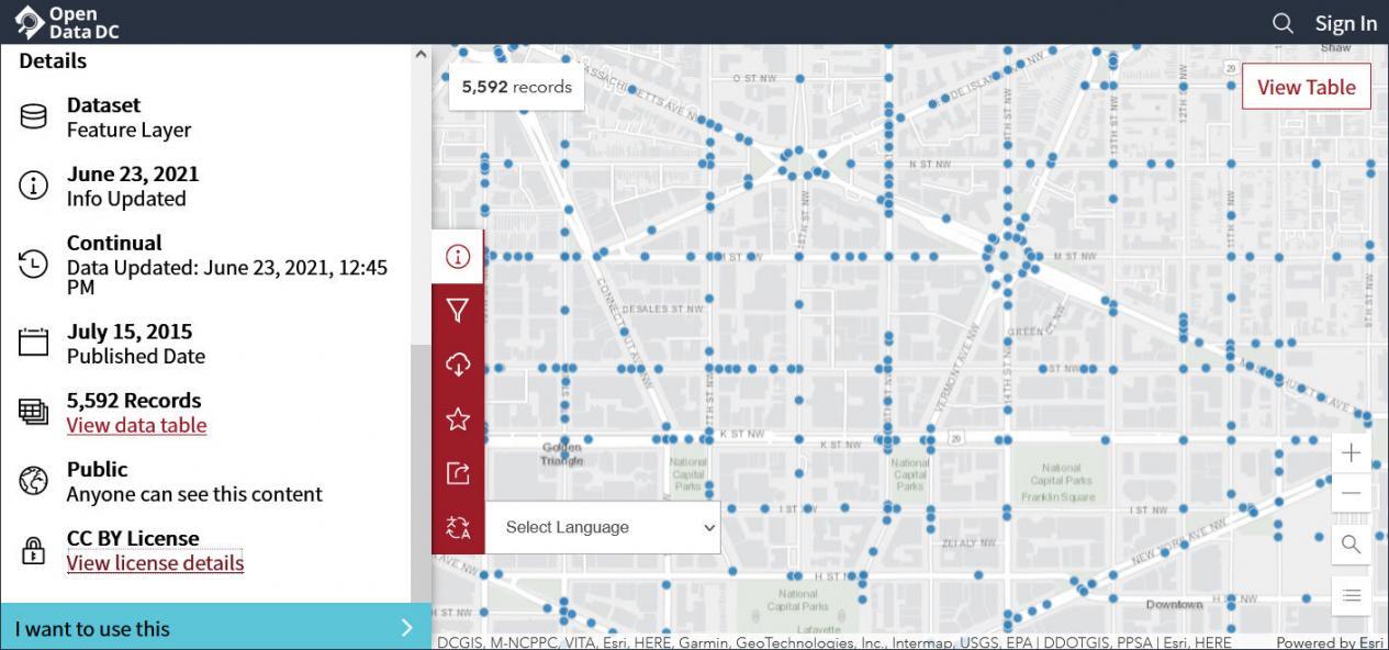
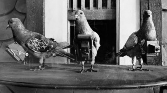
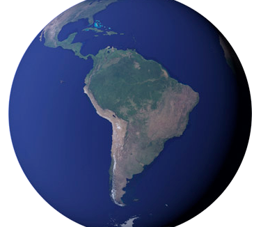
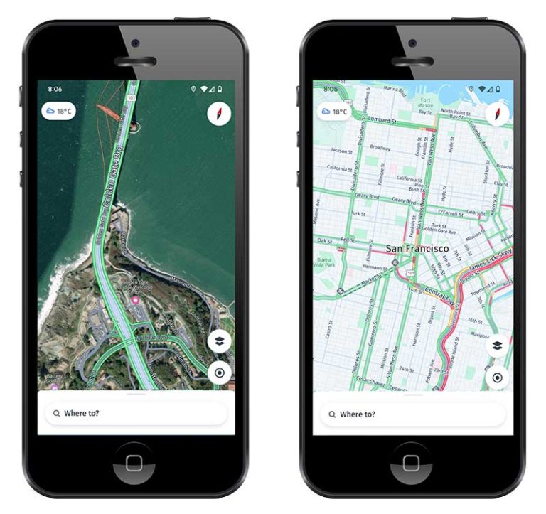
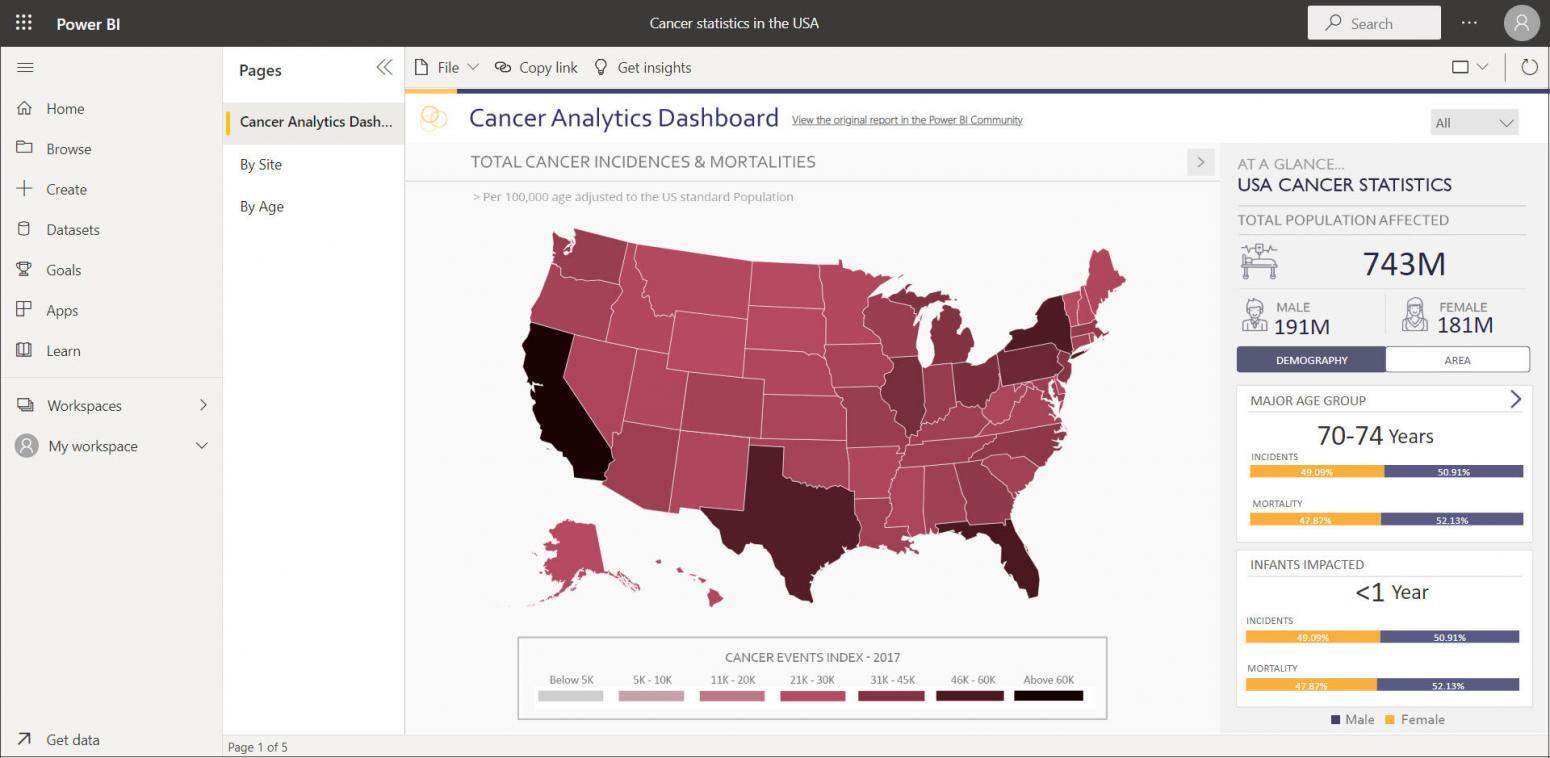
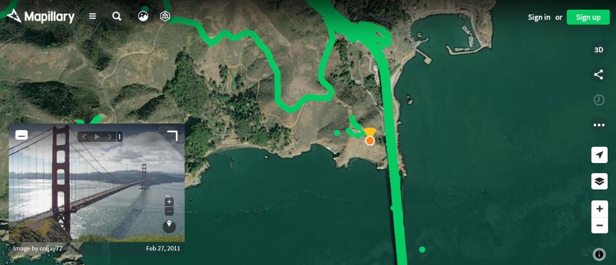
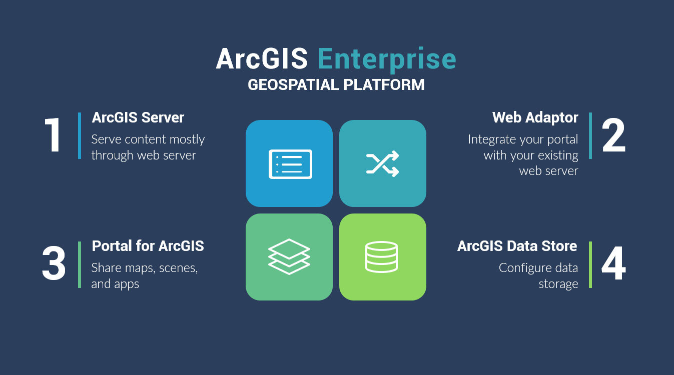
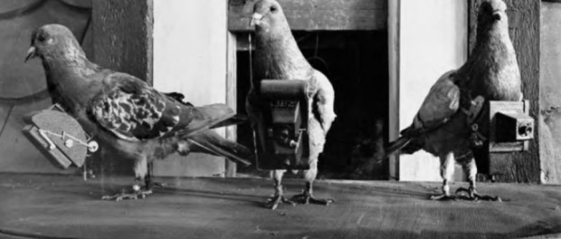
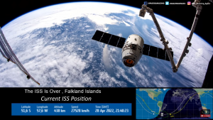
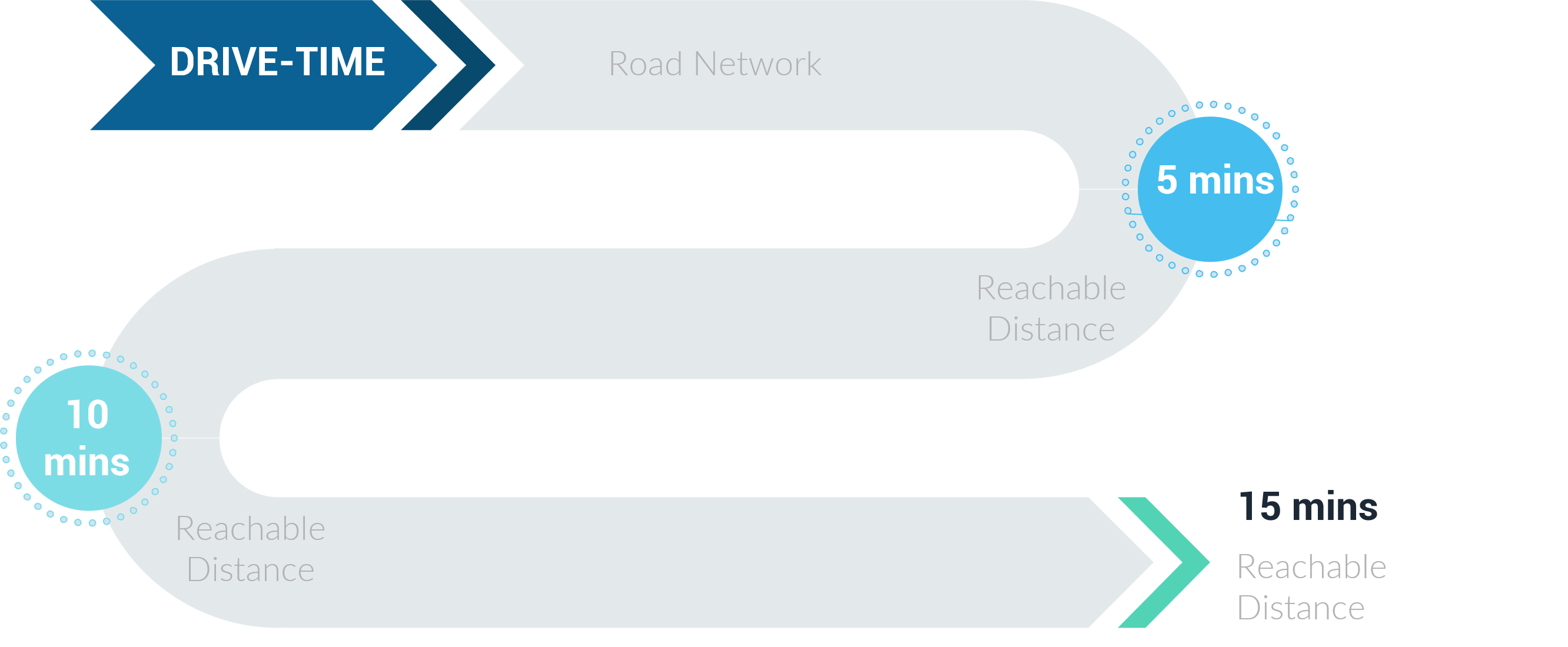
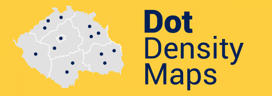
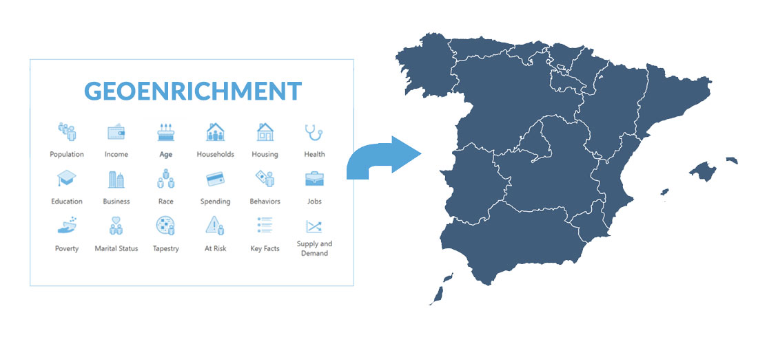
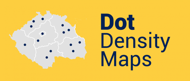
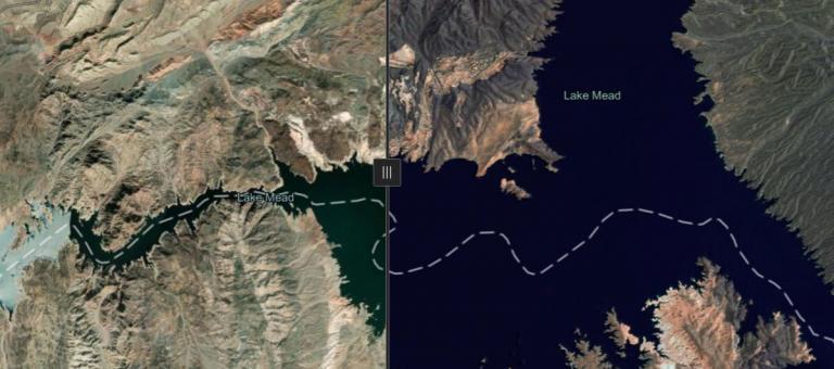
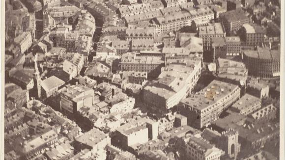
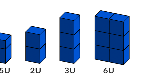
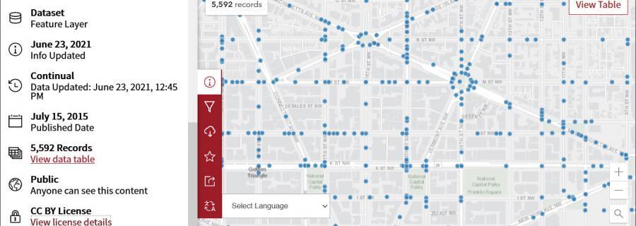
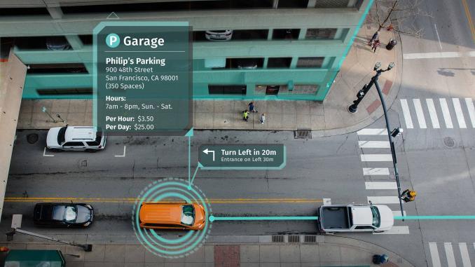
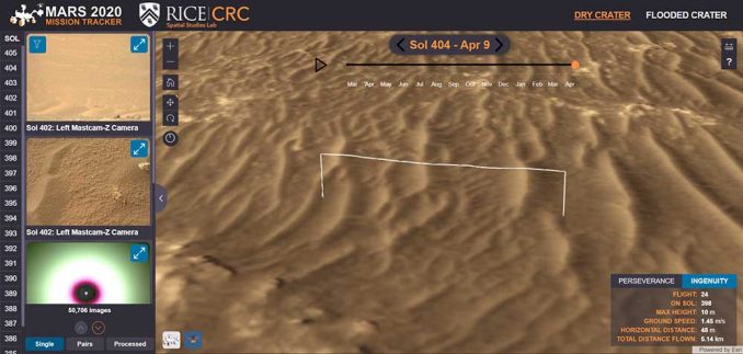
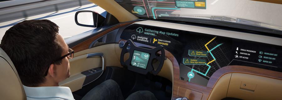
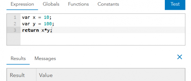
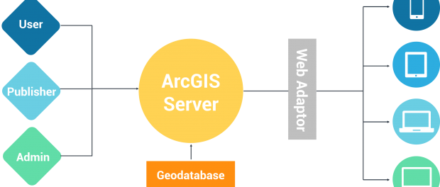
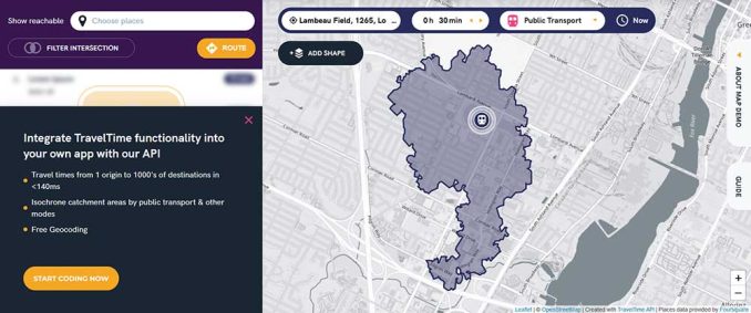
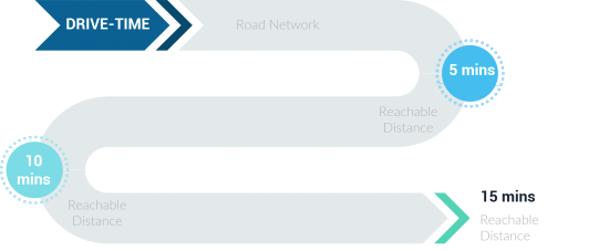
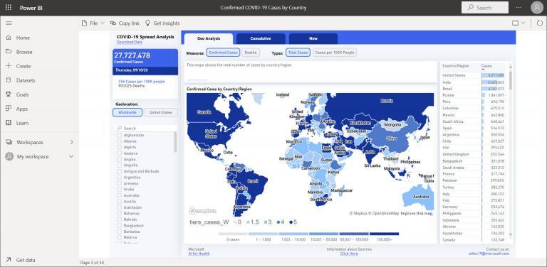
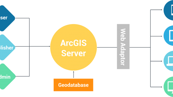
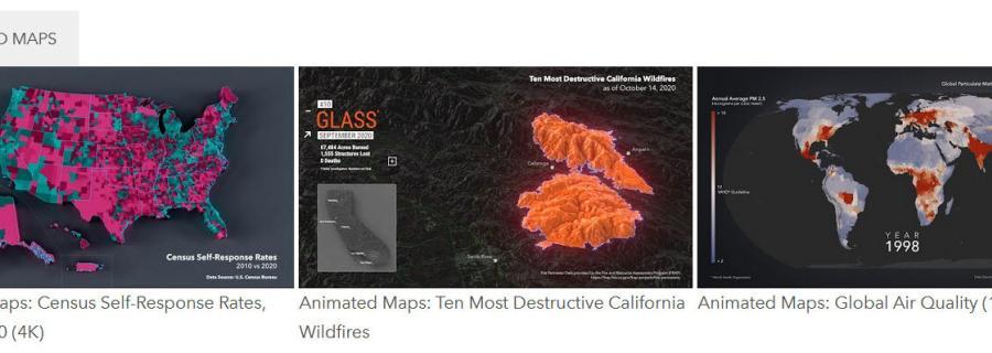
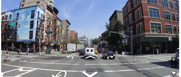
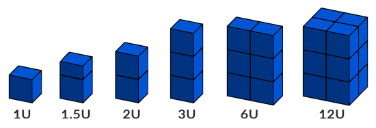
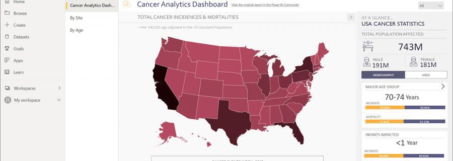
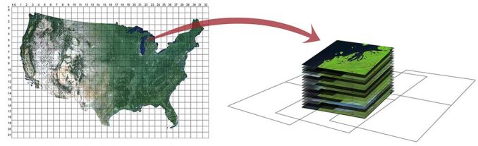
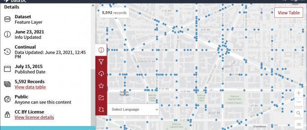
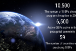
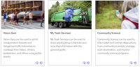
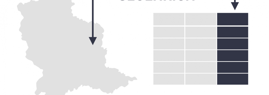
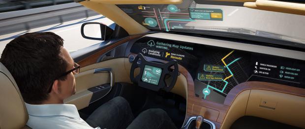
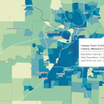
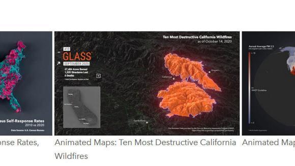
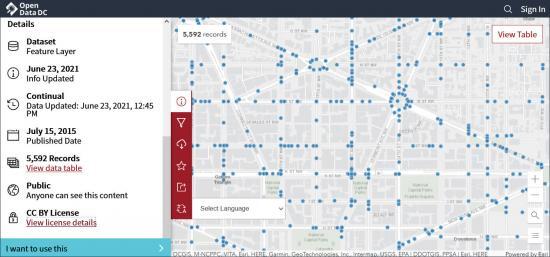
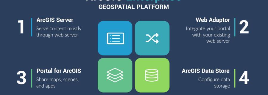
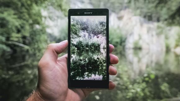
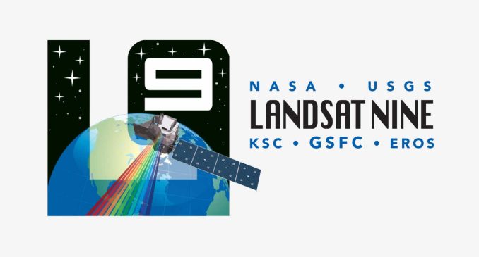
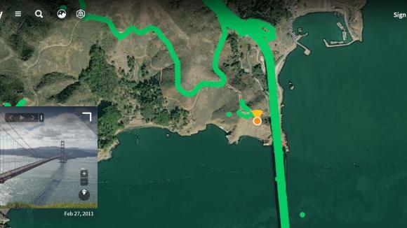
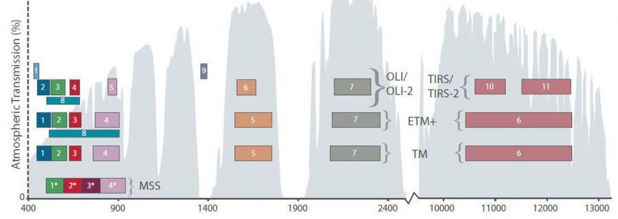
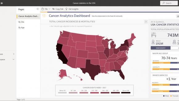
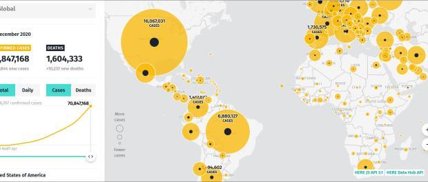
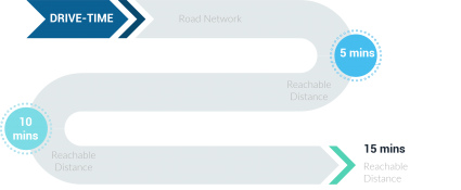
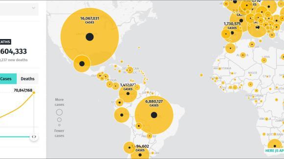
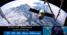
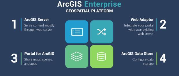
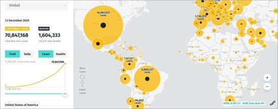
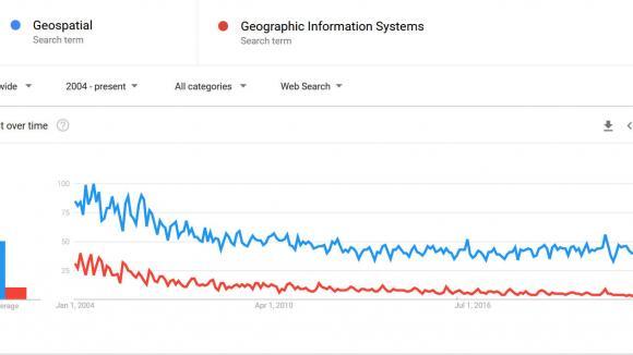
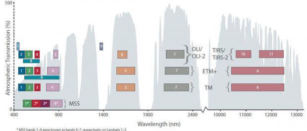
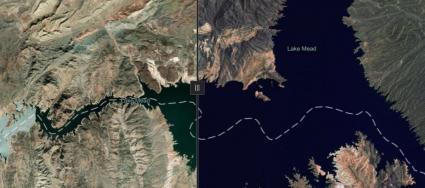
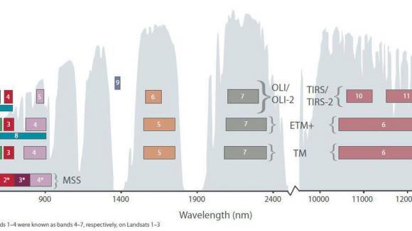
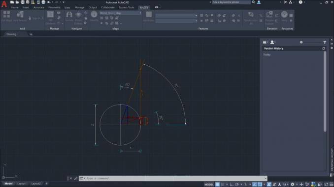
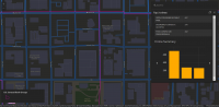
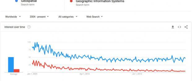
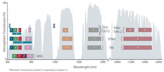
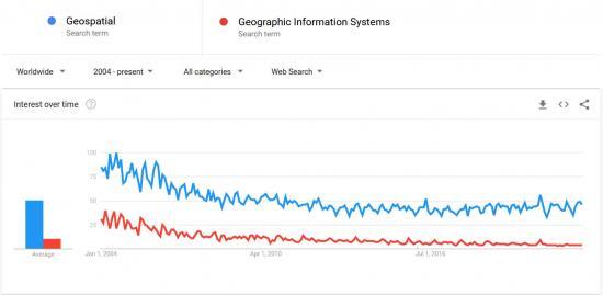
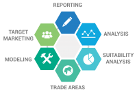
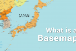
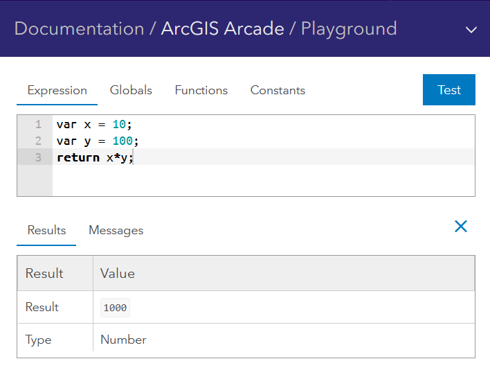
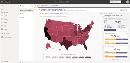
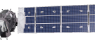
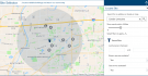
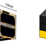
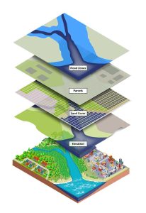
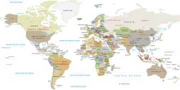
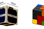
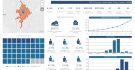
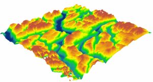
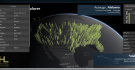
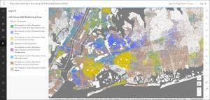
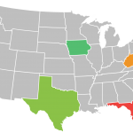
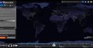
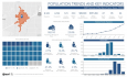
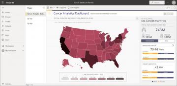
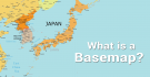
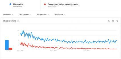
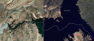
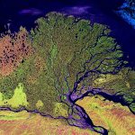
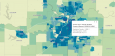
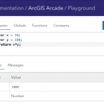
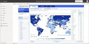
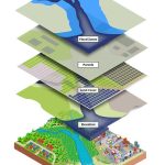
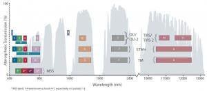
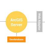
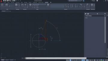
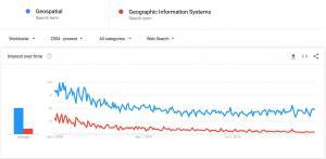
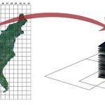
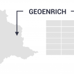
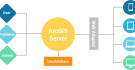
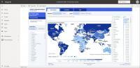
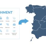
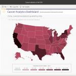
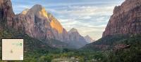
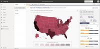
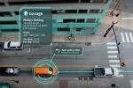
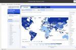
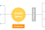
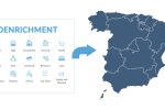
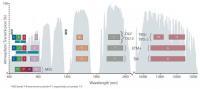
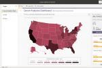
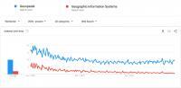
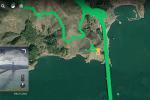
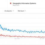
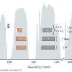
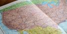
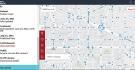
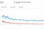
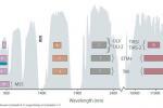