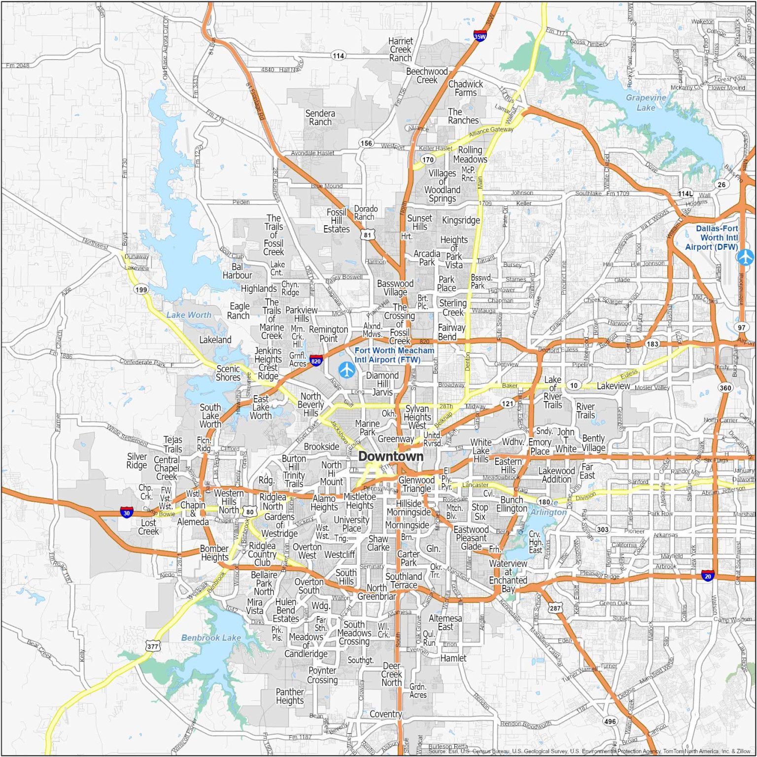
Fort Worth Neighborhood Map
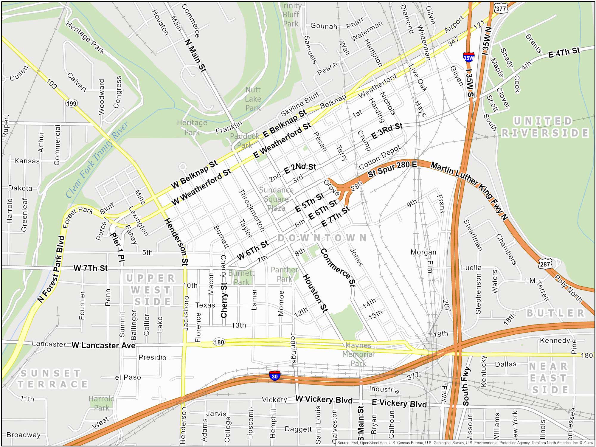
Downtown Fort Worth (Sundance Square)
Centrally located. Bordered by the Trinity River. Close to major highways I-30 and I-35W. Includes the retail district of Sundance Square.
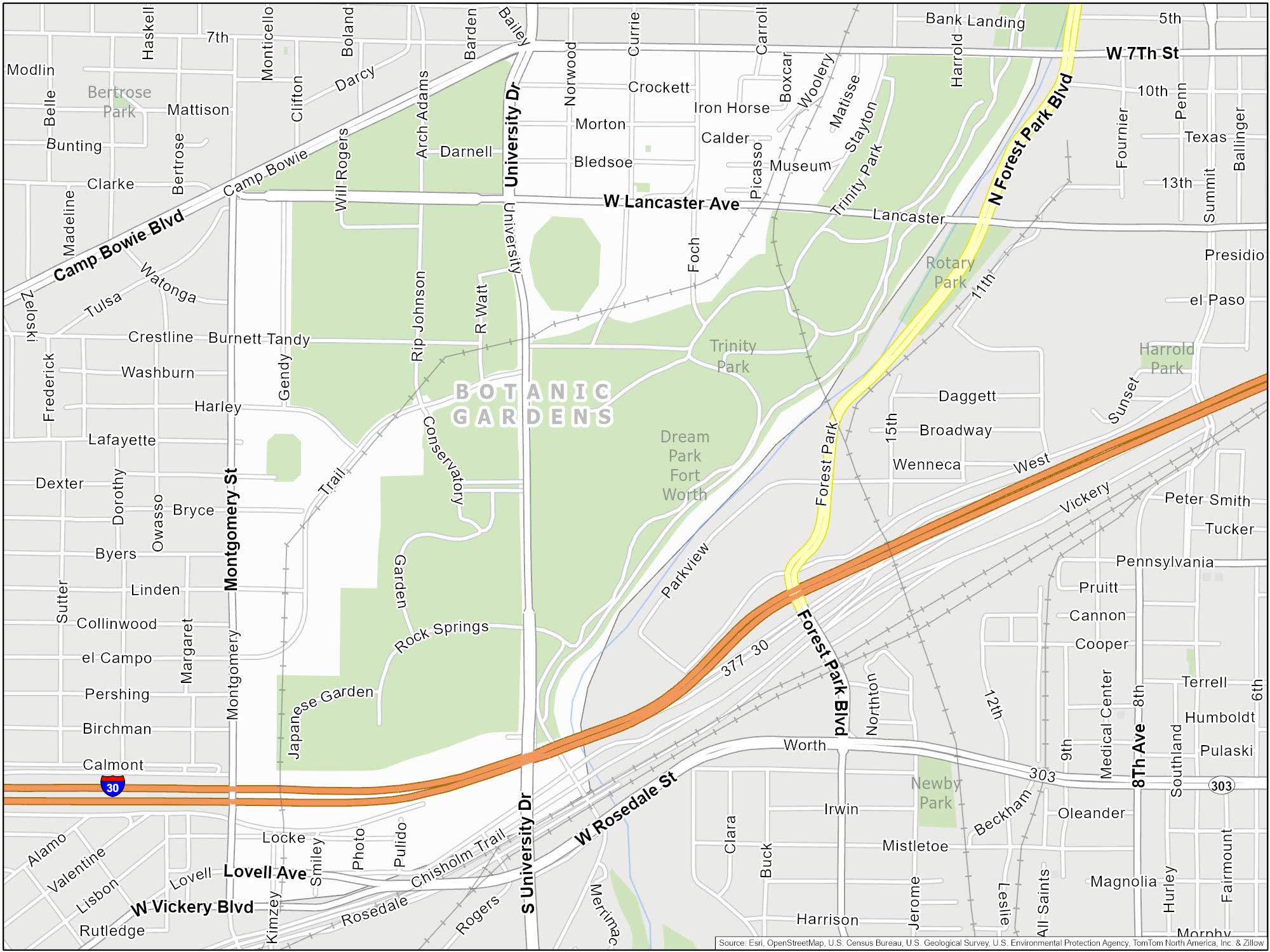
Botanic Gardens (Cultural District)
Near University Drive and I-30. Adjacent to the Fort Worth Zoo. The main routes are Lancaster Ave, Montgomery Street and I-35.
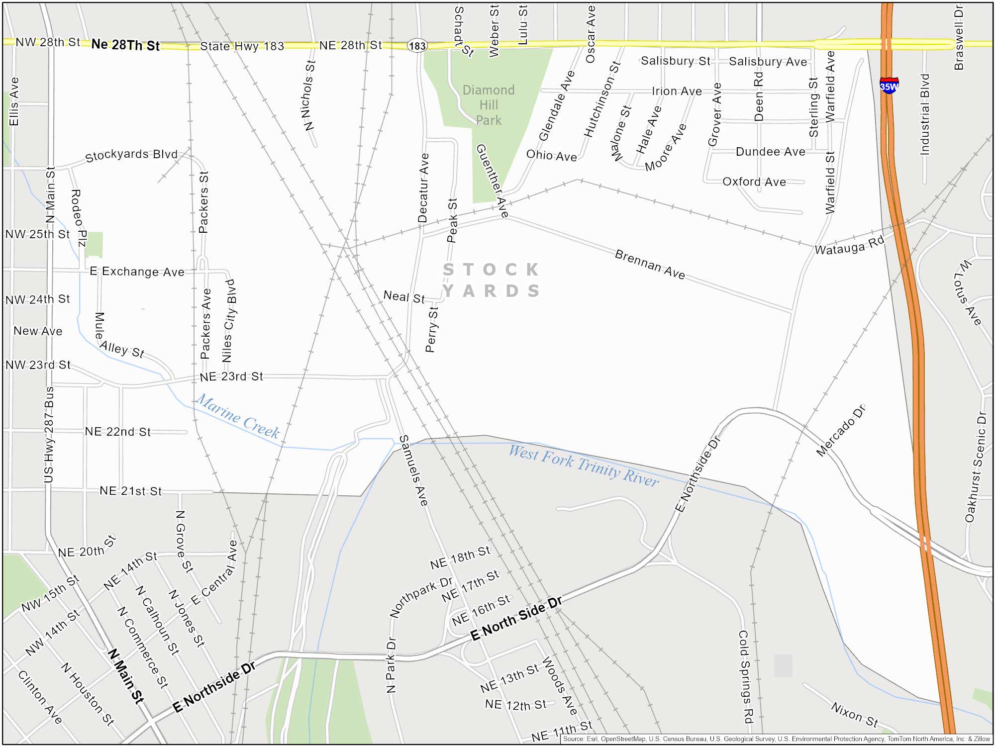
Stock Yards
Situated in North Fort Worth, centered around East Exchange Avenue. Off I-35W, 28th Street and North Main Street.
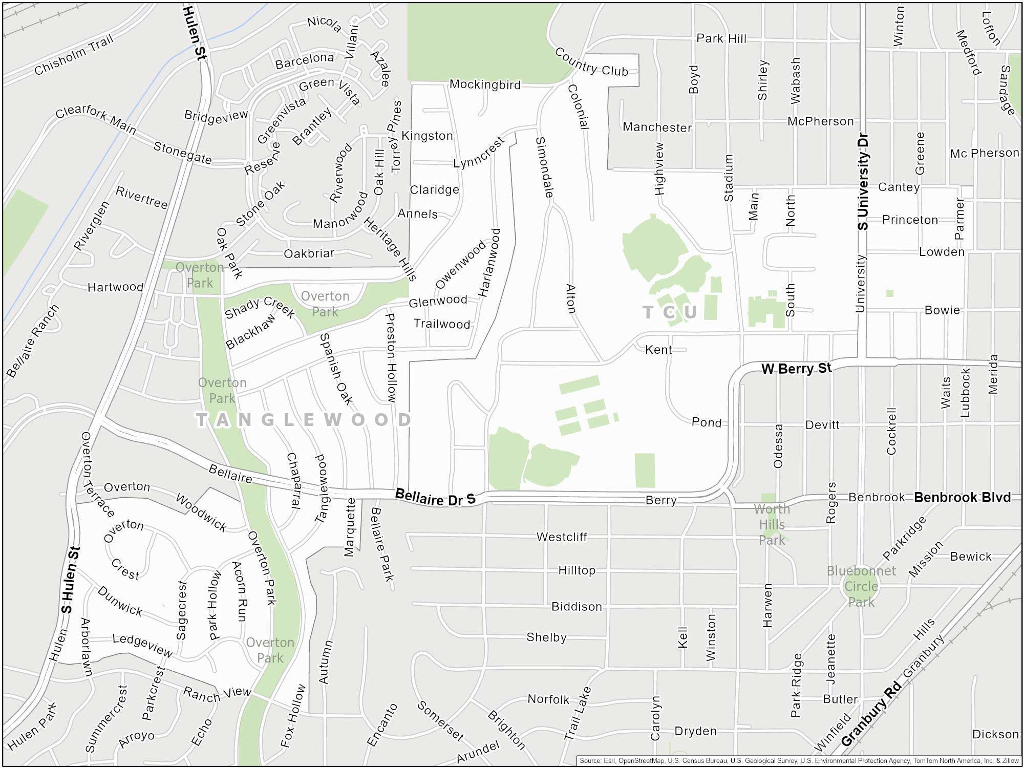
Texas Christian University
TCU is in the southwestern part of Fort Worth next to Tanglewood. Close to major streets like Berry Street and South University Drive.
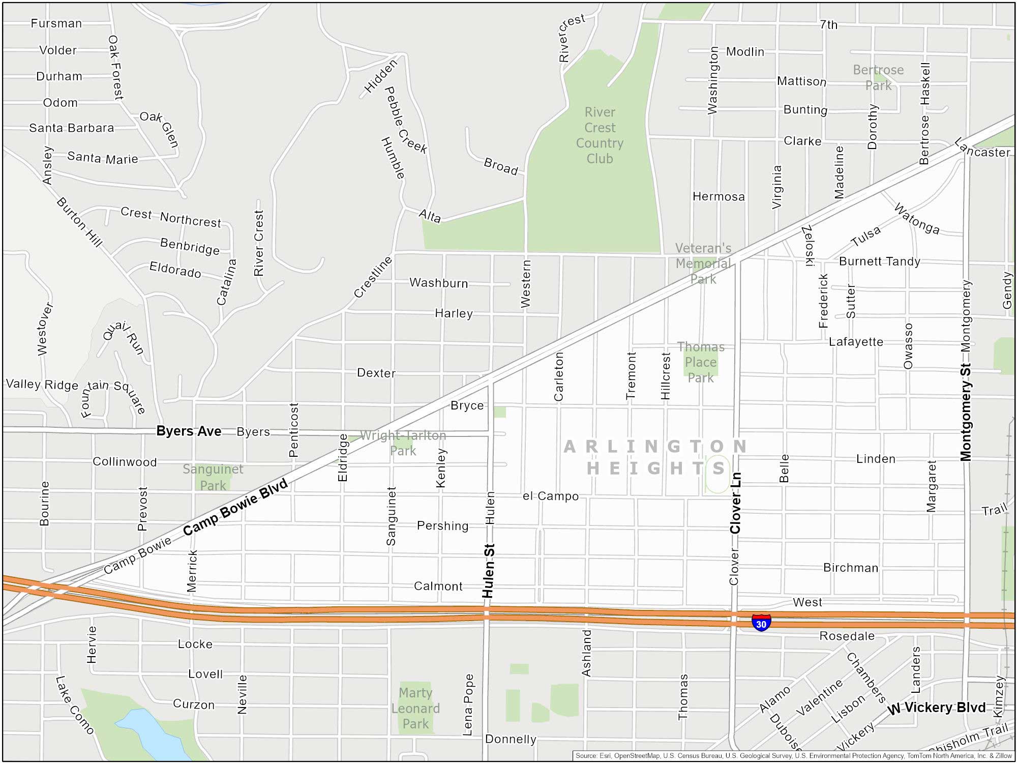
Arlington Heights
Triangular neighborhood bordered by Camp Bowie Blvd, Montgomery Street and I-30. Located in the western part of Fort Worth.