GIS Datasets
Learn how to tap into the different sources of GIS vector/raster, topography, and satellite imagery available.

Feature

10 Free GIS Data Sources: Best Global Raster and Vector Datasets
Turbo-charge your search for free GIS data with this list of 10 free, downloadable global GIS datasets from highly reputable sources – vector and raster.


Find GIS Data


How to Download OpenStreetMap Data (OSM)
OpenStreetMap is like the Wikipedia of maps. As “open” is its key philosophy, this is true for OSM data. Learn to download OpenStreetMap data.
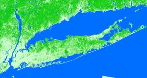
Imagery
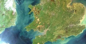
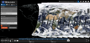
15 Free Satellite Imagery Data Sources
If you’re searching for free satellite imagery, we rank the best sources of free satellite data from authoritative sources like NASA, USGS and Maxar.

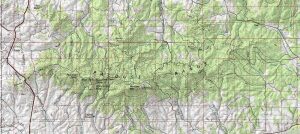
Topography


What is Topography? The Definitive Guide
Topography lays the underlying foundation of the Earth’s surface. In this comprehensive guide, you’ll learn everything about topography and topographic maps.
GIS Formats
The Ultimate List of GIS Formats and Geospatial File Extensions
How well do you know GIS formats? This list lets you know all the geospatial data formats that GIS technicians manage, and share data.