US Election of 2024 Map
In the 2024 U.S. presidential election, Donald Trump made a historic comeback to the White House by securing around 50% of the popular vote.
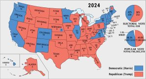
In the 2024 U.S. presidential election, Donald Trump made a historic comeback to the White House by securing around 50% of the popular vote.
Sundance Square, the Cultural District, the Stock Yards, TCU/Tanglewood and Arlington Heights are in our neighborhood map of Fort Worth.

You can learn all the neighborhoods of Austin on this page from our page. It includes Downtown, East Congress, Zilker, South Lamar, and more.

Familiarize yourself with neighborhoods of Jacksonville. Our map displays Downtown, Midtown, San Marco, and popular neighborhoods of Jax.
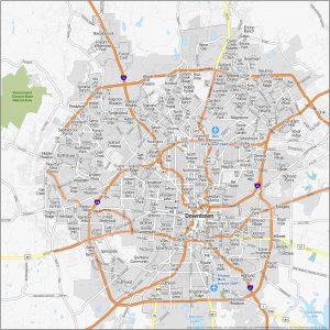
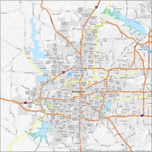
We kick off things with the heart of San Antonio – Downtown/RiverWalk. Then, move onto other neighborhoods like Alamo Heights and Southtown.
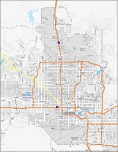
Here are the top neighborhoods of Phoenix, Arizona. We love downtown, especially Roosevelt Row (Arts District) as well as Paradise Valley.
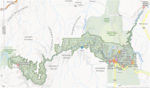
Our Grand Canyon National Park map highlights campgrounds, trails, visitor centers, attractions, highways, roads, and much more.
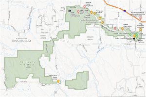
This Badlands National Park map is your guide through towering spires and deep canyons that tell a story millions of years in the making.
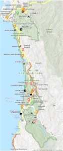
Embark on a world dominated by the tallest trees on Earth. Our Redwood National Park Map reveals campgrounds, trails, roads, attractions, etc.
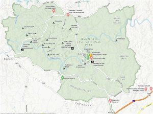
Get to know the world’s longest cave system with this Mammoth Cave National Park map, located in the heart of Kentucky.