Federal Lands of the United States Map

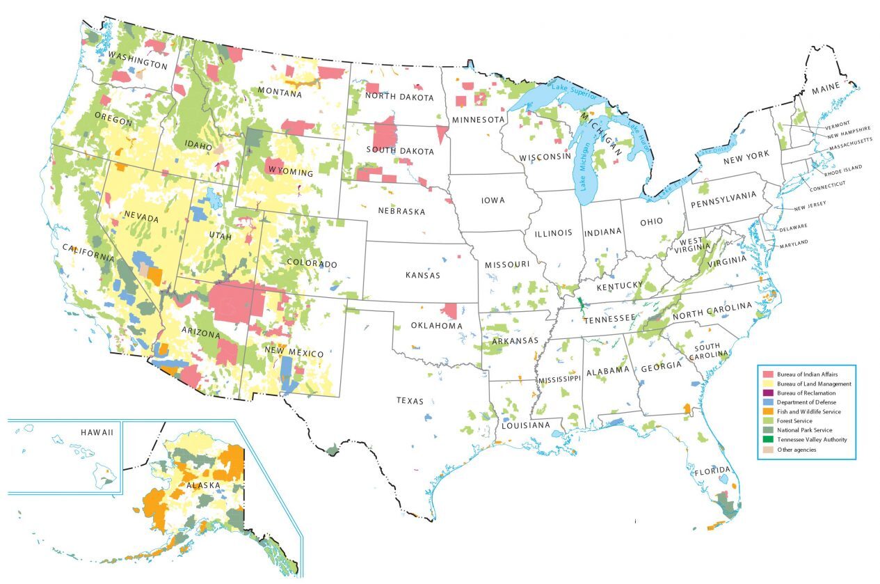
Download the United States Federal Lands map to see which lands the US government owns and regulates. For example, it includes:
- National Park Service
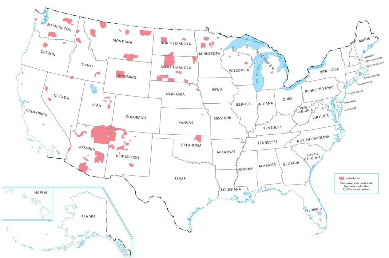
- Indian Lands
- Bureau of Reclamation
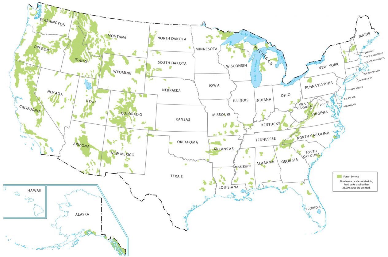
- National Forest Service
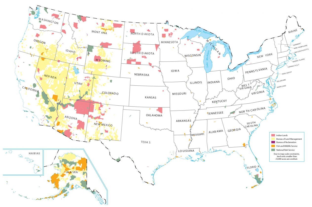
- Bureau of Land Management
- Fish and Wildlife
Each federal lands map displays a small-scale map, omitting land units smaller than 23,000 acres in area.
You are free to use our Federal Lands map for educational and commercial uses. Attribution is required. How to attribute?
Indian Lands Map

Forest Service Lands Map

Land Management Map


Needs the lands reconstituted to the Cherokee, Chickasaw, Choctaw, Muscogee, and Seminole Nations in McGirt v. Oklahoma.
What is the best source for a map of federal lands in which you can stay in a camper overnight regardless of whether or not it has facilities for showering or charges a fee?
The Agencies which manage the lands. Typically, Bureau of Land Management, The Forest Service, and National Park Service allow dispersed camping, unless they have an issue requiring regulation. The typical maximum length of stay is 10, or 14-days.
Hi Kelley, Article 4, Section 3, Clause 2 of the U.S. Constitution has long been held up as the explicit provision by which all federal lands are held. This has been settled law in the U.S. since the second constitutional convention. The founders debated and included this clause with the explicit goal of allowing the federal government to retain control over lands. The U.S. Supreme Court has confirmed this fact on several occasions. Whether or not you personally agree with it, it’s one of our country’s most well-established laws.
There is no provision in the Constitution for National Parks, National Monuments, National Forests, or BLM lands. These are not legitimately held by the Federal Government, to the loss of mainly Western States. No State should stand for this.
Well, since the western states, acknowledged Federal ownership of Lands within their state, and agreed to ever challenge that ownership as a condition of statehood, teh western states have no legal standing to challenge.
And, while the Constitution makes no mention of any federal agency managing the lands, it does acknowledge the right of Congress to manage. So, establishing agencies within the executive, and designating management of resources of the United States, to those agencies is entirely within the powers given to Congress.
The “promote the general welfare” clause covers it.
Does anyone have any information on the data set that was used to generate/fill in these maps? Was it based off zip codes?
My guess is that it is a composite developed from the GIS databases of the various agencies. If I were doing it, I would send a Freedom of Information request for the data to the agencies and then compile it onto one display map. That would be much faster and easier to do than try to get zip code level data, which was accurate.
No scale!