The United States Map Collection: 30 Defining Maps of America
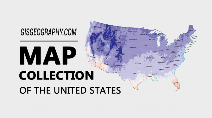
Exploring America: A Gallery of 30 Maps
These are the defining maps of the United States. They explain what‘s where in America. Better yet, it’s the complete package of maps including everything from:
- Reference and general information.
- Presidential elections.
- Climate and physical maps.
But do you want to know the best part? They are all free to use because the original source is the National Map.
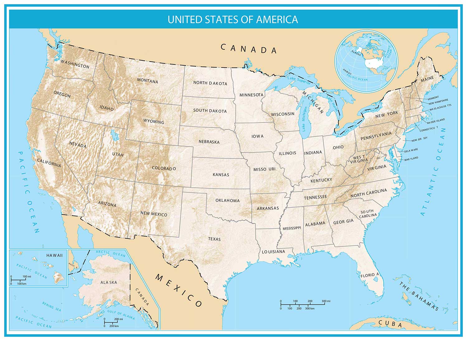
1. Detailed Map of USA
This is like a blueprint map of the United States with a plain and simple white background. It shows major interstate highways, cities, and capitals for all 50 states. Another key benefit to this United States map is how it includes major lakes, rivers, and mountains.

2. Detailed Map of USA with Hillshade
This map lays out a foundation with a beige-tone hillshade backdrop. As a result, it carves the major mountain chains like the Rocky Mountains and the Appalachians. It also includes major cities, roads, states, capitals, and landmarks.
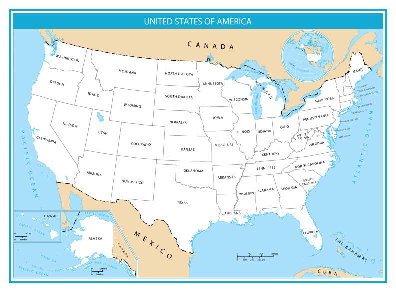
3. Simple Map
If you want a plain and simple map of the United States, this one only shows state boundaries. But it also includes state names and neighboring countries. If you don’t want state names, then use the next map below.
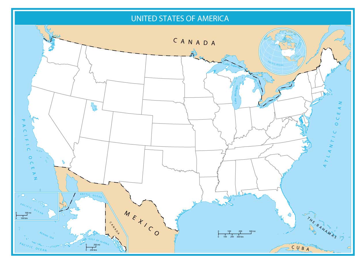
4. Blank State Map (Outline Map of USA)
This map of the United States completely discards state names. It’s just your 50 states of America with a white background. This makes it an excellent printable map for fill-in-the-blank type of activities in classrooms.
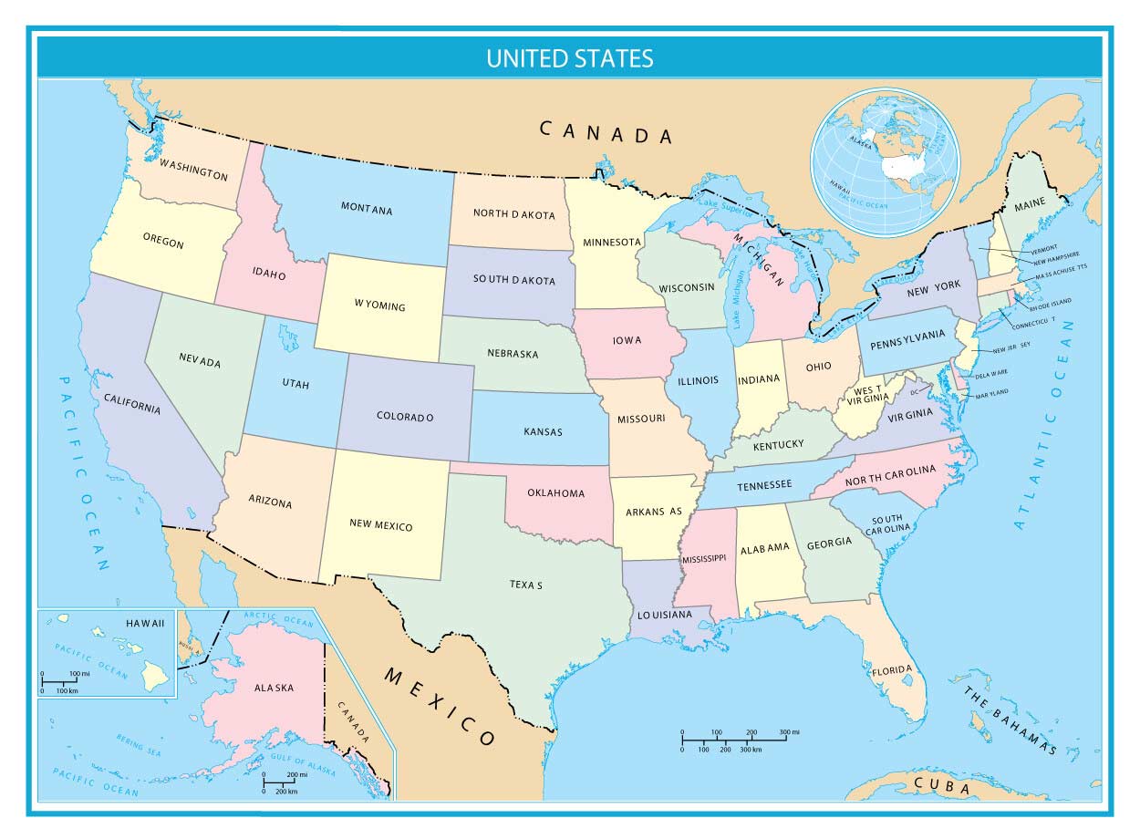
5. Pastel Color
This is an augmented map of the United States with a broad spectrum of colors. Each state has an appropriate color to separate it from others. By using a light pastel color palette, it gives a subtle tone to differentiate state boundaries.
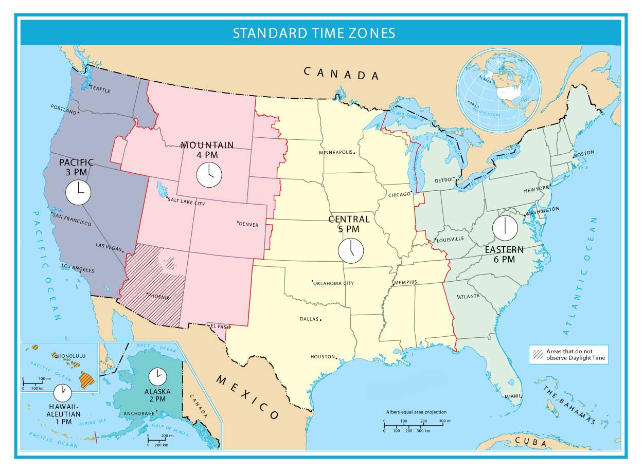
6. Time Zones
What time zone do you live in? By finding where you are on this map, you can instantly see which time zone you live in. Plus, you can see areas that do not observe daylight savings time. For example, it has all 6 time zones including the Hawaii-Aleutian, Alaska, Pacific, Mountain, Central, and Eastern time zones.
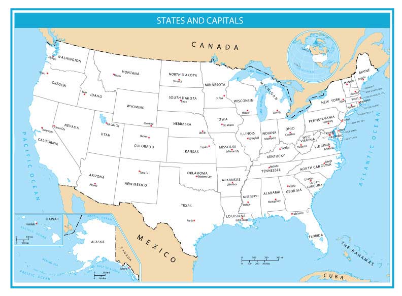
7. United States Map with Capitals
This map is a simple state map with a white background. But it pinpoints capital cities for all 50 states. Each capital has a red dot including Hawaii and Alaska.
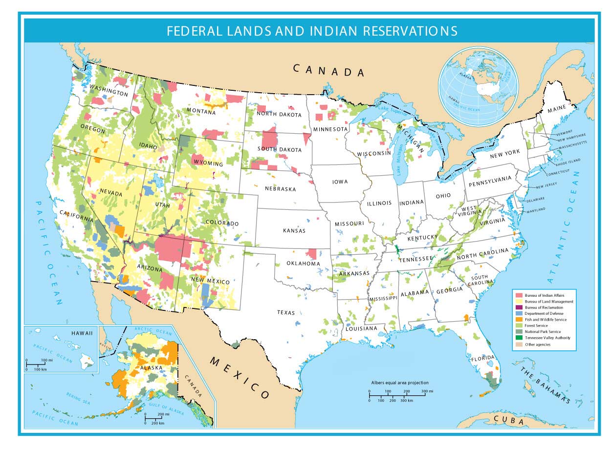
8. Federal Lands
Which areas are federal lands in the United States? This map shows National Parks, Fish and Wildlife, Forest Services, Defense, and Indian Reservations. Each federal lands map displays a small-scale map, omitting land units smaller than 23,000 acres in area.
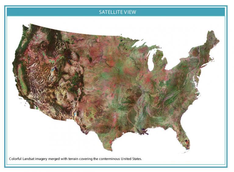
9. Satellite Map
This satellite map details the “true color” extent of land in the contiguous United States. It uses Landsat, a satellite program that’s been monitoring our planet for 50+ years. This composite image displays everything from forests, bare ground, deserts, and water in the conterminous United States.
10. Hillshade Map
Hillshade maps are excellent for highlighting valleys and mountains. In this case, you can see elevated and depressed regions in the United States. For example, areas like the Rockies and San Luis Valley particularly stand out.
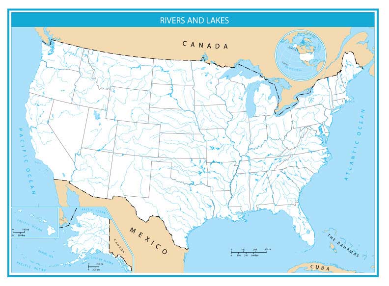
11. Rivers and Lakes Map
Did you know there are over 3,500,000 miles of rivers in the United States? This map carves out the major rivers and lakes and names them. For example, the Rio Grande, Colorado, and Mississippi Rivers are major rivers in the United States.

12. Blank Rivers and Lakes
There are over 250,000 rivers in the United States. Each one bends, loops, and meanders with flowing water on the surface. A way to use this map is to test your knowledge by filling in the river names.
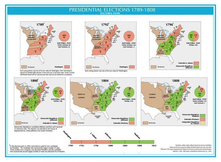
13. Presidential Elections 1789-1808
When George Washington was elected as the first US president in 1789, it became a moment forever ingrained in history.
From 1789 to 1808, these maps show the electoral vote for the Democratic-Republican and Federalist parties. In particular, this includes George Washington, John Adams, Thomas Jefferson, and James Madison.
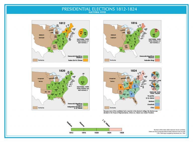
14. Presidential Elections 1812-1814
From 1812 to 1828, the electoral vote steadily increased. Candidates represented the Democratic-Republican, Federalist, and Fusion parties. Presidents included James Madison, James Monroe, and John Quincy Adams.
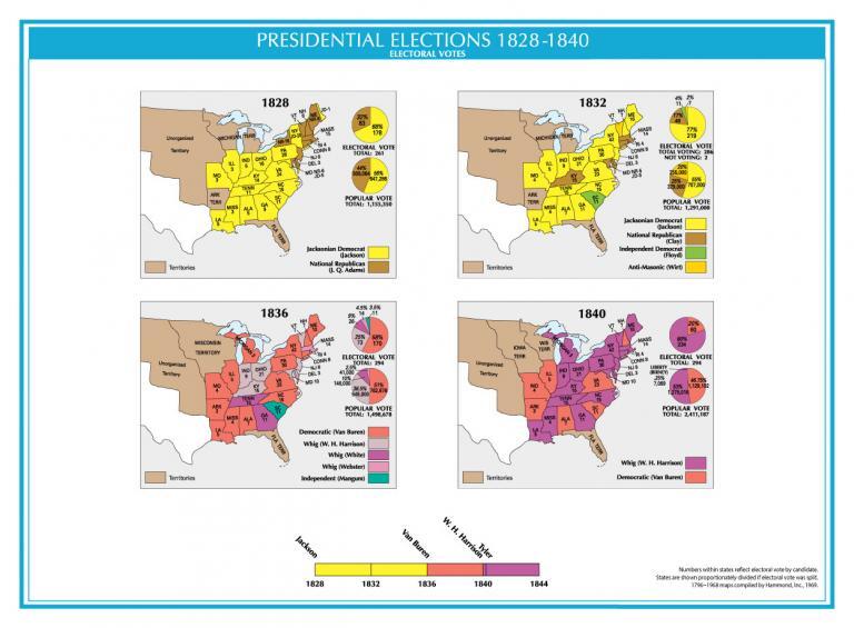
15. Presidential Elections 1828-1840
In 1828, Andrew Jackson claimed victory over John Quincy Adams of the National Republican Party to become the 7th president of the United States. Then in 1837, Martin Van Buren became president after serving as the eighth Vice President.
Finally, President William Henry Harrison was elected as president for only a month in office after dying from pneumonia. Consequently, John Tyler became the tenth President of the United States after filling in the role.
16. Presidential Elections 1844-1856
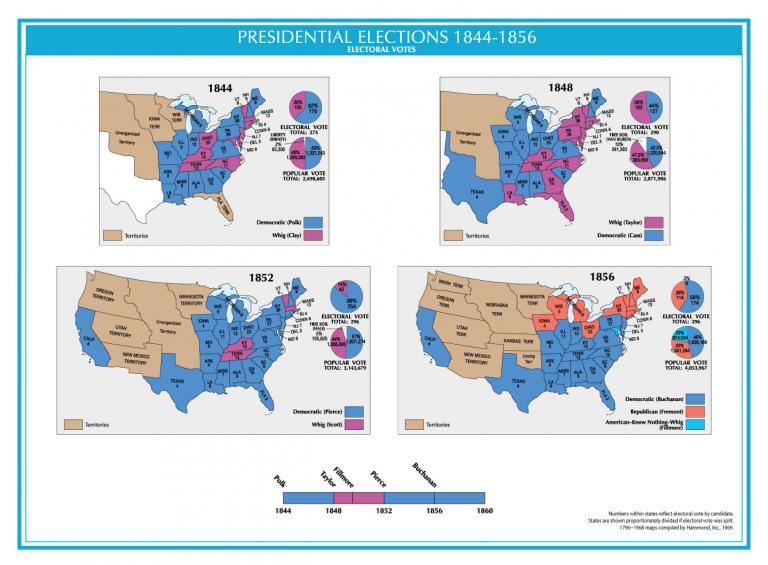
From 1844 to 1856, the lengths of the presidency were mostly short-lived. For example, James Knox Polk served as the 11th president of the United States from 1845 to 1849. This was followed by Zachary Taylor, Millard Fillmore, and Franklin Pierce as the 12th, 13th, and 14th presidents.
17. Presidential Elections 1860-1872
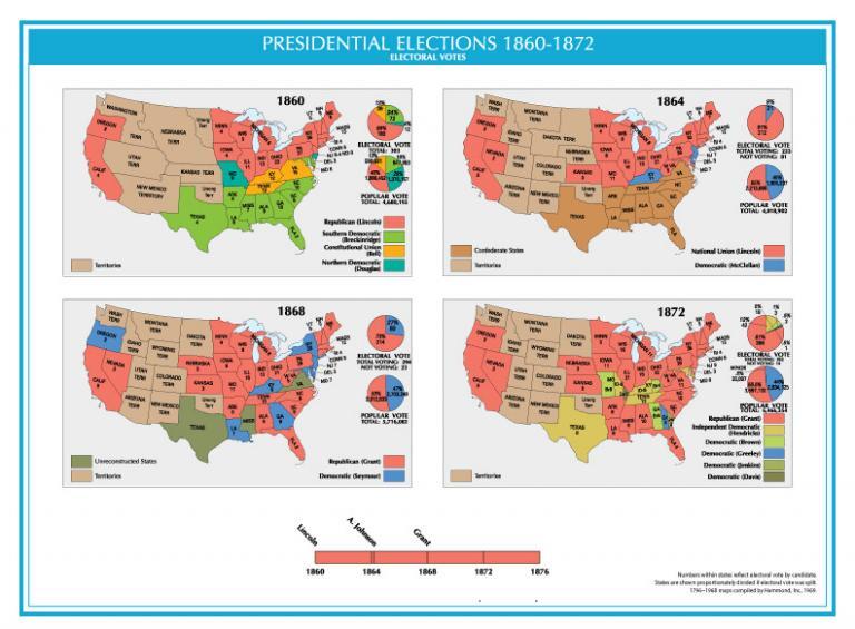
From 1860 to 1872, US presidents included Abraham Lincoln, and Andrew Johnson followed by Ulysses S. Grant. Terms as president ended early for both Lincoln and Johnson.
Lincoln was assassinated by stage actor John Wilkes Booth. Then, Andrew Johnson was impeached for “high crimes and misdemeanors”.
18. Presidential Elections 1876-1888
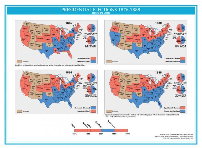
From 1876 to 1888, it was mostly a two-party race between the Republicans and Democrats. Hayes, Garfield, Arthur, Cleveland, and B. Harrison were presidents in this time span. B. Harrison won the electoral vote but lost the popular vote to Democratic candidate Cleveland.
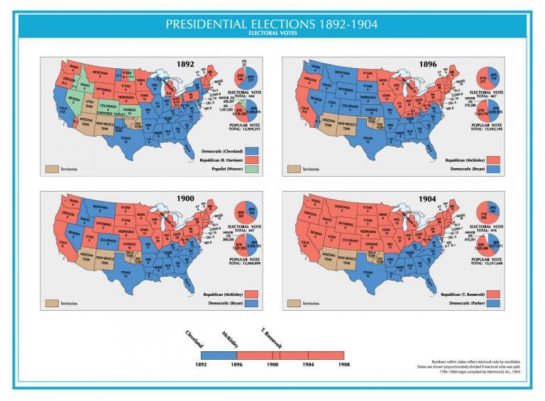
19. Presidential Elections 1892-1904
The presidential elections between 1892-1904 recognized three US presidents. This included Grover Cleveland, William McKinley, and Theodore Roosevelt.
In 1862, the Populist Party appealed to western farmers. But they could only win in states like Idaho, Colorado, and Kansas.
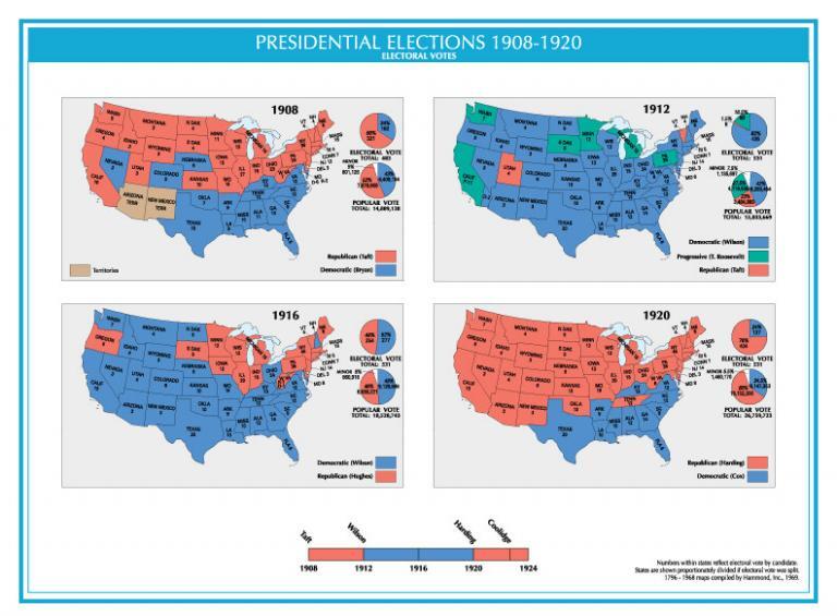
20. Presidential Elections 1908-1920
From 1908 to 1912, Taft, Wilson, Harding, and Coolidge became US presidents. As shown in the 1912 election map, this was the first year to include votes from all 48 contiguous states.
This presidential election also featured the Progressive Party by former president Theodore Roosevelt winning states like California, Washington, Minnesota, and Michigan.
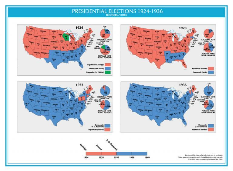
21. Presidential Elections 1924-1936
From 1924 to 1936, the United States was mostly a two-party system with Republican and Democratic candidates. Calvin Coolidge, Herbert Hoover, and Franklin D. Roosevelt (FDR) were nominated as the 30th, 31st, and 32nd presidents, respectively. The 1932 and 1936 elections colored almost the entire United States blue with substantial victories from FDR.
22. Presidential Elections 1940-1952
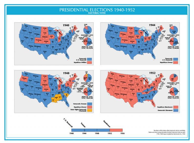
In 1940, Franklin D. Roosevelt was elected president during World War II until he died in 1945. Then, Harry S. Truman replaced FDR helping rebuild the economies in Western Europe after the war.
The 1948 election featured the “States’ Rights Democratic Party” (Dixiecrats), a short-lived segregationist party embraced in the southern United States. Finally, the 1952 election chose Dwight D. Eisenhower as the 34th president of the United States.
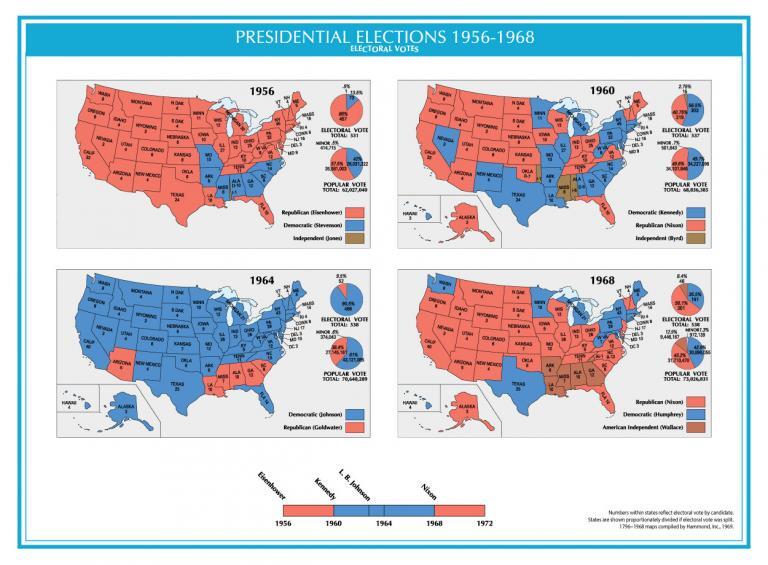
23. Presidential Elections 1956-1968
From 1956 to 1960, Eisenhower, Kennedy (JFK), L.B. Johnson, and Nixon were elected as presidents of the United States. Both Hawaii and Alaska participated in 1960 representing the first election with all 50 states.
A notable event in this span was the assassination of John F. Kennedy (JFK), who was later replaced by Lyndon B. Johnson as the 36th president of the United States.
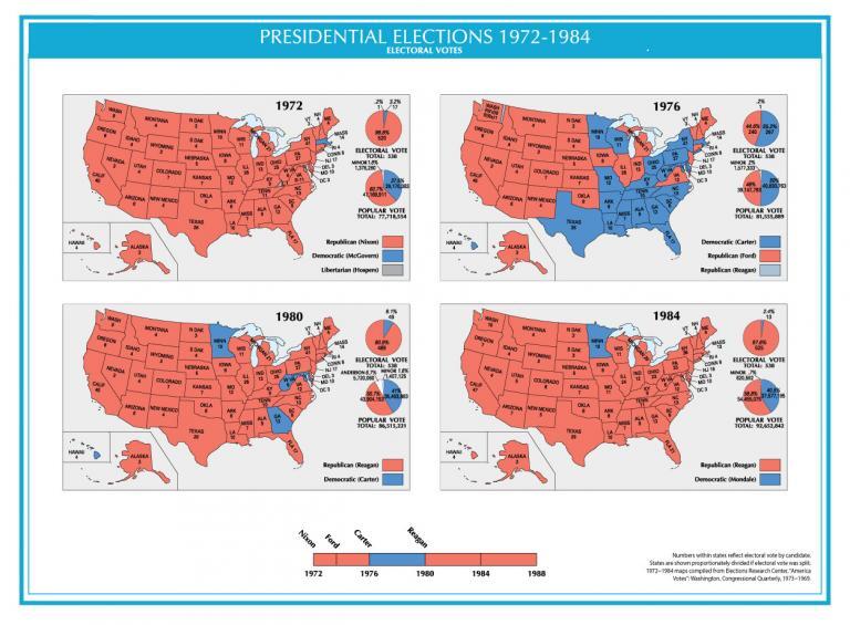
24. Presidential Elections 1972-1984
US presidents elected from 1972 to 1984 included Nixon, Ford, Carter, and Reagan. In 1972, Richard Nixon won a landslide during this election. He gained 60.7% of the popular vote – only to be impeached in 1973.
Then, Gerald Ford took his place. Jimmy Carter from the Democratic Party served as the 39th president of the United States. Finally, Ronald Reagan won 49 states (except for Minnesota) and was elected in the 50th quadrennial presidential election.
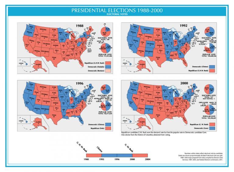
25. Presidential Elections 1988-2000
In 1988, George H.W. Bush was elected the 41st president of the United States. Then from 1922 until his impeachment scandal, Bill Clinton served as president. Finally, George W. Bush of the Republican Party took office from 2001 to 2009.
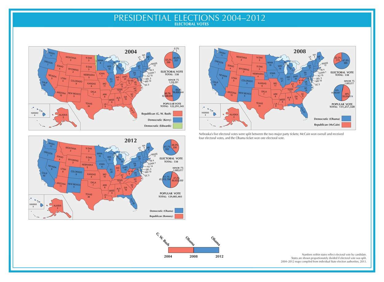
26. Presidential Elections 2004-2016
In 2008 and 2012, Barrack Obama was elected president for 2 consecutive terms. This brings us to our current president, Donald Trump, who was inaugurated as president in 2017. The next presidential election was held in 2020. Joe Biden from the Democratic Party defeated Donald Trump from the Republican Party.
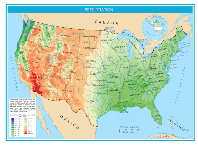
27. Precipitation
Precipitation varies widely across the United States. For example, the lowest is only 2.3 inches per year in California’s Death Valley to a high of 460 inches on Hawaii’s Mount Waialeale. Nevada ranks as the driest state, with an average annual precipitation of 9.5 inches. In contrast, Hawaii is the wettest, at 70.3 inches.
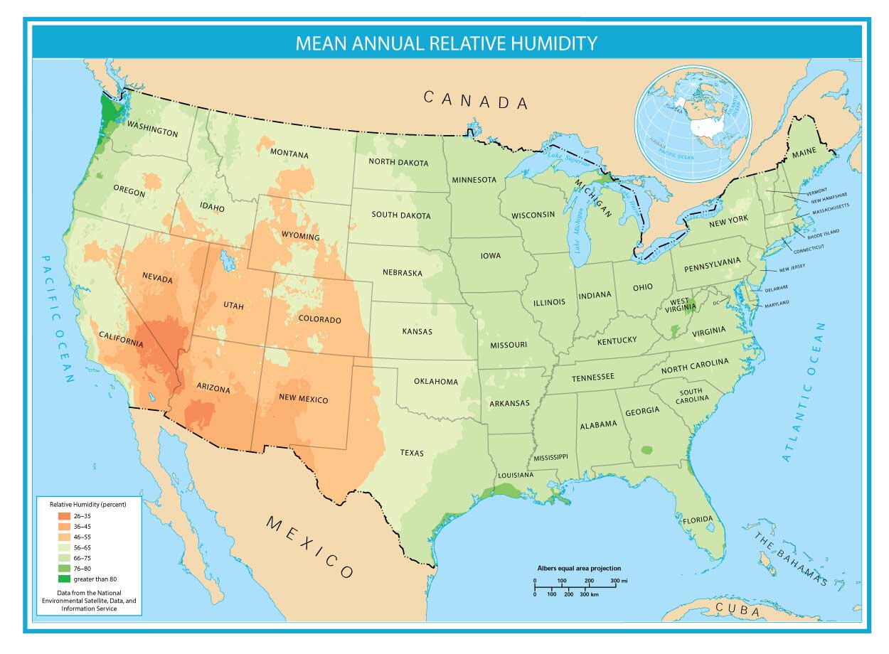
28. Relative Humidity
The relative humidity is a measure of how dry or humid the air is. Coastal regions experience more moisture in the air because they can absorb the water directly from the ocean. Whereas inland areas like Arizona, Nevada, and New Mexico have lower annual mean relative humidity.
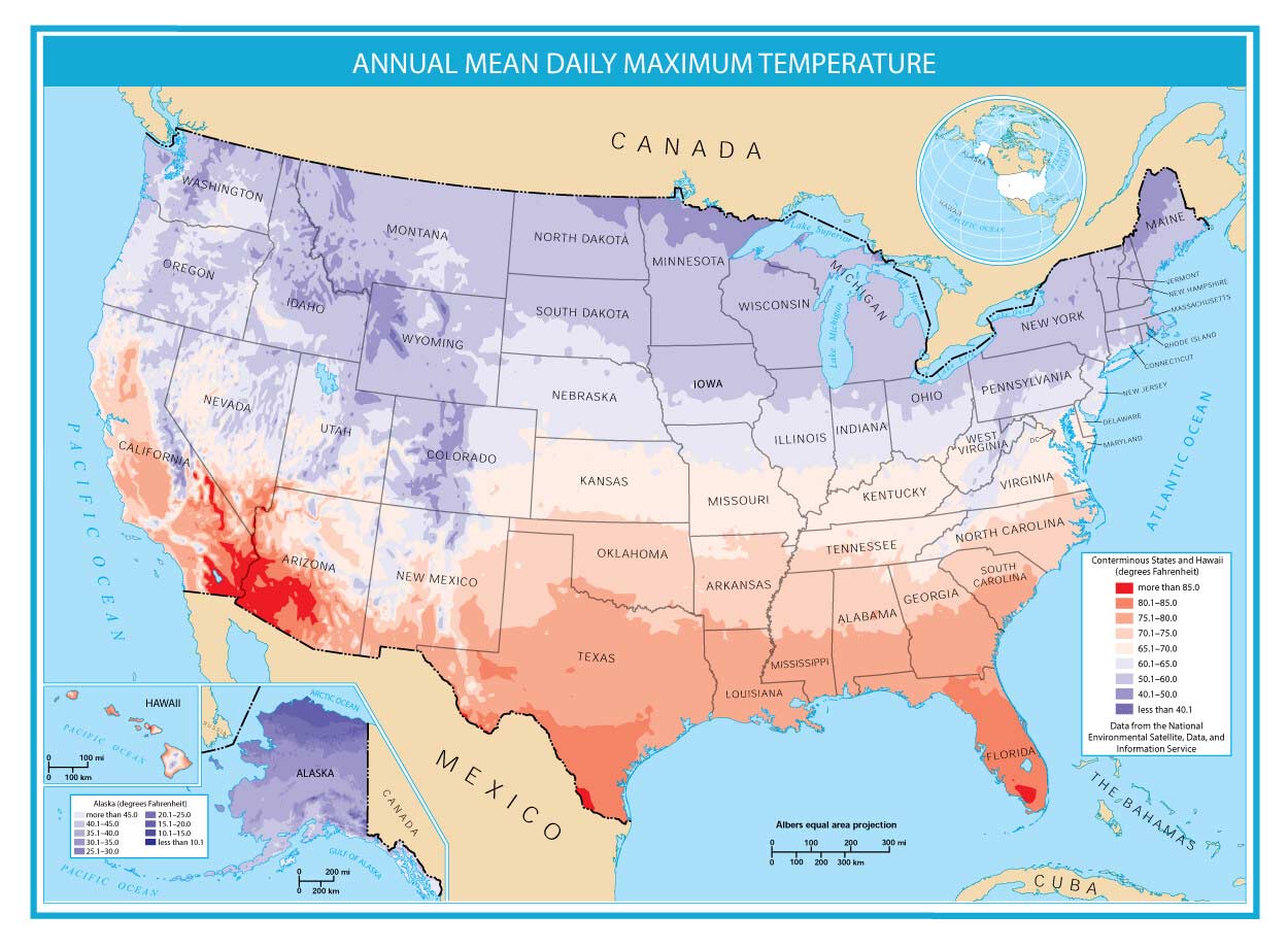
29. Maximum Temperature
This map displays the maximum temperature, which is the average highest temperature recorded daily. In general, temperature decreases towards the polar region and increases closer to the equator. This is why areas like Alaska and closer to Canada are colder. But states like Texas and Hawaii have a higher annual mean daily maximum temperature.
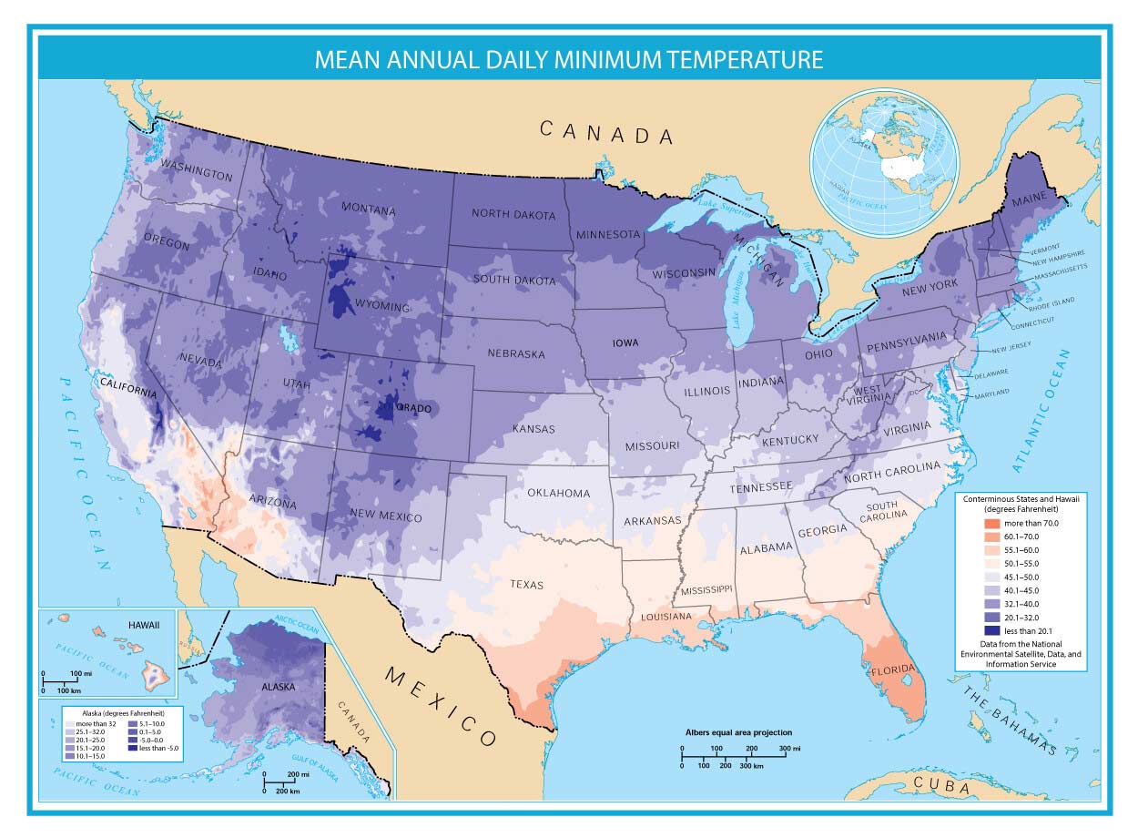
30. Minimum Temperature
This map displays the mean annual daily minimum temperature, which is the average lowest temperature recorded daily. As you can see, states like Wyoming and Colorado have relatively cool climates because of their elevation. Meanwhile, states like Florida and Texas have a higher mean annual daily minimum temperature.
The Defining Maps of America
From coast to coast, state to state, these 30 defining US maps have unraveled stories that have shaped the nation.
Whether tracing the evolution of state boundaries, the rise of urban centers, or the conservation of natural wonders, this United States map collection reminds us of the boundless beauty and complexity of this vast land.
I would like the map of the rivers, so the rivers are dark enough to make them out. The light thin blue lines on the white background just don’t get it. I would say black for the rivers. It might work out to have all major rivers (such as the ones with commercial commerce active) in black with the least important to be in red.
On the map of interstates, the red lines could stand to be just a tad bit wider.
You have a great collection of useful maps.
Thanks for allowing the opportunity to give an input.
yes I agree charlie
the maps are good
I say It’s helpful but i say the maps 1-5 are helpful to me. I got confused on maps 25-27 but then I figured out the definition of the words that I didn’t understand. So yes I say its pretty helpful I dont know for other’s
is it possible to get the elevation map without any markings or color?
If it’s for the hillshade maps, we might be able to send you what we have available. Try our contact page to reach us.
These maps are very helpful there gonna help me through so much of my history class!
Is it possible to obtain paper copies for individual maps?
I would like to have copies of:
#1. Detailed Map
#2. Hill shade Map
#5. Pastel Map
#7. States & Capitals Map
#8. Federal Land Map
Thank you.
Gene Buonviri
There are a lot of super important maps here, and I need a lot of them! This app is SUPER helpful. Thank you so much!!😍🗺
Very helpful! Thanks to whoever put this collection together!
These maps are very helpful, thank you to whoever made them! They helped to get my schoolwork done very efficiently.
Lose you leg man, you don’t even show us the map’s state.