How To Create a Topographic Profile in ArcGIS
Topographic profiles are cross-sectional views showing elevation along a line with applications in engineering, hydrology, land use planning and more.
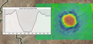
Topographic profiles are cross-sectional views showing elevation along a line with applications in engineering, hydrology, land use planning and more.
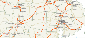
Maptitude prides itself as an affordable one-stop shop GIS on the market with a low learning curve. It shines in business and transportation.
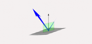
The EM radiation that makes it to Earth is called incident light. From here, Earth’s features reflect, absorb and transmit different amounts of energy.
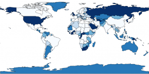
Equal intervals, quantile, natural breaks, pretty breaks- data classification methods generate different choropleth maps. We explain the types of maps here.