Erase Tool in GIS
The Erase Tool removes the area that is overlapping with the erasing features. Everything outside the erasing layer ends up in the output.
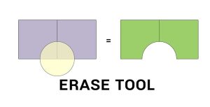
The Erase Tool removes the area that is overlapping with the erasing features. Everything outside the erasing layer ends up in the output.

Esri’s tapestry segmentation data provides insights on lifestyle choices made by customers helping you make more informative business decisions.
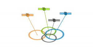
Have you ever wondered about your GPS accuracy? A well-designed GPS receiver can achieve a horizontal accuracy of 3 meters or better. But factors affect it.

Tobler’s First Law of Geography states that everything is related to everything else, but near things are more related than distant things.