Union Tool in GIS
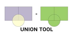
The Union tool combines input data layers into a single composite layer, preserving the boundaries and attributes from all input features.
The Union tool combines input data layers into a single composite layer, preserving the boundaries and attributes from all input features.
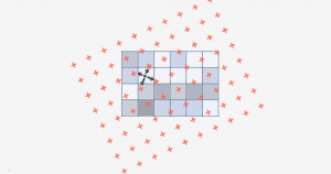
Bilinear interpolation (or bilinear resampling) uses 4 nearest neighbors to generate an output surface when you resample or reproject rasters.