Buffer Tool in GIS
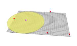
The buffer tool (planar/geodesic) generates a polygon around features at a set distance. Here are ring, geodesic & euclidean buffers.
The buffer tool (planar/geodesic) generates a polygon around features at a set distance. Here are ring, geodesic & euclidean buffers.

Routing, mapping and LiDAR. Will GIS thrive in a world of driverless cars? We explore the potential integration of GIS in autonomous vehicles.