Canary Islands Map
Canary Islands Map
If you’re looking for a map of the Canary Islands, we have a set of 3 maps for you.
In each map, we show key information as a representation of this unique archipelago off the northwest coast of Africa.
So let’s get started today. Download any of our maps featured in the Canary Islands collection.
Jump To: Interactive Map | Printable Road Map | 10 Things to Do | Reference Map
Canary Islands map collection
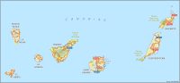

Interactive Map of Canary Islands
The interactive map below has the most up-to-date information about this Spanish archipelago. You’ll notice that the Canary Islands consist of seven main islands and several smaller ones.
But Tenerife is the largest island and is the most popular for tourists. So before you go, take a long look around the natural beauty and cultural richness using this interactive map.
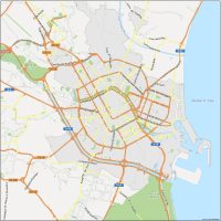
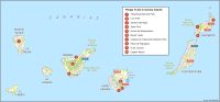
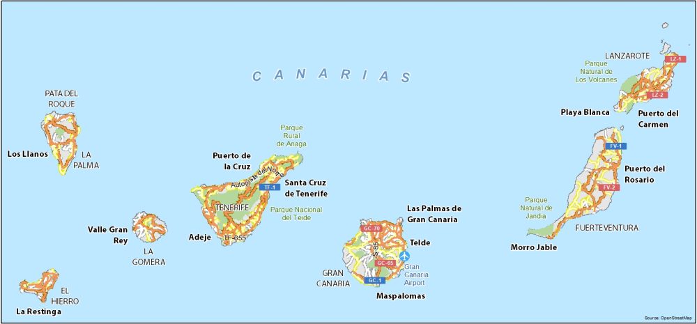
Canary Islands Road Map
Whether you’re planning a trip to the islands or simply want to learn more about this fascinating corner of the world, this road map provides a solid visual of its transportation network. You’ll be able to understand its highways and major routes with highway numbers and important streets labeled.
Highways: GC-1, GC-65, GC-70, TF-1, FV-1, FV-2, LZ-1, LZ2
10 Things To Do in the Canary Islands
The Canary Islands themselves are located along the Tropic of Cancer, giving them a warm and sunny climate year-round. That’s why on this list you’ll find a plethora of parks, beaches, and outdoor adventure activities. So pack your swimsuit and sandals and enjoy the exotic scenery.
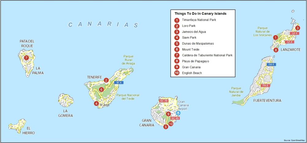
Here are the top 10 things to do that we recommend seeing in the Canary Islands.
- Timanfaya National Park
- Loro Park
- Jameos del Agua
- Siam Park
- Dunas de Maspalomas
- Mount Teide
- Caldera de Taburiente National Park
- Playa de Papagayo
- Gran Canaria
- English Beach
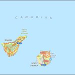
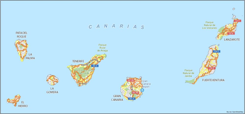
Canary Islands Reference Map
Our reference map of the Canary Islands shows key locations and the layout of the islands. You’ll also find the road system and other geographic and cultural features of higher significance as well.
Airports: Gran Canaria Airport
Parks: Parque Rural de Anaga, Parque Nacional del Teide, Parque Natural de Jandia, Parque Natural de Los Volcanes
Islands: Pata Del Roque, La Palma, La Gomera, El Hierro, Gran Canaria, Lazarote, Fuerteventura
Communities: Los Llanos, La Restinga, Valle Gran Rey, Puerto de la Cruz, Santa Cruz de Tenerife, Las Palmas de Gran Canaria, Telde, Maspalomas, Morro Jable, Playa Blanca, Puerto del Rosario, Puerto del Carmen