Valencia Map, Spain
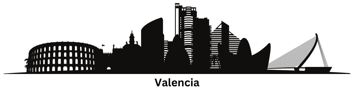
Valencia, Spain Map
If you’re planning a trip to Valencia, Spain, it’s essential to have a map of the city to help you navigate your way around.
This Valencia map collection contains a set of three maps with highways/roads, things to do, and populated places.
So let’s get started and discover all that Valencia, Spain has to offer with these maps.
Jump To: Interactive Map | Printable Road Map | 10 Things to Do | Reference Map
Valencia map collection
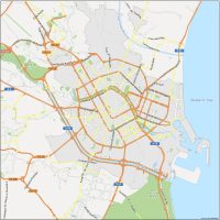
Interactive Map of Valencia
Valencia, the third-largest city in Spain, is located on the eastern coast of the country, overlooking the Mediterranean Sea. By using our interactive map, you can visit Valencia virtually and find out more about it. This includes everything from its historic architecture to the Ciutat Vella district.
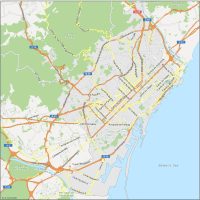
Valencia Road Map
To make the most of your visit, it’s useful to have a road map of Valencia that can guide you through its highways and major routes. In this map, you’ll find all the highway information you need to explore the city. It also gives you street names and highway numbers to navigate the streets of Valencia.
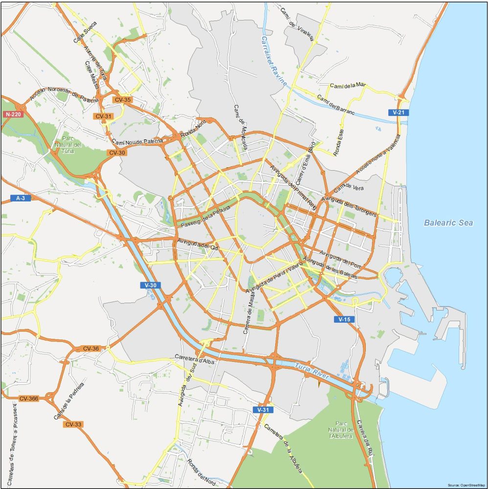
Highways: A-3, V-15, V-21, V-30, V-31, N-220, CV-30, CV-31, CV-35
Major Roads: Avinguda de Peris i Valero, Passeig de la Petxina, Camí Nou de Paterna, Avinguda del Cid, Carrera de Malilla, Avinguda de les Balears, Avinguda del Port, Avinguda del Primat Reig, Avingudadels Tarongers, Acceso norte a València, Carretera d’Alba, Calle Melisa, Camídel Barranc
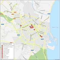
10 Things To Do in Valencia
Valencia, Spain is a unique mix of historical sights combined with modern architecture. Buildings like L’Oceanogràfic and Ciudad de las Artes y las Ciencias, the largest aquarium in Europe are standouts in the city. On this map, we show you a list of the top 10 things to do to get the most out of your visit to Valencia.
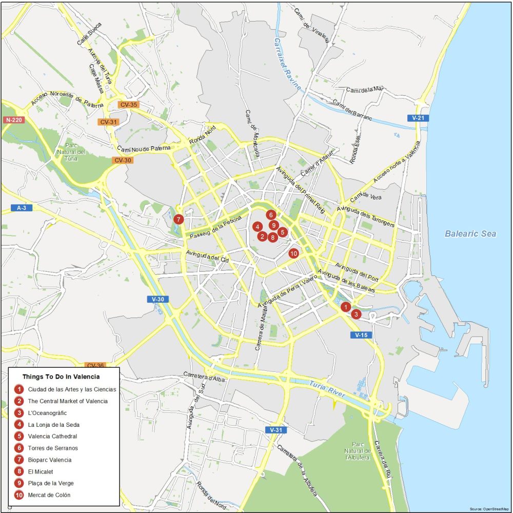
Valencia is the third most populous city in Spain (after Madrid and Barcelona). Here are the top 10 things to do that we recommend seeing.
- Ciudad de las Artes y las Ciencias
- The Central Market of Valencia
- L’Oceanogràfic
- La Lonja de la Seda
- Valencia Cathedral
- Torres de Serranos
- Bioparc Valencia
- El Micalet
- Plaça de la Verge
- Mercat de Colón
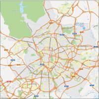
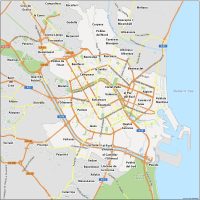
Valencia Reference Map
This is really an all-purpose which gives you essential information about Valencia, Spain. You’ll find suburbs, localities, waterways, parks, and the highway network. Download it today for an up-to-date map.
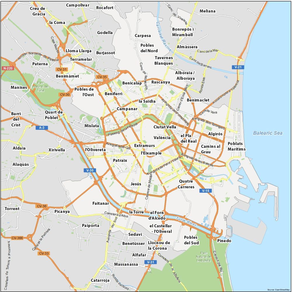
Water Features: Balearic Sea, Carraixet Ravine, Turia River
Parks: Parc Natural del Túria, Parc Natural de l’Albufera
Communities: Ciutat Vella, Extramurs, L’Eixample, Algirós, Camins al Grau, Poblats Marítims, Quatre Carreres, Patraix, l’Olivereta, Mislata, Campanar, La Saïdia, Benimaclet, Rascanya, Benicalap, Beniferri, Terramelar, Benimàmet, Carpesa, Sedaví, Rocafort, Pinedo