Atlanta Crime Map
This Atlanta crime map displays a heat map with incident points to highlight safe and dangerous areas within the city of Atlanta, Georgia.
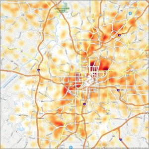
This Atlanta crime map displays a heat map with incident points to highlight safe and dangerous areas within the city of Atlanta, Georgia.

From the upscale Midtown area to the artistic atmosphere of Cabbagetown, learn about each unique area with this Atlanta neighborhood map.
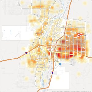
Our Albuquerque crime map presents of heat map of crime incidents to understand safe and dangerous neighborhoods in Albuquerque.
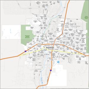
From the historic Old Town to the trendy streets of Nob Hill, this map provides a visual guide to the city’s diverse communities.

Indianapolis boasts various zip codes, from 46201 to 46290, that define the city’s postal boundaries. Download our Indianapolis zip code map.
With zip codes ranging from 33301 to 33394, our zip code map outlines the various postal areas. Download our Fort Lauderdale zip code map.

With 13 zip codes ranging from 50309 to 50321, Des Moines encompasses a wide range of postal areas. Download this map today for personal use.
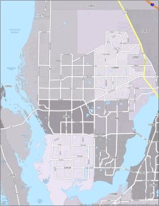
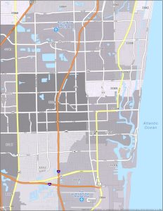
Here is your Cape Coral Zip Code Map, your guide to navigating the various zip codes of this coastal city in Florida, USA.

This Corpus Christi zip code map provides an overview of the zip code boundaries in Corpus Christ with interstate highways at a glance.
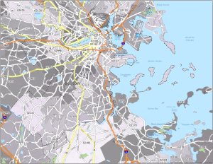
In this Boston Zip Code Map, you will find each postal region labeled by zip code. Understand the city’s postal layout and interstate highways.