Phoenix Zip Code Map
Whether you’re a government agency or business, use this Phoenix zip code map as your trusted companion to explore its postal boundaries.
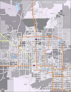
Whether you’re a government agency or business, use this Phoenix zip code map as your trusted companion to explore its postal boundaries.
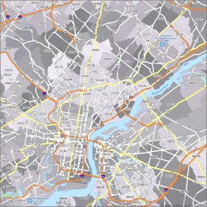
Welcome to the world of Philadelphia zip codes. Our color-coded map unveils the postal regions and highways of the “City of Brotherly Love”.
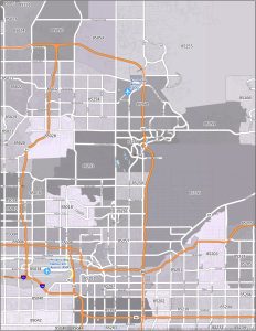
Check out our Scottsdale zip code map, which has a treasure trove of information for mail-related purposes (including highway routes).
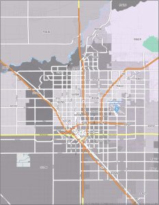
Discover postal boundaries with our Fresno zip code map. Download a copy of this zip code map for personal use.
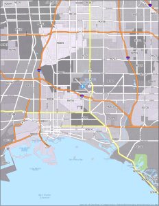
Understand the postal regions of Long Beach with this zip code map. On this map, you’ll find interstate highways and postal regions.

This color-coded map is your key to unraveling the postal regions of “Sin City”. Download this Las Vegas zip code map for personal reference
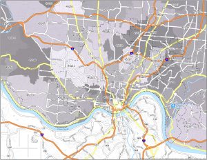
Our Cincinnati zip code map not only highlights postal regions but also includes interstate highways of the nicknamed “Queen City”.
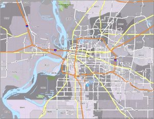
Check out our Memphis zip code map, which highlights not only postal regions but also interstate highways. It’s also available to download.
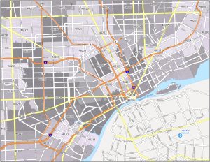
Explore our Detroit zip code map. This zip code map is the ultimate guide to the postal areas of the “Motor City” with interstate highways.
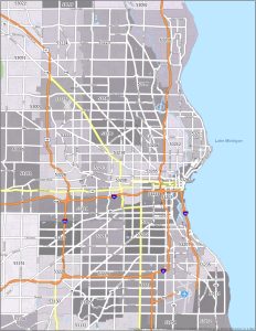
Check out our Milwaukee zip code map. This color-coded map presents the interstate highways and postal regions of “Brew City”.