What is Photogrammetry?
Photogrammetry uses photographs from at least two different vantage points. It obtains depth and perspective because of separate points of observation.
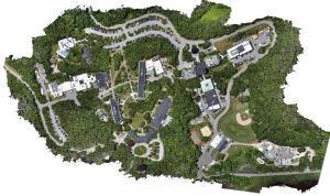
Photogrammetry uses photographs from at least two different vantage points. It obtains depth and perspective because of separate points of observation.
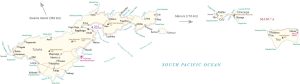
An America Samoa map that contains cities, towns, highways with satellite imagery and an elevation of the US unorganized territory in Oceania.

There are countless ways you can slice, dice and edit data in GIS. That’s why we’ve created this visual guide with the GIS editing tools.
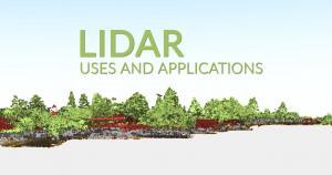
We reveal 15 LiDAR uses and applications. LiDAR isn’t a new technology, but it’s been growing so much lately that even your smartphone has it
Carto is where data meets maps on the web. Instead of using desktop GIS software, Carto provides it all in the cloud with just a web browser.