What is Photogrammetry?
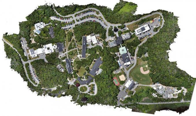
An intuition for photogrammetry
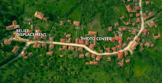
If you take a single aerial photo, there’s a center point in the photo where it’s looking straight down. At this center point, you can’t see any of the sides of the building or its features.
But if you look somewhere else in the image, you’ll see that features like buildings are leaning over in the photo. This radial displacement from the center point is known as relief displacement.
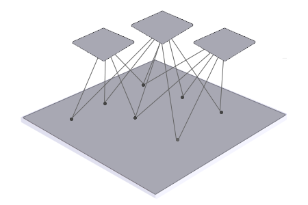
“Photogrammetry uses photographs from at least two different vantage points. Similar to how your eyes work, it obtains depth and perspective because of separate points of observation.”
Relief Displacement vs Parallax
What’s the difference between relief displacement and parallax? In this section, we’ll outline their differences.
RELIEF DISPLACEMENT: Relief displacement occurs when buildings, mountains, or hilltops are displaced from the central projection of an aerial photograph due to relief. The further objects are away from the center of the image, the more relief displacement occurs for a feature.
The goal of photogrammetry is to correct relief displacement in an image through overlapping stereo images. This is why planes zigzag over the same area similar to how a lawnmower cuts the grass. The multiple camera angles create the necessary overlap and parallax.
PARALLAX: Stereographic parallax is the apparent shift in relative positions of features when it is viewed in different locations. This is different from relief displacement because it takes point observations from the same object in separate photographs.
You only get stereographic parallax when you get two or more vantage points of the same object. Then, if you view the feature from different points of observation, you can measure relief displacement.
Steps to Create a Photogrammetric Model
Creating a photogrammetric model requires the following:
- TIE POINTS: Tie points link coordinates from two or more overlapping images. In general, you assign tie points for features that are visually apparent in two or more photographs. When you have overlap, tie points adjust photos together through common feature coordinates.
- GROUND CONTROL POINTS (GCP): Establishing ground control orientates and positions images to known geographic coordinates on Earth’s surface. By adding ground control points, you give photogrammetric products a spatial reference to the real world.
- BUNDLE ADJUSTMENT: Running a block bundle adjustment removes geometric distortion from a set of images of three-dimensional points at different viewpoints. This process minimizes the error between observed and predicted image points during reprojection.
Tie points link your images together. Ground control points give reference to the real world. And bundle adjustments put it all together minimizing error.
Products Derived From Photogrammetry
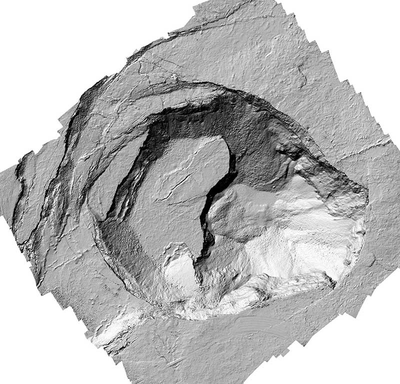
Photogrammetry generates a variety of products. They include orthophotos, digital elevation models (DEMs), 3D point clouds (similar to LiDAR), and textured 3D models.
ORTHOMOSAIC: Orthomosaics correct geometric distortion that’s inherent in imagery. By using the assigned tie points and GCPs, it can reference images to the real world. The final product is a seamless mosaic stitched through edge matching and color balancing.
DIGITAL SURFACE MODEL: A digital surface model (DSM) captures the natural and built features on the Earth’s surface by including their height. For example, height can come from the top of buildings, tree canopy, and powerlines.
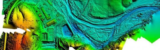
DIGITAL TERRAIN MODEL: A digital terrain model (DTM) is simply an elevation surface representing the bare earth. When you take away all the features on Earth, this is what a DTM represents. Depending on where you live, a DTM is synonymous with a Digital Elevation Model (DEM). For example, ASTER GDEM uses stereo pairs from two images at different angles and is an example of a photogrammetric DEM.
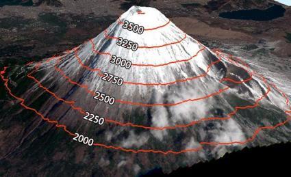
CONTOURS: Contours are lines of equal elevation and are a by-product of a digital terrain model. They are useful for showing the steepness of slopes, cliffs, ridges, and valleys.
Photogrammetry Software
Photogrammetry software processes the imagery into detailed 3D models and maps. Here are some of our top picks:
PIX4D: Pix4D is a very popular choice for photogrammetry software because it’s easy to use and has a large user base. For any type of drone, satellite, scans, or airplane overlapping imagery, Pix4D gives you a solid foundation in photogrammetry tools.
ESRI ORTHOMAPPING: Esri’s ortho mapping has come a long way since it was first introduced. It delivers a set of tools in ArcGIS Pro to add tie points, GCPs, and checkpoints to an orthomapping workspace. It allows you to adjust, mosaic, edge match, and color balance any of your ortho mapping products.
Autodesk ReCap: Autodesk ReCap is a photogrammetry software that enables you to create 3D models of real-world objects. These high-quality 3D models are useful for architectural, engineering, and construction projects or to complement your BIM workflows and design.


Hats off to you on the proper and detailed explanation
There are many high geometric Photogrammetry software since the end of 1990s like Z/I, Socketset, DAT E/M, ERDAS LPS, Inpho, etc. These software are being used very popularly even now also. Author didn’t mention about such software. Pix4D is mainly used for UAV image process, no doubt that Pix4D is great for UAV image process. However, I appreciate this article, good.
Good article. Very useful
This is a great guide for how to use photogrammetry. How many tie points and control points do you need to run a block bundle adjustment?
Thank you very much for this interesting and useful article. Definitions are very clear.