American Samoa Map
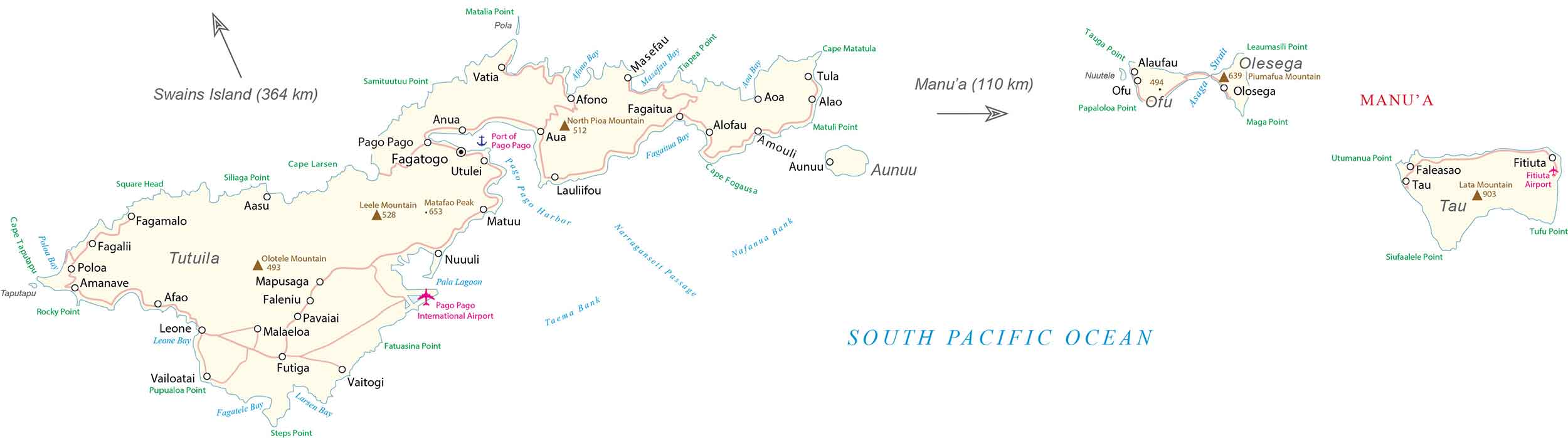
This American Samoa map contains cities, villages, roads, and highways as reference information. It includes satellite imagery and a physical map that highlights the volcanic islands and mountainous areas of American Samoa.
American Samoa map collection


About the map
American Samoa is an unincorporated territory of the United States that consists of 7 islands and atolls in the South Pacific Ocean. The country is recognized for its pristine beaches, reefs, culture, traditions, nature, and military bases.
It’s part of Polynesia and Oceania near the country of Samoa, just 73 kilometers (46 mi) away to the west. Additionally, the Tonga Islands are situated to the southwest, and the Cook Islands are to the east.
It’s the only US territory that is inhabited in the southern hemisphere, other than Jarvis Island. Pago Pago is the capital city located in the center of the main island of Tutuila. But its largest village is Tafuna.
You are free to use our American Samoa map for educational and commercial uses. Attribution is required. How to attribute?
SATELLITE IMAGERY
American Samoa Satellite Map
American Samoa occupies an area of just 200 square kilometers (77 sq mi). In comparison, this is roughly the same size as Washington DC but just a bit larger. American Samoa’s largest and main island is Tutuila, next to the island of Upolu to the west.
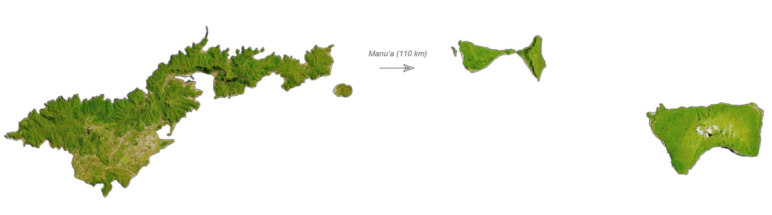
This island accounts for 68% of the total area of American Samoa and contains the Pago Pago International Airport and harbor as well as the National Park of Samoa. Otherwise, its other islands include Aunu’u, Ofu, Olosega, and Ta’u and its two atolls (Rose and Swains). The country is located just east of the international dateline. Whereas the country of Samoa is to the west.
PHYSICAL MAP
American Samoa Elevation Map
Overall, American Samoa is mostly mountainous because of its volcanic origin. For example, Rainmaker Mountain is a chain of mountains located near Pago Pago, American Samoa. The origin of the name is from its peaks that trap clouds within the island causing rainfall.
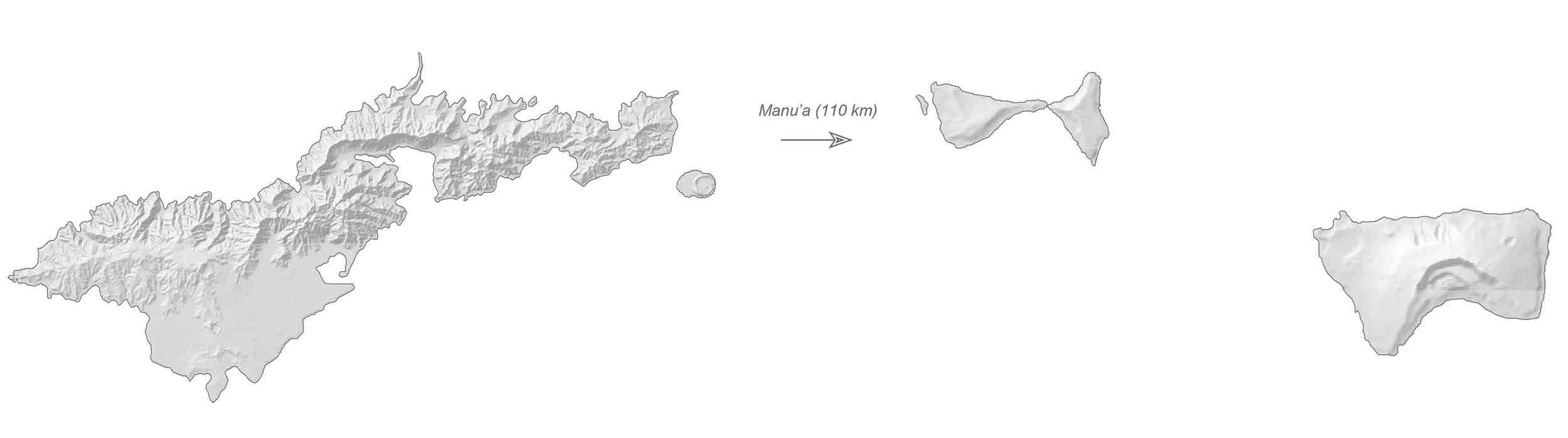
The mountain has a tri-peak of summits, including its highest at 523 meters (1,716 ft) in height. But Lata Mountain is the highest peak of American Samoa, on the island of Ta’u at 966 meters (3,170 ft) above sea level.
Capital City
Pago Pago
Cities and towns
Fagatogo
Leone
Aua
Taputapu
Fagalii
Towns, Villages and Populated Places
Vatia
Pola
Anua
Utulei
Aasu
Matuu
Nuuuli
Afao
Malaeloa
Vaitogi
Fagaitua
Masefau
Amouli
Alaufau
Asaga
Faleasao
Tau
Fitiuta
Poloa
Amanave
Afono
Fagamalo
Bays and Water Features
Poloa Bay
Pago Harbor
Leone Bay
Fagatele Bay
Larsen Bay
Afono Bay
Masefau Bay
Narragansett Passage
South Pacific Ocean
Pala Lagoon
Asaga Strait
Islands
Tutuila
Aunuu
Manu’a
Ofu
Olesega
Nuutele
Tau
Mountains and Peaks
Leele Mountain
Matafao Peak
Olotele Mountain
North Pioa Mountain
Lata Mountain
Piumafua Mountain
Points, Capes, and Heads
Matalia Point
Samituutuu Point
Siliaga Point
Cape Larsen
Square Head
Cape Taputapu
Rocky Point
Fatuasina Point
Vailoatai Pupualoa Point
Steps Point
Tiapea Point
Cape Matatula
Cape Fogausa
Matuli Point
Tauga Point
Siufaalele Point
Maga Point
Utumanua Point
Important Sites
Pago Pago International Airport
Port of Pago Pago


