Raleigh Zip Code Map
Download our Raleigh zip code map today. Nicknamed the “City of Oaks”, this map takes you on a journey through the city’s zip codes.

Download our Raleigh zip code map today. Nicknamed the “City of Oaks”, this map takes you on a journey through the city’s zip codes.

We present to you our Houston zip code map. This map highlights interstate highways and postal regions for addressing purposes.

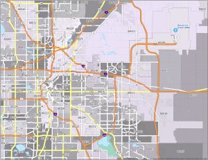
Behold our Oklahoma City zip code map. Also referred to as the “OKC”, this map showcases postal regions spanning across Oklahoma City.
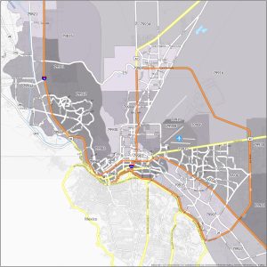
Check out our El Paso zip code map. This map showcases the interstate highways and postal regions for mail delivery and addressing.
Take a look at the Sacramento zip code map, which reveals the major highways and postal regions throughout Sacramento.

Behold our Orlando zip code map, known as “The City Beautiful”. This map highlights the interstate highways and postal regions across Orlando.

Feast your eyes on the Jacksonville zip code map. This map displays interstate highways and postal regions of Jacksonville. Download for free.
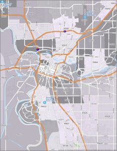
Welcome to the Mile High City! Check out this Denver zip code map, which highlights Denver’s interstate highways and postal regions.

Looking for a Tucson zip code map? Well, you’re in luck! Our map highlights zip codes with interstate highways overlaid as a top layer.
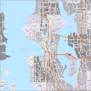
Learn about the postal addresses with this Seattle zip code map that overlays interstate highways. Download for free for personal usage.