Horn of Africa Map Collection
Today, we’ll provide you with our Horn of Africa map collection. Each map is free to download and use for any purpose.
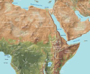
Today, we’ll provide you with our Horn of Africa map collection. Each map is free to download and use for any purpose.
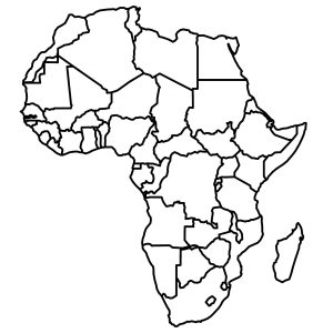
Are you searching for a blank map of Africa? Our blank map of Africa is free to use with all 54 country outlines (color & black and white).
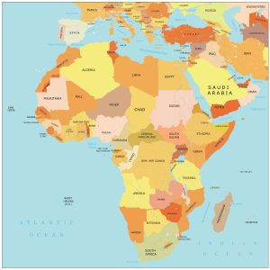
Ready to explore the continent of Africa? Dive into this map of Africa with countries and cities. Download for free and use any map of Africa
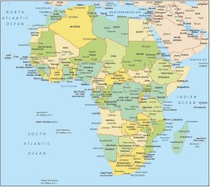
A map of Africa with countries and labels – It also shows individual countries with outlines for all regions of Africa from north to south.