GIS Dictionary – Geospatial Definition Glossary
The Ultimate GIS Dictionary: Your Complete Guide to GIS
GIS is more than just “maps and data”. Instead, it’s multi-disciplinary.
It impacts various sectors and uses different skill sets.
That’s why we’ve put together this list of GIS definitions to give you 20/20 vision.
From A to Z, sharpen your GIS knowledge with these GIS dictionary definitions and meanings.
Jump to Letter
A | B | C | D | E | F | G | H | I | J | K | L | M | N | O | P | Q | R | S | T | U | V | W | X | Y | Z
A

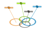
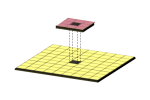
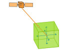
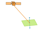
Active Sensors: [Remote sensing] Active sensors illuminates their target and measure the reflected backscatter that returns back to the sensor.
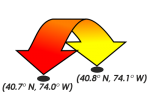
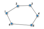
Adjacency: [geometry] Adjacency occurs when two objects share the same boundary and are next to or adjoining with a common side or vertex.

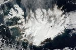
Advanced Very High Resolution Radiometer (AVHRR): [Remote sensing] AVHRR collects infrared, visible, and thermal images with an approximate 1-kilometer spatial resolution cell size.
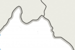
Affine transformation: [geometry] An affine transformation scales, rotates, skews, or translates points, polylines, and polygons preserving points, straight lines, and planes.
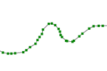
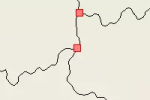
Arc: [data structure] Arcs are lines or polygon boundaries, represented as a series of vertices or coordinate points.

ArcCatalog: [software] ArcCatalog is an application in the ArcGIS suite for managing geographic data – similar to windows file explorer.
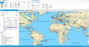
ArcGIS: [software] ArcGIS is a GIS software package produced by the Environmental Systems Research Institute (Esri) which allows you to collect, store, manage, visualize, export, analyze and map geographic data.
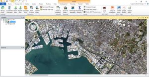
ArcGIS Pro: [software] ArcGIS Pro is Esri’s latest GIS software with a ribbon-based user interface, project files and 64-bit processing.
ArcGlobe: [software] ArcGlobe is a 3D visualization and analysis environment as part of the Esri ArcGIS suite (3D analyst), specializing in global datasets and larger study areas.
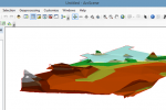
ArcScene: [software] ArcScene is a 3D feature and raster viewer part of the Esri ArcGIS suite of applications (3D analyst) specializing in small study area scenes.
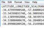
American Standard Code for Information Interchange (ASCII): [file format] ASCII uses a set of numbers between 0 and 255 for information storage and processing.
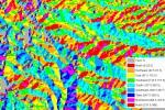
Aspect: [GIS processing] Aspect is the slope direction on a terrain surface measured clockwise starting north as 0° to 360° north again with flat areas given a value of -1 or 0 degree.
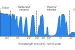
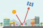
Atmospheric window: [remote sensing] An atmospheric window are wavelengths at which electromagnetic radiation (sunlight) from the sun will penetrate the Earth’s atmosphere overall constricting these spectrum bands from reaching the Earth.
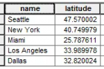
Attribute table: [data structure] An attribute table stores non-spatial information in columns and rows about geographic data – similar to spreadsheets.
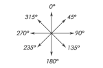
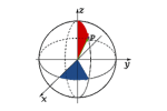
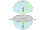
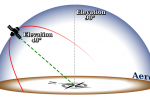
Azimuth: [surveying] An azimuth is an angle between 0° and 360° measured clockwise from north based on true north – Magnetic azimuths are based on magnetic north.
B
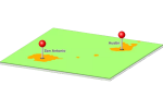
Base station: [surveying] A base station is a precisely surveyed location used as a fixed Global Navigation Satellite System (GNSS) recording station, typically used in differential correction.
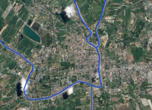
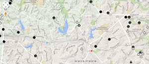
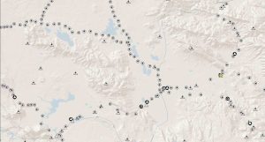
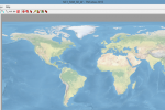
Basemap: [cartography] A basemap is a background, non-editable, georeferenced image that gives a point of reference on a map, providing aesthetic appeal such as aerial imagery, topography, terrain, and street layers.
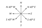
Bearing: [surveying] A bearing is a direction expressed as a geographic angle measured from a baseline used in surveying and navigation.
Benchmark: [surveying] Benchmarks are precisely surveyed points usually marked with brass or metal disk in the ground also genetically called survey marks, geodetic marks, and control stations.
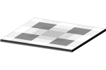
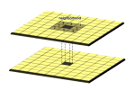
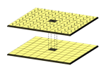
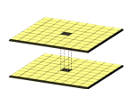
Bilinear interpolation: [mathematics] Bilinear interpolation is a technique for calculating values of a grid location by taking the weighted average of the four neighboring cells in an image to generate new values.

Boolean Algebra: [mathematics] Boolean algebra are conditions used to select features with a set of algebraic conditions including AND, OR, or NOT.
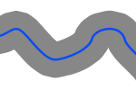
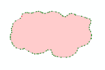
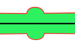
Buffer: [GIS processing] The buffer tool is a proximity function that creates a polygon at a set distance surrounding a selected feature or features.
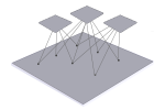
Bundle adjustment: [geometry] Bundle adjustments remove geometric distortions given a set of images of three-dimensional points at different viewpoints, minimizing the error between observed and predicted image points during reprojection.
C
Carrier-phase GPS: [surveying] Carrier-phase GPS signals are relatively slow but are very accurate (within 10cm or better) to determine position on the ground.
Cartesian coordinate: [surveying] A Cartesian coordinate system specifies each point uniquely with a pair of numerical coordinates or tripless for three-dimensional coordinate spaces.

Cartography: [GIS dictionary] Cartography is the study, aesthetics and science of representing real-world entities on maps by communicating spatial information.
Cartometry: [GIS dictionary] Cartometry is a division of cartography concerned with depicting objects with a high level of spatial accuracy such as measuring the perimeter of coasts, areas of countries, volumes, slopes, and densities.
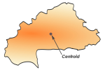
Centroid: [geometry] A centroid (or geometric center) is a central point of an area feature that represents the average position of all the points in the shape.
Clip: [geometry] A clip is an overlay tool that involves clipping an input layer to the extent of a defined feature boundary.

Code-Phase GPS: [GPS] The coarse acquisition (C/A) code or code-phase GPS, which is available to the general public, is a GPS signal that delivers rapid, low accuracy position estimates in tens of meters.
Coordinate Geometry (COGO): [editing] COGO involves the entry of spatial coordinate data points, usually obtained from field survey equipment.

Computer Aided Design/Drafting (CAD): [GIS dictionary] CAD is primarily used by engineers and architects for the purpose of producing two and three-dimensional drawings.
Conformal Projection: [map projection] A conformal map projection preserves the correct shapes of small areas with the scale being the same in all directions and greatly distorted areas.
Conic Projection: [map projection] A conic projection uses a cone to develop its surface on a plane with meridians converging at a single point.
Connectivity: [geometry] Connectivity is the representation of the connectedness of linear features when arcs share a common node.
Continuous raster: [data structure] Continuous rasters are grid cells with gradually changing data such as Digital Elevation Models (DEM), temperature data or distance from features.
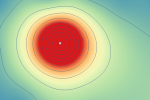
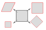
Contour Line: [data structure] A contour line is a constant value for mapping any variable such as elevation, temperature, isopleth or isoline maps.
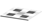
Control point: [coordinate system] Control points are locations known to have a high degree of accuracy that are used to convert digitized coordinates from paper maps and georeferencing to standard map projection coordinates.
Coordinate Transformation: [coordinate system] A coordinate transformation is the conversion from a non-projected coordinate system to a coordinate system using a series of mathematical equations.
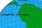
Coordinates: [coordinate system] Coordinates are pairs (X, Y) or triplets (X, Y, Z) of values that are used to represent points and features in a two and three-dimensional space.
Cubic Convolution Interpolation: [mathematics] Cubic convolution interpolation averages the 16 nearest cells, which is generally used for continuous surfaces where much noise exists.
Cylindrical Projection: [map projection] A cylindrical projection uses a cylinder to develop a plane surface such as Mercator and Plate Carree projections.
D

Data Model: [data structure] The two main GIS data models are rasters (pixels with a specific cell size) and vectors (points, lines and polygons).
Database Management System (DBMS): [data structure] A DBMS is a collection of tools that allows the entry, storage, input, output and organization of data, serving as an interface between users and a database.
Database Schema: [data structure] A database schema is supported in relational database management systems (RDBMS) and acts as blueprints for how database entries will be constructed.

Developable Surface: [map projection] A developable surface (cylinders, cones, planes, etc) is the geometric shape that a map projection can be mathematically built on.
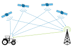
Differential Global Navigation Satellite System (GNSS): [surveying] Differential GNSS is a highly accurate (within centimeters) conventional surveying technique that uses a known location from a receiver to determine an unknown position.
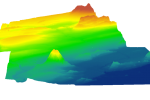
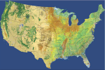
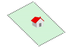
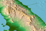
Digital Elevation Model (DEM): [GIS processing] A Digital Elevation Model (DEM) is a bare earth elevation model representing the surface of the Earth without features like houses, bridges, and trees.
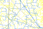
Digital Line Graph (DLG): [file format] DLG is vector data format developed and distributed by the United States Geological Survey (USGS) depicting geographic features like terrain, hydrography, transportation and man-made features.
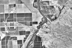
Digital Orthophotos Quadrangle (DOQ): [file format] DOQ is a geometrically-corrected photograph produced by the USGS with a scale of 1:40,000 and spatial resolution of about 1-meter pixels.
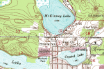
Digital Raster Graphics (DRG): [file format] DRG is a digital version map of USGS topographic maps including imagery (NAIP), roads, place names, hydrography, elevation contours, and boundaries.
Digital Surface Model (DSM): [file format] A digital surface model is an elevation model that includes the top of buildings, tree canopy, powerlines and other features above the bare earth.
Digital Terrain Model (DTM): [file format] DTM is a bare earth representation of the Earth’s surface that is augmented by natural features such as ridges and breaklines.
Digitize: [editing] When you digitize in a GIS, you are creating geographic computer-compatible stored data with lines, points, and polygons in a spatial database.
Dissolve tool: [GIS processing] The dissolve tool is a common GIS processing task where boundaries are merged with neighboring boundaries based on common attribute values.
E
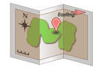
Easting: [coordinate system] Eastings refer to the x-axis (eastward) points approximately parallel to lines of equal latitude commonly used in the Universal Transverse Mercator map projection.
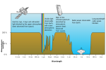
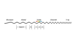
Electromagnetic (EM) Spectrum: [remote sensing] The EM spectrum refers to the range of energy wavelengths or frequencies from x-rays, ultraviolet, visible, infrared, and microwave to radio waves.

Ellipsoid: [surveying] Reference ellipsoids are mathematical models of the shape of the Earth with the major axis along the equatorial radius, primarily used as a surface to specify point coordinates such as latitude (north/south), longitude (east/west) and elevation (height).
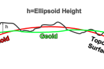
Ellipsoid Height: [surveying] The ellipsoid height is the height measured from an ellipsoidal surface to a point on the surface of the Earth.
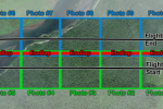
Endlap: [remote sensing] Endlap is the coverage overlap in aerial photographs from end to end between flight lines.
Enhanced Thematic Mapper (ETM+): [remote sensing] ETM+ is a sensor equipped on Landsat-7 which produces images of Earth in 8 spectral bands (blue, green, red, NIR, MIR, panchromatic, and thermal band).
Entity: [cartography] Entities represent a real-world point, line, or polygon features with a geographic location such as fire hydrants, hospitals, state boundaries, roads, rivers, lakes, etc.
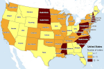
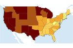
Equal Interval Classification: [cartography] The equal interval classification method divides attribute values into equal size ranges such as 0-20, 21-40, 41-60, 61-80, and 81-100.
Earth Resources Data Analysis System (ERDAS) Imagine: [software] ERDAS Imagine is a leading remote sensing software owned by Hexagon Geospatial.

Esri (Environmental Systems Research Institute): [software] Esri is the largest global supplier and developer of GIS software based in Redlands, California.
F
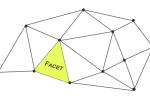
Facet: [data structure] A facet is a triangular face in a Triangular Irregular Network (TIN). TINs are three-dimensional coordinates depicting elevation surfaces.
False northing: [coordinate system] A false northing is a number added in a map projection in the y direction to avoid negative coordinate locations within the specified area of that map projection.
Feature: [data structure] A feature is a cartographic point, line, or polygon object with a spatial location in the real-world landscape that can be used in a GIS for storage, visualization, and analysis.
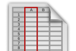
Field (Attribute Table): [data structure] An attribute field (or item) are characteristics used to describe each feature in a geographic data set usually viewed as columns in a table.
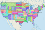
Federal Information Processing Standard (FIPS): [organization] FIPS is a federal unique identifier code used to define political or physical features in the United States.
Flow direction: [GIS processing] Flow direction calculates the direction water will flow using the slope from neighboring cells.
Focal Operation: [mathematics] The focal operation is a spatial function that computes an output value of each cell using neighborhood values such as convolution, kernel, and moving windows.
G

GDAL: [GIS software] Geospatial Data Abstraction Library (GDAL) is a C++ library for reading and writing raster geospatial data formats, implementing common GIS operations (unions, intersections, joins, clipping, etc.) with command line utilities.
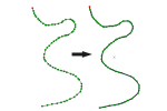
Generalization Tool: [GIS processing] The generalization tool is an editing process that simplifies the shapes by reducing the number of vertices in a line or polygon.
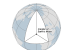
Geocentric: [geodesy] Geocentric is a measuring system that uses the center of the Earth as its origin, such as the WGS 1984 datum.
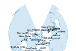
Geocoding: [GIS processing] Geocoding is the process of assigning geographic coordinates to places based on street address, town/city, province/state and country.

Geodesy: [GIS dictionary] Geodesy (or Geodetics) is a branch of applied mathematics and earth science of locating and assigning three-dimensional points on Earth by measuring the shape of the Earth.

Geofencing: [GIS dictionary] A virtual geographic boundary designed to give real-time alerts and increase awareness.
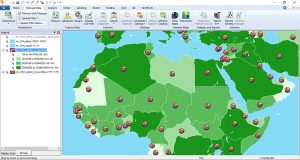
Geographic Information Systems (GIS): [GIS dictionary] GIS is a computer-based tool that analyzes, stores, manipulates and visualizes geographic information on a map, good for finding spatial patterns, relationships and trends.
Geoid: [geodesy] A geoid is a measurement-based equipotential surface model of the shape of the Earth primarily used as a basis of assigning terrain height.
Geomedia: [software] GeoMedia is a GIS software package produced by Hexagon Geospatial (previously Intergraph) used to analyze, store and visualize geographic data.
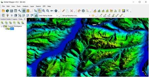
Global Mapper: [software] Global Mapper is a commercial GIS software product for spatial analysis and visualization.
Global Operation: [mathematics] A global operation is a process or function that is performed on each output cell using all of the cells of the input raster.
Gnomonic Projection: [map projection] A Gnomonic projection uses the center of the spheroid as the projection center.
GRASS GIS: [software] GRASS GIS (Geographic Resource Analysis Support System) is an open source GIS software package, highly used in academic institutions with over 400 modules for GIS analysis.
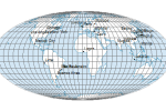
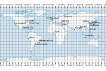
Graticule: [coordinate system] Graticules are lines of latitude or longitude on a digital or hard copy map and assist in showing the geographic locations of map features.
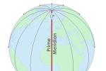
Greenwich Meridian (Prime Meridian): [coordinate system] The Greenwich meridian passes through the Royal Observatory in Greenwich, England, and is defined as a 0° line of longitude.
Geodetic Reference System 1980 (GRS 80): [geodesy] GRS80 is a geodetic reference system consisting of a global reference ellipsoid and a gravity field model (geoid).
H
Horizontal Datum: [geodesy] A horizontal datum provides a frame of reference as a basis for placing locations at a specific latitude and longitude points on the spheroid.
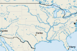
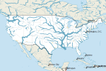
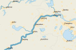
Hydrography: [GIS dictionary] Hydrography is a term describing the geographic representation of water features such as streams, rivers, and lakes.
Hypsography: [ GIS dictionary ] Hypsography is the geographic representation of features on a map related to elevation, altitude, and height above sea level from a reference surface. (Hypso is Greek for height).
I

Idrisi: [software] Idrisi is a GIS/remote sensing software package developed by Clark Laboratories in 1987, widely used in the education system.
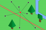
Inverse Distance Weighted (IDW) Interpolation: [mathematics] IDW interpolation is a technique used to estimate values of unsampled locations based on the value and distance of known, sampled locations.
IKONOS: [remote sensing] IKONOS is a high-resolution commercial imaging satellite that provides 1-meter panchromatic and 3-meter multispectral (blue, green, red, near-infrared) imagery.
Infrared: [remote sensing] An infrared image represents reflectance grid cells that are recorded in the near-infrared wavelengths, typically 0.7 to 1.1 micrometers.
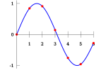
Interpolation: [mathematics] Interpolation is the estimation of unsampled locations based on known location sampled values such as elevation, temperature, and other predicted variables.
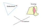
Intersect Tool (Overlay): [GIS processing] The intersect tool uses two inputs and restricts the output geometry similar to a clip by preserving the attributes in both input layers.
K
Kriging: [GIS processing] Kriging is a statistical interpolation technique that uses known location values to interpolate values at unknown locations and also estimates standard error and uncertainty.
L
Land Information System (LIS): [GIS dictionary definition] LIS was a name originally applied for GIS systems specifically developed for property ownership and boundary records management.
Landsat: [remote sensing] Landsat consists of 8 satellite missions spanning more than 4 decades with space-borne remote sensing capabilities for scanning land resources.
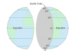
Latitude: [coordinate system] Latitudes are spherical coordinates of Earth locations that vary in north-south directions ranging from 0° at the Equator to 90° (North or South) at the poles.
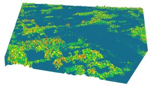
Light Detection and Ranging (LiDAR): [remote sensing] LiDAR uses laser pulse measurements to identify heights, depths, and other properties of features on the Earth’s surface.
Local Operator: [GIS processing] A local operation is a spatial operation where the output extent is limited to the same location as the input such as arithmetic, statistical, relational, trigonometric, exponential, and logarithmic operations.

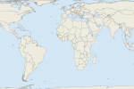
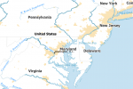
Locator Map: [cartography] Locator maps show the extent of the primary map in relation to a larger extent area giving context to the map reader to gain a better understanding of the overall area.
Longitude: [coordinate system] Longitudes are coordinate on Earth in east-west directions ranging from 0° to +180° east and −180° west.
M
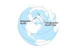
Magnetic North Pole: [geodesy] The magnetic north is a point in Northern Canada where the northern lines of attraction enter the Earth and which compass needles orient in direction.
Manifold GIS: [software] Manifold is a GIS software package used for mapping with a focus on speed in analysis and visualization.
Map Algebra: [mathematics] Map algebra is the combination of spatial data using mathematical, statistical, and trigonometric operations to generate new raster outputs.
Map Legend: [cartography] A map legend is a visual graphic of the symbology used in a map that tells the map reader what polygons, lines, points, or grid cells represent.
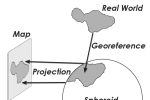
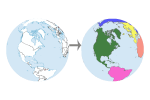
Map Projection: [cartography] A map projection is a systematic rendering of features that transforms a 3D ellipsoid or spheroid of Earth into a 2D map surface with some distortion.
MapInfo: [software] MapInfo by Precisely (founded in 1986) is a GIS location intelligence suite that allows users to manage, view, and create geospatial data.
Meridian: [coordinate system] Meridians are lines of longitude that vary in east-west directions ranging from 0° to +180° east and −180° west.

Metadata: [data structure] Metadata is data that describes data such as the date, abstract, coordinate system, attribute information, origin, and accuracy.
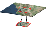
Minimum Mapping Unit: [remote sensing] A minimum mapping unit is the smallest resolution area when interpreting remotely-seemed satellite or aerial imagery.
Moderate Resolution Imaging Sensor (MODIS): [remote sensing] MODIS is a high spectral resolution and moderate spatial resolution (250-1000 meters) imaging scanner.
Moving Window: [mathematics] A moving window is a rectangular arrangement of cells that applies an operation to each cell in a raster dataset while shifting in a position entirely.
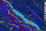
Multispectral Imagery: [remote sensing] A multispectral image had several channels consisting of several spectral bands of wavelengths such as red, green, blue, and NIR.
N
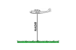
Nadir: [remote sensing] Nadir is the point directly below the aircraft which is usually near the center of the aerial image.
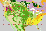
National Land Cover Dataset (NLCD): [organization] The NLCD is a Landsat Thematic Mapper (TM) based classification of land cover in the United States.

National Oceanic and Atmospheric Administration (NOAA): [organization] NOAA is the US government agency that oversees the development of national datums and several weather and ocean satellites.
National Wetlands Inventory (NWI): [organization] The NWI is a dataset compiled by the US Fish and Wildlife Services that describes the type and extent of wetlands in North America.
Nearest Neighbor Interpolation: [mathematics] Nearest neighbor interpolation involves taking the output value from the nearest input layer cell center, commonly used for discrete data like land covers.

Neat Line: [cartography] A neat line is a solid border cartographic element that surrounds all the data, legend, scale, and other features helping the map readers focus on the inner details in a map.
Neighborhood Operation: [mathematics] A neighborhood operation is a spatial function where the output location, area, and extent come from areas larger than and adjacent to the input cells.

Network: [data structure] A network in GIS is a connected set of line features used to model for and demand through real-world networks such as rivers and roads.

Node: [data structure] A node is an important point along a line feature where two lines intersect.

Nominal Scale: [cartography] A nominal scale is a type of measurement that indicates the difference between classes or categories of data.
North American Datum 1927 (NAD27): [geodesy] NAD27 is the adjustment of long-baseline surveys to establish a network of standardized horizontal positions in North America using the Clarke Ellipsoid of 1866 and a fixed center at Meade’s Ranch, Kansas.
North American Datum of 1983 (NAD83): [geodesy] NAD83 is the successor of NAD27 that creates a set of standard horizontal positions for North America based on the reference ellipsoid GRS80.
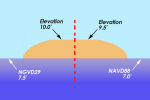
North American Vertical Datum of 1929 (NAVD29): [geodesy] NAVD29 or National Geodetic Vertical Datum of 1929 (NGVD29) gives a vertical measurement network reference frame for which vertical elevations and depressions can be based in North America.
North American Vertical Datum of 1988 (NAVD88): [geodesy] NAVD88 is a vertical datum that provides a reference surface in which vertical heights (altitude) and depth (depression) above and below mean sea level is measured.
North Arrow: [cartography] A north arrow provides an orientation to the map reader by showing the north direction as a graphical depiction.
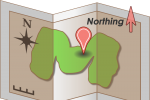
Northing: [coordinate system] A northing is the axis in the approximate north-south direction (or y-value) in UTM and other standard coordinate systems.
O
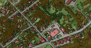
Object Based Image Analysis (OBIA): [remote sensing] OBIA is an image classification technique that segments images and classifies them using spectral, spatial, and relational properties and characteristics.
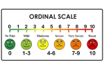
Ordinal Scale: [coordinate system] An ordinal scale represents the relative order of values but does not record the magnitude of differences between values.
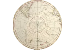
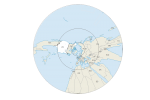
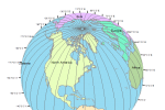
Orthographic Projection: [map projection] An orthographic projection is a map projection that represents 3D data in 2D where all the projection lines are orthogonal to the projection plane.
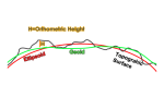
Orthometric Height: [map projection] Orthometric height is a height measured from the Geoid surface to a point on the surface of the Earth.
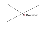
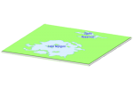
Overshoot: [editing] An overshoot is a digitized line that extends past the intended line of connection.
P
Panchromatic Image: [editing] A panchromatic image records wavelengths in only one wider range band resulting in grayscale images.
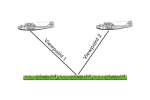
Parallax : [remote sensing] Parallax measures the apparent shift in relative positions of Earth features when it is viewed in different locations.
Passive Sensors: [remote sensing] Passive sensors measure natural energy from the sun as reflected sunlight or thermal radiation such as Landsat, SPOT, and GeoEye.
Pixels (GIS): [data structure] Pixels are the grid cells that make up raster images, which are identical in size.
Planar Topology: [editing] Planar topology requires that intersections for lines and polygons in a digital data layer are enforced and that no two lines or polygons cross.
Polygon: [data structure] A polygon is a closed, connected set of lines that defines a geographic boundary with an area and perimeter such as lakes, forests, and country boundaries.
Positional Dilution of Precision (PDOP): [data structure] PDOP is a quantitative measurement used to represent the quality of the satellite geometry when taking GPS readings.
Public Land Survey System (PLSS): [organization] The PLSS is a land measurement system used in the western United States to define parcel boundaries and locations.
Q
QGIS: [software] QGIS (formerly Quantum GIS) is a free and open source software package that allows you to create, edit, visualize, analyze and publish geospatial information.
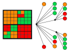
Quad-Trees: [remote sensing] Quad-Trees are raster data structures based on successive reduction of homogeneous cells for the purpose of reducing storage requirements.
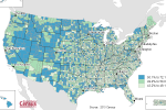
Quantile Classification: [cartography] Quantile classification is a classification method that divides classes so that the total number of features in each class is approximately the same.

Query: [programming] A query is a request or search of spatial or tabular data based on user-defined criteria, resulting in a subset of selected records.
R
Random Location Sampling: [statistics] Random location sampling is a statistical technique where sample locations are selected by a random process with minimal biases.
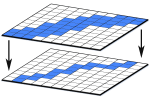
Raster Data: [data structure] A raster is a data model used in GIS which is usually regularly-size rectangular or square shaped grid cells arranged in rows in columns.

Raster Resampling: [mathematics] Raster resampling is a technique used to recalculate and assign new cell values when adjusting the cell size or orientation of a raster grid.
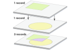
Record: [data structure] A record is an attribute table row that specifies an instance or spatial feature of an entity.
Registration : [GIS processing] Registration is the alignment or assignment of coordinates from a non-projected coordinate system to a coordinate system.

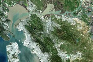
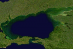
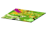
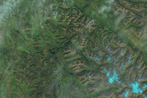
Remote Sensing: [GIS dictionary definition] Remote sensing is the science of obtaining information about the Earth without physically being there, such as by satellite, unmanned aerial vehicle and aircraft.

Rubbersheeting : [mathematics] Rubbersheeting is a transformation technique using polynomial or other non-linear functions to match feature geometry.
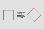
Rotate: [mathematics] Rotation is an affine transformation that changes polylines, polygons in a plane by changing the angle with a pivot location.
S

Scale Bar: [mathematics] A scale bar graphically shows the proportional distance on the map with units such as kilometers or meters.
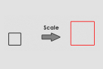
Scale: [mathematics] An affine transformation changes points, polylines, polygons in a plane by scaling, rotating, skewing, or translating coordinates in two or three-dimensional spaces.

Selection Tool: [GIS processing] The selection tool identifies an object or set of objects based on user-selected criteria and properties, typically with Structured Query Language (SQL).
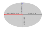
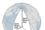
Semi-Major/Minor Axis: [geodesy] The semi-major axis is one-half of the major axis that is the larger of the two radial axes that define an ellipsoid.
Semivariance: [statistics] Semivariance is the variance between valued samples given an inter-sample distances known as lag.

Server: [hardware] A server is a computer component that offers data storage and organization providing subsets of GIS data in response to user requests.

Set Algebra: [mathematics] Set algebra is a method to select items in a database based on operators such as “greater than”, “less than”, “equal to” or ‘not equal to’ using command lines such as SQL.
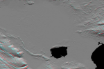
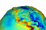
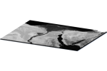
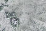
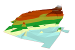
Shaded Relief: [remote sensing] A shaded relief map displays the brightness and shadows of terrain reflection given a sun angle and direction of sunlight.
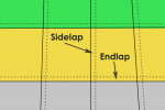
Sidelap: [remote sensing] Sidelap (or side overlap) consists of the overlapping edge areas of photographs between adjacent flight lines.
Skeletonize: [GIS processing] Skeletonizing is the process of thinning a raster line to a single pixel width, typically for conversion to vector data format.
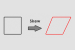
Skew: [mathematics] Skewing distorts a feature by arranging its vertices in the x or y-direction.
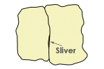
Sliver: [editing] A sliver is a small, spurious gap between polygons often considered as a topology error from imprecise digitization of features.
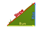
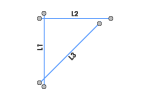
Slope: [mathematics] Slope is the change in elevation or steepness with respect to change in location measured in degrees or percent slope.
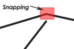
Snapping Environment: [editing] Snapping determines the distance that newly digitized points, lines, and polygons will occupy the same location as existing features.
Soil Survey Geographic Database (SSURGO): [organization] SSURGO is a fine-scale, county-level, soil survey database prepared by the National Resource Conservation Service.
Spaghetti Data Model: [data structure] The spaghetti data model is a simple and dated GIS model where lines may cross without intersecting or topology without attributes.
Spatial Relationship: [data structure] A spatial relationship that links features geographically with a table by a unique identifier.
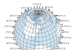
Spherical Coordinates: [coordinate system] Spherical coordinates is a coordinate system based on a sphere defined by two angles of rotation in orthogonal planes such as latitudes and longitudes in a geographic coordinate system.

Spheroid: [geodesy] A spheroid is a three-dimensional mathematical model representing the shape of the Earth based on the equation of a sphere.
Spline: [mathematics] A spline is an interpolation method that generates a smooth surface by using multiple constrained polynomial functions minimizing the overall surface curvature.
State Plane Coordinates: [coordinate system] State Plane Coordinates is a standardized system in the United States based on Lambert conformal conic and transverse Mercator projections.
State Soil Geographic (STATSGO): [organization] STATSGO is a coarse resolution digital soil dataset from detailed and derived soil survey maps.
Stereo Pairs: [remote sensing] Stereo pairs are overlapping photos taken at different positions that have parallax.

Stereographic Projection: [map projection] A stereographic projection is a mapping function that projects an entire sphere on a plane, except at the projection point.

Structured Query Language (SQL): [map projection] SQL is a set of commands used to manage data stored in relational database management systems (RDBMS).
Survey Station: [surveying] Survey stations are positions where surveys are performed during land surveys.
Systematic Sampling: [statistics] Systematic sampling involves selecting samples using a regular and ordered sampling framework.
Système Pour l’Observation de la Terre (SPOT) Satellites: [remote sensing] SPOT satellites are a group of French high resolution optical imaging Earth observation satellite which has been in operation for nearly 35 years.
T
Terrestrial Reference System: [geodesy] The terrestrial reference system is a set of measured points used to define a geodetic datum.
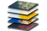
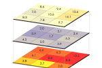
Thematic Layer: [data structure] A thematic layer is a distinct spatial entity in a data layer that is usually delineated as points, lines, and polygons.
Thematic Mapper (TM): [remote sensing] The Thematic Mapper is a high-resolution scanner on Landsat satellites (Landsat 4 and 5) that collects images in visible, near infrared, mid infrared, and thermal bands of the EM spectrum.
TNTmips: [software] TNTmips is a GIS software application produced by Microimages that specializes in image manipulation and vector processing.

Topography: [software] Topography is the study and mapping of Earth’s features including land surfaces, relief, natural, and constructed features.
Topologically Integrated Geographic Encoding and Referencing (TIGER): [organization] TIGER is the central hub for United States census data with an inventory of other spatial data related to rivers, lakes, buildings, cities, political areas, and roads.
Topology: [editing] Topology is a set of rules that dictates the spatial properties of point, line, and area features such as connectivity, adjacency and contiguity.
Traverse: [surveying] A traverse is a set of survey stations spanning along a survey and are closed when returning to a starting point.
Triangular Irregular Networks (TIN): [data structure] TINs are vector-based models depicting three-dimensional elevation surface terrains.
U
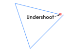
Undershoot: [editing] An undershoot is considered to be a digitizing error in which the new line falls short of the intended connection segment.
Union Tool: [GIS processing] The union tool spatially combines two data layers preserving the features and attributes from both layers at the same extents.
United States Geological Survey (USGS): [organization] USGS is a United States agency responsible for Landsat satellites, nationwide map-making, and spatial data development.
Universal Transverse Mercator (UTM): [coordinate system] UTM coordinate system is a standard set of map projections with a central meridian for each six-degree wide UTM zone.
V
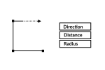
Variable Distance Buffer: [GIS processing] Variable distance buffer uses a feature attribute from the input to create a ring around the feature that varies in distance.
Vector Data Model: [data structure] A vector data model is a common GIS feature representation of spatial information based on defining coordinates and attribute information in points, polylines and polygons.
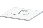
Vertex: [data structure] A vertex is a point that specifies a position on a line for arcs, polylines polygons.
Vertical Datum: [geodesy] A vertical datum is a reference surface to which vertical heights are measured from the zero surfaces to which elevations or depths are referred.
Vertical Dilution of Precision (VDOP): [GPS] VDOP is a quantitative measurement used to represent the quality of the height based on satellite geometry when taking GPS readings.
W
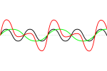
Wavelength: [remote sensing] An electromagnetic wave produce sinusoidal patterns with the distance between the peak and trough of a wave for successive waves.
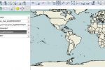
Web Mapping Service (WMS): [Web Mapping] A WMS is pre-established tiles on the server side for viewing only that have features pre-cached at a set of scales.
Web Feature Service (WFS): [Web Mapping] A Web Feature Service allows you to visualize and edit features (points, lines, and polygons) over the internet.
Wide Area Augmentation System (WAAS): [GPS] WAAS is a satellite-based signal correction that improves the estimation of GPS positions primarily by removing atmospheric distortion.
World Geodetic System 1984: [geodesy] WGS84 is a reference ellipsoid used for defining spatial locations in three dimensions.
Z

Zenith: [mathematics] Zenith is the angle measured directly in the z-direction (vertical direction opposite to the apparent gravitational force) on the imaginary celestial sphere at that location.
Zonal Operation: [mathematics] A zonal operation is a spatial function that computes an output value of each cell using the zone containing that cell.


Great resource. Is there an offline version?
Hello, I want to use your dictionary as a reference, could you give more information about the authors, the date, etc. please, I will appreciate it. Thank you.
Here’s how to cite – https://gisgeography.com/how-to-cite/
This was very helpful
Two items to add ( I may have missed them)
Data dictionary
ER plan
This is a great resource. Is it OK to copy selected items to put into a document for training for GIS Beginners? The pictures really help when explaining terms.
It depends on which ones. You’ll have to use the contact form to inform the images you’d like to use.
It’s totally awesome but I want to know about Digital Number(DN) values which I could not found in this dictionary.
It’s awesome I love it
Jump to Letter Q? No Q for you!
I must’ve missed that one. I added it. Thanks for letting us know!
How about ‘ layers’ can be included in the L words. Layers is when different information about a particular location on a map are captured in layers, with each layer describing a different feature about the location.
These are fantastic! Do you provide any resources in other languages?
Sorry, it’s all in English
The definition of “Zenith” should not involve the sun. The point on the “celestial sphere” vertically overhead of an observer on the earth is the zenith and the point on the opposite side of the celestial sphere, vertically below the observer, is the nadir. The zenith and nadir pass through the observer and the common center of the earth and the celestial sphere.