Cylindrical Projections in Cartography & Maps
When you place a cylinder around a globe and unravel it, you get the cylindrical projection like the Mercator, Transverse Mercator and Miller projections.
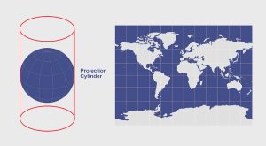
When you place a cylinder around a globe and unravel it, you get the cylindrical projection like the Mercator, Transverse Mercator and Miller projections.
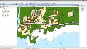
In Bentley Map, we step into a world of CAD and GIS all meshed into one. It combines the power of CAD with the strengths of a traditional GIS software.
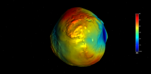
The geoid measures mean sea level and gravity. The GRACE and GOCE satellites are providing the most accurate measurements of the geoid to this date.
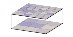
For raster resampling in GIS, you can use bilinear and cubic convolution for continuous data as well as nearest neighbor and majority for discrete data.

Spatial regression is used to model spatial relationships. Regression models investigate what variables explain their location.

With their focus on managing budgets, employees & business development, a GIS manager also needs good organizational skills and solid public speaking skills