The Geoid – Hypothetical Mean Sea Level
Dig a canal away from the ocean
The geoid is a measurement of mean sea level (MSL). When you average out the motion of waves, the level at which water settles is MSL.
If you want to calculate MSL, all you have to do is just measure the average level of the oceans… and there you have it.
But what about the land?
Let’s say you dig a canal away from the ocean inwards to the land. The level the water would settle could be interpreted as the mean sea level.
The geoid is the hypothetical MSL without digging a canal… And surveyors use it to measure precise surface elevations as a true zero surface in a vertical datum.
Do all objects on Earth fall at 9.81 m/s2?
How consistent is gravity at different places on Earth? Is it a steady 9.81 m/s2 (that’s meters, per second, per second) or does it change depending on where you are?
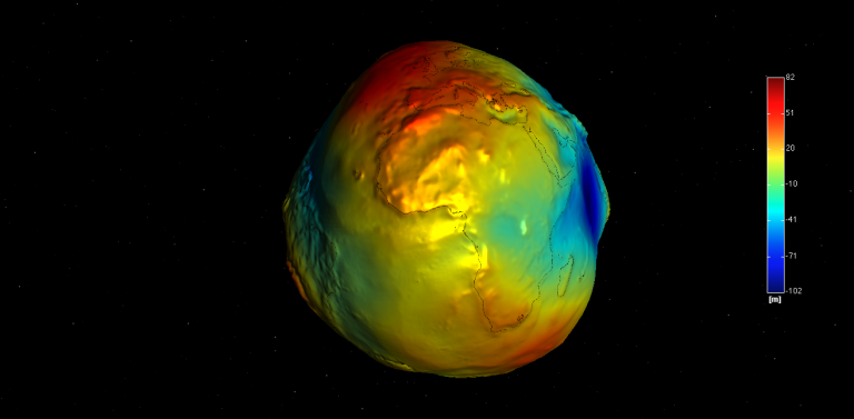
Turns out that gravity is completely location-based. Based on the geoid model, it differs from place to place on Earth.
So gravity is a function of mass. For example, the mountains have more mass than valleys. As a result, gravity in the Rocky Mountains is relatively stronger than other locations on Earth.
Gravity on the Earth’s surface ranges from 9.7639 m/s2 in Peru to 9.8337 m/s2 in the Arctic.
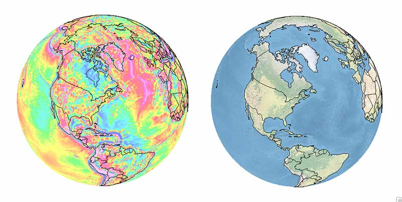
This also means that our planet is actually very bumpy and non-uniform. As you can see in this 3D Geoid Viewer, it’s not a sphere and not as smooth as most people tend to think it is.
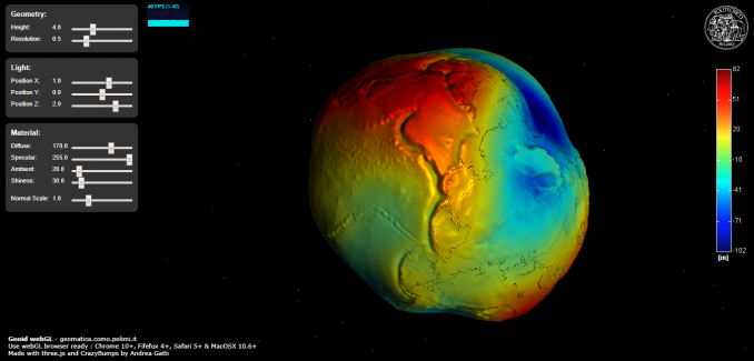
This 3D geoid viewer uses WebGL, three.js, and OpenGL viewer. GOCE and geodesy purposes
Other effects on gravity are because:
- The Earth bulges at the equator from rotational forces. This means the difference between the center of the Earth and the surface is smaller at the poles than at the equator.
- The material composition of the Earth varies and the matter isn’t evenly distributed, which adds more complexity to understanding gravity.
Tom and Jerry Pair of Satellites
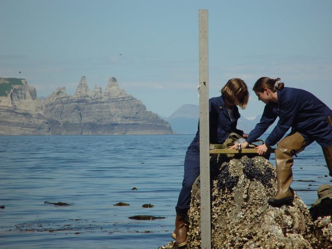
How do you measure the geoid (mean sea level)? If you want to measure the mean sea level, you can use a tide gauge.
Over time, you can just average out the results. And of course, that average is the mean sea level.
But you’d need a lot of tide gauges placed around the entire globe. So this is why satellites like NASA’s GRACE mission (Gravity Recovery and Climate Experiment) and ESA’s GOCE mission (Gravity Field and Steady-State Ocean Circulation Explorer) are measuring our planet’s gravity field with a precision never obtained before.
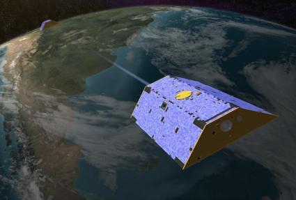
How do these satellites work? GRACE is a pair of satellites in the same orbit approximately 220 kilometers apart. When the leading satellite increases speed, this means there is a greater gravitational pull. If the leading satellite slows down, this means there is less gravitational pull.
These tugs and pushes in gravity are measured using microwave pulses from one satellite to the other. Each satellite position is pinned down with GPS. The end result is the most accurate measurement of gravity anomaly to date.
Why learn about the geoid?
As gravity is one of the key elements in the field of geodesy, scientists are extracting GOCE and GRACE satellite data to study some key applications on Earth.
Geoid applications include weather forecasting, drought predictions, survey accuracy, water cycle, polar ice-mass loss, and anything that can track mass change.
Here are some detailed geoid applications:
EARTH’S INTERIOR – Scientists are closer than ever to earthquake prediction. Because we can retrieve variations in the geoid, these subduction events are like retrieving earthquake signatures. Geoid variations were associated with more than 98 percent of earthquakes of magnitude 9 or above, around 60 percent for magnitude 8.8, 40 percent for magnitude 8.6, and 33 percent for magnitude 8.3.

CLIMATE CHANGE – Ocean circulation, tide gauges, and sea level… If all the ice melted, climate scientists would measure change by the Earth’s rising sea levels and tide gauges. GRACE measures mass change from the melt of Arctic ice. It helps us understand if ocean circulation is changing and how it affects world climate change.
Wrapping things up
As you walk around Earth, you weigh a little more or less depending on where you are. It’s actually a function of how much mass is below you. The geoid derived from the GRACE and GOCE missions can sense just how much that mass is.
We love remote sensing applications. And the list goes on for these uniquely interesting satellite missions.
Earthquake prediction, climate change models, and the water cycle are some of the areas in which the geoid is helping us understand how the planet works. But the list of GRACE applications doesn’t stop here.
Have you ever used the geoid model? We are interested in hearing from you. If you have (or haven’t), let us know with a comment below.


Does centrifugal force from the earth’s rotation affect weight (not gravity) depending on location. If so, I would expect things located at the equator would be lighter (more centrifugal force) than those same thing located at either pole (less centrifugal force). I’m not a physicist (obviously) but this just seems to make common sense to me. Common sense, of course, is often wrong.
Thanks for this write up. I have used a range ( EIGEN 6C4, EGM96, EGM 2008, XGGM2016 & our local UGG2014).
I have loved the wrap up, my eyes are open to something.
I use published global geoid models in GPS surveys