Supervised and Unsupervised Classification in Remote Sensing
Supervised classification creates training areas, signature file and classifies. Unsupervised classification generate clusters and assigns classes.
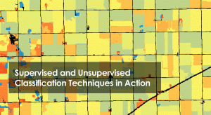
Supervised classification creates training areas, signature file and classifies. Unsupervised classification generate clusters and assigns classes.
Businesses around the world are embracing commercial GIS software because sometimes it just makes more business sense. We list commercial mapping software.
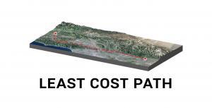
The least cost path finds the most cost-effective path, from a start point to a destination, making it a useful tool for linear routing.
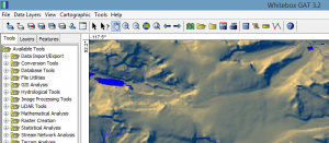
Whitebox GAT (Geospatial Analysis Toolbox) specializes in terrain analysis. But you can do processes like LiDAR and hydrology analysis.
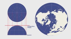
The azimuthal projection plots the surface of Earth using a flat plane. For example, common azimuthal projections are gnomonic, stereographic & orthographic
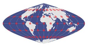
The equal area projection retains the relative size of area throughout a map. So that means at any given region, it keeps the true size and area of features.
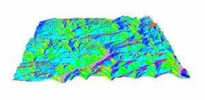
In the mountains, the terrain slopes are in all directions – east, west, north and south-facing. The compass direction that the slope faces is slope aspect.