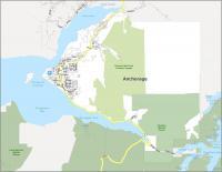
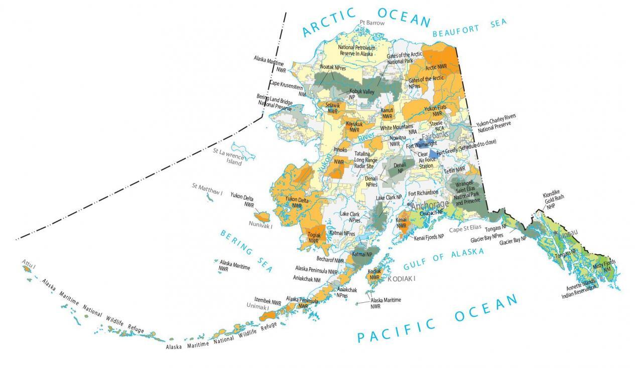
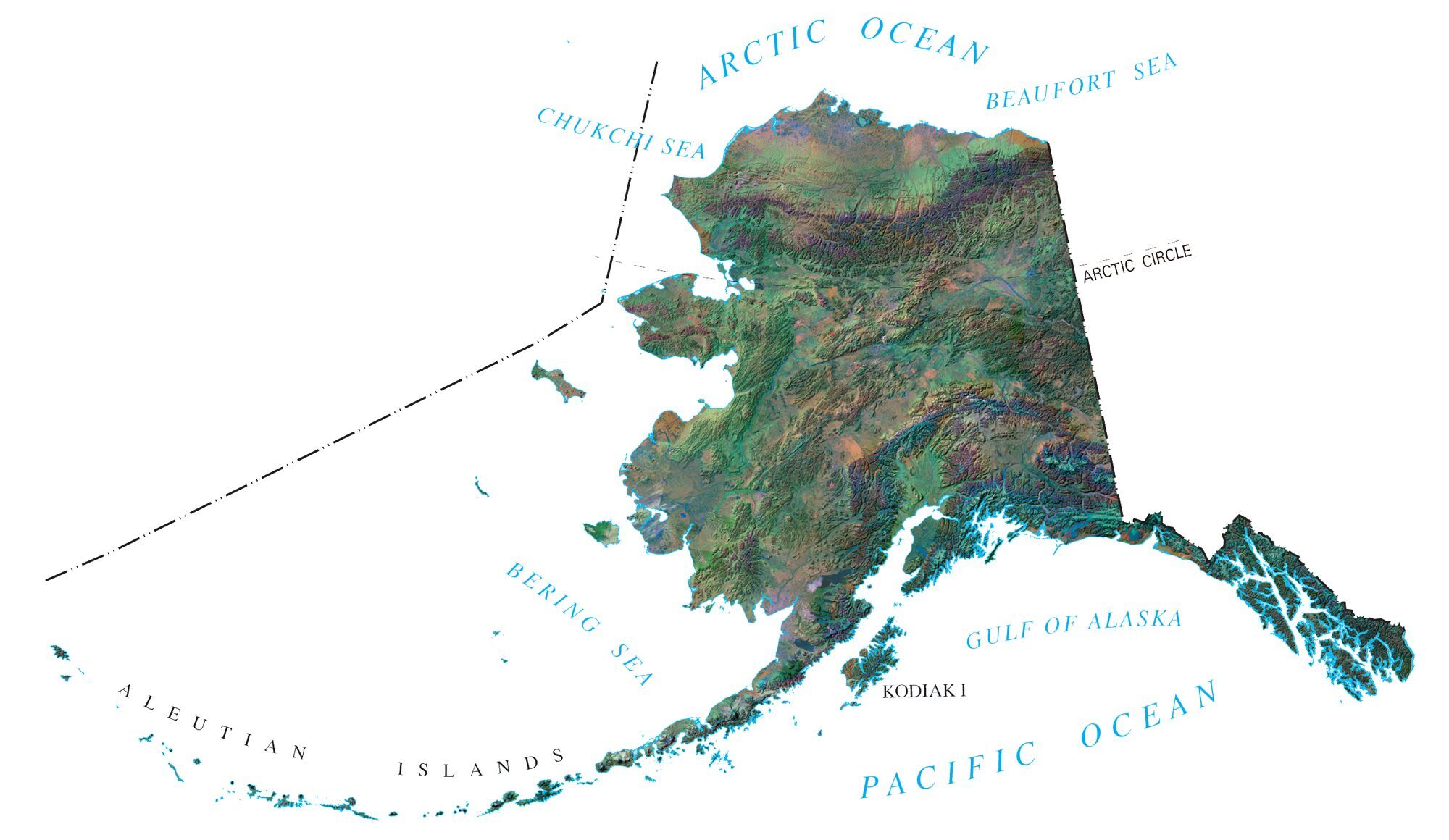
Alaska State Map – Places and Landmarks
About the map
Our Alaska State Map shows major landmarks and places in Alaska. It also includes national forests and military bases. Plus, it has preserves, wildlife refuges, and other federal lands in Alaska.

There’s a lot of interesting wildlife and parks to see in Alaska! When you’re trekking through the state, use this map to better understand you’re surroundings.
The origin of this map is from the National Map. But we’ve modified it in an easy-to-understand way. Because it’s from the National Map, you are allowed to use this map in any way. If you would like the original source of the Alaska State Map, download the PDF from the link below.
You are free to use our map of Alaska for educational and commercial uses. Attribution is required. How to attribute?
Alaska map collection

National forests, preserves and refuges
National Park and Preserve (NP)
Katmai NP
Lake Clark NP
Denali NP
Wrangell-Saint Elias NP
Glacier Bay NP
Kenai Fjords NP
Kobuk Valley NP
Glacier Bay NP
Gates of the Arctic NP
*Denali is the highest mountain peak in North America
National Preserve (NPr)
Aniakchak NPr
Yukon-Charley Rivers NPr
Noatak NPr
Bering Land Bridge NPr
National Monument (NM)
Aniakchak NM
Misty Fjords NM
Cape Krusenstern NM
National Wildlife Refuge (NWR)
Alaska Maritime NWR
Alaska Peninsula NWR
Kodiak NWR
Becharof NWR
Togiak NWR
Kenai NWR
Innoko NWR
Nowitna NWR
Koyukuk NWR
Selawik NWR
Kanuti NWR
Yukon Flats NWR
Tetlin NWR
Izembek NWR
Yukon Delta NWR
National Forest (NF)
Chugach NF
Tongass NF
Alaska Map – Landmarks and places
National Petroleum Reserve in Alaska
Klondike Gold Rush NHP
Steese National Conservation Area
White Mountains National Recreation Area
Army, naval and military
Tatalina Long Range Radar Site
Fort Wainwright
Fort Greely
Fort Richardson
Clear Air Force Station
State capital
Juneau