Map of Berlin, Germany
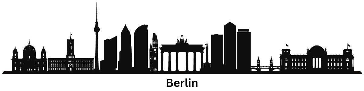
Berlin Map
Looking for a map of Berlin, Germany? You’re in luck because we have an entire collection.
Our Berlin Map collection contains 3 maps in total – a road map, a reference map, and a list of things to do.
Download them, print them out, and keep them handy so you can know your way around the capital city of Germany.
Jump To: Interactive Map | Printable Road Map | 10 Things to Do | Reference Map
Berlin map collection

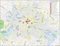
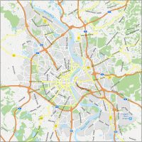
Interactive Map of Berlin
This interactive map is for exploring Berlin. You’ll learn everything there is to know with the latest information on attractions, roads, restaurants, museums, and more. Berlin is a city with an immense history. Make sure you take it all in with this interactive map.
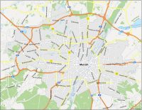
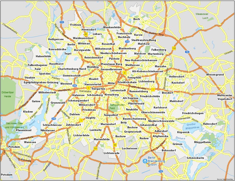
Berlin Road Map
This Berlin road map displays the road transportation system of the city. You’ll find motorways and major roads with highway numbers and street names. We can’t get into too much detail but it’s perfect for an overview map with road information.
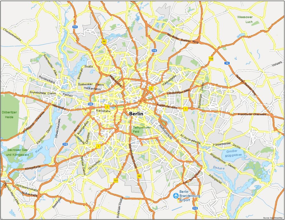
Highways: 1, 2, 10, 96, 100, 101, 113, 114, 115, 158,
Major Roads: Hinckeldeybrücke, Nördlicher Berliner Ring, Landsberger Allee, Potsdamer Chaussee, Heerstraße, Märkische Allee, Adlergestell, Königstraße, Frankfurter Allee, Seestraße, Müllerstraße, Mariendorfer Damm, Potsdamer Straße, Berliner Straße, Danziger Straße, Alt-Friedrichsfelde, Am Seegraben, Karl-Marx-Allee, Alt-Biesdorf, Tempelhofer Damm, Greifswalder Straße
10 Things To Do in Berlin
Berlin is famous for its world-class beer, creative industries, and historical architecture. As such, most of our things to do revolve around these types of attractions. Whether you want to awe at the 18th-century Brandenburg Gate or get a side of history at the Berlin Wall, this city has a bit of something for everyone.

Berlin is the most populous and capital city of Germany. Here are the top 10 things to do that we recommend seeing.
- Brandenburg Gate
- Berlin Wall Memorial
- East Side Gallery
- Holocaust Memorial
- Berlin Cathedral
- Charlottenburg Palace
- Berliner Fernsehturm
- Reichstag Building
- Berlin Zoological Garden
- Topography of Terror
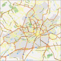
Berlin Reference Map
This reference map of Berlin displays points of reference and different localities. You’ll also find airports, parks, waterways, and other identifying features. Overall, this map is a great way to get acquainted with Berlin so please feel free to download and use it today.
Airports: Berlin Brandenburg Airport
Water Features: Havel River, Dahme River, Großer Müggelsee
Parks: Tempelhofer Feld, Döberitzer Heide, Sacrower See und Königswald, Weesower Luch
Communities: Reinickendorf, Neukölln, Prenzlauer Berg, Kreuzberg, Friedrichshain, Rudow, Mahlsdorf, Hennigsdorf, Karlshorst, Kleinmachnow, Teltow, Ahrensfelde, Glienicke/Nordbahn, Großziethen, Schönwalde-Siedlung, Eiche, Seeburg, Schönwalde-Dorf