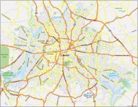
Map of Hamburg, Germany

Hamburg Map
Get to know Hamburg, Germany like a local. Our Hamburg map collection shows highways, localities, and things to do.
We also include an interactive map with all of the top tourist attractions to visit the second most populous cities in Hamburg.
So download our maps and have a look at the beautiful city of Hamburg. Get to know the best places to go and learn about Hamburg, Germany.
Jump To: Interactive Map | Printable Road Map | 10 Things to Do | Reference Map
Hamburg map collection
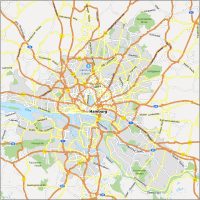
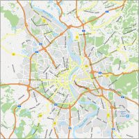
Interactive Map of Hamburg
Get to know Hamburg better! This road map includes the transportation system of Hamburg. You’ll get highway numbers and street names with detailed street names. For visiting Hamburg’s top attractions, this map is perfect for explorers of all levels.
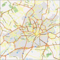
Hamburg Road Map
See the sights and sounds of Hamburg. With this map, you can see all the attractions and hotspots in Hamburg, Germany. From the city’s famous landmarks to its world-famous museums, you will have everything you need to explore this beautiful city. With so much to see and do, it’s no wonder that Hamburg is one of the most popular tourist destinations in Germany.
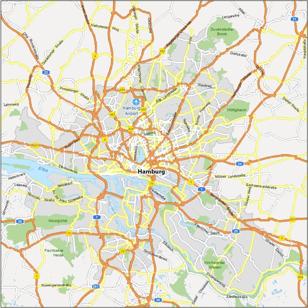
Highways: 1, 3, 4, 7, 23, 25, 26, 75, 432, 433
Major Roads: Peutestraße, Langenhorner Chaussee, Südring, Mittelweg, Ebertallee, Großmoordamm, Elbdeich, Tegelweg, Berner Heerweg, Alte Landstraße, Allermöher Deich, Süderquerweg, Sachsenwaldstraße, Glinder Weg, Möllner Landstraße
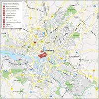
10 Things To Do in Hamburg
See the sights and sounds of Hamburg. With this map, you can check out all the attractions and hotspots in Hamburg, Germany. From the city’s famous landmarks to its world-famous museums, you will have everything you need to explore this beautiful city.
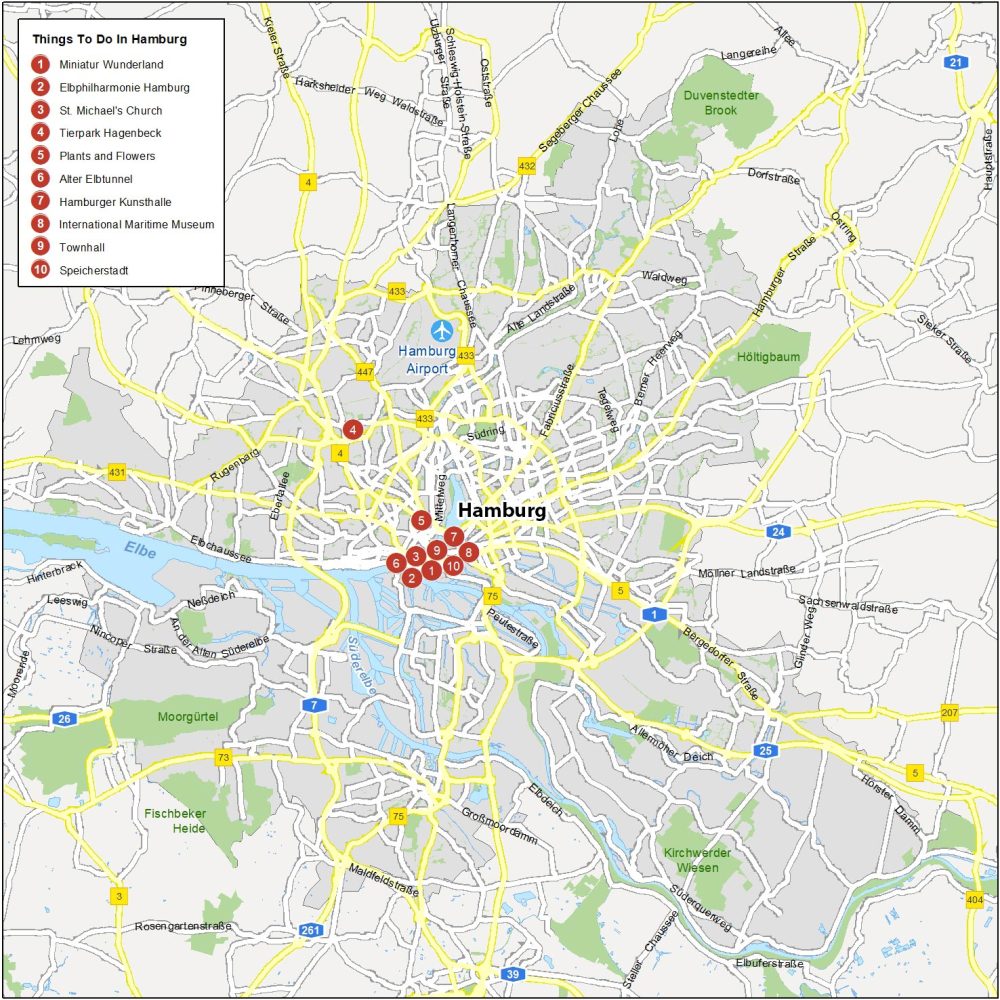
As you can see, Hamburg is a city with plenty to offer. Here are our top recommendations for things to do in Hamburg.
- Miniatur Wunderland
- Elbphilharmonie Hamburg
- St. Michael’s Church
- Tierpark Hagenbeck
- Plants and Flowers
- Alter Elbtunnel
- Hamburger Kunsthalle
- International Maritime Museum
- Townhall
- Speicherstadt
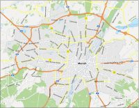
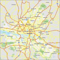
Hamburg Reference Map
This reference map of Hamburg displays major neighborhoods and other complementary information. You’ll see airports, parks, and waterways. Have a look at the beautiful city of Hamburg before you head there. This map will help you find your way around and see all of the right information.
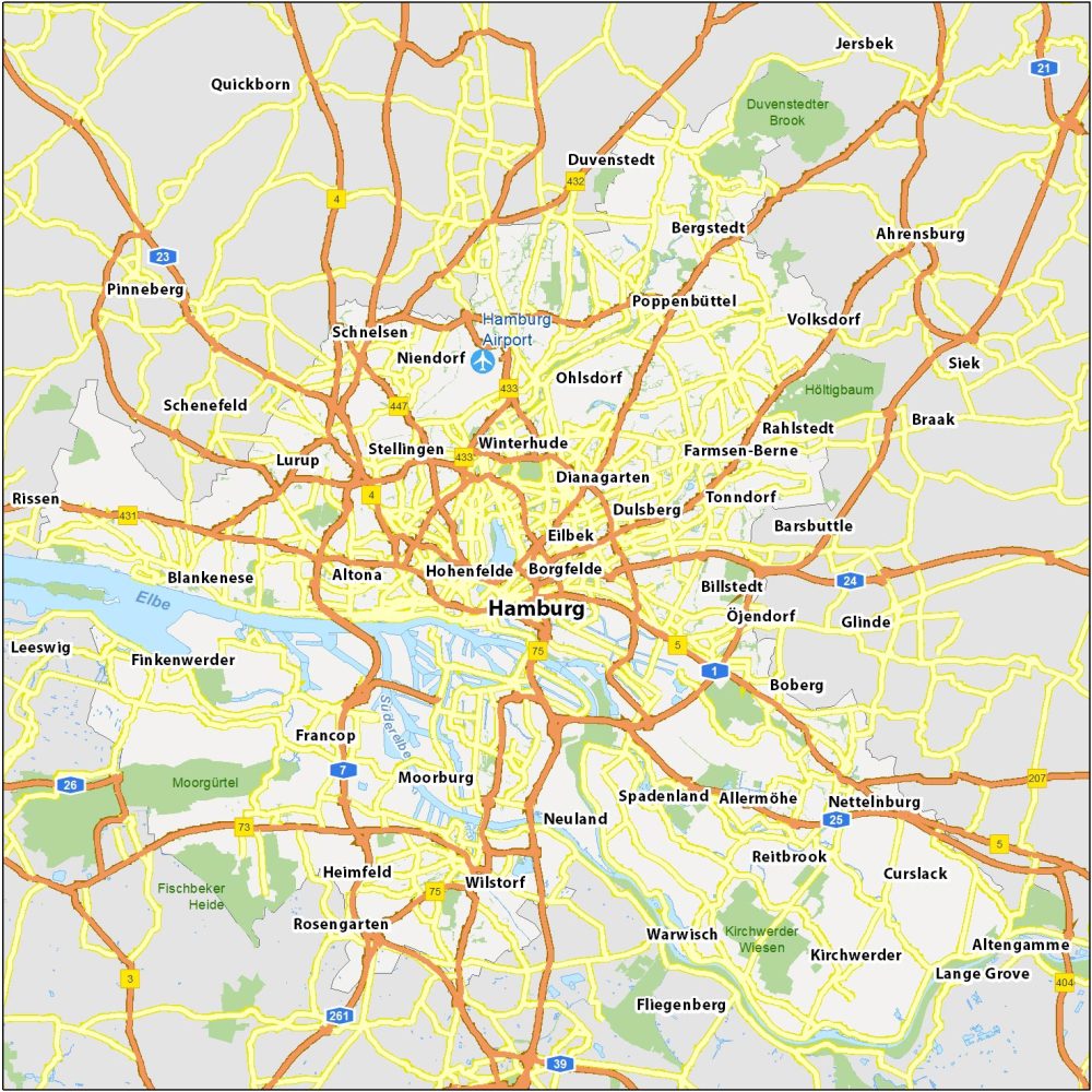
Airports: Hamburg Airport
Water Features: Elbe River, Süderelbe River
Parks: Moorgürtel, Fischbeker Heide, Kirchwerder Wiesen, Höltigbaum, Duvenstedter Brook
Communities: Dianagarten, Winterhude, Dulsberg, Eilbek, Hohenfelde, Borgfelde, Stellingen, Altona, Lurup, Moorburg, Billstedt, Öjendorf, Ohlsdorf, Neuland, Spadenland, Francop, Heimfeld, Rosengarten, Wilstorf, Neuland, Spadenland, Lurup, Bergstedt