Map of Frankfurt, Germany
Frankfurt Map
This Frankfurt map collection can help you see where all the action is in Frankfurt, Germany.
Altogether, it features 3 printable maps including a road map, things to do, and a reference map of Frankfurt.
With this map collection, you can explore all of Frankfurt’s attractions and highways in no time.
Jump To: Interactive Map | Printable Road Map | 10 Things to Do | Reference Map
Frankfurt map collection
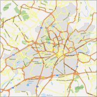
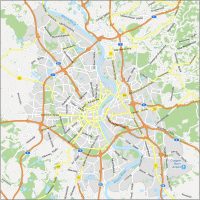
Interactive Map of Frankfurt
Looking for a place to visit in Frankfurt? In this interactive map, you can find the best places to eat, drink, and shop. Search for addresses and find all the important tourist destinations and places of interest.
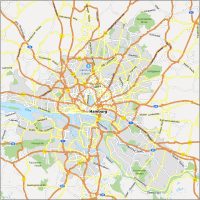
Frankfurt Road Map
Find your way around Frankfurt quickly and easily with our Frankfurt road map. From the main routes to the busiest motorways, we have everything you need right here. Use this map to explore Frankfurt, Germany. Print and access the map offline or use it for navigation to get around quickly.

Highways: 3, 5, 8, 40, 43, 44, 66, 455, 661
Major Roads: Europa-Allee, Kleyerstraße, Gutleutstraße, Kennedyallee, Marbachweg, Mainzer Landstraße, Schwanheimer Ufer, Babenhäuser Landstraß, Hanauer Landstraße, Marktstraße, Stroofstraße, Oeserstraße, Rosa-Luxemburg-Straße, Friedberger Straße, Hugo-Eckener-Ring, Pfaffenwiese
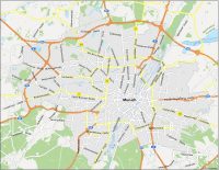
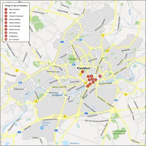
10 Things To Do in Frankfurt
Frankfurt is a city of culture and diversity, and this map has all the information you need to explore it. From the city’s main sights to the best museums and historical buildings, this map has what you need to explore Frankfurt.
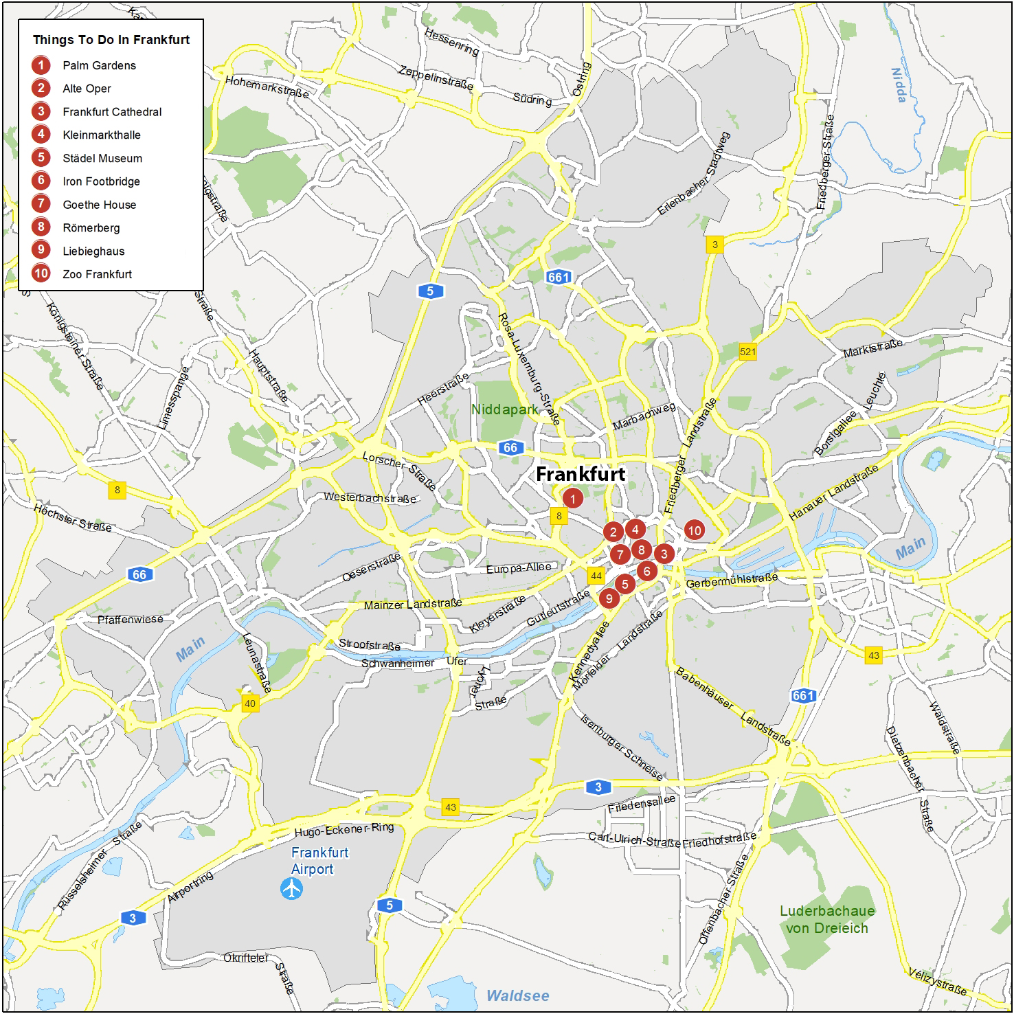
Frankfurt is the fifth-most populous of Germany. Here are the top 10 things to do that we recommend seeing.
- Palm Gardens
- Alte Oper
- Frankfurt Cathedral
- Kleinmarkthalle
- Städel Museum
- Iron Footbridge
- Goethe House
- Römerberg
- Liebieghaus
- Zoo Frankfurt
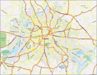
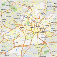
Frankfurt Reference Map
From localities to parks and waterways, this reference map has it all. Get a sense of the area around Frankfurt. The map provides an overview of Frankfurt’s major areas so you can make the most informed decisions when planning your trip.
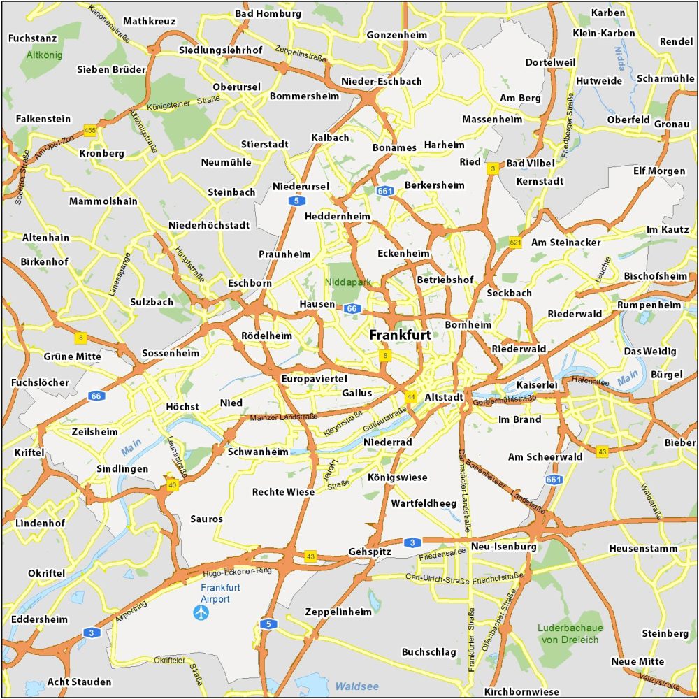
Airports: Frankfurt Airport
Water Features: Main River, Nidda River, Waldsee
Parks: Luderbachaue von Dreieich, Niddapark, Altkönig
Communities: Eckenhein, Heddernheim, Berkersheim, Betriebshof, Bornheim, Seckbach, Riederwald, Altstadt, Europaviertel, Rödelheim, Eschborn, Praunheim, Niederrad, Kalbach, Niederursel, Niederhöchstadt, Königswiese