Cologne Map, Germany
Cologne Map
Looking for a map of Cologne? Look no further than right here! We have a map that will help you explore and learn more about Cologne.
Our Cologne map collection includes a highway/road map, a reference map, and a list of things to do.
Plus with our interactive map, you can explore Cologne in detail, from its landmarks to its neighborhoods.
Jump To: Interactive Map | Printable Road Map | 10 Things to Do | Reference Map
Cologne map collection
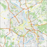
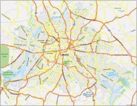
Interactive Map of Cologne
Get a detailed view of the city and find what you’re looking for—fast. This interactive map of Cologne will help you get around quickly and easily. It includes all the best coffee shops, bars, restaurants, and points of interest in the city. Overall, it has all the latest information about the city to make your trip go smoothly in Cologne.
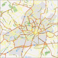
Cologne Road Map
With this map, you can quickly and easily find your way around the city. The map includes a wealth of information such as transportation options and the entire highway network of Cologne. As you familiarize yourself with Cologne, make sure to print this free map and keep it in a safe spot.
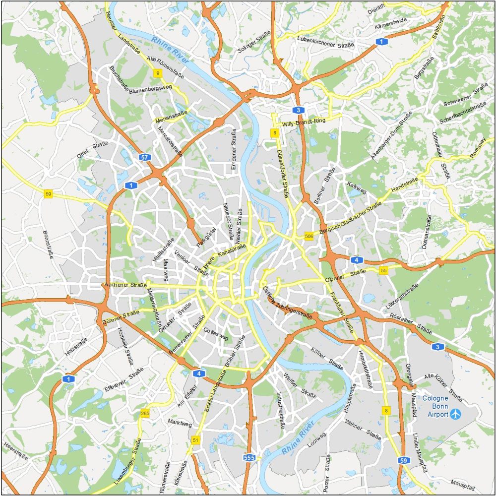
Highways: 1, 3, 4, 8, 9, 51, 55, 57, 59, 265, 555
Major Roads: Östliche Zubringerstraße, DüsseldorferStraße, Bergisch Gladbacher Straße, Brühler Landstraße, Dürener Straße, Aachener Straße, Handstraße, Altenberger-Dom-Straße, Neusser Landstraße, Merianstraße, Luxemburger Straße, Frankfurter Straße, Kölner Straße, Wahner Straße, Willy-Brandt-Ring, Orrer Straße
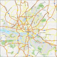
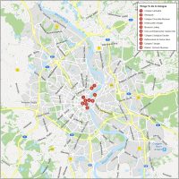
10 Things To Do in Cologne
This map has all the important tourist destinations marked out, so you can plan your trip with ease. From world-famous museums to awe-inspiring gardens, you’ll be able to discover all the top attractions in and around Cologne, Germany.
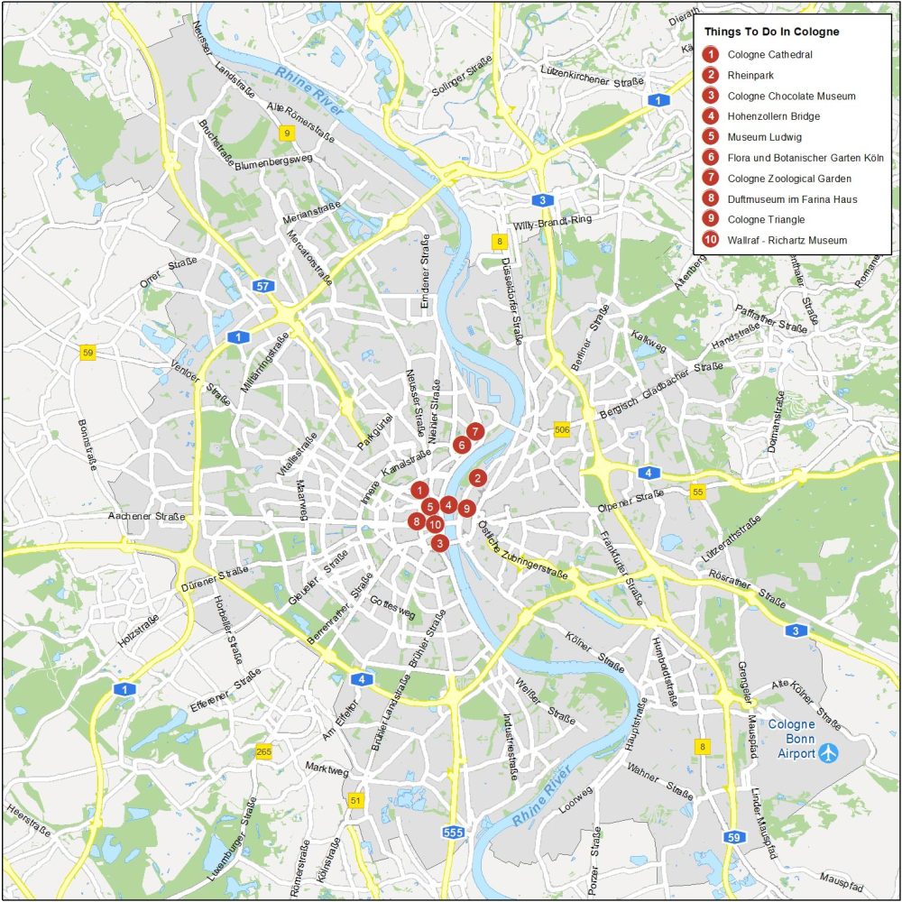
Cologne is the fourth-most populous of Germany and is the largest city in the German western state of North Rhine-Westphalia (NRW). Here are the top 10 things to do that we recommend doing.
- Cologne Cathedral
- Rheinpark
- Cologne Chocolate Museum
- Hohenzollern Bridge
- Museum Ludwig
- Flora und Botanischer Garten Köln
- Cologne Zoological Garden
- Duftmuseum im Farina Haus
- Cologne Triangle
- Wallraf – Richartz Museum
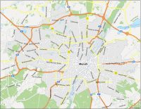
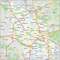
Cologne Reference Map
Get to know the city like a local—by finding all the popular neighborhoods and localities of Cologne. Whether you’re looking for a new place to eat or want to explore a new part of town, this map will help you get there quickly and easily.
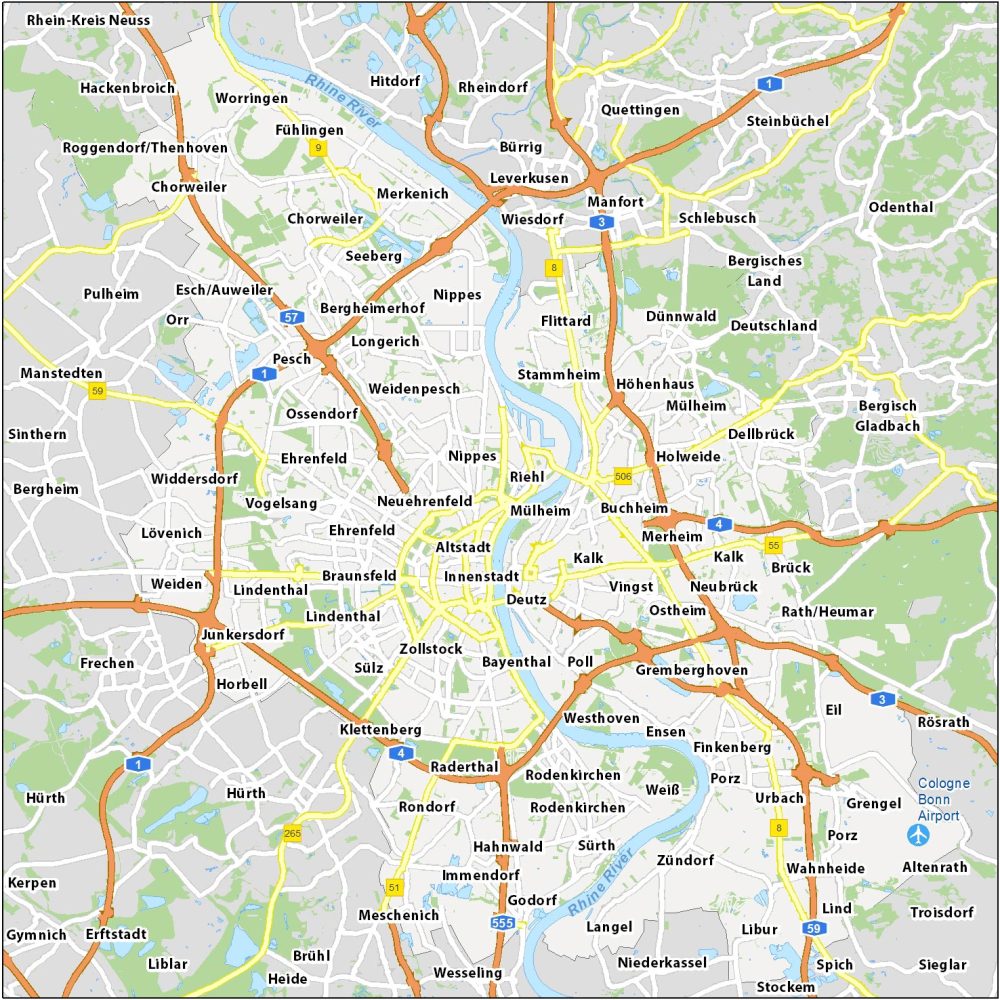
Airports: Cologne Bonn Airport
Water Features: Rhine River
Communities: Mülheim, Altstadt, Innenstadt, Deutz, Kalk, Riehl, Nippes, Neuehrenfeld, Ehrenfeld, Braunsfeld, Lindenthal, Sülz, Zollstock, Bayenthal, Poll, Westhoven, Gremberghoven, Vingst, Ostheim, Merheim, Buchheim, Holweide, Höhenhaus, Stammheim, Weidenpesch, Ossendorf, Longerich, Bergheimerhof, Widdersdorf, Lövenich, Chorweiler, Merkenich, Fühlingen