Map of Charleston, South Carolina
Map of Charleston
Print out our Charleston map collection. We feature maps for the South Carolina city displaying roads/highways, things to do, and major landmarks. Get your bearings with our interactive map to find out what’s going on in the city.
Charleston, South Carolina is not only famous for the “Charleston dance” named after it. But it’s also known for its historical buildings and muggy landscape.
Charleston is one of those cities that has a lot to offer. Also, it has one of the best downtowns in South Carolina with great cultural attractions.
Jump To: Interactive Map | Printable Road Map | 10 Things to Do | Reference Map
Charleston map collection
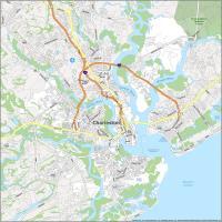
Interactive Map of Charleston
Charleston is the largest city in South Carolina and is located in the southeast of South Carolina in the coastal area. Get a sense of what’s around you with this interactive map. Find what you love to do and see what’s near your favorite restaurant, hotel, or event venue.
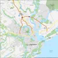
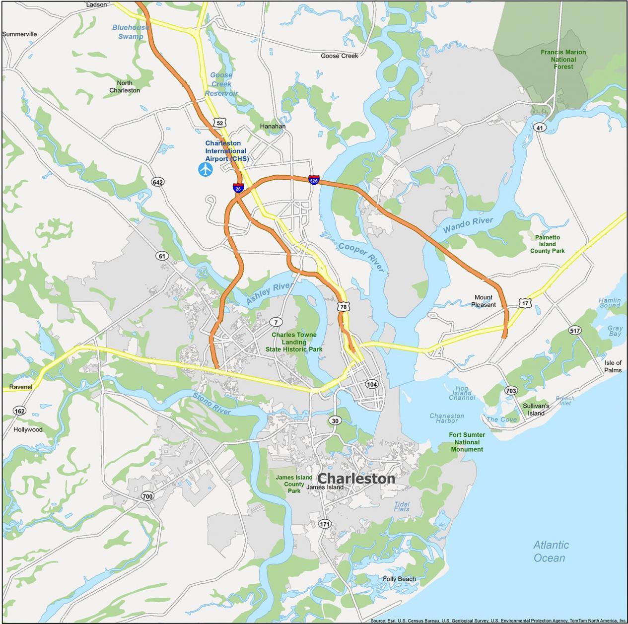
Charleston Road Map
Plan a road trip with this Charleston road map. You can get directions and find all the highways and major roads of Charleston, South Carolina. If you want to travel within the state, then use our South Carolina road map to help navigate the roads.
Interstate Highways: I-26, I-526
US Highways: 7, 17, 30, 41, 52, 61, 78, 171, Savannah Hwy
Major Roads: Ashley Ave, Ashley River Rd, Broad St, Calhoun St, Cannon St, Clements Ferry Rd, Coming St, Cypress St, Folly Rd, King St, Lockwood Blvd, Meeting St, Old Towne Rd, Romney St, Rutledge Ave, Saint Andrews Blvd, Sam Rittenberg Blvd, Spring St, Wesley Dr
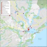
10 Things To Do in Charleston
South Carolina is home to many interesting places such as the city of Charleston. If you’re planning a road trip, use this printable list of things to do. Explore all the points of interest and historical sites in the city.
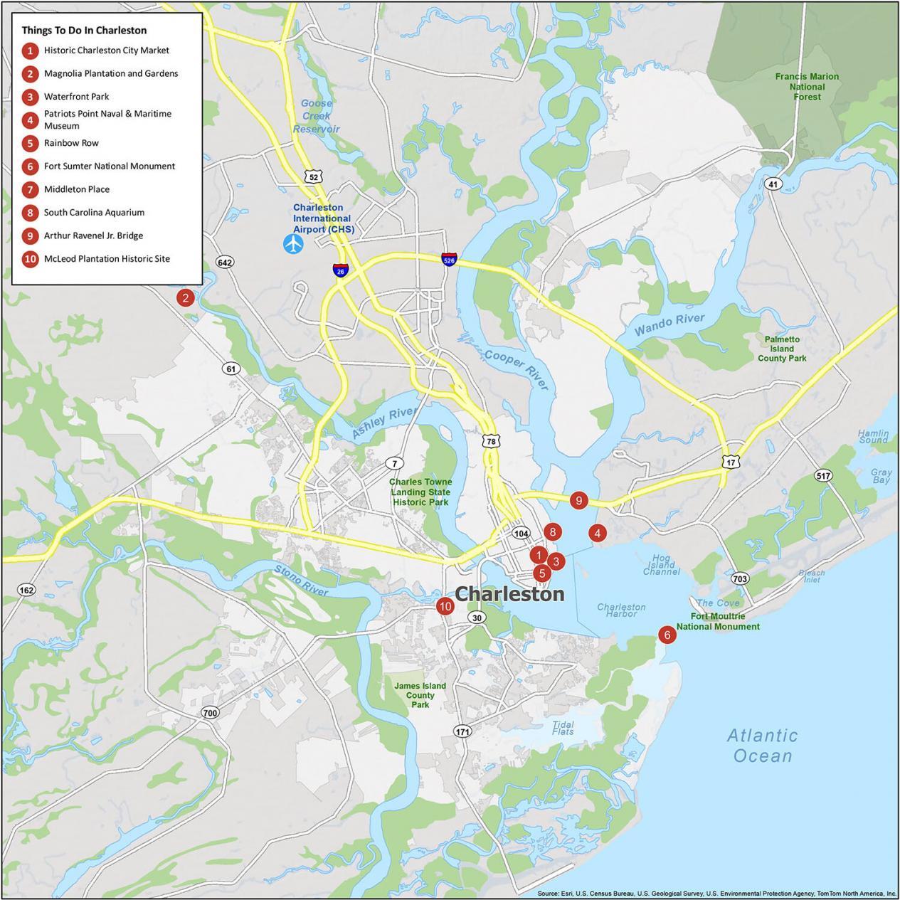
- Historic Charleston City Market
- Magnolia Plantation and Gardens
- Waterfront Park
- Patriots Point Naval & Maritime Museum
- Rainbow Row
- Fort Sumter National Monument
- Middleton Place
- South Carolina Aquarium
- Arthur Ravenel Jr. Bridge
- McLeod Plantation Historic Site
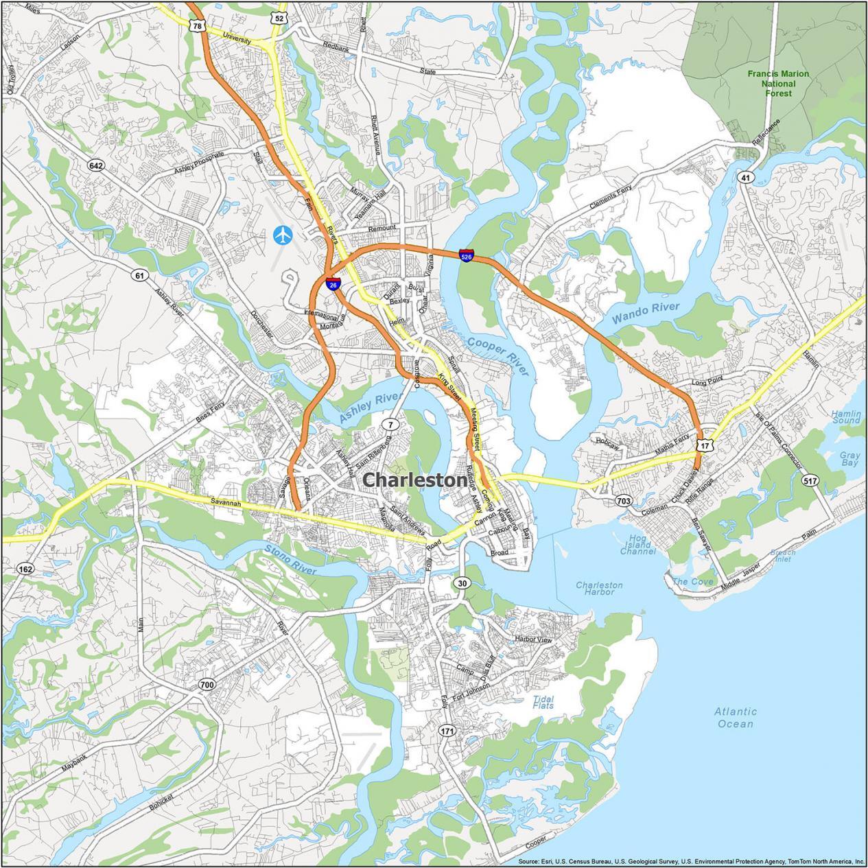
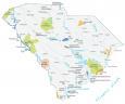
Charleston Reference Map
This map is a great tool to help you make the most of your time. You can rely on this map to show you the neighborhoods of Charleston. Also, find out its parks, rivers, beaches, and monuments.
Cities: Charleston, Folly Beach, Goose Creek, Hanahan, Isle of Palms, North Charleston
Towns: Hollywood, James Island, Mount Pleasant, Ravenel, Sullivan’s Island, Summerville
Census-designated place (CDP): Ladson
Rivers/Lakes: Ashley River, Cooper River, Stono River, Wando River, Charleston Harbor
It would be helpful to have an enlarged map of the historical district.