Charlotte Map, North Carolina

Map of Charlotte
If you need a map of Charlotte, North Carolina – then keep reading below. We have a Charlotte map with roads, landmarks, and things to do. All are available to download to take on your journey through Queen City.
If you ever go to Charlotte, the main highlights are its attractions! It’s a perfect fit for families because of its Motor Speedway, NASCAR Hall of Fame, and amusement parks like Carowinds.
The city of Charlotte, North Carolina is located in the Piedmont Triad region. It is the largest city in the state with a population of over 850,000. In this guide, we’ll walk you through all the great things to do in Charlotte with several maps.
Jump To: Interactive Map | Printable Road Map | 10 Things to Do | Reference Map
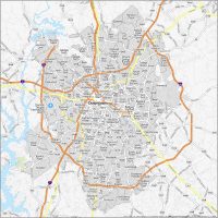
Charlotte map collection
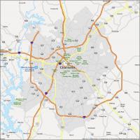
Interactive Map of Charlotte
If you live in Charlotte or are just visiting, you know how important it is to be able to navigate the city and get around. This interactive Charlotte map will help you get around Charlotte, NC. No matter where you are, you can find places of interest, transportation, parking, and more.
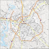
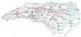
Charlotte Road Map
A map of Charlotte is a great tool for exploring, locating places, and understanding where you are. Whether you’re new in town or a local, we all love to explore places on a map, and Charlotte has much to explore! It includes interstates like I-77 and I-88, highways, and other major roads in the city so you’ll never get lost. Use this North Carolina road map to travel around statewide.

Interstate Highways: I-277, I-485, I-495, I-77, I-85
US Highways: 16, 21, 24, 27, 29, 49, 51, 74, 115, 160, 277, 485, 495, 521, 1004, 1126, 1128, 1138, 1143, 1784, 2019, 2108, 2110, Independence Expy, Lancaster Hwy
Parkways/Expressways: Billy Graham Pky, Independence Expy, Josh Birmingham Pky
Major Roads: 3rd St, 4th St, 5th St, 7th St, Albemarle Rd, Arrowood Rd, Bellhaven Blvd, Brevard St, Brookshire Blvd, Brown Grier Rd, Caldwell St, Church St, Clanton Rd, Clarkson St, College St, Dalton Ave, Dixie Rd, East Blvd, Freedom Dr, Graham St, Independence Blvd, Johnston Rd, Mcdowell St, Mint St, Morehead St, Oakdale Rd, Old Statesville Rd, Peachtree Rd, Pineville-Matthews Rd, Providence Rd, Rozzelles Ferry Rd, South Blvd, Statesville Rd, Steele Creek Rd, Sunset Rd, Trade St, Tryon St, University City Blvd, Walnut Ave, West Blvd, Westinghouse Blvd, Wilgrove Mint Hill Rd, Wilkinson Blvd, Woodlawn Rd, York Rd
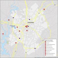
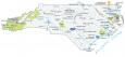
10 Things To Do in Charlotte
If you’re looking to get around the city, you can use this map to help you navigate through this city. Plus, we point out some of the top attractions. Find places like Charlotte Motor Speedway and the NASCAR Hall of Fame on the map.
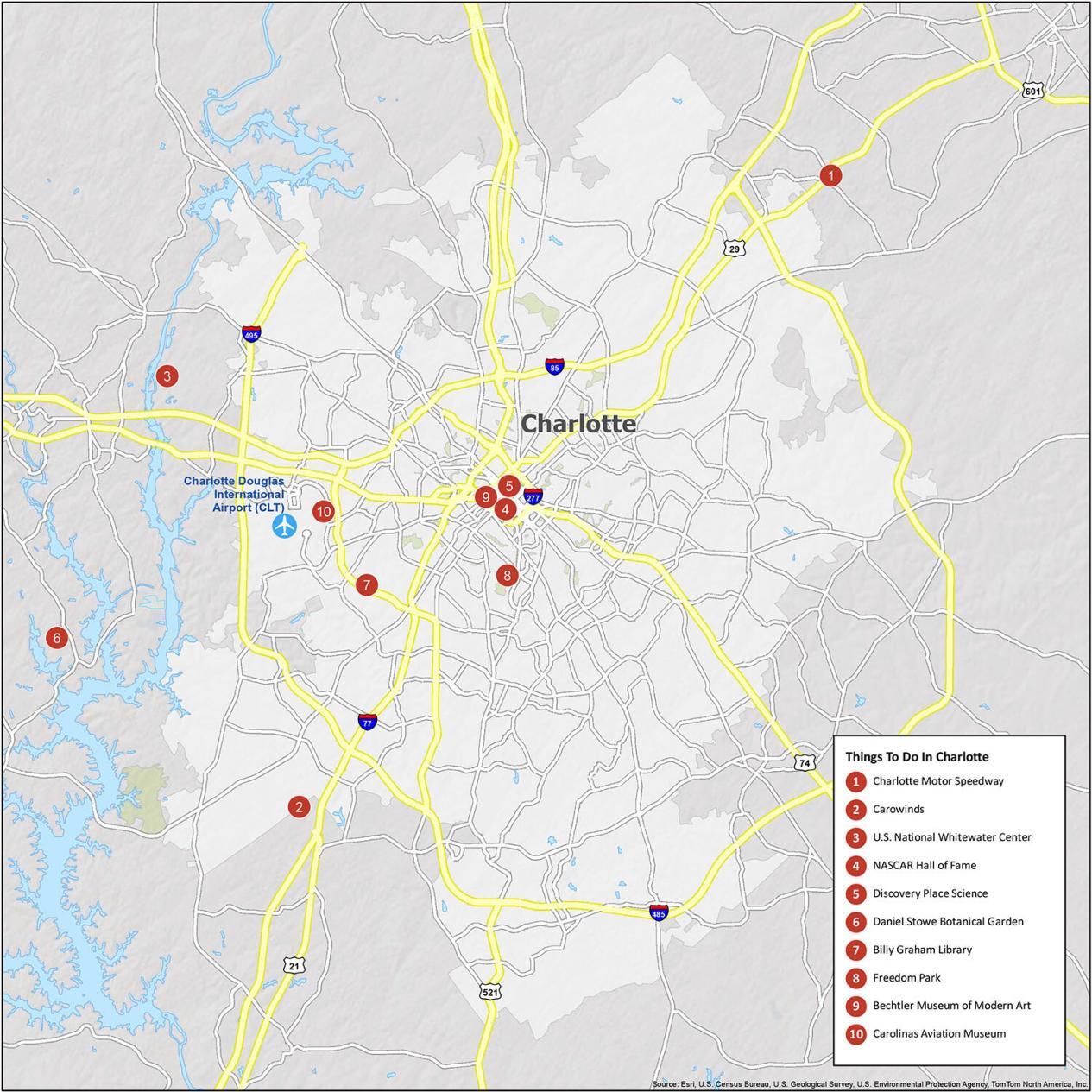
- Charlotte Motor Speedway
- Carowinds
- U.S. National Whitewater Center
- NASCAR Hall of Fame
- Discovery Place Science
- Daniel Stowe Botanical Garden
- Billy Graham Library
- Freedom Park
- Bechtler Museum of Modern Art
- Carolinas Aviation Museum
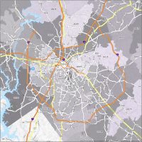
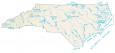
Charlotte Reference Map
This map is for anyone looking to get a better understanding of the area. Explore everything in one printable map. Find the parks, towns, and neighborhoods around Charlotte, North Carolina, and get reacquainted.
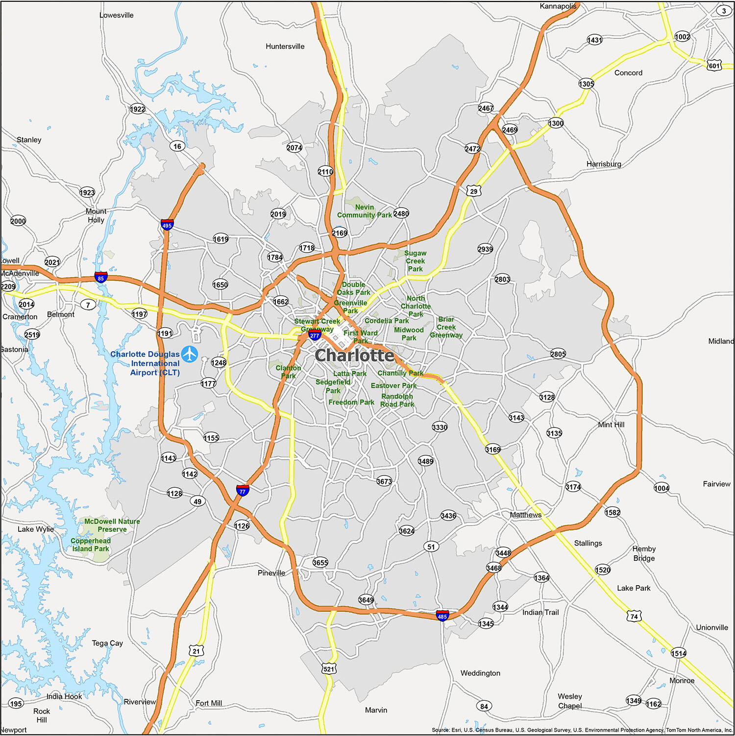
Cities: Belmont, Charlotte, Concord, Gastonia, Kannapolis, Lowell, Monroe, Mount Holly, Rock Hill, Tega Cay
Towns: Cramerton, Fairview, Fort Mill, Harrisburg, Hemby Bridge, Huntersville, Indian Trail, Matthews, McAdenville, Midland, Mint Hill, Pineville, Stallings, Stanley, Unionville, Weddington
Villages: Lake Park, Marvin, Wesley Chapel
Census-designated place (CDP): India Hook, Lake Wylie, Lowesville, Newport, Riverview
I am so sick of driving in circles in Charlotte and very few alternate routes. Really bad city planning. And what is with all the cement divides in the middle of streets? Are you trying to kill us???????????? Paint them so we can see them at night. Stop making driving a feat of creativity. Don’t you wonder why there are so many accident EVERY FREAKING DAY???????????? I am looking for a new way around town and the Google Maps on my computer does not put the names of streets and highways? Really?