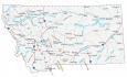
Glacier National Park Map
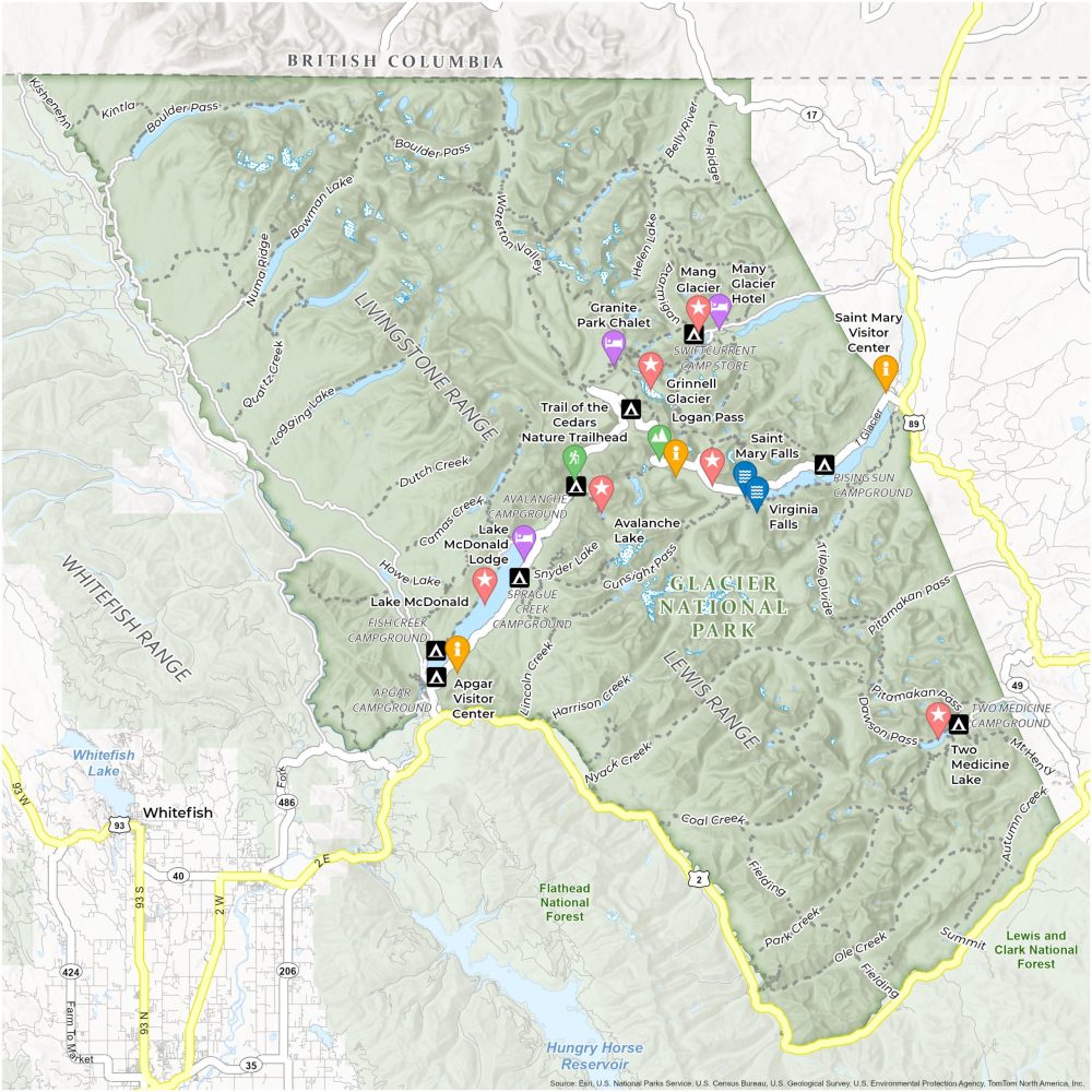
About the map
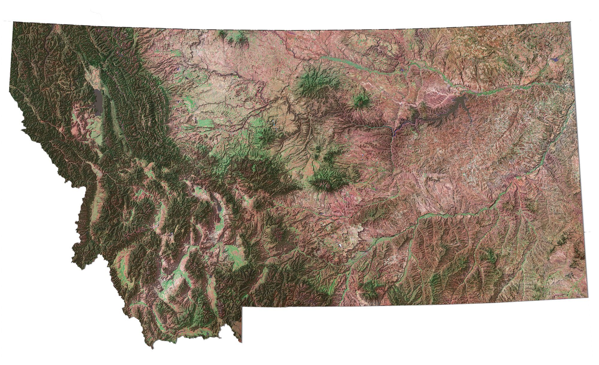
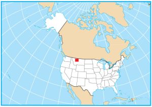
Navigate your way through the pristine wilderness in Montana using our Glacier National Park map. This map guides you through its rugged mountains, alpine meadows, and crystal-clear lakes.
Discover over 700 miles of trails, campgrounds, and attractions. You’ll find all the top attractions in Glacier National Park like Grinnell Glacier, Logan Pass, and Lake McDonald.
We include visitor centers and major roads so you don’t get too far off the beaten path. Use this map of Glacier National Park to plan your adventure and explore the park’s natural beauty safely. Enjoy your journey in this crown jewel of the continent.
You are free to use our Glacier National Park map for educational and commercial uses. Attribution is required. How to attribute?
Top Things to Do
- Lake McDonald: The largest lake in the park. It’s known for its crystal-clear waters and a scenic backdrop of mountains.
- Logan Pass: The highest point on the Going-to-the-Sun Road. It’s also a starting point for several hiking trails.
- Grinnell Glacier: One of the most famous glaciers in the park.
- Avalanche Lake: Another crystal-clear lake surrounded by cliffs and waterfalls.
- Saint Mary Falls: A set of beautiful cascading waterfalls easily accessible by a short hike.
- Trail of the Cedars Nature Trailhead: An accessible, boardwalk trail that meanders through cedar forest.
- Two Medicine Lake: A less crowded area of the park that’s ideal for hiking, boating, and fishing.
- Virginia Falls: A waterfall taller than St. Mary Falls.
- Going-to-the-Sun Road: A 50-mile road that crosses the park. It’s a must-do for first-time visitors.
- Many Glacier: An area of the park known for its impressive glacier-carved terrain, abundant wildlife, and hiking trails.
Discovery and Visitor Centers
Apgar Visitor Center
Logan Pass Visitor Center
Saint Mary Visitor Center
Campgrounds
Apgar Campground
Fish Creek Campground
Sprague Creek Campground
Avalanche Campground
St. Mary Campground
Many Glacier Campground
Medicine Campground
Rising Sun Campground
Trails
Dutch Creek Trail
St Mary Lake Trail
Howe Lake Trail
Snyder Lake Trail
Lincoln Creek Trail
Camas Creek Trail
Red Eagle Trail
Gunsight Pass Trail
Lincoln Creek Trail
Harrison Creek Trail
Nyack Creek Trail
Triple Divide Trail
Pitamakan Pass Trail
Dawson Pass Trail
Coal Creek Trail
Helen Lake Trail
Lee Ridge Trail
Belly River Trail
Boulder Pass Trail
Waterton Valley Trail
Bowman Lake Trail
Kishenehn Trail
Kintla Trail
Quartz Creek Trail
Logging Lake Trail
Fielding Trail
Park Creek Trail
Ole Creek Trail
Summit Trail
Autumn Creek Trail
Mt Henry Trail
Landforms/Physical Regions
Lewis Range
Livingstone Range
Flathead National Forest
Lewis and Clark National Forest
Hungry Horse Reservoir
Whitefish Range
Highways and Major Roads
US Highway 2
US Highway 89
Going-to-the-Sun Road
Lodges and Chalets
Lake McDonald Lodge
Many Glacier Hotel
Granite Park Chalet
Other Landmarks
Whitefish
Swift Current Camp Store
British Columbia Border
References
- Glacier National Park (National Park Service)
- USGS Glacier National Park Map
- Topographic Maps of Glacier NP (USGS)