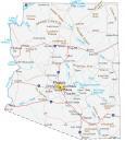
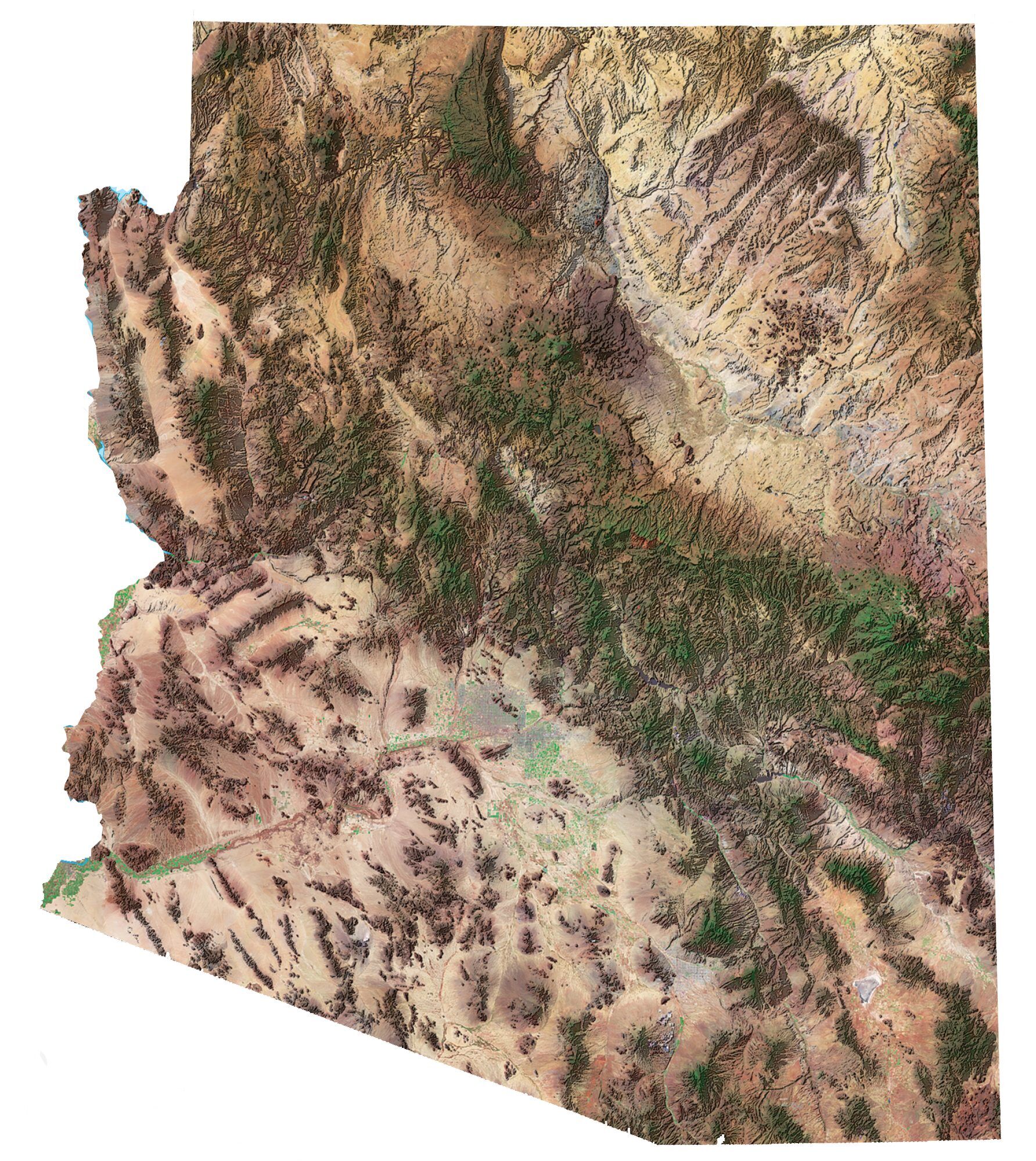
Grand Canyon National Park Map

Top Things To Do
Here is our list of the top 10 things to do in the Grand Canyon National Park.
- Desert View Watchtower: Panoramic views and cultural history atop a Grand Canyon watchtower.
- Grand Canyon West Skywalk: Glass bridge offering breathtaking views.
- Mather Point: Popular viewpoint providing iconic Grand Canyon vistas and trails.
- Grand Canyon Railway: Historic train journey through scenic landscapes to the Grand Canyon.
- Grandview Point: Elevated viewpoint offering expansive views.
- Yavapai Geology Museum: Educational exhibits on the geological history of the Grand Canyon.
- Historic Navajo Bridge: Historic bridge spanning the Colorado River with scenic views.
- Hopi Point: Prime sunset viewing spot with wide-ranging canyon vistas.
- Havasu Falls: Stunning blue-green waterfalls in a remote area.
- Hermit’s Rest: Rest stop with historical significance.
Visitor Centers
Grand Canyon Visitor Center
Verkamp’s Visitor Center
Desert View Visitor Center
North Rim Visitor Center
You are free to use our Grand Canyon National Park map for educational and commercial uses. Attribution is required. How to attribute?
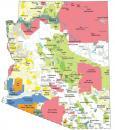
Grand Canyon National Park Campgrounds Map
Explore the Grand Canyon National Park’s campgrounds with this detailed map. This map pinpoints popular camping spots like Mather Campground and North Rim Campground in the east of the park.
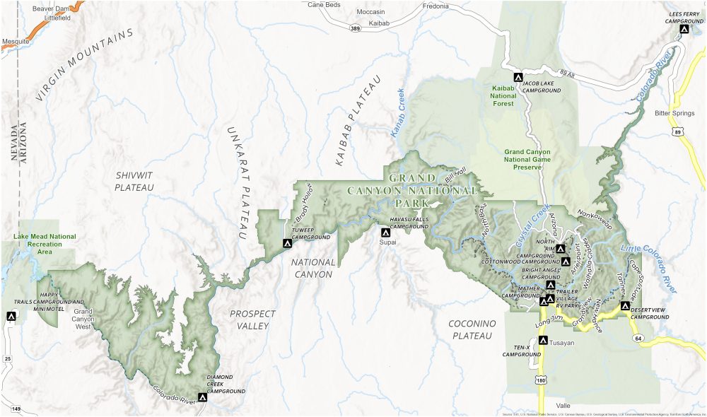
Campgrounds
Mather Campground
Bright Angel Campground
Lees Ferry Campground
Jacob Lake Campground
Cottonwood Campground
North Rim Campground
Happy Trails Campground and Mini Motel
Diamond Creek Campground
Havasu Falls Campground
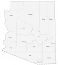
Grand Canyon National Park Trail Map
This trails-focused map is your guide to exploring the scenery of one of the world’s Seven Natural Wonders. It highlights key trails like the Bright Angel, South Kaibab, and Grandview Trail.
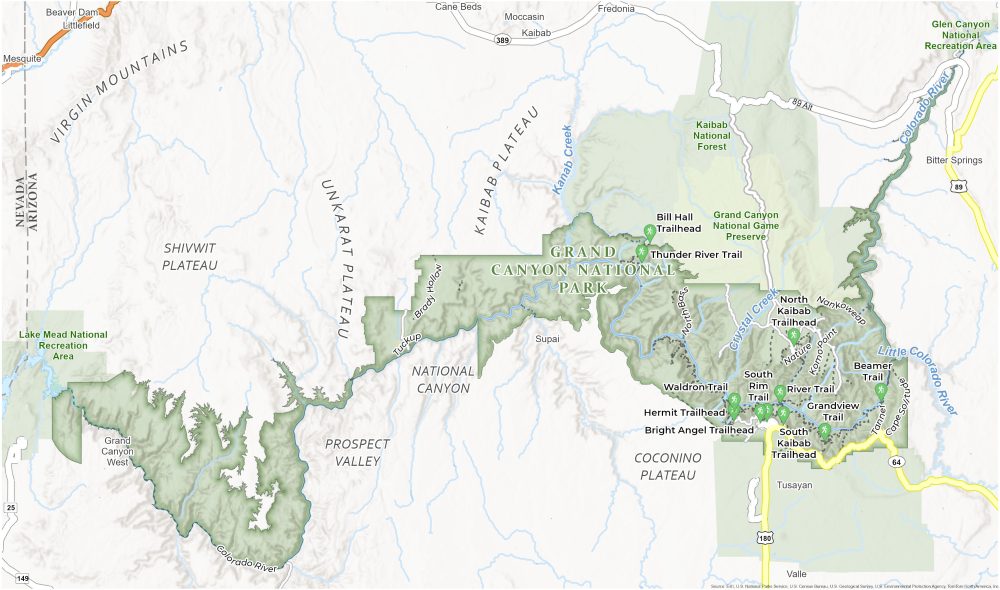
Trails
South Rim Trail
Bright Angel Trail
South Kaibab Trail
Beamer Trail
Grandview Trail
Bright Angel Trail
Waldron Trail
Colorado River Trail
North Kaibab Trail
Thunder River Trail
Bill Hall Trail
Brady Hollow Trail
North Bass Trail
Cape Solitude Trail
Tanner Trail
Landforms, Places and Rivers
Coconino Plateau
National Canyon
Kaibab Plateau
Unkarat Plateau
Prospect Valley
Shivwit Plateau
Crystal Creek
Kanbab Creek
Colorado River
Mesquite
Parks and Protected Areas
Lake Mead National Recreation Area
Grand Canyon National Game Preserve
Kaibab National Forest
References
- Grand Canyon National Park (NPS)
- USGS Grand Canyon National Park Map
- Topographic Maps of Grand Canyon N.P.