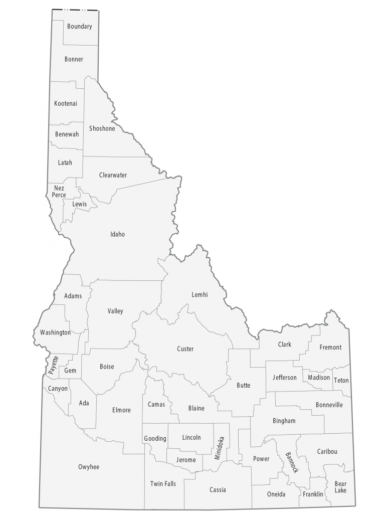
Idaho County Map
About the map
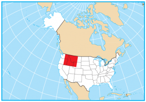
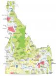
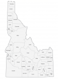
This Idaho county map displays its 44 counties. We have created individual maps for all counties in Idaho. Also, you get a perspective of where the county is in the state of Idaho with our locator maps below.
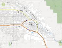
Ada is the largest county in Idaho in terms of population with over 480,000 people. Boise is the capital city of Idaho and is located in Ada County. Find the Boise map collection here. The least populated county in Idaho is Clark County with small rural communities like Dubois.
Idaho County is the largest in terms of size with an area of about 8503.2 square miles. This is followed by Owyhee County in the southwest and Custer County in the center. Conversely, Payette County is the smallest size county in Idaho and is just 409.4 square miles.
You are free to use our county map of Idaho for educational and commercial uses. Attribution is required. How to attribute?
Idaho county list
| FIPS Code | Name | Land (sq mi) | Water (sq mi) | Population (2024) |
|---|---|---|---|---|
| 16-001 | Ada County | 1052.0 | 8.6 | 535,799 |
| 16-003 | Adams County | 1362.8 | 6.7 | 4,998 |
| 16-005 | Bannock County | 1112.5 | 35.6 | 91,010 |
| 16-007 | Bear Lake County | 975.7 | 73.9 | 6,779 |
| 16-009 | Benewah County | 776.9 | 7.3 | 10,529 |
| 16-011 | Bingham County | 2093.8 | 26.4 | 50,889 |
| 16-013 | Blaine County | 2637.7 | 17.2 | 25,261 |
| 16-015 | Boise County | 1899.5 | 7.4 | 8,581 |
| 16-017 | Bonner County | 1733.2 | 184.9 | 53,955 |
| 16-019 | Bonneville County | 1866.0 | 34.3 | 133,644 |
| 16-021 | Boundary County | 1268.7 | 9.4 | 14,040 |
| 16-023 | Butte County | 2236.5 | 2.0 | 2,735 |
| 16-025 | Camas County | 1074.2 | 4.5 | 1,247 |
| 16-027 | Canyon County | 587.0 | 16.7 | 266,892 |
| 16-029 | Caribou County | 1764.2 | 34.4 | 7,239 |
| 16-031 | Cassia County | 2565.6 | 15.1 | 25,976 |
| 16-033 | Clark County | 1763.1 | 1.0 | 794 |
| 16-035 | Clearwater County | 2457.3 | 30.7 | 9,151 |
| 16-037 | Custer County | 4922.2 | 16.4 | 4,597 |
| 16-039 | Elmore County | 3075.1 | 26.4 | 29,729 |
| 16-041 | Franklin County | 663.0 | 4.7 | 15,638 |
| 16-043 | Fremont County | 1864.0 | 32.2 | 14,399 |
| 16-045 | Gem County | 559.8 | 4.8 | 21,857 |
| 16-047 | Gooding County | 729.3 | 4.8 | 16,189 |
| 16-049 | Idaho County | 8477.4 | 26.1 | 17,912 |
| 16-051 | Jefferson County | 1093.7 | 12.0 | 34,854 |
| 16-053 | Jerome County | 597.5 | 5.1 | 26,056 |
| 16-055 | Kootenai County | 1237.8 | 71.2 | 188,323 |
| 16-057 | Latah County | 1075.9 | 0.9 | 42,180 |
| 16-059 | Lemhi County | 4563.7 | 5.4 | 8,397 |
| 16-061 | Lewis County | 478.8 | 0.9 | 3,728 |
| 16-063 | Lincoln County | 1201.4 | 4.5 | 5,556 |
| 16-065 | Madison County | 469.3 | 4.1 | 55,549 |
| 16-067 | Minidoka County | 757.0 | 5.4 | 22,691 |
| 16-069 | Nez Perce County | 848.3 | 8.2 | 42,847 |
| 16-071 | Oneida County | 1198.9 | 1.5 | 4,976 |
| 16-073 | Owyhee County | 7668.2 | 28.6 | 12,748 |
| 16-075 | Payette County | 406.9 | 3.4 | 27,662 |
| 16-077 | Power County | 1403.8 | 38.3 | 8,381 |
| 16-079 | Shoshone County | 2637.4 | 5.4 | 14,074 |
| 16-081 | Teton County | 449.1 | 1.1 | 12,932 |
| 16-083 | Twin Falls County | 1921.7 | 7.0 | 96,509 |
| 16-085 | Valley County | 3665.1 | 68.4 | 12,777 |
| 16-087 | Washington County | 1452.8 | 20.6 | 11,539 |