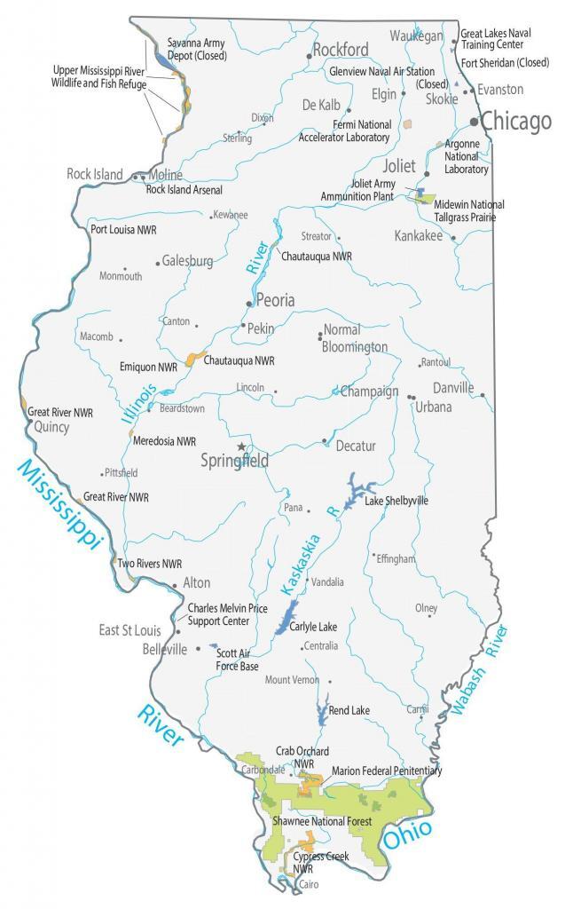
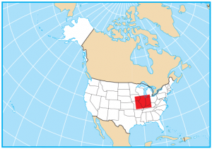
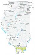
Illinois State Map – Places and Landmarks
About the map
Our Illinois State Map shows major landmarks and populated places. You’ll find national forests, military bases, wildlife refuges, and other federal lands.
Some of Illinois’ biggest highlights include the Shawnee National Forest, which spans an area of 1,000+ km². Also, Chautauqua National Wildlife Refuge mostly consists of wetlands. This refuge is located in the middle of the Mississippi Flyway along the Illinois River.
Also, Illinois is home to the US Department of Energy’s Fermilab, which is a particle acceleration laboratory just outside of the city of Chicago. Illinois contains the Argonne National Laboratory, a world-class research facility. Both have tours available around the laboratories.
Illinois map collection

You are free to use our map of Illinois for educational and commercial uses. Attribution is required. How to attribute?
Federal lands
National Forests (NF)
Shawnee National Forest
National Wildlife Refuge (NWR)
Chautauqua NWR
Port Louisa NWR
Chautauqua NWR
Emiquon NWR
Great River NWR
Meredosia NWR
Great River NWR
Two Rivers NWR
Crab Orchard NWR
Cypress Creek NWR
Other Landmarks
Fermi National Accelerator Laboratory
Argonne National Laboratory
Upper Mississippi River Wildlife and Fish Refuge
Midewin National Tallgrass Prairie
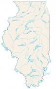
Illinois lakes, rivers and reservoirs
Lakes and reservoirs
Lake Shelbyville
Carlyle Lake
Rend Lake
Rivers and streams
Kaskaskia River
Wabash River
Mississippi River
Ohio River
Illinois River
Military and penitentiary
Great Lakes Naval Training Center
Fort Sheridan (Closed)
Savanna Army Depot (Closed)
Glenview Naval Air Station (Closed)
Joliet Army Ammunition Plant
Rock Island Arsenal
Charles Melvin Price Support Center
Scott Air Force Base
Penitentiary
Marion Federal Penitentiary
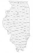
Illinois populated places
Springfield
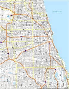
Chicago
Alton
Belleville
Bloomington
Champaign
Danville
De Kalb
Decatur
East St Louis
Elgin
Evanston
Galesburg
Kankakee
Moline
Normal
Pekin
Quincy
Rock Island
Skokie
Urbana
Waukegan
Peoria
Rockford
Joliet
Beardstown
Cairo
Canton
Carmi
Centralia
Dixon
Effingham
Kewanee
Lincoln
Macomb
Monmouth
Mount Vernon
Olney
Pittsfield
Sterling
Streator
Vandalia
Rantoul
Pana
Carbondale
State capital
Springfield