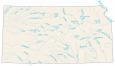
Kansas Lakes and Rivers Map
About the map
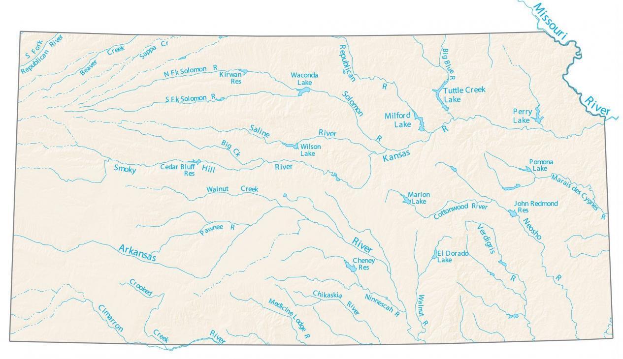
This map displays the major rivers, reservoirs, and lakes of Kansas like Milford, Perry, and Waconda Lake. Kaw Lake, Milford Lake, and Perry Lake all exceed 10,000 acres in area.
The only river that forms a border in Kansas is the Missouri River. This river in the northeast of Kansas delineates a border with its neighboring state of Missouri. The Arkansas River flows in an east-west direction and around the city of Wichita.
There are a number of rivers and lakes throughout the state of Kansas that are great for fishing. From swimming to kayaking and canoeing, these bodies of water offer a great way to cool down during the summer and experience nature at the same time.
Kansas map collection
You are free to use our lakes and rivers map of Kansas for educational and commercial uses. Attribution is required. How to attribute?
Kansas lakes, rivers and reservoirs
Lakes in Kansas
Milford Lake
Perry Lake
Waconda Lake
Wilson Lake
Pomona Lake
Marion Lake
El Dorado Lake
Rivers and streams
Saline River
Smoky Hill River
Kansas River
Cimarron River
Neosho River
Arkansas River
Missouri River
Republican River
Verdigris River
Big Blue River
Solomon River
Marais des Cygnes River
Cottonwood River
Walnut River
Ninnescah River
Chikaskia River
Medicine Lodge River
Pawnee River
Reservoirs in Kansas
Kirwan Reservoir
John Redmond Reservoir
Cheney Reservoir
Cedar Bluff Reservoir
Creeks and tributaries
Tuttle Creek
Beaver Creek
Sappa Creek
Walnut Creek
Crooked Creek