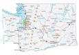
Olympic National Park Map
About the map
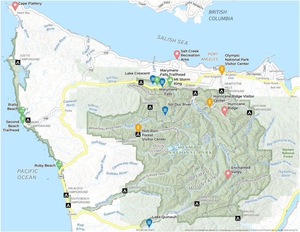
Our Olympic National Park Map is your path to the glacier-capped mountains on Washington’s Olympic Peninsula. This map carefully plots the scenic routes winding through the lush Hoh Rain Forest. It also guides you along the trails that lead to the awe-inspiring Hurricane Ridge.
Within this map, you’ll also find campgrounds, highways, roads, visitor centers, and other points of interest. Find a quiet retreat near Lake Crescent or a family-friendly spot in the Sol Duc Valley. Our map of Olympic National Park has you covered.
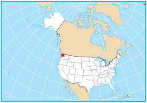
Whether you’re here for a day trip or a week-long adventure, keep this map as a close companion. It can help ensure you don’t miss a thing in Olympic National Park, situated in the heart of Washington State.
You are free to use our Olympic National Park map for educational and commercial uses. Attribution is required. How to attribute?
Top Things to Do
Here are some of the top things to do at Olympic National Park.
- Lake Crescent: A deep, glacially-carved lake known for its brilliant blue waters and scenic surroundings.
- Hurricane Ridge: Offers panoramic views of the park’s mountains, valleys, and the Strait of Juan de Fuca.
- Ruby Beach: Known for its sea stacks, abundant driftwood, and colorful tide pools.
- Sol Duc River: A serene river flowing through lush forests, popular for fishing.
- Mt. Storm King: A challenging hike leading to views of Lake Crescent and surrounding mountains.
- Lake Quinault: A tranquil lake surrounded by rainforest, ideal for boating, fishing, and hiking.
- Marymere Falls: A gorgeous waterfall easily accessible near Lake Crescent.
- Rialto Beach: Features sea stacks, pebbled shores, and tide pools.
- Enchanted Valley: Known as the “Valley of 10,000 Waterfalls” for its numerous cascades.
- Salt Creek Recreation Area: Offers tide pools, coastal views, and camping facilities near Crescent Bay.
Visitor Centers
Olympic National Park Visitor Center
Hoh Rain Forest Visitor Center
Hurricane Ridge Visitor Center
Campgrounds
Sol-Duc Campground
Hoh Campground
Heart of the Hills Campground
Deer Park Campground
Mora Campground
Ozette Campground
Queets Campground
Staircase Campground
Kalaloch Campground
Elwha Campground
South Beach Campground
Heart o’the Hills Campground
Graves Creek Campground
Landforms and Places
Mount Olympus
Port Angeles
Olympus Mountains
British Columbia
Forks
Amanda Park
Neah Bay
Sequim
Olympic National Forest
Lakes, Rivers, and Water
Lake Crescent
Lake Quinault
Sol Duc River
Elwha River
Gray Wolf River
Hayes River
Goldie River
Bogachiel River
Quinault River
Queets River
Clearwater River
Hoh River
Dosewalips River
Duckabush River
Salish Sea
Pacific Ocean
Trails
Hoh River Trail
Queets River Trail
Aurora Ridge Trail
Bogachiel River Trail
Duckabush River Trail
Other Features
US-101
Second Beach Trailhead
Cape Flattery
Bell Hill
Sequim
River Road
References
- Olympic National Park (National Park Service)
- USGS Olympic National Park Map
- Topographic Maps of Olympic NP (USGS)