Map of Philadelphia, Pennsylvania

Map of Philadelphia
This Philadelphia map collection displays highways, roads, places of interest, and things to do. We also feature an interactive map of Philadelphia for you to explore the city in more detail.
Philadelphia is known as the “City of Brotherly Love” and is the largest city in Pennsylvania with 1.6+ million people. Philly is one of the most historic cities in the country, with roots dating back to the founding of the American colonies.
While many people associate Philadelphia with its role in the American Revolution, the city is also home to many historic places from earlier in American history. Explore one of America’s most iconic cities with this Philadelphia map collection.
Jump To: Interactive Map | Printable Road Map | 10 Things to Do | Reference Map
Philadelphia map collection
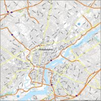
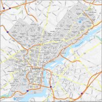
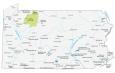
Interactive Map of Philadelphia
Philadelphia is an amazing city with loads of attractions and things to do. Explore this interactive map, and you can easily find the best restaurants, hotels, attractions, and more. Get the lay of the land, such as how the Delaware River outlines the eastern boundary of the city with the state of New Jersey. This interactive map will provide the best up-to-date map of Philly, and you can also explore it as a street map.
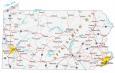
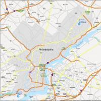
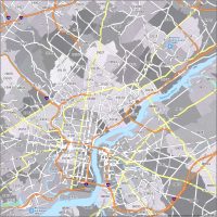
Philadelphia Road Map
Philadelphia is a big, beautiful city with a whole lot of history. Get your bearings with this road map and learn Philly like the locals. This map is the perfect travel companion to help you find your way around Philadelphia. Explore the area and all it has to offer including its interstates, highways, and major roads. Learn the ins and outs of the city, and use it as a navigation tool for the city. But if you plan on traveling outside the city, then download our Pennsylvania road map to plan a road trip around the state.

Interstate Highways: I-76, I-95, I-676
US Highways: 1, 3, 13, 30, 63, 73, 90, 291, 611, Bustleton Pike, Germantown Pike, Industrial Hwy, Lincoln Hwy, Ridge Pike
Expressways/Parkways: Benjamin Franklin Pky, Cobbs Creek Pky, Vine Street Expy
Major Roads: 6th St, 15th St, 26th St, 30th St, 32nd St, 34th St, 38th St, 63rd St, Arch St, Baltimore Ave, Broad St, Cheltenham Ave, Chestnut St, City Ave, Cottman Ave, Girard Ave, John F Kennedy Blvd, Juniper St, Lancaster Ave, Market St, Old York Rd, Penn Sq, Penrose Ave, Pollock St, Roosevelt Blvd, University Ave, Walnut St
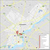
10 Things To Do in Philadelphia
Philadelphia is a great place to visit. But it can be difficult to find the best attractions and landmarks. Our map makes it easy to explore Philly by helping you find the top attractions including historical landmarks, museums, and much more. It’s never been easier to explore Philadelphia with this one convenient map. This easy-to-use tool will help you make the most of your time in the “City of Brotherly Love”.
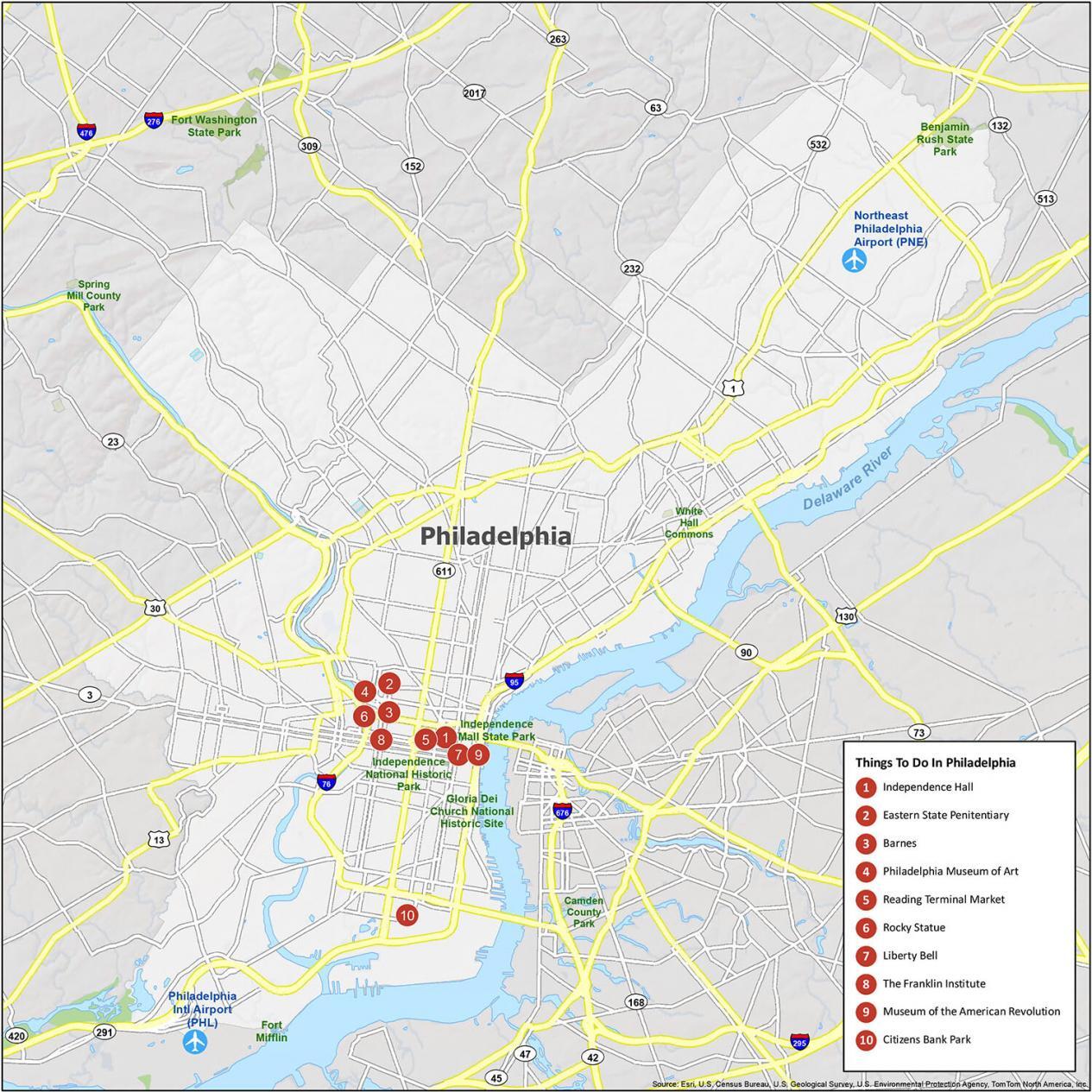
Philadelphia is known for being the birthplace of democracy and is a defining city in America’s history! If you ever go there, we highly recommend these 10 things to do.
- Independence Hall
- Eastern State Penitentiary
- Barnes
- Philadelphia Museum of Art
- Reading Terminal Market
- Rocky Statue
- Liberty Bell
- The Franklin Institute
- Museum of the American Revolution
- Citizens Bank Park
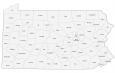
Philadelphia Reference Map
See the city in a whole new way. Philadelphia is a fun and exciting city. Use this reference map to explore the delights of Philadelphia and to learn more about the city. From history and culture to architecture and transportation, this comprehensive map of Philadelphia includes information on neighborhoods, state parks, and points of interest. If you’re planning a trip to Philly, our reference map will serve as your guide.
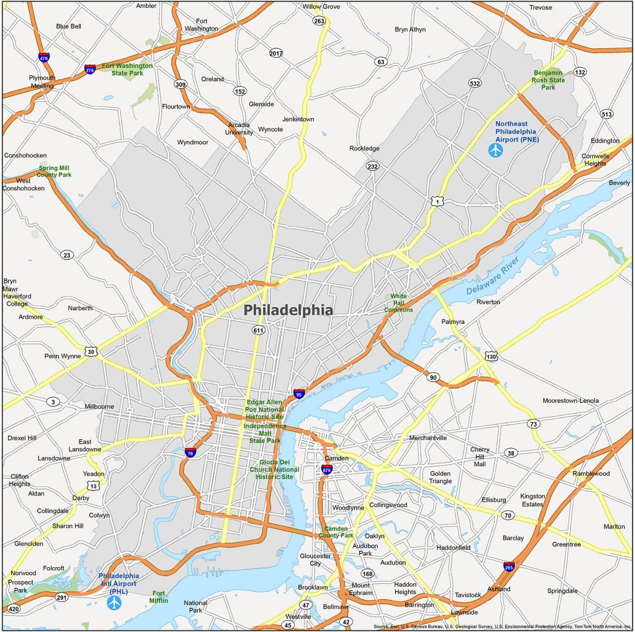
Airports: Philadelphia International Airport (PHL), Northeast Philadelphia Airport (PNE)
Cities: Beverly, Camden, Gloucester City, Philadelphia
Boroughs: Aldan, Ambler, Audubon, Audubon Park, Barrington, Bellmawr, Brooklawn, Bryn Athyn, Clifton Heights, Collingdale, Collingswood, Colwyn, Conshohocken, Darby, East Lansdowne, Folcroft, Glenolden, Haddon Heights, Haddonfield, Jenkintown, Lansdowne, Lawnside, Magnolia, Merchantville, Millbourne, Mount Ephraim, Narberth, National Park, Norwood, Oaklyn, Palmyra, Prospect Park, Riverton, Rockledge, Runnemede, Sharon Hill, Somerdale, Tavistock, West Conshohocken, Westville, Woodlynne, Yeadon
Census-designated place (CDP): Arcadia University, Ardmore, Ashland, Barclay, Blue Bell, Bryn Mawr, Cherry Hill Mall, Cornwells Heights, Drexel Hill, Echelon, Eddington, Ellisburg, Feasterville, Flourtown, Fort Washington, Glenside, Golden Triangle, Greentree, Haverford College, Kingston Estates, Marlton, Moorestown-Lenola, Oreland, Penn Wynne, Plymouth Meeting, Ramblewood, Springdale, Trevose, Willow Grove, Wyncote, Wyndmoor