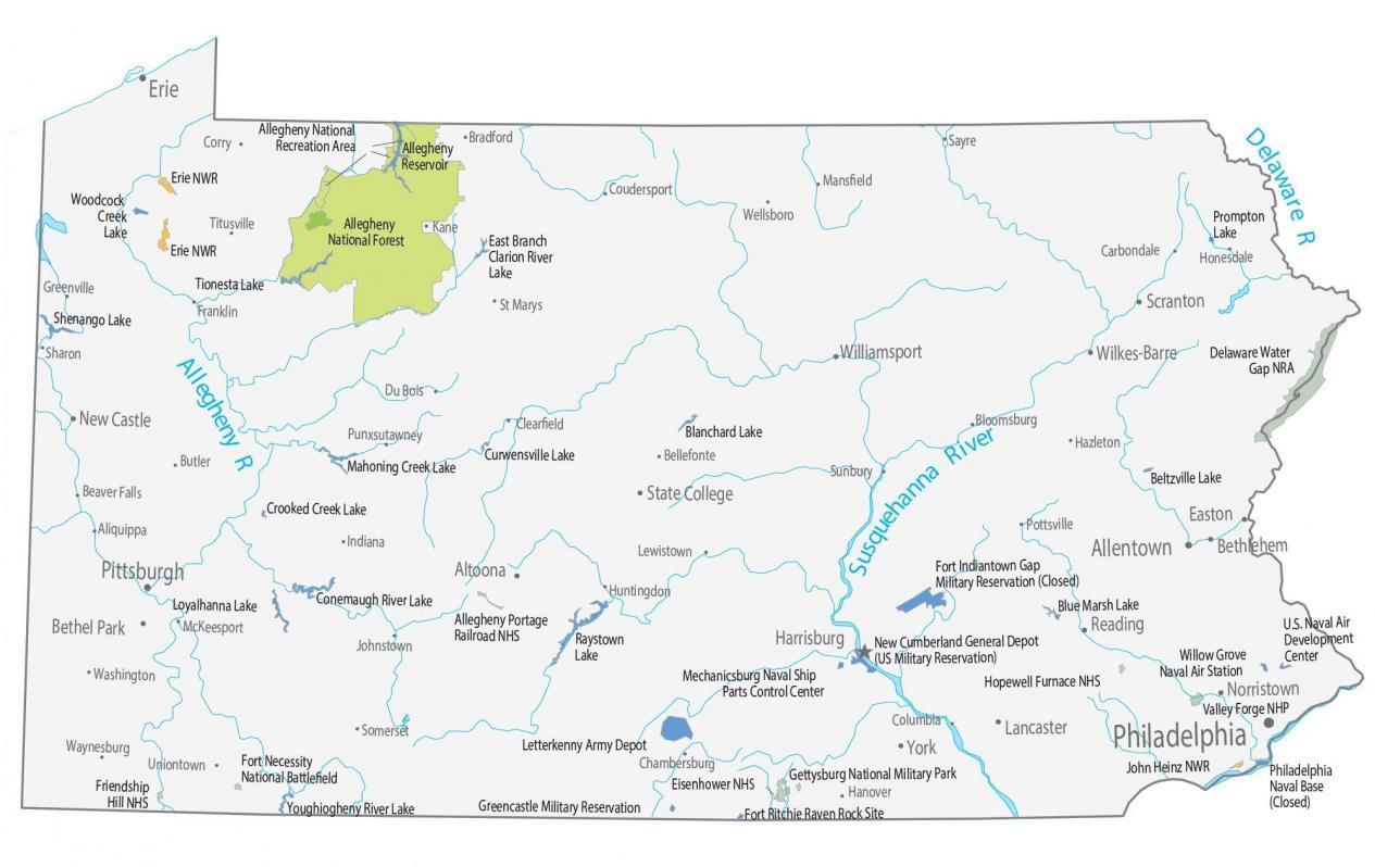
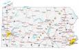
Pennsylvania State Map – Places and Landmarks
About the map
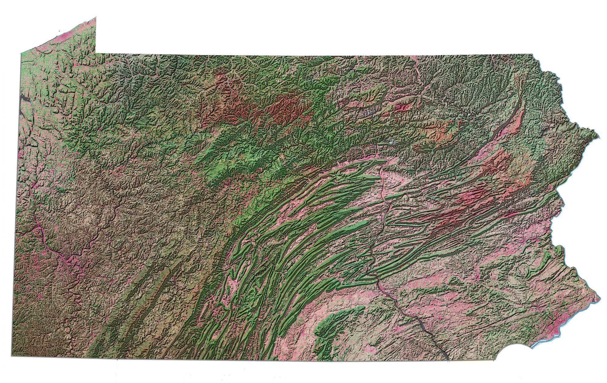
This Pennsylvania State Map shows major landmarks and places in Pennsylvania. For example, it includes national forests, military bases, preserves, wildlife refuges, and other federal lands in Pennsylvania.
There is a timeless history to the state of Pennsylvania. This can be seen with its long list of historical sites available in tours like the Gettysburg guided tours, Founding Fathers tours, and more.
For example, it includes the following national historic sites: Allegheny Portage Railroad, Hopewell Furnace, and the Eisenhower National Historic Site. Not to mention the Valley Forge National Historic Park and Fort Necessity National Battlefield & Friendship Hill NHS.
Pennsylvania map collection
You are free to use our map of Pennsylvania for educational and commercial uses. Attribution is required. How to attribute?
Federal lands
National Forests (NF)
Allegheny National Forest
National Wildlife Refuge (NWR)
Erie NWR
John Heinz NWR
Historical sites
Hopewell Furnace National Historic Site
Valley Forge National Historic Park
Allegheny Portage Railroad National Historic Site
Eisenhower National Historic Site
Fort Necessity National Battlefield & Friendship Hill NHS
National Recreation (NRA)
Delaware Water Gap NRA
Allegheny NRA
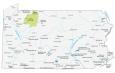
Pennsylvania lakes, rivers and reservoirs
Lakes, rivers and reservoirs
Lake Erie
Prompton Lake
Allegheny Reservoir
East Branch Clarion River Lake
Woodcock Creek Lake
Tionesta Lake
Beltzville Lake
Blanchard Lake
Shenango Lake
Curwensville Lake
Mahoning Creek Lake
Blue Marsh Lake
Crooked Creek Lake
Raystown Lake
Conemaugh River Lake
Loyalhanna Lake
Youghiogheny River Lake
Rivers and streams
Susquehanna River
Delaware River
Allegheny River
Army, naval and military
Fort Indiantown Gap Military Reservation (Closed)
U.S. Naval Air Development
Willow Grove Naval Air Station
New Cumberland General Depot (US Military Reservation)
Mechanicsburg Naval Ship Parts Control Center
Philadelphia Naval Base (Closed)
Letterkenny Army Depot
Gettysburg National Military Park
Fort Ritchie Raven Rock Site
Greencastle Military Reservation
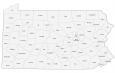
Pennsylvania Map – Landmarks and places
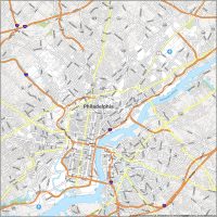
Philadelphia
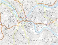
Pittsburgh
Harrisburg
Altoona
Bethel Park
Bethlehem
Easton
Lancaster
New Castle
Norristown
Reading
Scranton
State College
Wilkes-Barre
Williamsport
York
Allentown
Erie
Aliquippa
Beaver Falls
Bellefonte
Bloomsburg
Bradford
Butler
Carbondale
Chambersburg
Clearfield
Columbia
Uniontown
Corry
Coudersport
Du Bois
St Marys
Franklin
Greenville
Hazleton
Honesdale
Huntingdon
Indiana
Kane
Lewistown
Mansfield
McKeesport
Pottsville
Sharon
Somerset
Sunbury
Titusville
Sayre
Washington
Waynesburg
Wellsboro
Punxsutawney
Hanover
Johnstown
State capital
Harrisburg