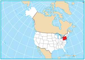
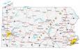
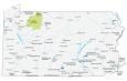
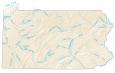
Pennsylvania County Map

About the map
This Pennsylvania county map displays its 67 counties. Pennsylvania’s tally of 67 counties ties for the 20th most in the United States. Both Florida and Alabama also have 67 counties.
Philadelphia County is the most populous county in the United States with close to 1.6 million people. In fact, it has such a high population that it has the 23rd highest population of all counties in the nation. Following this, Allegheny, Montgomery, and Bucks County are the next most populated.
Conversely, Cameron County has the fewest people in the state of Pennsylvania with under 5000 people. For size, Lycoming County is the largest with an even 1250 square miles in area. But the smallest county in Pennsylvania is Montour County with an area of 132.2 square miles.
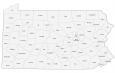
You are free to use our county map of Pennsylvania for educational and commercial uses. Attribution is required. How to attribute?
Pennsylvania County List
| FIPS Code | Name | Land (sq mi) | Water (sq mi) | Population (2024) |
|---|---|---|---|---|
| 42-001 | Adams County | 518.8 | 3.0 | 107,914 |
| 42-003 | Allegheny County | 730.1 | 14.4 | 1,231,814 |
| 42-005 | Armstrong County | 653.2 | 10.7 | 63,679 |
| 42-007 | Beaver County | 434.7 | 9.3 | 165,540 |
| 42-009 | Bedford County | 1012.3 | 4.6 | 47,643 |
| 42-011 | Berks County | 856.4 | 9.4 | 439,117 |
| 42-013 | Blair County | 525.8 | 1.3 | 120,269 |
| 42-015 | Bradford County | 1147.4 | 13.6 | 59,699 |
| 42-017 | Bucks County | 604.4 | 17.4 | 650,131 |
| 42-019 | Butler County | 788.6 | 6.2 | 199,341 |
| 42-021 | Cambria County | 688.4 | 5.3 | 130,108 |
| 42-023 | Cameron County | 396.2 | 2.2 | 4,348 |
| 42-025 | Carbon County | 381.5 | 5.9 | 65,743 |
| 42-027 | Centre County | 1109.9 | 3.2 | 159,805 |
| 42-029 | Chester County | 750.5 | 8.7 | 560,745 |
| 42-031 | Clarion County | 600.8 | 9.0 | 36,855 |
| 42-033 | Clearfield County | 1144.7 | 9.2 | 78,132 |
| 42-035 | Clinton County | 888.0 | 8.9 | 37,865 |
| 42-037 | Columbia County | 483.1 | 7.1 | 66,012 |
| 42-039 | Crawford County | 1012.3 | 25.2 | 82,089 |
| 42-041 | Cumberland County | 545.5 | 4.8 | 275,516 |
| 42-043 | Dauphin County | 524.9 | 33.3 | 293,029 |
| 42-045 | Delaware County | 183.8 | 6.8 | 584,882 |
| 42-047 | Elk County | 827.4 | 4.9 | 30,124 |
| 42-049 | Erie County | 799.1 | 759.1 | 267,750 |
| 42-051 | Fayette County | 790.3 | 8.0 | 123,941 |
| 42-053 | Forest County | 427.3 | 3.2 | 6,601 |
| 42-055 | Franklin County | 772.2 | 0.6 | 159,285 |
| 42-057 | Fulton County | 437.5 | 0.5 | 14,452 |
| 42-059 | Greene County | 575.9 | 2.0 | 33,960 |
| 42-061 | Huntingdon County | 874.6 | 14.6 | 43,359 |
| 42-063 | Indiana County | 827.5 | 6.8 | 82,953 |
| 42-065 | Jefferson County | 652.4 | 4.4 | 43,367 |
| 42-067 | Juniata County | 391.3 | 2.2 | 23,395 |
| 42-069 | Lackawanna County | 458.8 | 6.1 | 216,859 |
| 42-071 | Lancaster County | 943.9 | 39.9 | 563,293 |
| 42-073 | Lawrence County | 358.2 | 4.5 | 84,233 |
| 42-075 | Lebanon County | 361.8 | 0.7 | 145,319 |
| 42-077 | Lehigh County | 345.2 | 3.0 | 385,655 |
| 42-079 | Luzerne County | 890.3 | 15.9 | 331,379 |
| 42-081 | Lycoming County | 1228.7 | 15.1 | 113,236 |
| 42-083 | McKean County | 979.2 | 5.0 | 39,478 |
| 42-085 | Mercer County | 672.6 | 10.0 | 108,140 |
| 42-087 | Mifflin County | 411.0 | 3.7 | 45,935 |
| 42-089 | Monroe County | 608.3 | 8.8 | 166,523 |
| 42-091 | Montgomery County | 483.0 | 4.3 | 879,190 |
| 42-093 | Montour County | 130.2 | 2.1 | 18,115 |
| 42-095 | Northampton County | 369.6 | 7.5 | 322,989 |
| 42-097 | Northumberland County | 458.0 | 19.5 | 90,027 |
| 42-099 | Perry County | 551.4 | 4.1 | 46,816 |
| 42-101 | Philadelphia County | 134.2 | 8.5 | 1,573,916 |
| 42-103 | Pike County | 545.0 | 21.9 | 62,376 |
| 42-105 | Potter County | 1081.3 | 0.2 | 15,993 |
| 42-107 | Schuylkill County | 778.6 | 4.2 | 144,523 |
| 42-109 | Snyder County | 328.8 | 2.8 | 39,627 |
| 42-111 | Somerset County | 1074.4 | 6.6 | 72,134 |
| 42-113 | Sullivan County | 449.9 | 2.6 | 5,927 |
| 42-115 | Susquehanna County | 823.5 | 8.6 | 38,100 |
| 42-117 | Tioga County | 1133.8 | 3.2 | 40,698 |
| 42-119 | Union County | 316.0 | 1.8 | 42,159 |
| 42-121 | Venango County | 674.3 | 8.6 | 49,476 |
| 42-123 | Warren County | 884.1 | 14.4 | 37,373 |
| 42-125 | Washington County | 857.0 | 3.9 | 210,434 |
| 42-127 | Wayne County | 725.6 | 25.0 | 51,419 |
| 42-129 | Westmoreland County | 1028.0 | 8.0 | 350,935 |
| 42-131 | Wyoming County | 397.3 | 7.7 | 25,771 |
| 42-133 | York County | 904.2 | 6.5 | 471,240 |
Thank you for a wonderful website… Found out what I needed…