Map of San Diego, California

Map of San Diego
San Diego is an amazing city to visit, but it can be difficult to know where to start. Our San Diego map collection will help you explore this SoCal metropolis city by showing highways, roads, things to do, and more.
Nicknamed “America’s Finest City”, San Diego is full of culture, history, and natural beauty. From its beaches to its museums and shopping districts, San Diego has something to offer everyone.
This coastal city in California is situated on hills and mesas with the Laguna Mountains to the east. It also shares an international border with Tijuana, Mexico and it’s the fourth-busiest land border in the world.
Jump To: Interactive Map | Printable Road Map | 10 Things to Do | Reference Map
San Diego map collection
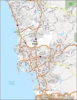
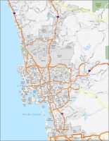
Interactive Map of San Diego
This interactive map is designed for you to get the most out of your time on the road. It lets you explore all of San Diego’s neighborhoods, attractions, and amenities. Whether you want to find the best place to stay, explore, and have fun, this interactive map really helps you get up close and personal with the city. Whether you’re a local or visiting, this map helps you easily navigate the city with multiple points of interest including hotels, restaurants, and parks.
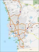
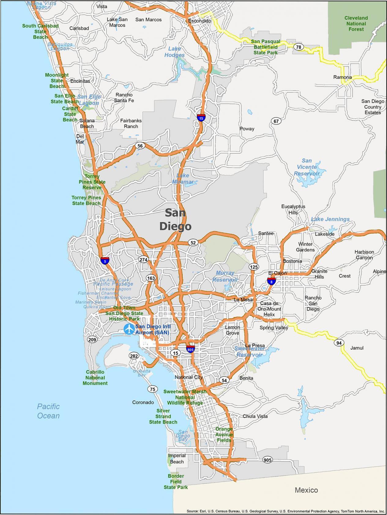
San Diego Road Map
San Diego is a big place and it’s easy to get lost without a map. This San Diego road map is perfect for finding your way to your favorite landmarks and attractions. From the main attractions to scenic drives, it’s a time-saving way to get around and discover the best of what this area has to offer. But if you plan on getting out of the city, then download our California road map for highway information of the state.

Interstate Highways: I-5, I-8, I-15, I-805
US Highways: 8, 15, 18, 30, 52, 54, 56, 66, 75, 78, 94, 125, 163, 206, 209, 259, 274, 330, 905, Del Dios Hwy, Hills Pky, Ocean View Hills Pky, Pacific Hwy
Expressways/Parkways: Bear Valley Pky, Bernardo Heights Pky, Cesar E Chavez Pky, Chollas Pky, La Jolla Pky, Sabre Springs Pky, Scripps Poway Pky, Valencia Pky
Major Roads: 10th Ave, 11th Ave, 32nd St, Aero Dr, Balboa Ave, Bernardo Dr, Black Mountain Rd, Canon St, Carmel Mountain Rd, Carmel Valley Rd, Catalina Blvd, Cypress Canyon Park Dr, Del Rio, Garnet Ave, Harbor Dr, Kearny Villa Rd, Mira Mesa Blvd, Miramar Rd, Mission Bay Dr, Otay Mesa Rd, Palm Ave, Point Loma Ave, Pomerado Rd, Rancho Carmel Dr, Rosecrans St, San Pasqual Valley Rd, Santo Rd, Sunset Cliffs Blvd, Talbot St, Tierrasanta Blvd
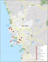
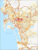
10 Things To Do in San Diego
San Diego is full of adventure and fun, and you can see it all with this map. It includes all the important attractions so you can decide which activities to do with your family and friends. Whether you are looking for the perfect place to spend your summer, planning a weekend getaway, or just want to explore the city, this is your go-to map. From Petco Park to the San Diego Zoo, it’s the perfect travel companion.

San Diego is known for its white sandy beaches and beautiful, warm weather. From the San Diego Zoo to SeaWorld San Diego, we highly recommend these 10 things to do.
- San Diego Zoo
- Balboa Park
- SeaWorld San Diego
- USS Midway Museum
- La Jolla Cove
- Mt. Soledad National Veterans Memorial
- La Jolla Shores Park
- Sunset Cliffs Natural Park
- Petco Park
- Torrey Pines State Reserve
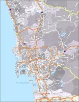
San Diego Reference Map
San Diego is a great place to travel. It’s a big city with lots to offer tourists, and there are plenty of things to do in the area if you want to explore it. Explore the San Diego attractions, see which beaches are worth visiting, and discover the best parks in the city. Have all your trips and adventures planned with convenience, including the ability to customize your own map? This reference map has all the things you need to know when exploring the city.
Airports: San Diego International Airport (SAN)
Cities: Carlsbad, Chula Vista, Coronado, Del Mar, El Cajon, Encinitas, Escondido, Imperial Beach, La Mesa, Lemon Grove, National City, Poway, San Diego, San Marcos, Santee, Solana Beach, Vista
Census-designated place (CDP): Alpine, Bonita, Bostonia, Casa de Oro-Mount Helix, Crest, Eucalyptus Hills, Fairbanks Ranch, Granite Hills, Harbison Canyon, Jamul, La Presa, Lake San Marcos, Lakeside, Ramona, Rancho San Diego, Rancho Santa Fe, San Diego Country Estates, Spring Valley, Winter Gardens


Need updated map please.
Some people have phobia to height. I’m one of them and I avoid to go on bridges, but maps don’t show them or indicate them. So must of the time, I have to use street routes and it takes me a long time to get to the places I want to go. Also, my vehicle is kind of old and can’t really go on elevated areas, such as the Torrey Pines roads (which I used trying to avoid a short but really high bridge on the I-5 south. Maps don’t indicate this, so I called Sandbag and MTS to see if they could give me a suggestion but they didn’t. I do need to go around those have to take my child to medical appointments around La Jolla, Carmel Valley, etc. I have been looking for a map that shows bridges and routes with elevations. I know for most people this might sound silly, but for people who suffer with Acrophobia would be a tremendous help. Thank you.
Would like to visit San Diego. It looks like a beautiful city.