Sequoia National Park Map
About the map
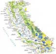
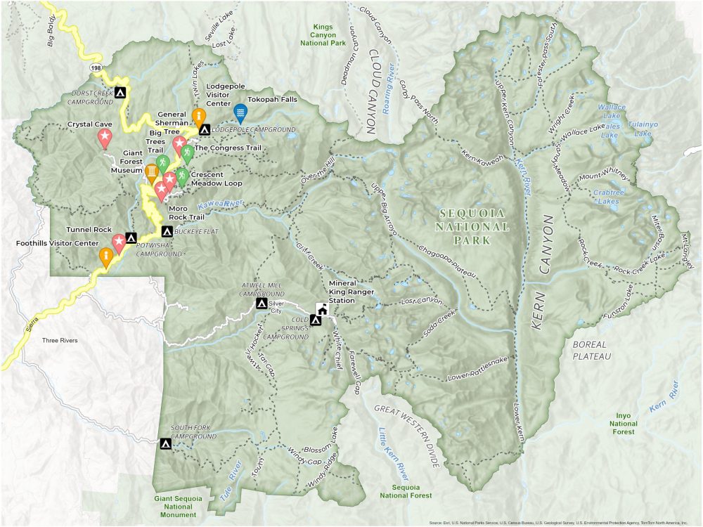
Start your journey with this Sequoia National Park Map, a realm of giants and rugged natural beauty. This printable map unlocks the secrets of land where the world’s largest trees reach skyward in California’s Sierra Nevada mountains.
Within this map, you’ll find the famous General Sherman Tree, a colossal sequoia renowned as the largest living tree on Earth. Equally impressive is Moro Rock, a granite dome with panoramic views of the Great Western Divide. Everything is concentrated in the northwest section of the park.
Our map outlines the trails, roads, attractions, and campgrounds. These all provide a perfect base for your wilderness adventure. Let this map of Sequoia National Park lead you through the scenic drives, alpine meadows, and cascading streams.
You are free to use our Sequoia National Park map for educational and commercial uses. Attribution is required. How to attribute?
Top Things to Do
Here are what we recommend to take in when visiting Sequoia National Park.
- General Sherman Tree: World’s largest tree by volume, an awe-inspiring giant sequoia and a major park attraction.
- Sequoia National Park’s Tunnel Log: Iconic fallen sequoia tree you can drive through, symbolizing the park’s natural wonders.
- Giant Forest Museum: Educational center offering insights into the park’s giant sequoias.
- Moro Rock: Granite dome with spectacular views of the park and Great Western Divide after a steep climb.
- Crystal Cave: Marble cave showcasing unique formations, accessible via guided tours.
- Kings Canyon: Dramatic, deep canyon with scenic vistas, hiking trails, and wildlife.
- The Congress Trail: Popular loop trail through Giant Forest, home to famous sequoia clusters.
- Tokopah Falls: Scenic waterfall hike along the Marble Fork of the Kaweah River.
- Big Trees Trail: Easy, accessible trail around lush meadow. Perfect for viewing giant sequoias.
- Tunnel Rock: Natural granite tunnel offering a unique photo opportunity and glimpse into the park’s geological history.
Visitor Centers and Museums
Lodgepole Visitor Center
Foothills Visitor Center
Giant Forest Museum
Mineral King Ranger Station
Campgrounds
Dorst Creek Campground
Lodgepole Campground
Potwisha Campground
Buckeye Campground
Atwell Mill Campground
Cold Springs Campground
South Fork Campground
Trails
Crescent Meadow Loop
The Congress Trail
Big Trees Trail
Twin Lakes Trail
Lost Lake Trail
Seville Lake Trail
Cliff Creek Trail
Over the Hill Trail
Upper Big Arroyo Trail
Tar Gap Trail
Lost Canyon Trail
Chagoopa Plateau Trail
Deadman Canyon Trail
Soda Creek Trail
Lower Rattlesnake Trail
Farewell Cap Trail
Lower Kern Trail
White Chief Trail
Windy Gap Trail
Blossom Lake Trail
Windy Ridge Trail
Mt Langley Trail
Wright Creek Trail
Rock Creek Trail
Funston Lake Trail
Landforms and Places
Kern Canyon
Cloud Canyon
Great Western Divide
Boreal Plateau
Kings Canyon National Park
Inyo National Forest
Sequoia National Forest
Giant Sequoia National Monument
Lakes and Rivers
Kawean River
Roaming River
Kern River
Tule River
Wallace Lake
Tulainyo Lake
Wales Lake
Crabtrees Lakes
Roads and Other Features
The Giant Forest
Grant Grove
Boyden Cavern
Crescent Meadow Loop
Three Rivers
Highway 198