Shenandoah National Park Map
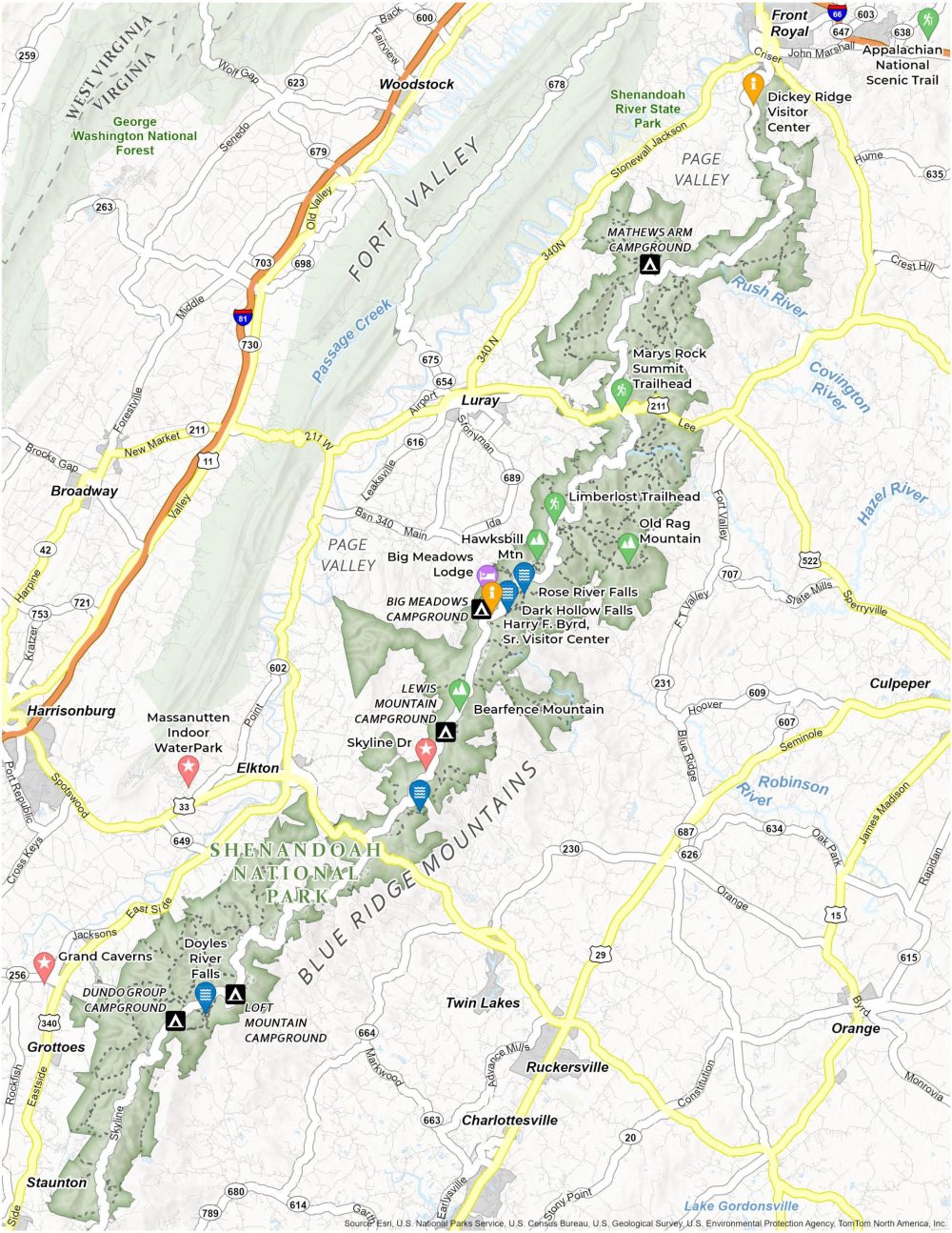
About the map
Our Shenandoah National Park Map highlights campgrounds, trails, roads, visitor centers, and attractions of this park in the Blue Ridge Mountains in Virginia. As you explore this map, you’ll find the famous Skyline Drive, a scenic byway that runs the length of the park.
Discover Old Rag Mountain, a favorite for hikers seeking a challenging ascent and rewarding views. For those seeking to immerse themselves in nature, our printable map details the park’s campgrounds like Big Meadows and Lewis Mountain Campground.
As you navigate Shenandoah National Park with this map in hand, let it open your eyes to the Virginia wilderness. From hiking the Blue Ridge Mountains to exploring Shenandoah’s most beloved trails like the Appalachian Trail, download our map of Shenandoah National Park to reconnect with nature.
You are free to use our Shenandoah National Park map for educational and commercial uses. Attribution is required. How to attribute?
Top Things to Do
Explore our top suggestions for activities at Shenandoah National Park.
- Bearfence Mountain: Offers a panoramic 360-degree view from the summit, featuring a unique rock scramble.
- Skyline Drive: Iconic 105-mile road with stunning views of the Shenandoah National Park.
- Grand Caverns: Historic and scenic cave with impressive formations, America’s oldest show cave.
- Old Rag Mountain: Challenging hike known for its rock scrambles and spectacular summit views.
- Doyles River Falls: Picturesque double waterfall, accessible via a scenic hiking trail.
- Big Meadows Lodge: Rustic lodge providing comfortable accommodations amidst beautiful meadows.
- Rose River Falls: Lovely waterfall with a moderately challenging hike.
- Hawksbill Mountain: Highest peak in Shenandoah, offering views of the park.
- Dark Hollow Falls: Easily accessible waterfall, one of the park’s most popular and scenic spots.
- South River Falls: Stunning 83-foot waterfall, accessible through a moderately strenuous trail.
Visitor Centers
Dickey Ridge Visitor Center
Harry F. Byrd, Sr. Visitor Center
Campgrounds
Mathews Arm Campground
Big Meadows Campground
Lewis Mountain Campground
Loft Mountain Campground
Dundo Group Campground
Trails
Limberlost Trail
Appalachian National Scenic Trail
Mary’s Rock Summit Trail
Landforms, Rivers and Parks
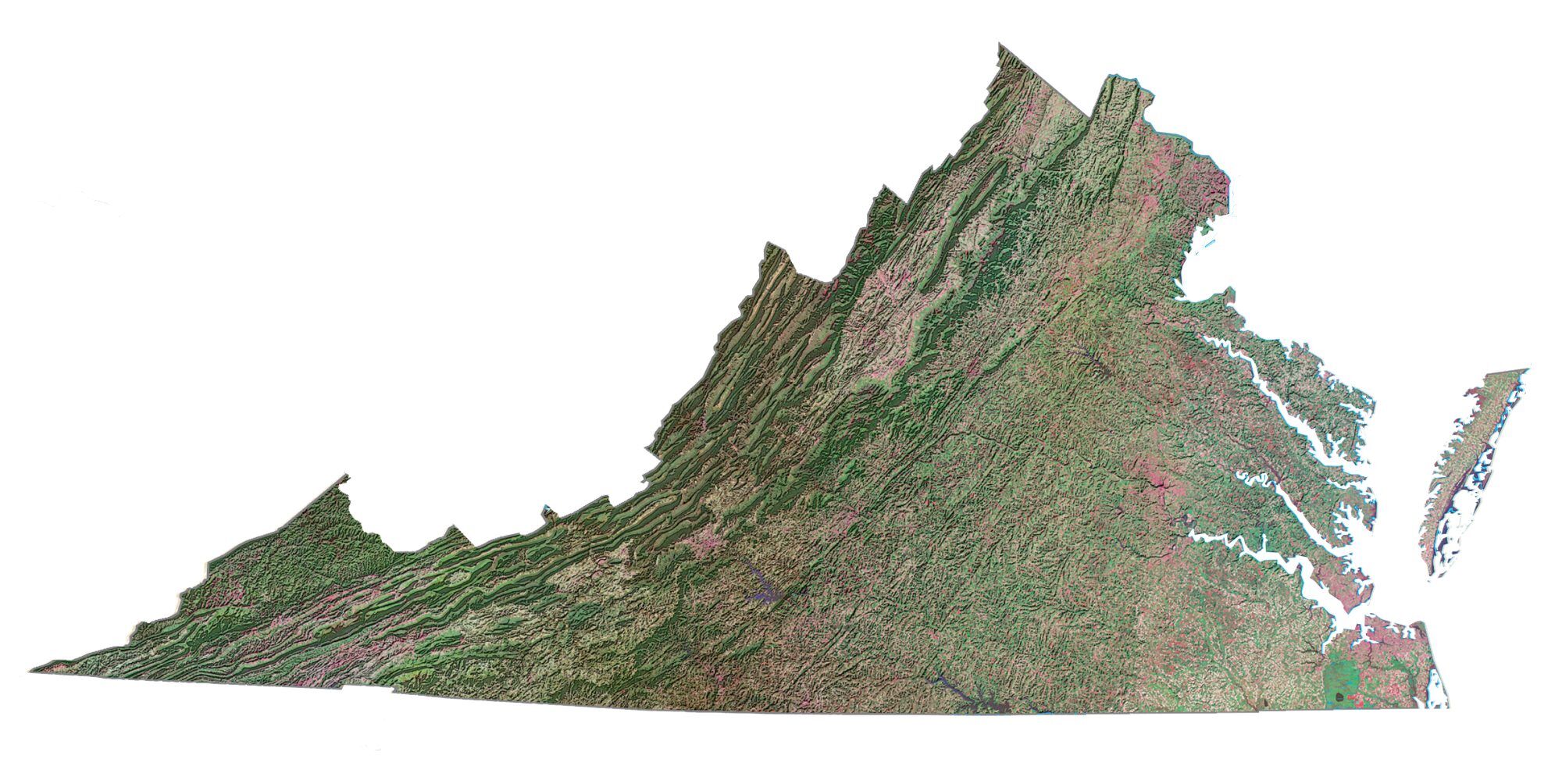
Blue Ridge Mountains
Page Valley
Fort Valley
Shenandoah River State Park
Covington River
Rush River
Passage Creek
Hazel River
Robinson River
Other Features
Veritas Vineyards and Winery
Massanutten Indoor WaterPark
South River Falls
Urban Areas
Staunton
Weyers Cave
Woodstock
Broadway
Crozet
Harrisonburg
Elkton
Stuarts Draft
Twin Lakes
Front Royal
Luray
Ruckersville
Charlottesville
Grottoes
Orange
Highways and Roads
Skyline Drive
Interstate 66 (I-66)
Highway 33 (US-33)
U.S. Highway 211 (US-211)
Highway 340
Lee Highway
Stonewall Jackson Hwy
John Marshall Hwy
East Side Highway
References
- Shenandoah National Park (National Park Service)
- USGS Shenandoah National Park Map
- Topographic Map of Shenandoah NP (USGS)