Unsupervised Classification in Remote Sensing
Unsupervised classification is a technique in remote sensing that clusters pixels within a satellite or aerial image into distinct classes.
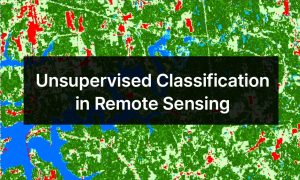
Unsupervised classification is a technique in remote sensing that clusters pixels within a satellite or aerial image into distinct classes.
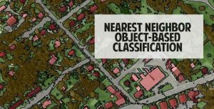
Nearest neighbor classification is a powerful approach to classify segmented objects based on specific statistics and training samples chosen by the user.
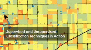
Supervised classification creates training areas, signature file and classifies. Unsupervised classification generate clusters and assigns classes.

Object-based Image Analysis (OBIA) segments an image by grouping pixels together into vector objects. Using these objects, you classify as land cover types.

We look at the image classification techniques in remote sensing (supervised, unsupervised & object-based) to extract features of interest.

Every object has its own unique composition. This is equivalent to it having its own spectral signature. Choose the spectral bands for ideal classification