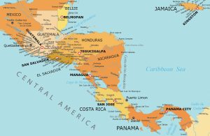
Central America Map – Countries and Cities
Our map of Central America is free to download and use for any purpose. We’ve created five separate maps as part of our collection.
Our map of Central America is free to download and use for any purpose. We’ve created five separate maps as part of our collection.
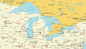
Dive into our Great Lakes map collection highlighting Superior, Michigan, Huron, Erie, and Ontario. Download and print them today.
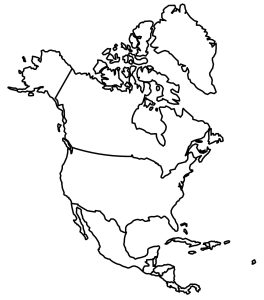
Take a look at these blank maps of North America. You’ll find a full continent map and individual maps of all the countries in the continent.
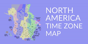
A North America time zone map with the eight time zones of Canada and the United States such as Eastern, Central, Mountain, Pacific, etc.
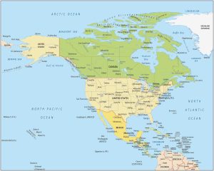
A North America map showing the countries and geography. It includes the Caribbean, Northern, and Central America with each country.