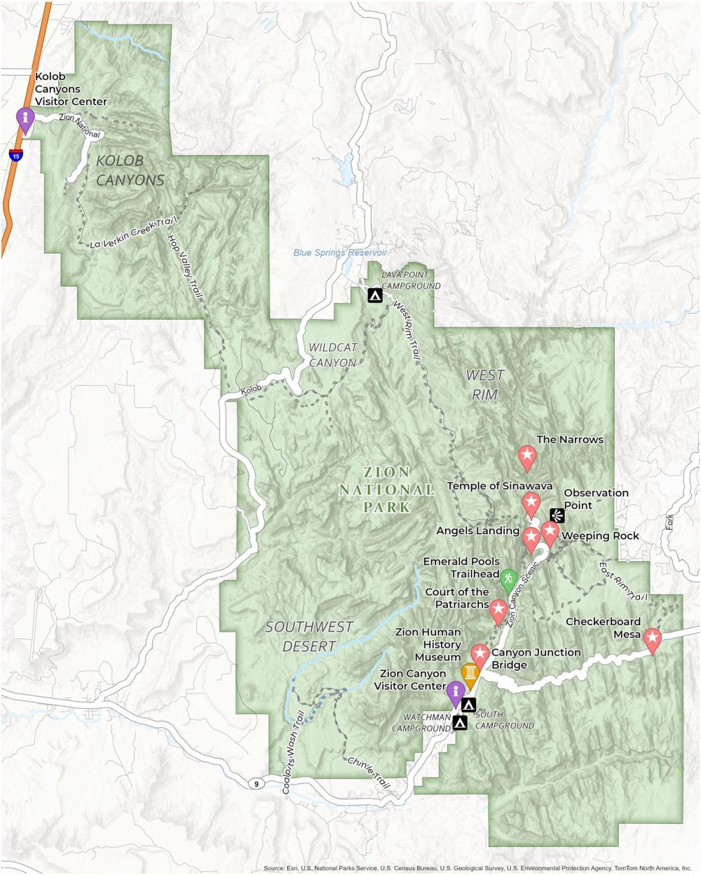
Zion National Park Map
About the map
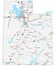
This map of Zion National Park can help you explore one of Utah’s most beautiful spots. Think red rocks, towering cliffs, and lush valleys – Zion has it all. This map is designed to make your visit smooth and memorable.
You’ll find famous spots like Angel’s Landing and the Emerald Pools marked here. They’re both perfect for a relaxed day out. And don’t miss the Narrows! It’s a unique hike right through a river canyon. Just make sure you’re ready to get your feet wet.
This Zion National Park map covers everything. It has trails, campsites, where to get help, and even major landmarks. So, whether you’re a hiking pro or just here to soak up the views, this printable map is how you can dive into this incredible national park in Utah.
You are free to use our Zion National Park map for educational and commercial uses. Attribution is required. How to attribute?
Top Things to Do
- The Narrows: The narrowest section of Zion Canyon with gorge walls a thousand feet tall.
- Angel’s Landing: Thrilling climb of a 1,488 foot tall rock formation with a stunning view at the top.
- Zion Human History Museum: Provides insight into park’s past and culture.
- Temple of Sinawava: A natural amphitheater that serves as the starting point for The Narrows hike.
- Emerald Pools Trailhead: Scenic hike to oasis-like pools and waterfalls.
- Kolob Canyons: Remote, breathtaking red rock vistas in the less-visited area of the park.
- Weeping Rock: Short trail to a rock alcove with dripping springs.
- Checkerboard Mesa: Iconic criss-cross rock patterns. Great for photographers.
- Canyon Overlook Trail: Easy hike with with one of the best canyon views in the park.
- Courts of the Patriarchs: A scenic viewpoint in Zion National Park, featuring three prominent sandstone cliffs.
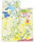
Discovery and Visitor Centers
Zion Canyon Visitor Center
Springdale Visitor Center
Kolob Canyon Visitor Center
Campgrounds
Watchman Campground
South Campground
Lava Point Campground
Trails
Cable Mountain Trail
East Rim Trail
Chinle Trail
Coalpits Wash Trail
West Rim Trail
Hop Valley Trail
La Verkin Creek Trail
Landforms/Physical Regions
Southwest Desert
Wildcat Canyon
Kolob Canyons
West Rim
Blue Springs Reservoir
Highways and Major Roads
US Highway 9
Highway 15
Zion National Rd
Kolob Terrace Rd
References
- Zion National Park (National Park Service)
- USGS Zion National Park Map
- Topographic Maps of Zion NP (USGS)