How to Fill NoData for Raster Data
SAGA GIS has a quick and dirty tool to fill NoData holes with raster data. We show you how to close gaps in DEMs or any raster data with holes in it.
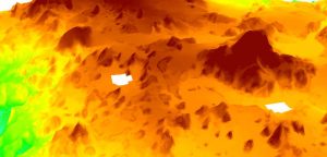
SAGA GIS has a quick and dirty tool to fill NoData holes with raster data. We show you how to close gaps in DEMs or any raster data with holes in it.

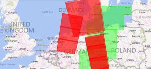
It’s all about predicting risk in the insurance industry. Insurance technology like GIS and mapping can better manage risk with its location intelligence.
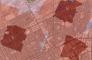
The ArcGIS Network Analyst Service Area analysis tool is perfect finding out just how far your cities firefighters, ambulance or paramedics can service.
A vertical datum is a reference surface of zero elevation to which heights are referred to. Datums are used to measure height and depth from mean sea level.
The role of GIS technician seems to indicate a lot of digitization, putting together maps, collecting data, and basic maintenance of data.
If you want to download Sentinel satellite data, then you’ve come to the right place. We show you how to obtain free Sentinel satellite data.
If you want to display rasters in true color, you will have to combine the red, green & blue bands. The ArcGIS Composite Bands tool creates RGB composites.

ArcObjects is a library of Component Object Models (COM) to build UI components and stand-alone applications on top of the ArcGIS platform.
From geodatabases to PostGIS, spatial databases have quickly become the primary method of managing spatial data effectively in a GIS.

We give you 5 steps to deliver a GIS business case at your organization because for some organizations it’s hard to imagine without one