Learn Synthetic Aperture Radar (SAR) by Example
Synthetic Aperture Radar (SAR) is an emerging technology in remote sensing with the advantage to see in any weather condition and even at night.
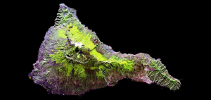
Synthetic Aperture Radar (SAR) is an emerging technology in remote sensing with the advantage to see in any weather condition and even at night.

Web mapping is in an arm’s race and the war is in the cloud. It’s a web GIS battle with ArcGIS Online, Carto, Mapbox, Mango Map, and GIS Cloud.

Today you’re going to see the best 3D maps in action. You can interactively fly around buildings and landscapes in three dimensions.
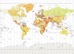
A World Time Zone Map that displays the 24 different time zones of the world. Each time zone is 15° longitude apart with irregular boundaries
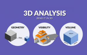
3D analysis is a growing trend because it better represents the real world. For some problems, 3D is sometimes the only way to solve it.