5 Best Web Mapping Platforms – The Battle of Web GIS
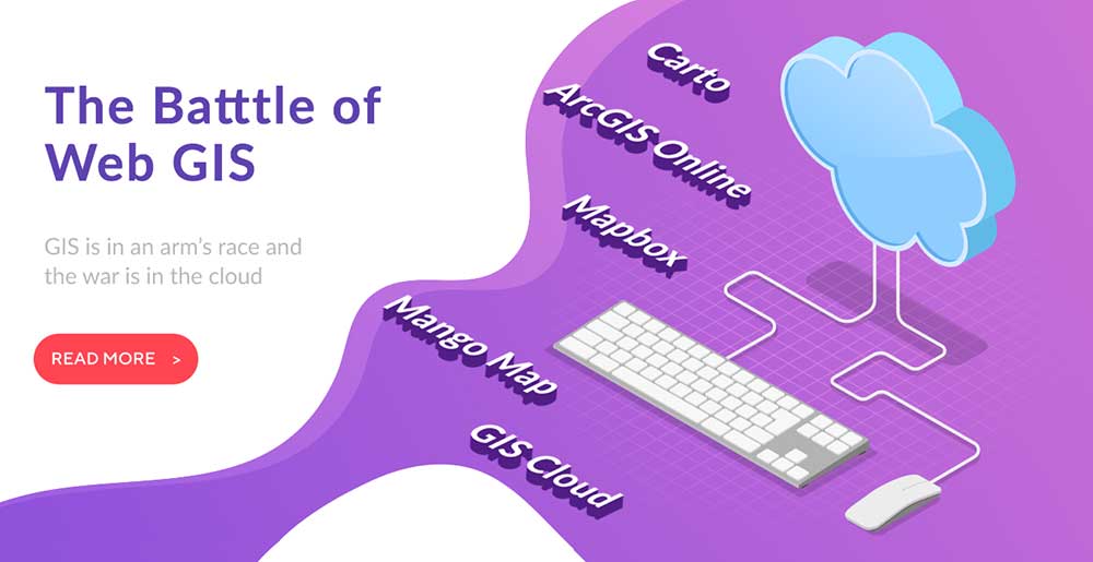
ArcGIS Online vs Carto vs Mapbox vs Mango Map vs GIS Cloud
Web mapping is in an arm’s race – and the war is in the cloud.
We’ve hit a hinge point in GIS. But only a few competitors lead the way.
Who stands out in the Battle of Web GIS?
We’ve battle-tested the best web mapping platforms. But who takes the top spot? Let’s go for a deep dive into web GIS.
Jump To: Overview | Pricing | Functionality | Popularity | Visualization | Extras | Suitability
1. Overview
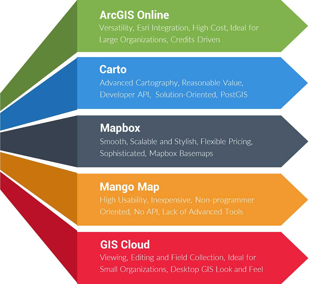
ArcGIS Online
Esri has a death grip on the GIS industry. It’s not only GIS desktop software, but it’s now mapping in the cloud. ArcGIS Online (AGOL) is Esri’s cloud service with loads of functionality. It’s ideal for large organizations because it’s easy to integrate. And the best part of all – it’s targeted towards non-programmers.
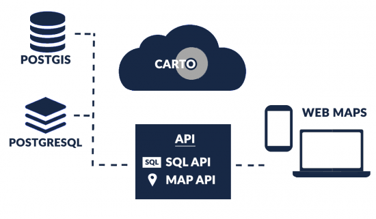
Carto
Carto’s secret sauce is how you work in Postgres + PostGIS as a web service. That means you gain control of a fully managed database, without the need to set up, backup, or perform updates. Although Carto is tailored to programmers, no development is needed for some of its solution-based web mapping platforms.
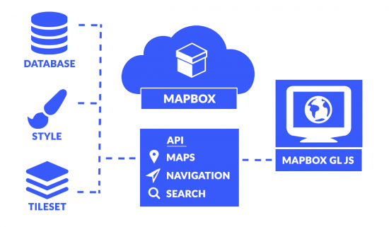
Mapbox
Mapbox is the cool kid on the block. Foursquare, Pinterest, and major newspapers use Mapbox because you can map with a swagger. It’s programmer-centric like Carto. The display is smooth and pleasing to the eyes. Mapbox is tile-focused. It’s speedy, scalable, and fully customizable. This makes it a top choice for high-traffic websites.
Mango Map
While other cloud mapping platforms focus on packing as much punch as they can, Mango Map takes a different approach. Instead, they offer the simplest way to publish a web map. They rethink the user interface, putting usability ahead of complexity. Unlike Mapbox and Carto, no coding is required.
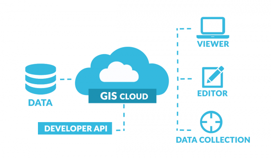
GIS Cloud
GIS Cloud is not an alternative to ArcGIS Online. Not by any means. But it does have a bit of an ArcGIS Online vibe to it, without a lot of the key functionality. The tab interface is a nice touch giving it a desktop GIS look and feel. Although its user base has grown to 70,000+ users, it’s been a bit of an uphill battle with all the other elephants in the room.
2. Pricing
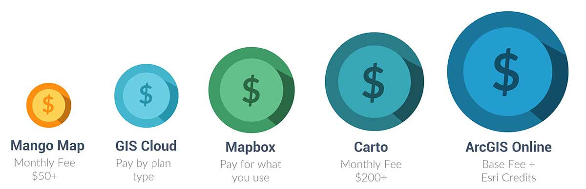
ArcGIS Online
ArcGIS Online costs 2500$ for a single-user subscription. Esri also has a credit currency for advanced functionality. Yet the only drawback is that without credits you don’t have the same functionality as the full-fledged ArcGIS Online.
Carto
Carto has reasonable value for what you pay for. The monthly pricing for Carto ranges anywhere from free to 200$. The difference you pay is based on the number of datasets, map loads, and API access.
Mapbox
For Mapbox, you only pay for what you use. All Mapbox pricing falls in tiers based on usage, making it one of the most flexible web mapping platforms. It has an excellent free tier, meaning you won’t have to pay anything at all depending on usage. No wonder CNN, Bloomberg, and the Washington Post leverage Mapbox.
Mango Map
Mango Map pricing ranges from 50-500$ per month. You only pay as needed and can cancel anytime. Discounts are available for a longer commitment. It also has a free trial, if you want to test it out before purchasing a plan.
GIS Cloud
GIS Cloud has very competitive pricing for its functionality. Basically, you pay for how you want to use it. For its mobile data collection and app, a single user costs just 20$ per month. The map editor adds capabilities for real-time editing for 55$. Other options are available in the GIS Cloud pricing, including volume discounts.
3. Functionality
ArcGIS Online
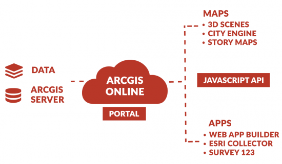
ArcGIS Online is loaded with cross-platform functionality. It’s built by the leading GIS software company in the world so you know it’s a class above the rest. Esri users love it because it has everything you need like editing, 3D scenes, and field collection.
READ MORE: An Introduction to Esri ArcGIS Online (AGOL)
Building apps is easy with the Web App Builder (WAB). You can host in Esri’s cloud or ArcGIS Server. Then, you can edit its HTML, CSS, and JavaScript. Esri’s Javascript API opens up a ton of possibilities for customization.
Carto
Developers use Carto to build their own tools around the APIs. By using the SQL API, you interact (insert, update, delete) with your tables and data through SQL statements. Then, the MAPS API requests map tiles for display.
Data scientists, developers, and analysts use PostGIS behind the scenes for spatial queries and analysis. For example, they geoenrich data streams based on geometry such as financial, demographics, and points of interest.
Mapbox
MBTiles are the backbone for storing tilesets. Mapbox has a ton of customization features for personalized maps. But if you fully want to experience Mapbox, it’s all about the APIs. By using APIs, you can programmatically access Mapbox tools and services.
Finally, Mapbox Studio is how to convert your data to tilesets and create styles. This is where Mapbox really knocks it out of the park for web map customization and data management.
Mango Map
Mango Map is simple and effective. You don’t get a whole lot of functionality like routing, story maps, or even 3D. Instead, you get an intuitive user interface with a product not aimed at programmers. No APIs or anything like that. Just simple web mapping like these examples of Mango Map.
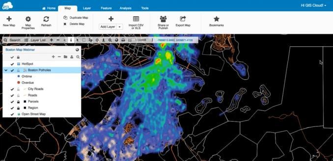
GIS Cloud
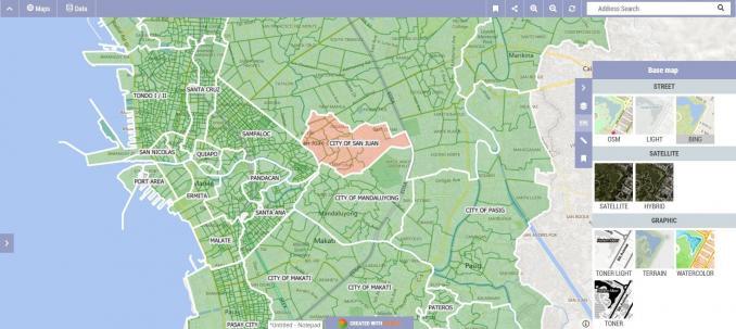
GIS Cloud is not going to blow you away. Instead, it’s mostly solution-oriented. For example, its focus is on field collection, data editing, and crowdsourcing. Overall, it gets the job done for these web mapping solutions. But it won’t take you the extra mile, with some of their best examples on the GIS Cloud channel.
4. Popularity
While ArcGIS Online gets the lion’s share of the popularity, Mapbox is a close second place. Carto is third in the market share of popularity. Finally, Mango Map and GIS Cloud are in the rear.
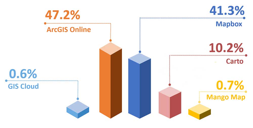
How did we get these numbers? Great question.
We used the exact phrases that users search for over the last 12 months. To rephrase, this doesn’t equal the number of users for each web. Instead, it says how much people are looking for each web mapping platform in search engines.
Not the perfect metric. I admit. But if you have anything better, please provide feedback in the comments section.
| Web GIS Platform | Score |
|---|---|
| ArcGIS Online | 47.2 |
| Mapbox | 41.3 |
| Carto | 10.2 |
| Mango Map | 0.7 |
| GIS Cloud | 0.6 |
5. Visualization
ArcGIS Online
Ironically, it’s the visualizations where ArcGIS Online lags behind its competitors. You get less control compared to Mapbox. Further, the interface is bulky compared to Mango Maps. Despite these shortfalls, it has some bright spots.
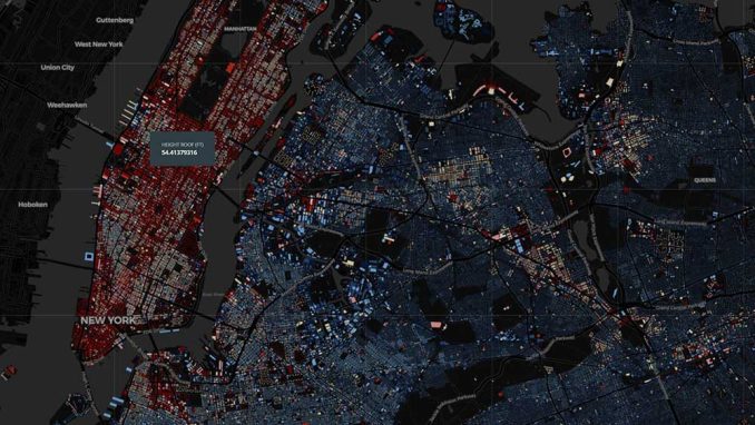
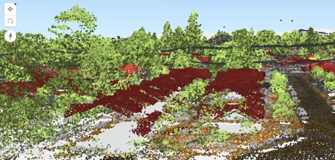
City Engine is a stud. Nothing else is in its class. 3D scenes have come a long way. This includes LiDAR which really resonates with your audience. Finally, Esri has built an entire scripting language (Arcade) for customizations.

Carto
The power of Carto as a platform is how it serves underlying data as tiled web maps. It has a high level of control for cartography. The display is smooth and pleasant to the eye. Dashboards are ready to integrate and share.
Carto for deck.gl is a powerful WebGL framework for large-scale datasets. Not to mention you can also build applications with Google Maps and Mapbox GL.
Mapbox
Mapbox’s four flavors of maps are Streets, Terrain, Traffic, and Satellite maps. You can integrate any of these into your application or project. By changing the style component, this is how you really make it your own. Finally, the Mapbox WebGL JavaScript Library is how to interact with the properties, options, and controls on your map.
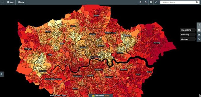
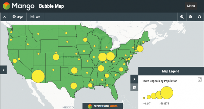
Mango Map
Mango Map latches onto its simplicity with a good selection of styles and templates. One neat feature is how it clusters points at a small scale. But when you select one, it automatically explodes the points so you can see them individually. Mango Map also enables you to add out-of-the-box tools to your web maps.
GIS Cloud
Visualization is not where GIS Cloud shines. Sure, you have control of labeling. You can also stylize thematic maps. Also, it has a nice touch with the tabs, giving it a bit of a desktop GIS software feel. But because of its clunkiness, GIS Cloud should come with a bottle of antacid.
6. Extras
ArcGIS Online
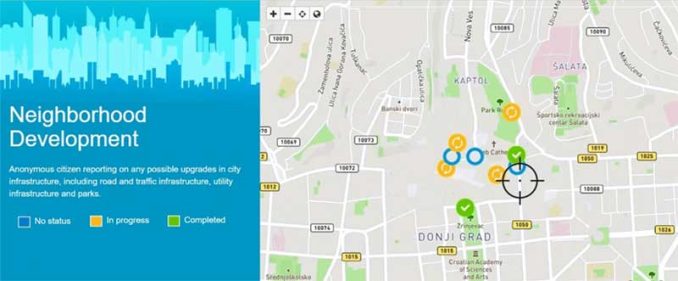
ArcGIS Online has a stranglehold on niche tools like operational dashboards, story maps, and crowdsourcing. Survey123 is a form-centric to capture data in the field. In the meantime, you can track where field crews go in real time.
Then, you can schedule where they will work in the Esri Workforce App. Esri recognizes the needs of customers like its open data portals. The APIs accommodate custom development opening up a whole world of possibilities.
Carto
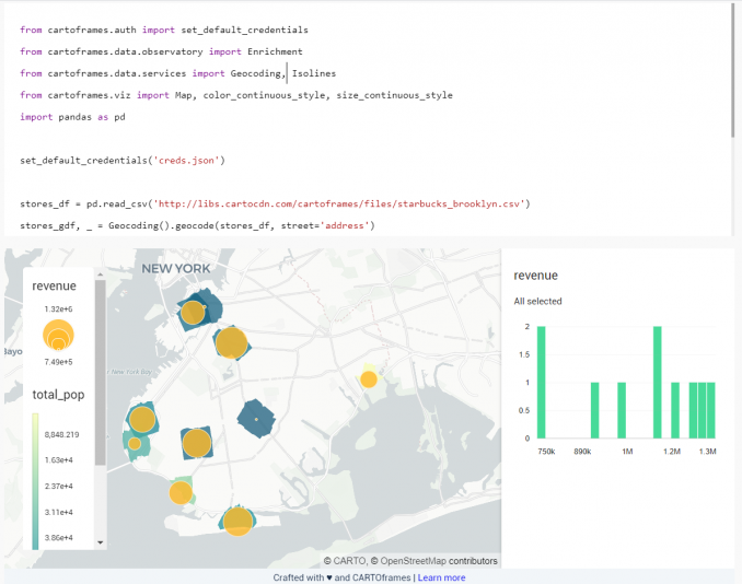
Carto specializes in putting analysis into production. It’s meant for those types of projects where you dig deep into the data. No development is needed to build spatial models driven by machine learning.
Out-of-the-box solutions like site selection, territory planning, and vehicle routing tackle everyday challenges. But it can be a bit of a steep learning curve if you don’t know HTML, CSS, JavaScript, and SQL. Here’s an example of using Cartoframes, which are like dynamic notebooks you can interactively update on the fly.
Mapbox
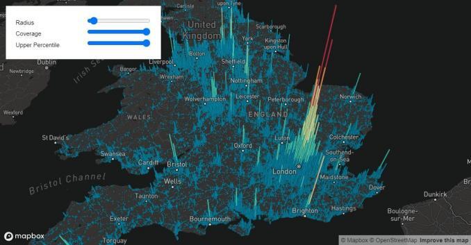
Mapbox provides the building blocks for creating maps, data, and spatial analysis. All of this is done in the comfort of a browser. Mapbox knows how to turn it up a notch or two. For example, it has APIs that you can integrate into apps such as store locators.
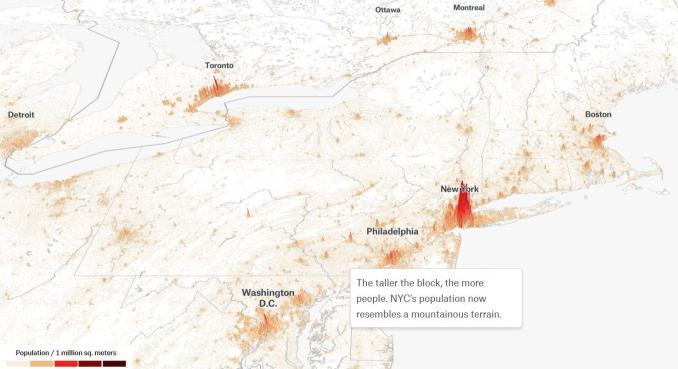
Its street map rivals Google Maps. You can do so much in Mapbox like AR navigation, logistics, and business intelligence. Here’s an example of interactive storytelling in Mapbox.
Mango Map
Simplicity is the ultimate sophistication for Mango Maps. It doesn’t have any APIs for personal customizations. Augmented reality? Nope. Geoenrichment? Negative. Good old fashioned web maps? Absolutely.
If you’re a non-techie and just want to build maps online (nothing fancy), it’s the most reasonable option. Plus, there are a lot of nice features like this bubble map.
GIS Cloud
When your only tool is a hammer, the whole world is a nail. For GIS Cloud, this is true for three things – field collection, data editing, and web map publishing. But this can only take you so far. If you only need a small set of tools, go for it. But look elsewhere to propel you beyond the web mapping basics.
7. Suitability
ArcGIS Online
ArcGIS Online is great for large organizations and governments. If you have a large budget and you want to do it all, this is the ultimate solution. If you’re not a developer, it’s a good choice for you. Also for organizations that already work in an Esri environment, it’s easy to integrate products such as ArcGIS Pro.
Carto
Carto is a great option if you’re into web development and you want to build customized tools around their APIs. If you are familiar with Postgres + PostGIS, it’s the backbone of Carto as they package it as a web service.
Mapbox
If you want scalability, Mapbox has the most flexible pricing. You only pay for what you use with a very generous free usage amount. It’s also one of the most sophisticated web mapping platforms in the cloud. Although it has the second-highest popularity, it still requires some development.
Mango Map
Mango Map is the most inexpensive web mapping platform. Plans are less than $50 per month. It’s not only priced reasonably, but it’s also one of the easiest to use. The features are not too rich, so it’s not overwhelming for casual users.
GIS Cloud
If you want to display, edit, or perform field collection, then GIS Cloud is a top option. It’s suitable for small shops, less than 5-10 people. If you already are working with QGIS or ArcGIS, it has a publisher option that bridges the gap between them.
Web Mapping Platforms Comparison Table
Here’s a comparison table that covers various aspects of ArcGIS Online, Carto, Mapbox, Mango Map, and GIS Cloud.
| Aspect | ArcGIS Online | Carto | Mapbox | Mango Map | GIS Cloud |
|---|---|---|---|---|---|
| Pricing | Subscription-based | Subscription-based | Usage-based and Subscription | Subscription-based | Subscription-based |
| Free Tier | Yes (with limitations) | Yes (with limitations) | Yes (with limitations) | Yes (with limitations) | Yes (with limitations) |
| Functionality | Extensive geospatial tools | Mapping, analysis, BI | Custom mapping, geospatial | Web mapping, analysis | Comprehensive tools |
| Popularity | Widely used | Popular | Popular | Moderate | Moderate |
| Visualization | High-quality maps | User-friendly | Customizable | User-friendly | Limited |
| Extras | Robust GIS capabilities | Data-driven insights | AR/VR capabilities | Minimal extra features | Integration with 3rd party tools |
| Suitability | Professional use | Businesses, analysts | Developers, businesses | Simple to moderate needs | Businesses, enterprises |
Please note that software pricing can change over time, so it’s advisable to check the respective platforms’ official websites for the most up-to-date information.
The Final Word on Web Mapping
Mapping in the cloud is revolutionizing the industry of GIS because the benefits are extraordinary.
Third parties maintain everything with backups, security patches, and server maintenance.
So we, the analysts, data scientists, and developers can focus on the task at hand.
The future of GIS in cloud computing is trending upwards.
How much work is in the cloud for Web GIS? Who do you trust for your web mapping platform?
Please let us know in the comment section below.


Can you please advise what browser based visualisation application you recommend that will allow the majority of users to see and use an application, without access to the raw data itself.
This will help the numbers of users to utilise the GIS application we will produce for park land, tree-scapes and roads and layouts and water areas in the eight parks across London and the outer counties. We wish to adopt GIS to enable data records and mapping to emerge.
Thank you
Best wishes
Chris Eaglen
It sounds like I am going to need more background for what you’re trying to do. Basically, if it’s for basic visualization… It’s actually possible to use something as simple as Google Maps. If you don’t have an internet connection, you can download Google Maps offline. Here’s instructions for that – https://blog.google/products/maps/google-maps-offline/
But for data collection, I’d recommend something like ArcGIS Online or QField. ArcGIS Online has a trial version or it can be subscription-based. QField is completely open sources and does not require any payment of any sort.
Here’s some background of both in our article of field apps for data collection – https://gisgeography.com/field-apps-data-collection-tools/
Please update the pricing – I think some of the free tiers are gone e.g. AGOL, Carto, GIS Cloud.
It looks like they still have free usage. CARTO has a free 14-day trail (https://carto.com/pricing). GIS Cloud also allows you to try it for free. It’s been awhile since I’ve signed up for AGOL, and I can’t say for sure if they still allow you to try it for free.
The pricing are updated?
You’ll have to take a look at all the pricing again on each individual web platform to make sure it’s up-to-date.
There is a major error in the ArcGIS Online pricing – $2,500 per year is for five full Creator users. You can also buy a single Creator user for $500 per year. I see that Carto is $200 per month per user which is $2,400 per year or almost five times more expensive than ArcGIS Online. Personal use with no limits on the number of features is $100 per year and includes ArcGIS Pro. Finally, ArcGIS Platform is a new developer focused product built on the APIs of ArcGIS Online with a consumption pricing model similar to Mapbox.
I feel like you are misrepresenting ESRI with this article. You can purchase an ArcGIS Pro license for $700/year for the basic level and then blocks of 1,000 credits for a $100 each. You would not have the ability to create or build relational databases inside of Pro, but you can still do some really awesome stuff. There is the Standard level license at $2750/year that will allow for a full-blown desktop software and a named user account that works with the relational databases created by ArcGIS desktop and cloud-based software. Then you can purchase other license levels within ArcGIS Online that give access to field apps, ArcGIS Pro, and other functionalities from $350-$500/year/user.
Another really useful summary! Thank you.
What if you just want to make web maps for fun, or as volunteer work for a charity? I believe ArcGIS Online allows a free account for non-commercial use. What about the others?
And how do you think open source options fit into this? Leaflet?
Hi Fiona, great questions.
As for your question about web maps for fun, all 5 of the big web mapping companies offer some level of a free trial at this time.
1. ArcGIS Online – Yes, that’s correct ArcGIS Online has a free account for non-commercial use. But you are limited to 1000 features.
2. Carto – The free trial is 12 months with 3 private/public maps. You get 20,000 map loads per month with up to 10 datasets.
3. Mapbox – You start in the free tier for Mapbox. Once you surpass a number of map loads (50,000), it starts to get into pricing tiers that cost money to use.
4. Mango Map – They give you a 30-day free trial. Discounts are available for annual plans. I contacted them about non-profit mapping, and they offer 25% discounts for non-profits.
5. GIS Cloud – They also have free plans for individuals who create only public maps. Discounts are available for the education industry and nonprofit organizations.
Leaflet is one of the open-source JavaScript libraries that power Mango Map. It looks like you can integrate it with ArcGIS Online, Carto, and Mapbox.