Bakersfield Map, California
Bakersfield, California is a city known for its sunshine and warm weather. It is one of the fastest-growing cities in California. This is because of its well-developed economy and location in California.
Bakersfield is just a hop, skip, and jump away from Los Angeles. It’s just a 2-hour drive, about 110 miles (175 km) northwest of Los Angeles, California. It’s also just a short distance of 110 miles (180 km) away from Sequoia National Park.
Our Bakersfield map shows highways, roads, and other major landmarks. Also, our map of Bakersfield lists the top 10 things to do in the city. But if you’re looking for a larger perspective map, then check out this California map to see where it all fits statewide.
Jump To: Interactive Map | Printable Road Map | 10 Things to Do | Reference Map
Bakersfield map collection

Interactive Map of Bakersfield
Bakersfield is located in southern California and is the most populous city in Kern County. This interactive map allows you to easily zoom in and out. You can also find the location you are looking for, and explore Bakersfield. Discover the best restaurants, attractions, and more from our interactive map of Bakersfield.
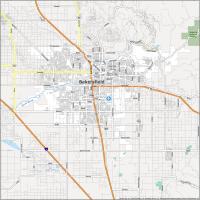
Bakersfield Road Map
Find your way around town with this Bakersfield road map. It can also help you find other attractions around the heart of California including its parks and mountain ranges. If you want to travel outside the city, you will never get lost again with this California road map.
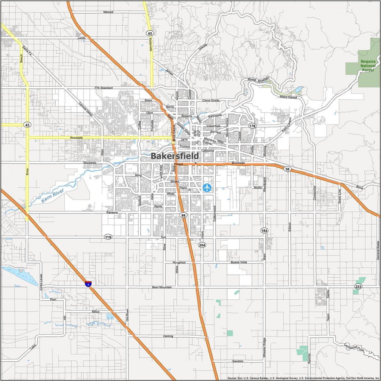
Interstate Highways: I-5
US Highways: 58, 99, 178, 184, 204, Rosedale Hwy, Stockdale Hwy, Taft Hwy
Major Roads: 23rd St, 24th St, 30th St, 7th Standard Rd, Airport Dr, Allen Rd, Brundage Ln, Buck Owens Blvd, California Ave, Chester Ave, Coffee Rd, Cottonwood Rd, Dr. Martin Luther King Jr Blvd, Enos Ln, Espee St, Frontage Rd, Golden State Ave, Gosford Rd, Kern Canyon Rd, Manor St, Ming Ave, Monterey St
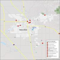
10 Things To Do in Bakersfield
Tourist maps are a great way to explore new places and learn about the best things to do in Bakersfield. You can find the best spots to visit, the key attractions, and other points of interest to help you plan your trip. Pro tip. You’re just a short distance from Kern River Canyon perfect for hiking and scenery.
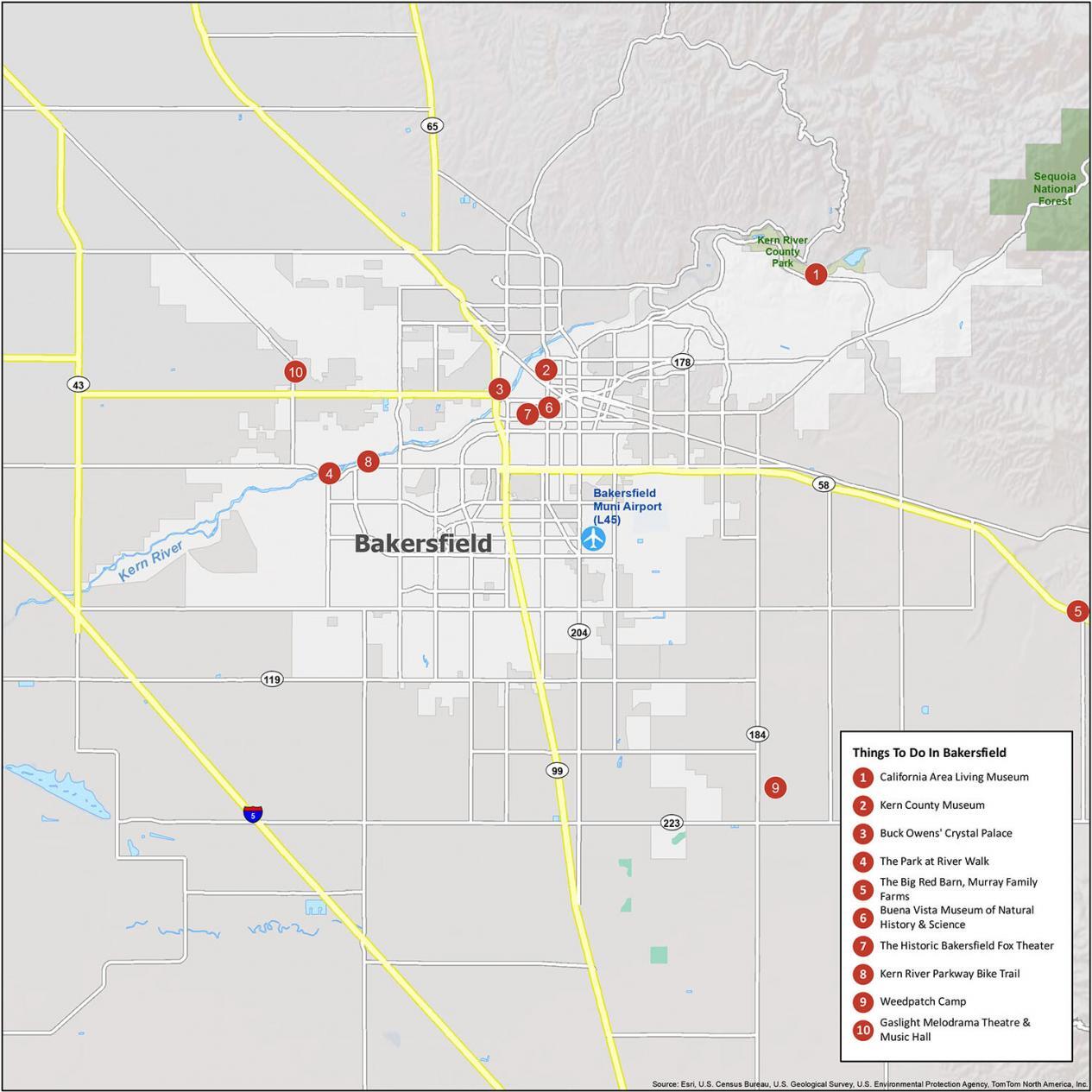
- California Area Living Museum
- Kern County Museum
- Buck Owens’ Crystal Palace
- The Park at River Walk
- The Big Red Barn, Murray Family Farms
- Buena Vista Museum of Natural History & Science
- The Historic Bakersfield Fox Theater
- Kern River Parkway Bike Trail
- Weedpatch Camp
- Gaslight Melodrama Theatre & Music Hall
Reference Map of Bakersfield
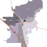
With this Bakersfield map, explore the area and find out different neighborhoods. The city was founded in 1869. Since then, it’s still been growing. But the population is largely made up of people who work in the oil fields. Now, almost 400,000 residents call Bakersfield their home.
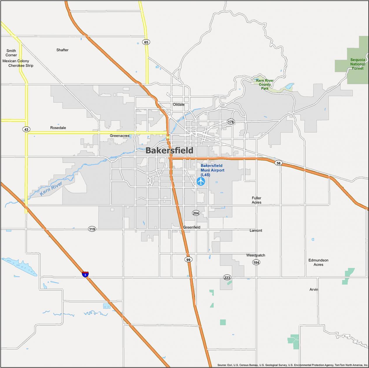
Airport: Bakersfield Municipal Airport (L45)
Cities: Arvin, Bakersfield, Shafter
Census-Designated Places (CDP): Cherokee Strip, Edmundson Acres, Fuller Acres, Greenacres, Greenfield, Lamont, Mexican Colony, Oildale, Rosedale, Smith Corner, Weedpatch